|
Gosberton
Gosberton is a village and civil parish in the South Holland district of Lincolnshire, England. It is situated south-west of Boston, north of Spalding and north-west of Holbeach. The parish includes the villages of Gosberton Clough and Risegate, and the hamlets of Westhorpe and Gosberton Cheal. The population of Gosberton, which was approximately 2500, increased to 2,958 at the 2011 Census. The place-name 'Gosberton' is first attested in the Domesday Book of 1086, where it appears as ''Gosebertechirche'' and ''Gozeberdechercha''. The name meant 'Gosbeorht's church', which was later changed to Gosberton, meaning 'Gosbeorht's town or settlement'. Eilert Ekwall comments, "''Gosbeorht'' is probably a Continental name (Old High German ''Gauzpert'', ''Gosbert'' from ''Gautberht'')."Eilert Ekwall, ''The Concise Oxford Dictionary of English Place-names'', p.201. The village was skirted by the A16 road but has been bypassed. The crossroads of the B1397 (Dowsby to Boston road) an ... [...More Info...] [...Related Items...] OR: [Wikipedia] [Google] [Baidu] |
Gosberton Clough
Gosberton Clough is a village in the civil parish of Gosberton and the South Holland district of Lincolnshire, England. It is south-east from the city and county town of Lincoln, north from the nearest large town of Spalding, and west-southwest from parish village of Gosberton.Extracted fro"Gosberton Clough" Grid Reference Finder (uses Ordnance Survey National Grid). Retrieved 7 February 2019Extracted fro"Gosberton Clough" ''GetOutside'', Ordnance Survey. Retrieved 7 February 2019 Gosberton Clough and the village Risegate to the east are conjoined as a linear settlement on the east to west B1397 road which runs along the south side of Risegate Eau (drain). Within Gosberton Clough the B1397 is named 'Clough Road', and in Risegate, 'Risegate Road', the villages separated at a bridge over the Risegate Eau at the junction with Chesboule Lane, running north, and Beach Lane, running south. The B1397 and the village is mirrored at the north of Risegate Eau by the parallel 'Silts ... [...More Info...] [...Related Items...] OR: [Wikipedia] [Google] [Baidu] |
Risegate
Risegate is a village in the civil parish of Gosberton and the South Holland district of Lincolnshire, England. It is south-east from the city and county town of Lincoln, north from the nearest large town of Spalding, and west-southwest from parish village of Gosberton.Extracted fro"Risegate, South Holland" Grid Reference Finder (uses Ordnance Survey National Grid). Retrieved 6 February 2019Extracted fro"Risegate" ''GetOutside'', Ordnance Survey. Retrieved 6 February 2019 Risegate and the village of Gosberton Clough to the west are conjoined as a linear settlement on the east to west B1397 road which runs along the south side of Risegate Eau (drain). Within Risegate the B1497 is named 'Risegate Road', and in Gosberton Clough, 'Clough Road', the villages separated at a bridge over the Risegate Eau at the junction with Chesboule Lane, running north, and Beach Lane, running south. The B1397 and the village is mirrored at the north of Risegate Eau by the parallel 'Siltsid ... [...More Info...] [...Related Items...] OR: [Wikipedia] [Google] [Baidu] |
Westhorpe, Lincolnshire
Westhorpe is a hamlet in the civil parish of Gosberton and the South Holland district of Lincolnshire, England. It is south-east from the city and county town of Lincoln, north from the nearest large town of Spalding, and west from parish village of Gosberton.Extracted fro"Westhorpe, South Holland" Grid Reference Finder (uses Ordnance Survey National Grid). Retrieved 8 February 2019Extracted fro"Westhorpe" ''GetOutside'', Ordnance Survey. Retrieved 8 February 2019 Westhorpe is a linear settlement on the east to west Westhorpe Road. It is centred on the junction of Westhorpe Road with Windmill Lane which runs to the village of Risegate to the south. Adjacent to the east of this junction is a road bridge over the north to south National Rail line from Lincoln to Peterborough. Westthorpe Road, which starts at Gosberton, runs 1500yds to the west from the Windmill Lane junction, where it becomes Swale Bank (road) at the junction with Quadring Bank (road) which runs north. ... [...More Info...] [...Related Items...] OR: [Wikipedia] [Google] [Baidu] |
Lincolnshire
Lincolnshire (abbreviated Lincs.) is a Counties of England, county in the East Midlands of England, with a long coastline on the North Sea to the east. It borders Norfolk to the south-east, Cambridgeshire to the south, Rutland to the south-west, Leicestershire and Nottinghamshire to the west, South Yorkshire to the north-west, and the East Riding of Yorkshire to the north. It also borders Northamptonshire in the south for just , England's shortest county boundary. The county town is Lincoln, England, Lincoln, where the county council is also based. The Ceremonial counties of England, ceremonial county of Lincolnshire consists of the non-metropolitan county of Lincolnshire and the area covered by the unitary authority, unitary authorities of North Lincolnshire and North East Lincolnshire. Part of the ceremonial county is in the Yorkshire and the Humber region of England, and most is in the East Midlands region. The county is the List of ceremonial counties of England, second-la ... [...More Info...] [...Related Items...] OR: [Wikipedia] [Google] [Baidu] |
Quadring
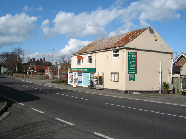
Quadring is a small village and civil parish in the South Holland district of Lincolnshire. It lies on the A152, north-east of Gosberton, and 2 miles south-east of Donington. The village includes the community of Barholme to its south-west. To the east of Quadring is Quadring Eaudike, and to the west is Quadring Fen. Nearby to the west is the Peterborough to Lincoln Line. The A152 (as Main Road within the village) transects Quadring and provides links to Spalding, Boston, Donington and Gosberton. The village name is derived from the Old English "cwead+haefer+ingas" (Muddy settlement of Haefer), and is recorded in the ''Domesday Book'' as ''Quadheveringe'' and ''Quedhaveringe''. The Grade I listed village church, dedicated to St Margaret of Antioch, lies at Church End, north of, and separate from, the village. Mainly an example of Perpendicular architecture, it was rebuilt in 1872.Cox, J. Charles (1916) ''Lincolnshire'' p. 245; Methuen & Co. Ltd Other listed building ... [...More Info...] [...Related Items...] OR: [Wikipedia] [Google] [Baidu] |
Donington, Lincolnshire
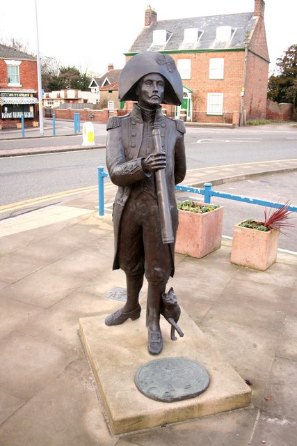
__NOTOC__ Donington is a large village and civil parish in the South Holland district of Lincolnshire, England. It is north from the market town of Spalding on the A152, is bypassed by the A52, and sits between the A16 and A17. The parish includes the hamlet of Northorpe, and falls within the drainage area of the Black Sluice Internal Drainage Board. Donington is the birthplace of the explorer Matthew Flinders. History Donington was large enough in the C18th to attract the travelling theatrical companies. In 1784 Mathew Flinders, father of the famous navigator, wrote 'in the latter half of October and beginning of November we have a small Company of Comedians with us. I went 3 or 4 times and once or twice was tolerably entertained'. Governance As well as having its own parish council, Donington is part of the electoral ward of Donington, Quadring and Gosberton within the South Holland district of Lincolnshire. The total population of the ward taken at the 2011 census was ... [...More Info...] [...Related Items...] OR: [Wikipedia] [Google] [Baidu] |
Great Northern And Great Eastern Joint Railway
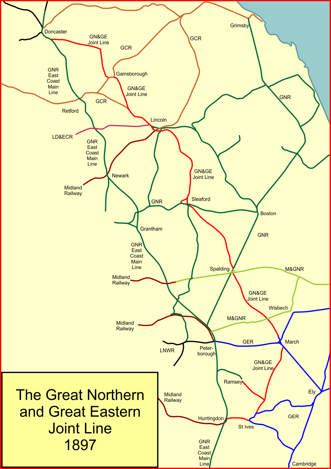
The Great Northern and Great Eastern Joint Railway, colloquially referred to as "the Joint Line"''Joint Line Joy'', in the Railway Magazine, June 2015 was a railway line connecting Doncaster and Lincoln with March and Huntingdon in the eastern counties of England. It was owned jointly by the Great Northern Railway (GNR) and the Great Eastern Railway (GER). It was formed by transferring certain route sections from the parent companies, and by the construction of a new route between Spalding and Lincoln, and a number of short spurs and connections. It was controlled by a Joint Committee, and the owning companies operated their own trains with their own rolling stock. The Joint Line amounted to nearly of route. The motivation for its formation was chiefly the desire of the GER to get direct access to the coalfields of South Yorkshire and elsewhere, and the wish of the GNR to discourage more ambitious incursion by the GER into its own territory, as well as the provision of relief ... [...More Info...] [...Related Items...] OR: [Wikipedia] [Google] [Baidu] |
Surfleet
Surfleet is a small village and civil parish in the South Holland district of Lincolnshire, England. It is situated on the B1356 road, north of Spalding, in the Lincolnshire fens. The River Glen runs through the village. The village has a population of 1,301 people, increasing to 1,338 at the 2011 census, many of whom commute to regional population centres such as Spalding, Boston and Peterborough. Landmarks Surfleet church is dedicated to Saint Laurence and includes a 15th-century font. The church tower leans out of perpendicular. Remains of Roman sea banks and salt pans can also be seen near the village. The church is situated exactly between the nearby villages of Gosberton to the North and Pinchbeck to the South. The churchyard contains a gravestone in memory of a murder victim, Samuel Stockton. Stockton was lured from north-west England to Lincolnshire by a Gedney Hill farmer called Hooten in 1768. Hooten passed himself off as a preacher and brought Stoc ... [...More Info...] [...Related Items...] OR: [Wikipedia] [Google] [Baidu] |
Baptists
Baptists form a major branch of Protestantism distinguished by baptizing professing Christian believers only (believer's baptism), and doing so by complete immersion. Baptist churches also generally subscribe to the doctrines of soul competency (the responsibility and accountability of every person before God), '' sola fide'' (salvation by just faith alone), '' sola scriptura'' (scripture alone as the rule of faith and practice) and congregationalist church government. Baptists generally recognize two ordinances: baptism and communion. Diverse from their beginning, those identifying as Baptists today differ widely from one another in what they believe, how they worship, their attitudes toward other Christians, and their understanding of what is important in Christian discipleship. For example, Baptist theology may include Arminian or Calvinist beliefs with various sub-groups holding different or competing positions, while others allow for diversity in this matter withi ... [...More Info...] [...Related Items...] OR: [Wikipedia] [Google] [Baidu] |
John Bunyan
John Bunyan (; baptised 30 November 162831 August 1688) was an English writer and Puritan preacher best remembered as the author of the Christian allegory ''The Pilgrim's Progress,'' which also became an influential literary model. In addition to ''The Pilgrim's Progress'', Bunyan wrote nearly sixty titles, many of them expanded sermons. Bunyan came from the village of Elstow, near Bedford. He had some schooling and at the age of sixteen joined the Parliamentary Army during the first stage of the English Civil War. After three years in the army he returned to Elstow and took up the trade of tinker, which he had learned from his father. He became interested in religion after his marriage, attending first the parish church and then joining the Bedford Meeting, a nonconformist group in Bedford, and becoming a preacher. After the restoration of the monarch, when the freedom of nonconformists was curtailed, Bunyan was arrested and spent the next twelve years in prison as he ref ... [...More Info...] [...Related Items...] OR: [Wikipedia] [Google] [Baidu] |
Public House
A pub (short for public house) is a kind of drinking establishment which is licensed to serve alcoholic drinks for consumption on the premises. The term ''public house'' first appeared in the United Kingdom in late 17th century, and was used to differentiate private houses from those which were, quite literally, open to the public as "alehouses", " taverns" and " inns". By Georgian times, the term had become common parlance, although taverns, as a distinct establishment, had largely ceased to exist by the beginning of the 19th century. Today, there is no strict definition, but CAMRA states a pub has four characteristics:GLA Economics, Closing time: London's public houses, 2017 # is open to the public without membership or residency # serves draught beer or cider without requiring food be consumed # has at least one indoor area not laid out for meals # allows drinks to be bought at a bar (i.e., not only table service) The history of pubs can be traced to Roman taverns ... [...More Info...] [...Related Items...] OR: [Wikipedia] [Google] [Baidu] |
Lincolnshire Wildlife Trust
The Lincolnshire Wildlife Trust, (part of the The Wildlife Trusts, Wildlife Trusts partnership), covers the whole ceremonial county of Lincolnshire, England. It was founded in 1948 as a Volunteering, voluntary charitable organisation dedicated to conserving the wildlife and wild places of Lincolnshire and to promoting the understanding and enjoyment of the natural world. Description Its headquarters are at Banovallum House, Manor House Street, Horncastle, Lincolnshire, Horncastle. It has over 27,000 members and manages 95 nature reserves with a total area of . These include five main visitor-focused reserves used for educational purposes: *''Gibraltar Point, Lincolnshire, Gibraltar Point National Nature Reserve'' opened in 1949 and was the first nature reserve to be purchased by the Trust. A reserve of sand dunes, salt marsh and brackish pools situated on the coast south of Skegness. Facilities include two car parks and a visitors' centre with a cafe, shop and toilets. *''Far ... [...More Info...] [...Related Items...] OR: [Wikipedia] [Google] [Baidu] |
_(cropped).jpg)


