|
Gooimeer
The Gooimeer (Gooi Lake) is a bordering lake in the Netherlands between the southeastern part of North Holland (the Gooi) and Flevoland. There is a railroad bridge over the narrow west side, between Weesp and Almere Muziekwijk, with a parallel highway bridge, the Hollandse Brug. The narrow eastern border of the lake is crossed by two parallel highway bridges. On the south bank of Gooimeer, which used to be the IJsselmeer, before the creation of the new polder Flevoland, the old cities of Naarden and Huizen can be found. The Naarderwoonbos, part of the Naarderbos, was built in the eighties. It is situated directly adjacent to the southern shore of the Gooimeer. The Gooimeer is related to the crash of El Al Flight 1862 On 4 October 1992, El Al Flight 1862, a Boeing 747 cargo aircraft of the then state-owned Israeli airline El Al, crashed into the Groeneveen and Klein-Kruitberg flats in the Bijlmermeer (colloquially "Bijlmer") neighbourhood (part of Amsterd ... in 1992 ... [...More Info...] [...Related Items...] OR: [Wikipedia] [Google] [Baidu] |
Gooi
The Gooi () is an area around Hilversum, in the centre of the Netherlands. It is a slightly hilly area characterised by its green landscape, its historical charm, the wealth of its inhabitants, and its villas. The Gooi is known in the Netherlands as the home of the rich and famous. Name The name ''Gooi'' is related to ''gouw'', the Dutch word for " gau", being an old name for a 'region'. The Gooi is conventionally referred to in Dutch as ''het Gooi'' or '''t Gooi'', literally meaning 'the Gooi'. It is also sometimes referred to as "Gooiland". In English, the area is generally referred to as "Het Gooi" (capital "H") or "the Gooi area". Location and composition The Gooi is the area around Hilversum in the southeastern corner of the province of North Holland. It is located east of Amsterdam and north of Utrecht, between Amersfoort and Amsterdam. The boundaries are not clearly demarcated. It is generally the area between a dry ditch called the Gooyergracht, dug in 1356 to dema ... [...More Info...] [...Related Items...] OR: [Wikipedia] [Google] [Baidu] |
Almere
Almere () is a planned city and municipality in the province of Flevoland, Netherlands, located about 20 km to the east of Amsterdam (as the crow flies) across the IJmeer. Bordering Lelystad and Zeewolde, the municipality of Almere comprises six official areas that are the districts of Almere Stad (which is further split up into Almere Stad Oost, Almere Stad West and Almere Centrum), Almere Buiten and Almere Pampus (which is currently being designed), and the boroughs of Almere Haven, Almere Hout and Almere Poort. Four of them feature official district or borough offices. Furthermore, it also comprises the unofficial historic district and neighborhood Oostvaardersdiep, which has an active semi-self-governing community, and the planned district of Almere Oosterwold. Almere is part of the Amsterdam Metropolitan Area (MRA). Almere is the newest city in the Netherlands: the land on which the city sits, the Southern Flevoland polder, was reclaimed from the IJsselmeer from ... [...More Info...] [...Related Items...] OR: [Wikipedia] [Google] [Baidu] |
El Al Flight 1862
On 4 October 1992, El Al Flight 1862, a Boeing 747 cargo aircraft of the then state-owned Israeli airline El Al, crashed into the Groeneveen and Klein-Kruitberg flats in the Bijlmermeer (colloquially "Bijlmer") neighbourhood (part of Amsterdam-Zuidoost) of Amsterdam, the Netherlands. The crash is known in Dutch as the (Bijlmer disaster). In all, 43 people were officially reported as killed, including all of the aircraft's three crew members, a nonrevenue passenger in a jump seat, as well as 39 people on the ground. In addition to these fatalities, 11 people were seriously injured and 15 people received minor injuries. The exact number of people killed on the ground is disputed, as the building housed many undocumented immigrants. The crash is the deadliest aviation disaster to occur in the Netherlands. Flight On 4 October 1992, the cargo aircraft, a Boeing 747-258F, registration , travelling from John F. Kennedy International Airport in New York to Ben Gurion Interna ... [...More Info...] [...Related Items...] OR: [Wikipedia] [Google] [Baidu] |
Bordering Lake
In the Netherlands, the bordering lakes (in Dutch: ''Randmeren'') are a chain of lakes which separate the Flevopolder and Noordoostpolder from the ancient lands of the provinces of Gelderland, Utrecht, Overijssel and Friesland.''Wateralmanak 2009: Vaargegevens'', ANWB, 2009p. 329/ref> Strictly speaking, these 'lakes' are not separated from each other, but are a continuous body of water between the old land and the new '' polder'' lands, consisting of lakes divided by straits, dams, locks, or in some cases just a bridge over narrow water. The purpose of these lakes is to isolate the water management of the polder land from that of the neighbouring old land. When a polder is created, the ground level within it is below that of the surrounding area. If the polder is connected directly to the old land, the groundwater level in the old land falls, which causes the soil to dry out.Tijdshrift van het Koninklijk Nederlandsch Aardrijkskundig Genootschap, 1964p. 24/ref> This was observed ... [...More Info...] [...Related Items...] OR: [Wikipedia] [Google] [Baidu] |
Bordering Lakes
In the Netherlands, the bordering lakes (in Dutch: ''Randmeren'') are a chain of lakes which separate the Flevopolder and Noordoostpolder from the ancient lands of the provinces of Gelderland, Utrecht, Overijssel and Friesland.''Wateralmanak 2009: Vaargegevens'', ANWB, 2009p. 329/ref> Strictly speaking, these 'lakes' are not separated from each other, but are a continuous body of water between the old land and the new ''polder'' lands, consisting of lakes divided by straits, dams, locks, or in some cases just a bridge over narrow water. The purpose of these lakes is to isolate the water management of the polder land from that of the neighbouring old land. When a polder is created, the ground level within it is below that of the surrounding area. If the polder is connected directly to the old land, the groundwater level in the old land falls, which causes the soil to dry out.Tijdshrift van het Koninklijk Nederlandsch Aardrijkskundig Genootschap, 1964p. 24/ref> This was observed in ... [...More Info...] [...Related Items...] OR: [Wikipedia] [Google] [Baidu] |
Naarderbos
Naarderbos is a recreational area in the Gooi region in the province of North Holland in the Netherlands. It is situated on the shores of the Gooimeerlake and is part of the city of Naarden. It consists partly of woodland and meadows and has a villa closed community also referred to as "Naarderwoonbos". This community consists of approx. 180 villas, which each having its own boat pier as well as a public 18 hole golf course. A beach was created and 3 urban villas were erected during 2007. The Naarderbos is a forest that was planted in 1980. It is a recreation park and some facilities such as golf and beaches are available. The Naarderbos consists mostly of oak, chestnut and beech-wood trees and it has many paths for walking, as well as picnic areas. The Naarderbos is about 20 km southeast of Amsterdam. Naarderbos also has a wild variety of animals. There have been sightings of moles, snakes, ferrets and a variety of bird species. There is a family of storks that live there an ... [...More Info...] [...Related Items...] OR: [Wikipedia] [Google] [Baidu] |
Blaricum
Blaricum () is a municipality and village in the province of North Holland, the Netherlands. It is part of the region of Gooiland and part of the Amsterdam Metropolitan Area (Metropoolregio Amsterdam). It is known for its many monumental farm buildings, local cafes and restaurants, nature, several annual community events, and extensive up-market residential areas. According to statistics published by the Dutch land registry office in February 2011, Blaricum is the most expensive location to purchase a house in the Netherlands. The average home in Blaricum costs €800,000 and had risen an average of 12% from the previous year. Blaricum is a popular residence of many Dutch celebrities, including Rene Froger, Anita Meijer, Paul de Leeuw, Dennis Bergkamp, Gordon, Jerney Kaagman, John de Mol, Anita Witzier and Marco Borsato. Districts The municipality of Blaricum consists of the following districts: Topography ''Dutch Topographic map of the municipality of Blaricum, June ... [...More Info...] [...Related Items...] OR: [Wikipedia] [Google] [Baidu] |
Flevoland
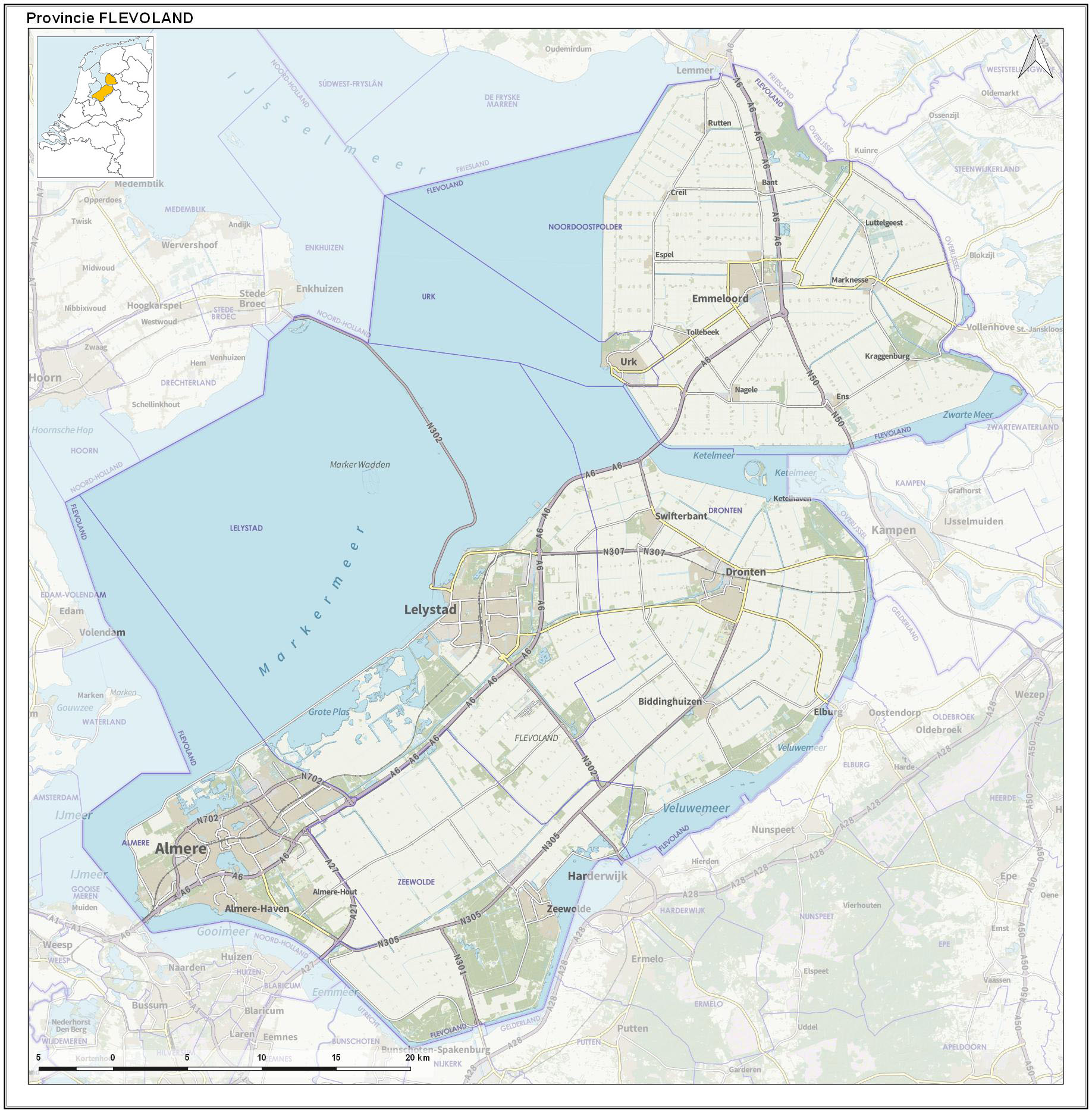
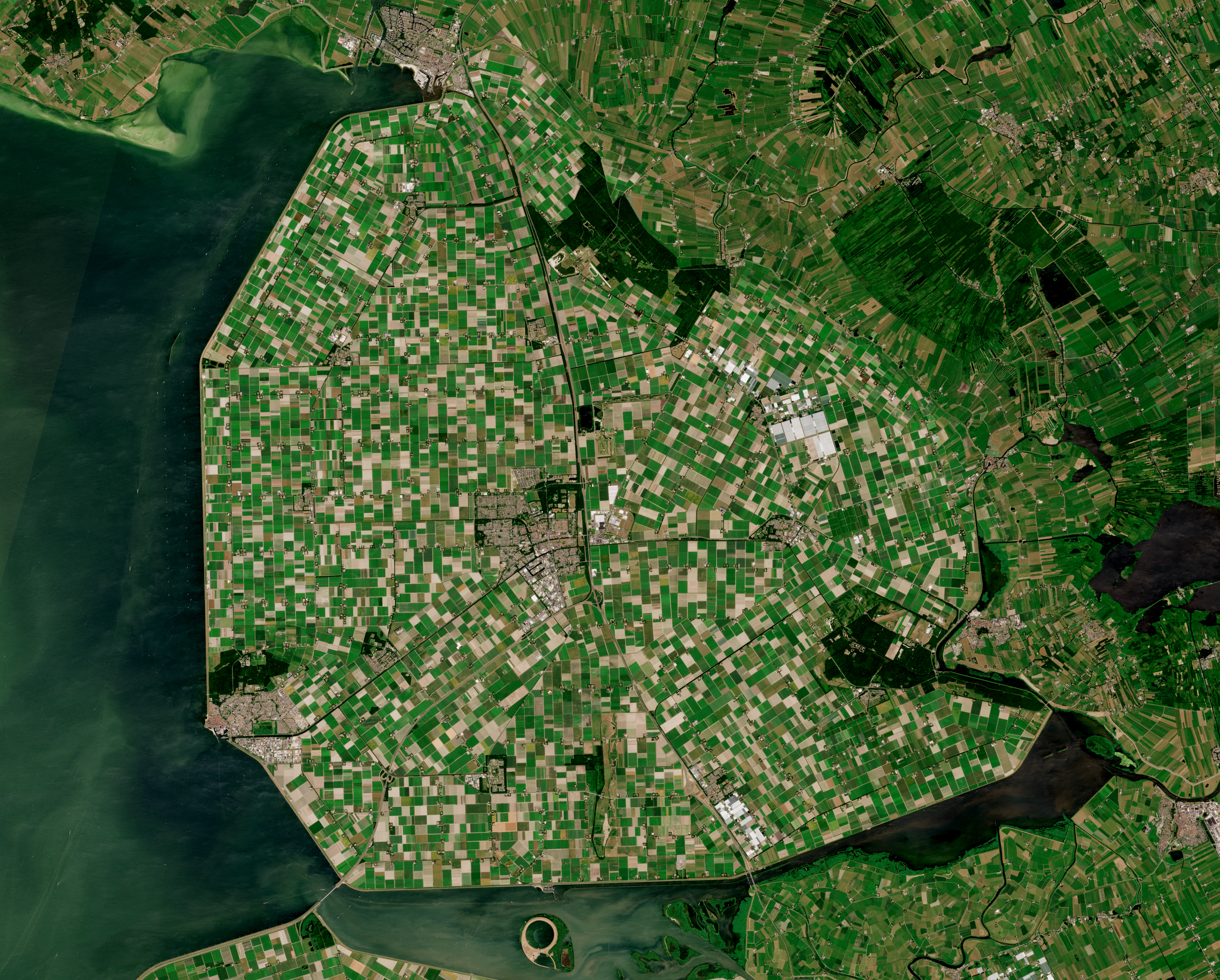
Flevoland () is the twelfth and youngest province of the Netherlands, established in 1986, when the southern and eastern Flevopolders, together with the Noordoostpolder, were merged into one provincial entity. It is in the centre of the country in the former Zuiderzee, which was turned into the freshwater IJsselmeer by the closure of the Afsluitdijk in 1932. Almost all of the land belonging to Flevoland was reclaimed in the 1950s and 1960s while splitting the Markermeer and Bordering lakes from the IJsselmeer. As to dry land, it is the smallest province of the Netherlands at , but not gross land as that includes much of the waters of the fresh water lakes (meres) mentioned. The province has a population of 423,021 as of January 2020 and consists of six municipalities. Its capital is Lelystad and its most populous city is Almere, which forms part of the Randstad and has grown to become the seventh largest city of the country. Flevoland is bordered in the extreme north by Fr ... [...More Info...] [...Related Items...] OR: [Wikipedia] [Google] [Baidu] |
Bordering Lakes
In the Netherlands, the bordering lakes (in Dutch: ''Randmeren'') are a chain of lakes which separate the Flevopolder and Noordoostpolder from the ancient lands of the provinces of Gelderland, Utrecht, Overijssel and Friesland.''Wateralmanak 2009: Vaargegevens'', ANWB, 2009p. 329/ref> Strictly speaking, these 'lakes' are not separated from each other, but are a continuous body of water between the old land and the new ''polder'' lands, consisting of lakes divided by straits, dams, locks, or in some cases just a bridge over narrow water. The purpose of these lakes is to isolate the water management of the polder land from that of the neighbouring old land. When a polder is created, the ground level within it is below that of the surrounding area. If the polder is connected directly to the old land, the groundwater level in the old land falls, which causes the soil to dry out.Tijdshrift van het Koninklijk Nederlandsch Aardrijkskundig Genootschap, 1964p. 24/ref> This was observed in ... [...More Info...] [...Related Items...] OR: [Wikipedia] [Google] [Baidu] |
Lakes Of The Netherlands
The Netherlands Environmental Assessment Agency published in 2010 a map of surface water bodies in the Netherlands. It distinguishes over 20 different types. There are water bodies with salty, brackish and sweet water; natural and artificial lakes by size, peat puddles and fens. The combined surface of the lakes larger than 50 hectares is 2,500 square kilometers. A comprehensive list of past and present lakes in the Netherlands is not available, selected lists are. Groups of lakes There are several groups of lakes or lake systems that are frequently described as a whole. Examples are: * Frisian Lakes, a group of 24 lakes in the province of Friesland * Borderling lakes, a body of water surrounding the Flevopolder often divided in ten parts or lakes Lakes The following is a list of lakes of the Netherlands. Ancient lakes The waterscape of the Netherlands is in continuous change. The following is a list of historical lakes in the Netherlands: * Haarlemmermeer * Lake A ... [...More Info...] [...Related Items...] OR: [Wikipedia] [Google] [Baidu] |
Huizen
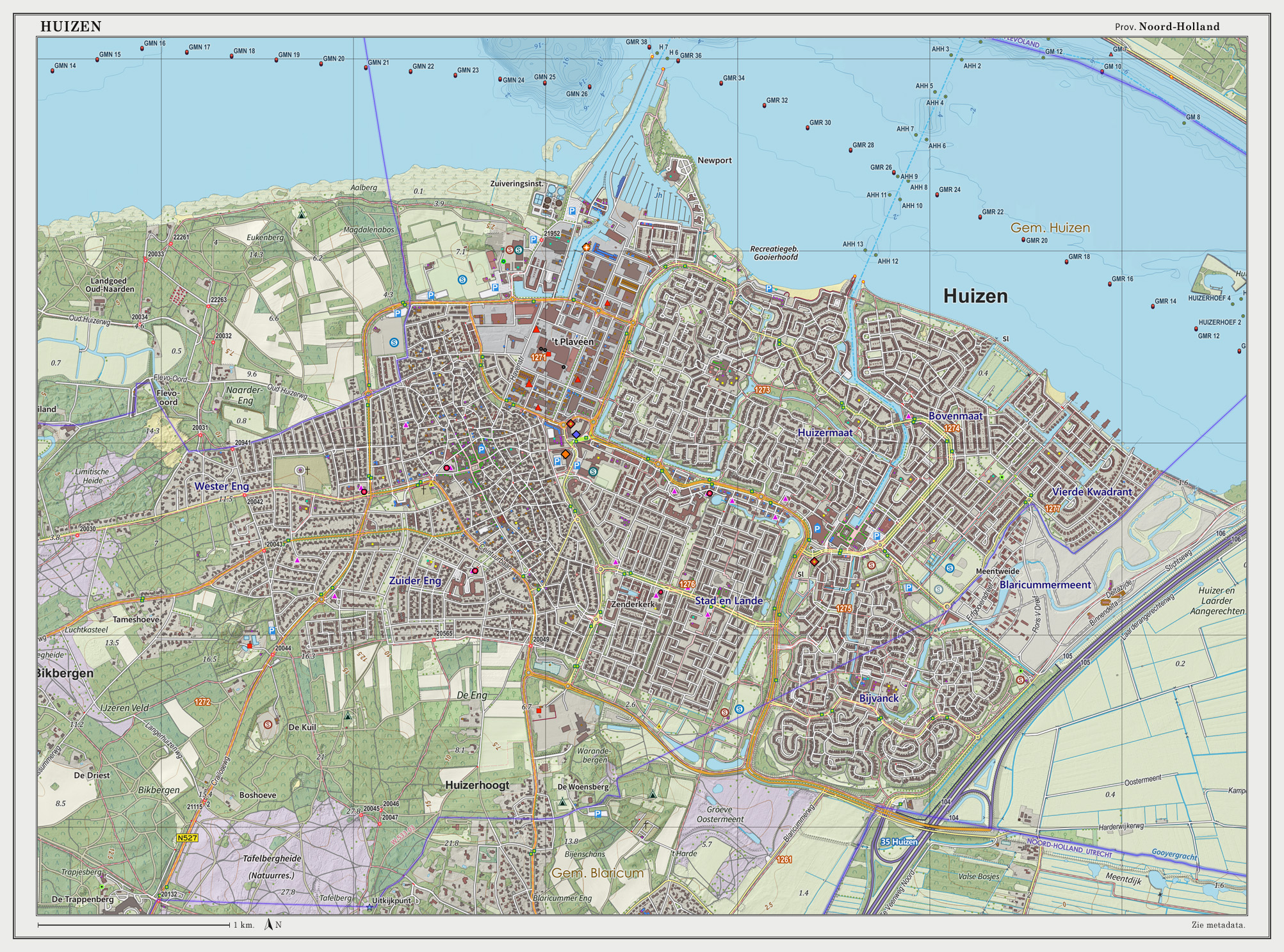
Huizen () is a municipality and a village in the province of North Holland, the Netherlands. The name "Huizen" is Dutch for "houses" and this usage has been linked to the belief that the first stone houses, instead of the more common sod houses at the time, in the region appeared here. Huizen is part of the metropolitan area of Amsterdam. History Huizen was originally an agricultural village, nearby the Zuiderzee until 1932. During wintertime the farmers went fishing, which started the development from an agricultural village to a coastal village with a thriving fishing industry, which was stimulated by building the harbour around 1850. After the damming of the Zuiderzee due the making of the Afsluitdijk in 1932, the old sea was degraded to a lake, without any economical activities shifted towards industry and commerce. In the 1960s the town was designated to build substantially large residential areas, to overcome the housing shortage in the region. From then on, the village to ... [...More Info...] [...Related Items...] OR: [Wikipedia] [Google] [Baidu] |
Zuiderzee Works
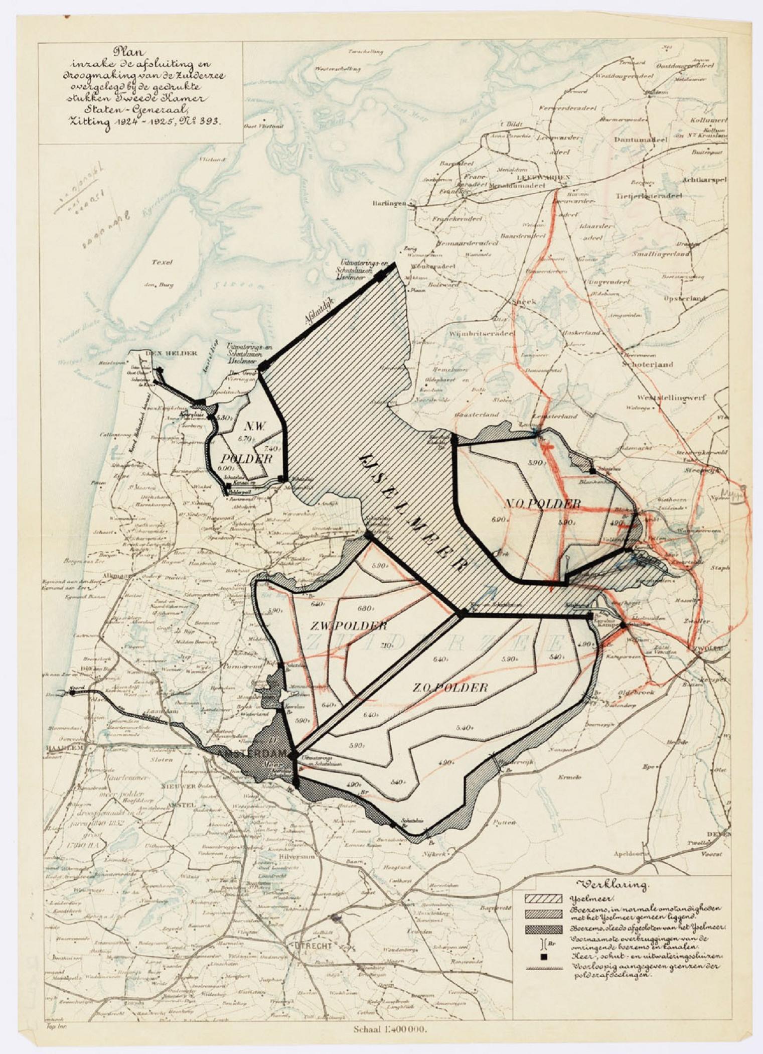
The Zuiderzee Works ( nl, Zuiderzeewerken) is a man-made system of dams and dikes, land reclamation and water drainage work, in total the largest hydraulic engineering project undertaken by the Netherlands during the twentieth century. The project involved the damming of the Zuiderzee, a large, shallow inlet of the North Sea, and the reclamation of land in the newly enclosed water using polders. Its main purposes are to improve flood protection and create additional land for agriculture. The American Society of Civil Engineers declared these works, together with the Delta Works in the South-West of the Netherlands, as among the Seven Wonders of the Modern World. Background The "Netherlands" (literally the "Low Countries") have low flat topography, with half the land area below or less than one metre above sea level, and has for centuries been subject to periodic flooding by the sea. The seventeenth century saw early proposals to tame and enclose the Zuiderzee, but the ambit ... [...More Info...] [...Related Items...] OR: [Wikipedia] [Google] [Baidu] |

.png)


