|
Gobannium
Gobannium was a Roman fort and civil settlement or Castra established by the Roman legions invading what was to become Roman Wales and lies today under the market town of Abergavenny, Monmouthshire in south east Wales. Documentary evidence Gobannium was first recorded in the Antonine Itinerary of the late 2nd century AD as 'Gobannio' sited some 12 miles from Burrium, (modern Usk) and 22 miles south of Magnis (now Kenchester, Herefordshire). Gobannium is also mentioned in the Ravenna Cosmography as 'Bannio', sited between Isca Augusta the major legionary fortress covering South Wales (Caerleon) further down the River Usk, and Bremia ( Llanio, Ceredigion). The name is thought to have a Celtic or Brythonic language origin and linked to Gobannus and Gofannon and may mean 'the river of the blacksmiths'. Location Gobannium lies in the broad valley of the River Usk surrounded by hills and mountains, such as the Sugar Loaf Mountain, Wales, the Skirrid and the Blorenge, just be ... [...More Info...] [...Related Items...] OR: [Wikipedia] [Google] [Baidu] |
Abergavenny
Abergavenny (; cy, Y Fenni , archaically ''Abergafenni'' meaning "mouth of the River Gavenny") is a market town and community in Monmouthshire, Wales. Abergavenny is promoted as a ''Gateway to Wales''; it is approximately from the border with England and is located where the A40 trunk road and the A465 Heads of the Valleys road meet. Originally the site of a Roman fort, Gobannium, it became a medieval walled town within the Welsh Marches. The town contains the remains of a medieval stone castle built soon after the Norman conquest of Wales. Abergavenny is situated at the confluence of the River Usk and a tributary stream, the Gavenny. It is almost entirely surrounded by mountains and hills: the Blorenge (), the Sugar Loaf (), Ysgyryd Fawr (Great Skirrid), Ysgyryd Fach (Little Skirrid), Deri, Rholben and Mynydd Llanwenarth, known locally as " Llanwenarth Breast". Abergavenny provides access to the nearby Black Mountains and the Brecon Beacons National Park. The M ... [...More Info...] [...Related Items...] OR: [Wikipedia] [Google] [Baidu] |
Gofannon
Gofannon () is a Middle Welsh reflex of Gobannus, one of the deities worshipped by the ancient Celts. He features in Middle Welsh literature as a great metal worker and as the son of Dôn. His name can be compared with the Old Irish ''gobae'' (gen. ''gobann'') ‘smith’, Middle Welsh / Cornish / Breton ''gof'' (pl. ''gofein'') ‘smith’, Gaulish ''gobedbi'' ‘with the smiths’, all of which are cognate with Lithuanian ''gabija'' ‘sacred home fire’, ''gabus'' ‘gifted, clever’. His apparent counterpart in Irish mythology, Goibniu, in addition to his duties as a smith, also takes on the role of a divine hero who brewed an ale of immortality, in addition to being an architect and builder. In Welsh mythology, Gofannon killed his nephew, Dylan Ail Don, not knowing who he was. One of the tasks given to Culhwch if he were to win the hand of Olwen In Welsh mythology, Olwen (or Olwyn) is the daughter of the giant Ysbaddaden and cousin of Goreu. She is the heroine of t ... [...More Info...] [...Related Items...] OR: [Wikipedia] [Google] [Baidu] |
Gobannus
Gobannus (or Gobannos, the Gaulish form, sometimes Cobannus) was a Gallo-Roman smithing god. A number of statues dedicated to him are preserved, found together with a bronze cauldron dedicated to ''Deus Cobannos'', in the late 1980s and illegally exported to the United States, now in the Getty Museum in the Getty Center, in California. He is mentioned in an inscription found in the 1970s in Fontenay-près-Vézelay, reading AVG(VSTO) SAC(RVM) E COBANNO, i.e. dedicated to Augustus and ''Deus Cobannus''. Etymology The theonym ''Gobannos'', attested as ''Deo Cobanno'' on inscriptions, is derived from the Proto-Celtic stem *''goben''-, meaning 'smith' (cf. Old Irish ''gobae'', Middle Welsh ''gof,'' Middle Breton ''gof(f)'', Old Cornish ''gof'' 'smith'; cf. also Gaulish ''gobedbi'' 'with the smiths' < *''goben-bi'' or *''gob-et''-''bi-''). The same stem can be found in the Irish deity '' |
Bremia (fort)
Bremia is the name of the Roman fort in the small dispersed settlement of Llanio, West Wales. It is in Llanddewi Brefi Community (Wales), community area, south-west of Tregaron, in Ceredigion. The fort was built by the Roman Britain, Romans around AD 75 and was in use to AD 120 in Wales in the Roman Era, Roman Wales. The fort was situated on Sarn Helen, a Roman road leading north from the fort at Dolaucothi. Five inscribed stones have been found within the fort and surrounding military settlement. Two of these have inscriptions which show the garrison to include to a cohort (military unit), cohort from the Asturias, northern Spain.coflein NPRN: 303530 accessed 15 October 2013 Amongst the excavations on the site, is the Thermae, bathhouse. The bathhouse and fort are scheduled monuments, giving them statutory protection from dis ... [...More Info...] [...Related Items...] OR: [Wikipedia] [Google] [Baidu] |
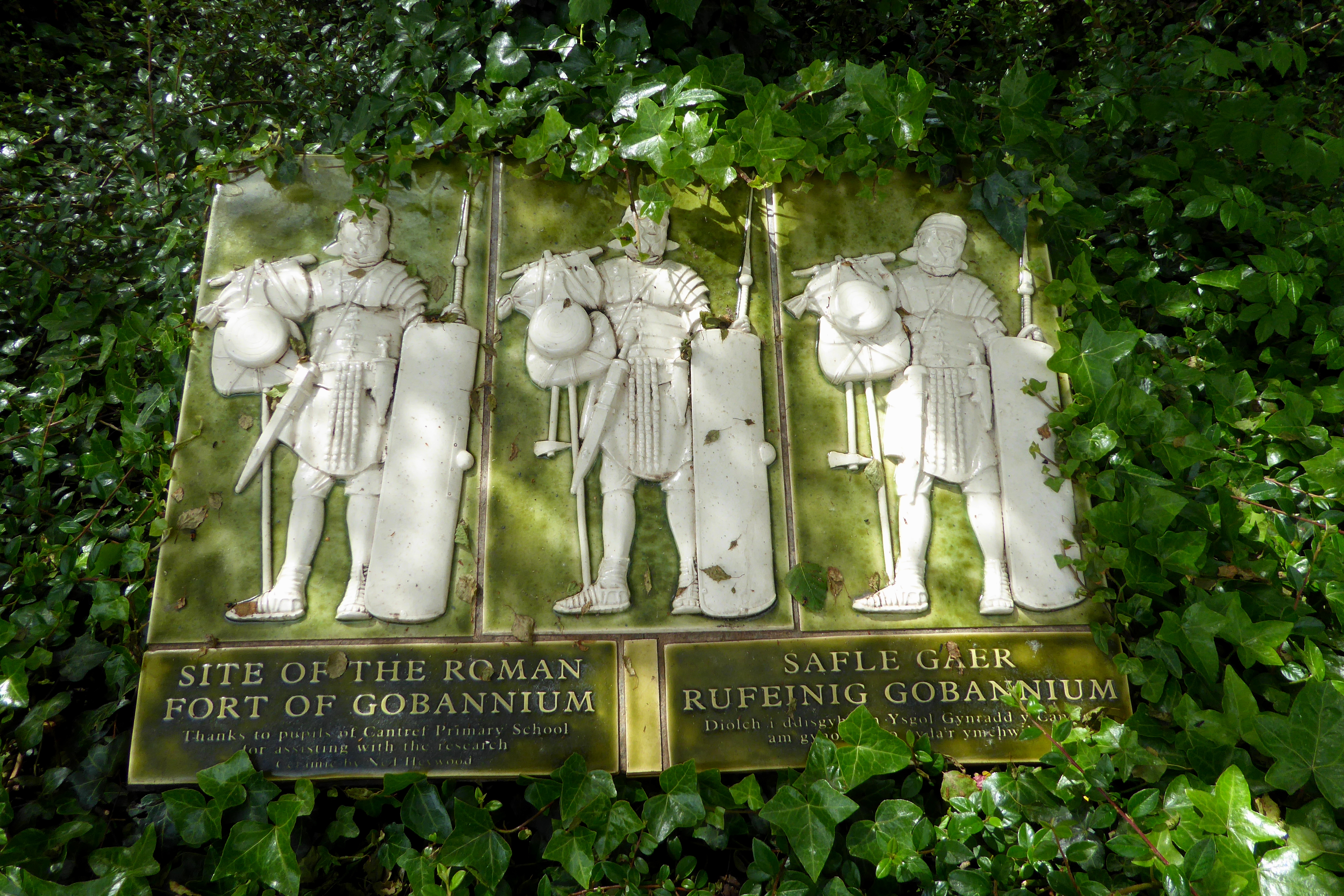
Plaque Marking The Roman Fort In Abergavenny
Plaque may refer to: Commemorations or awards * Commemorative plaque, a plate or tablet fixed to a wall to mark an event, person, etc. * Memorial Plaque (medallion), issued to next-of-kin of dead British military personnel after World War I * Plaquette, a small plaque in bronze or other materials Science and healthcare * Amyloid plaque * Atheroma or atheromatous plaque, a buildup of deposits within the wall of an artery * Dental plaque, a biofilm that builds up on teeth * A broad papule, a type of cutaneous condition * Pleural plaque, associated with mesothelioma, cancer often caused by exposure to asbestos * Senile plaques, an extracellular protein deposit in the brain implicated in Alzheimer's disease * Skin plaque, a plateau-like lesion that is greater in its diameter than in its depth * Viral plaque, a visible structure formed by virus propagation within a cell culture Other uses * Plaque, a rectangular casino token See also * * * Builder's plate * Plac (other) * ... [...More Info...] [...Related Items...] OR: [Wikipedia] [Google] [Baidu] |
Caerleon
Caerleon (; cy, Caerllion) is a town and community in Newport, Wales. Situated on the River Usk, it lies northeast of Newport city centre, and southeast of Cwmbran. Caerleon is of archaeological importance, being the site of a notable Roman legionary fortress, Isca Augusta, and an Iron Age hillfort. Close to the remains of Isca Augusta are the National Roman Legion Museum and the Roman Baths Museum. The town also has strong historical and literary associations: Geoffrey of Monmouth elevated the significance of Caerleon as a major centre of British history in his ''Historia Regum Britanniae'' (c. 1136), and Alfred Lord Tennyson wrote '' Idylls of the King'' (1859–1885) while staying in Caerleon. History Pre-Roman history The area around Caerleon is of considerable archaeological interest with a number of important Neolithic sites. By the Iron age, the area was home to the powerful Silures tribe and appears to have been the centre of a wealthy trading network, both manufact ... [...More Info...] [...Related Items...] OR: [Wikipedia] [Google] [Baidu] |
Archaeological
Archaeology or archeology is the scientific study of human activity through the recovery and analysis of material culture. The archaeological record consists of artifacts, architecture, biofacts or ecofacts, sites, and cultural landscapes. Archaeology can be considered both a social science and a branch of the humanities. It is usually considered an independent academic discipline, but may also be classified as part of anthropology (in North America – the four-field approach), history or geography. Archaeologists study human prehistory and history, from the development of the first stone tools at Lomekwi in East Africa 3.3 million years ago up until recent decades. Archaeology is distinct from palaeontology, which is the study of fossil remains. Archaeology is particularly important for learning about prehistoric societies, for which, by definition, there are no written records. Prehistory includes over 99% of the human past, from the Paleolithic until the adven ... [...More Info...] [...Related Items...] OR: [Wikipedia] [Google] [Baidu] |
Blorenge
Blorenge, also called The Blorenge (; cy, Blorens), is a prominent hill overlooking the valley of the River Usk near Abergavenny, Monmouthshire, southeast Wales. It is situated in the southeastern corner of the Brecon Beacons National Park. The summit plateau reaches a height of . Geography Blorenge overlooks the market town of Abergavenny and the villages of Llanfoist and Govilon in the Usk Valley to the north. At the foot of the hill lies the Monmouthshire & Brecon Canal. It drops away steeply to the northwest into Cwm Llanwenarth. To the south, gentler slopes fall away to Blaenavon at the head of the Lwyd valley. Prominent peaks seen from the Blorenge include the Skirrid to the east of Abergavenny and the Sugar Loaf to the north. The high moorland ridge continues to the south of the minor road at Foxhunter car park and assumes the name Mynydd y Garn-fawr. The cairn referenced in the title of this southerly shoulder of Blorenge may be that now known as Carn y Defaid whic ... [...More Info...] [...Related Items...] OR: [Wikipedia] [Google] [Baidu] |
Skirrid
Ysgyryd Fawr ( en, Skirrid) is an easterly outlier of the Black Mountains in Wales, and forms the easternmost part of the Brecon Beacons National Park. The hill is often referred to locally as just The Skirrid. The smaller hill of Ysgyryd Fach or "Little Skirrid" (270m) lies about 4.5 km / 2.5 mi to the south. It is 486 m or 1594 feet high and lies just to the north-east of Abergavenny, Monmouthshire, about 10 miles from the English border. The Beacons Way passes along the ridge. Geology The distinctive shape of this Old Red Sandstone hill comprises a long ridge oriented nearly north–south, with a jagged western side resulting from ice age landslips . The upper slopes of the hill are composed of Devonian age sandstones assigned to the Senni Formation (formerly known as the "Senni Beds"). These overlie weaker mudstones of the St Maughans Formation - a situation which has contributed to the instability of the hill's steep flanks, resulting in a ve ... [...More Info...] [...Related Items...] OR: [Wikipedia] [Google] [Baidu] |
Sugar Loaf Mountain, Wales
Sugar Loaf, sometimes called The Sugar Loaf ( cy, Mynydd Pen-y-fâl or ), is a hill situated north-west of Abergavenny in Monmouthshire, Wales and sits within the Brecon Beacons National Park. It is the southernmost of the summit peaks of the Black Mountains, with a height of 1,955 feet (596 metres). Sugar Loaf was gifted to the National Trust by suffragette Lady Rhondda. Name The original Welsh name of the hill appears to have been Mynydd Pen-y-fâl. Translated into English, this name means 'mountain of the head/top of the peak/summit' from ''mynydd'', ''pen'' and ''bâl''. The name Sugar Loaf has been popularly applied to numerous hills which have a perceived resemblance to a sugarloaf; the nearest other such hill is the Sugar Loaf, Carmarthenshire. Prehistory A southern foothill of Sugar Loaf, ''Y Graig'', was discovered in the 1990s to be the site of prehistoric flint tools dating from the Mesolithic, Neolithic and Bronze Ages. Geology It is a popular m ... [...More Info...] [...Related Items...] OR: [Wikipedia] [Google] [Baidu] |
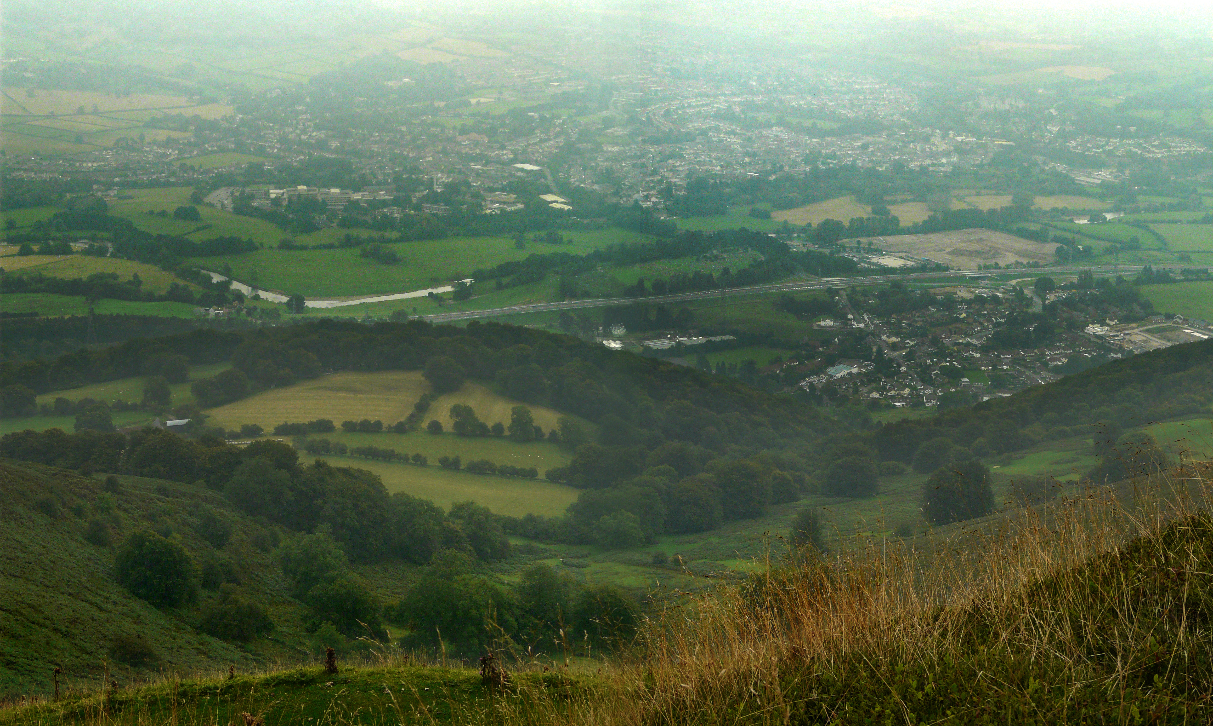
Location Of Gobannium In Abergavenny
In geography, location or place are used to denote a region (point, line, or area) on Earth's surface or elsewhere. The term ''location'' generally implies a higher degree of certainty than ''place'', the latter often indicating an entity with an ambiguous boundary, relying more on human or social attributes of place identity and sense of place than on geometry. Types Locality A locality, settlement, or populated place is likely to have a well-defined name but a boundary that is not well defined varies by context. London, for instance, has a legal boundary, but this is unlikely to completely match with general usage. An area within a town, such as Covent Garden in London, also almost always has some ambiguity as to its extent. In geography, location is considered to be more precise than "place". Relative location A relative location, or situation, is described as a displacement from another site. An example is "3 miles northwest of Seattle". Absolute location An absolute locatio ... [...More Info...] [...Related Items...] OR: [Wikipedia] [Google] [Baidu] |
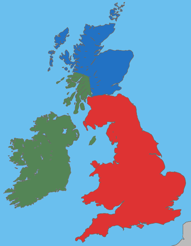
Brythonic Languages
The Brittonic languages (also Brythonic or British Celtic; cy, ieithoedd Brythonaidd/Prydeinig; kw, yethow brythonek/predennek; br, yezhoù predenek) form one of the two branches of the Insular Celtic language family; the other is Goidelic. The name ''Brythonic'' was derived by Welsh Celticist John Rhys from the Welsh word , meaning Ancient Britons as opposed to an Anglo-Saxon or Gael. The Brittonic languages derive from the Common Brittonic language, spoken throughout Great Britain during the Iron Age and Roman period. In the 5th and 6th centuries emigrating Britons also took Brittonic speech to the continent, most significantly in Brittany and Britonia. During the next few centuries the language began to split into several dialects, eventually evolving into Welsh, Cornish, Breton, Cumbric, and probably Pictish. Welsh and Breton continue to be spoken as native languages, while a revival in Cornish has led to an increase in speakers of that language. Cumbric and Pictish ... [...More Info...] [...Related Items...] OR: [Wikipedia] [Google] [Baidu] |


.jpg)

.jpg)

.jpg)
