|
Glendowie
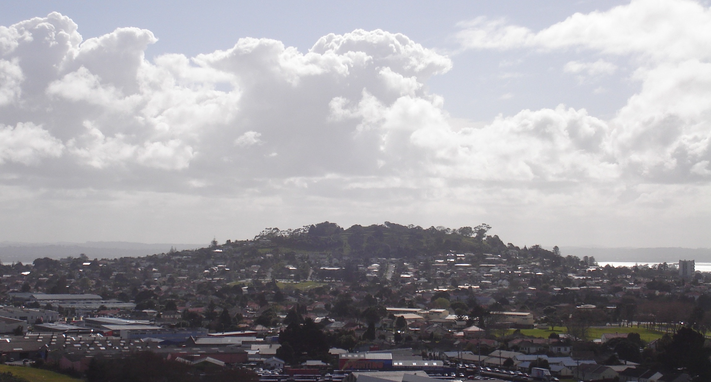
Glendowie is a suburb in Auckland, New Zealand. It is under the local governance of Auckland Council. It was under Auckland City Council from 1989 until the merger of all of Auckland's councils into the "super city" in 2010. Location Glendowie is located on the north-eastern extent of the Auckland isthmus. Its northern and eastern boundaries are defined by the Waitematā Harbour and the Tamaki Estuary. The suburbs exhibit an affluent suburban residential character. History Historically, the area of Glendowie around Taylors Hill was a forest of mostly puriri trees. The eastern edge of Glendowie bordering the Tāmaki River was called Tauoma, and was the Eastern edge of the area settled by Te Waiohua, the largest settlement of which was called Te Taurere (located at Taylors Hill). Around 1750, Ngāti Whātua expanded their territory further into Tāmaki Makaurau, and gifted the land to Ngāti Pāoa in the late 1700s. The suburb of Glendowie was established in the 1920s, when ... [...More Info...] [...Related Items...] OR: [Wikipedia] [Google] [Baidu] |
Saint Heliers
Saint Heliers is an affluent seaside suburb of Auckland with a population of as of This suburb is popular amongst visitors for the beaches, cafés, and views of Rangitoto Island, the distinctive volcanic island in the Hauraki Gulf. St. Heliers is located at the eastern end of Tamaki Drive, and used to be the place where the Tamaki River, Tamaki estuary formally divided Auckland from Manukau City, until the entire Auckland region was amalgamated under a single city authority, the Auckland Council, in 2010. Local government of St. Heliers is the responsibility of the Ōrākei Local Board, which also covers the suburbs of Ōrākei, Kohimarama, Mission Bay, New Zealand, Mission Bay, Glendowie, New Zealand, Glendowie, Saint Johns, New Zealand, St Johns, Meadowbank, New Zealand, Meadowbank, Remuera and Ellerslie, New Zealand, Ellerslie. Demographics Saint Heliers covers and had an estimated population of around 12,000 as of August 2022 with a population density of people per km2. ... [...More Info...] [...Related Items...] OR: [Wikipedia] [Google] [Baidu] |
Wai O Taiki Bay
Wai o Taiki Bay is a suburb in Auckland, New Zealand. It is under the local governance of Auckland Council. Location Bordering Glen Innes, Glendowie and the Tamaki River estuary. Demographics The statistical area of Glen Innes East-Wai O Taiki Bay covers and had an estimated population of as of with a population density of people per km2. Glen Innes East-Wai O Taiki Bay had a population of 3,447 at the 2018 New Zealand census, a decrease of 90 people (−2.5%) since the 2013 census, and a decrease of 408 people (−10.6%) since the 2006 census. There were 915 households, comprising 1,725 males and 1,719 females, giving a sex ratio of 1.0 males per female. The median age was 29.3 years (compared with 37.4 years nationally), with 900 people (26.1%) aged under 15 years, 858 (24.9%) aged 15 to 29, 1,434 (41.6%) aged 30 to 64, and 255 (7.4%) aged 65 or older. Ethnicities were 39.7% European/Pākehā, 22.1% Māori, 46.0% Pacific peoples, 9.9% Asian, and 2.5% other ethnicities ... [...More Info...] [...Related Items...] OR: [Wikipedia] [Google] [Baidu] |
Glen Innes, New Zealand
Glen Innes is a suburb in East Auckland, New Zealand, located nine kilometres to the east of the city centre, close to the waters of the Tamaki River estuary. Glen Innes gets its name from a large farm owned by William Innes Taylor that was here. There were four Taylor brothers in Auckland, the sons of a British man who had had a military career in India. Three of the brothers had farms in this area and built houses; William Innes Taylor at Glen Innes, Richard James Taylor at Glendowie and Charles John Taylor at Glen Orchard (now Saint Heliers). Their brother Allan Kerr Taylor had a farm estate in Mount Albert, whose house was called Alberton. The main streets in Glen Innes are Taniwha Street and Apirana Avenue, which meet in the shopping centre of the suburb. Glen Innes has a train station on the Eastern Line of the Auckland rail network, and is a hub for eastern Auckland isthmus buses ( Metrolink). Glen Innes has for the most part been a low-income, working class area ... [...More Info...] [...Related Items...] OR: [Wikipedia] [Google] [Baidu] |
Charles John Taylor
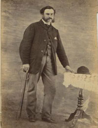
Charles John Taylor (1826 – 22 April 1897) was a New Zealand politician. He was the second son of General Taylor (1790–1868) who owned land at west Tamaki, now absorbed into the Auckland suburban area. Charles was a judge in India before emigrating to New Zealand, and was a director of The Bank of New Zealand, of which his brother, Allan Kerr Taylor, was auditor Charles John Taylor lived at Glen Orchard (now Saint Heliers, Auckland), and had two brothers and one half-brother who also lived in Auckland: William Innes Taylor at Glen Innes, and Richard James Taylor at Glen Dowie. The names of the latter two properties became the names of the suburbs Glen Innes and Glendowie respectively. The half-brother, Allan Kerr Taylor, lived in Mount Albert in a house called Alberton. The Mount Albert Taylors became known as the Kerr Taylors or Kerr-Taylors – apparently adopting Allan's middle name as part of their surname. Charles John Taylor served in the 1st New Zealand Par ... [...More Info...] [...Related Items...] OR: [Wikipedia] [Google] [Baidu] |
Allen Kerr Taylor
Allan Kerr Taylor (30 December 1832 – 14 April 1890) was a notable New Zealand landowner and businessman. He was born in Negapatam, India in 1832. His second wife was Sophia Taylor (née Davis). His father was General William Taylor. Personal life In 1848, he emigrated to New Zealand where his father owned land at west Tamaki, now absorbed into the Auckland suburban area. At the age of 16, he bought of land at Mount Albert, later adding another , and calling the property ''Alberton''. Allan Kerr Taylor's three eldest brothers lived in Auckland near the Tamaki River: Charles John Taylor at Glen Orchard (now Saint Heliers), William Innes Taylor at Glen Innes, and Richard James Taylor at Glen Dowie. The names of the latter two properties became the names of the suburbs Glen Innes and Glendowie respectively. The Mount Albert Taylors became known as the Kerr Taylors or Kerr-Taylors – apparently adopting Allan's middle name as part of their surname. Kerr Taylor was a member ... [...More Info...] [...Related Items...] OR: [Wikipedia] [Google] [Baidu] |
Te Ākitai Waiohua
Te Ākitai Waiohua is a Māori iwi of the southern part of the Auckland Region of New Zealand. History Te Ākitai Waiohua are descended from Kiwi Tāmaki, the grandson of Huakaiwaka, himself the ancestor of the Waiohua iwi, who lived in Tāmaki (the Auckland isthmus). The name ''Te Ākitai'' commemorates Kiwi Tāmaki's uncle Huatau, who, in the early 18th century, died at sea in the Manukau Harbour and whose body was dashed up (''āki'') by the sea (''tai'') on Puketutu Island. Kiwi Tāmaki was killed in battle with Te Taoū ''hapū'' (sub-tribe) of Ngāti Whātua in the mid-18th century. Ngāti Whātua settled in Tāmaki and the Waiohua retreated to Drury, Pōkeno, Kirikiri/Papakura, Ramarama and other parts of South Auckland. In the 1780s Te Ākitai Waiohua re-established settlements at Wiri, Pūkaki and Otahuhu. Kiwi Tāmaki had a surviving son named Rangimatoru, who lived in South Auckland with Ngā Oho, a hapū of Ngāti Whātua Ōrākei formed by intermarriages between ... [...More Info...] [...Related Items...] OR: [Wikipedia] [Google] [Baidu] |
Mount Albert, New Zealand
Mount Albert is an inner suburb of Auckland, New Zealand, which is centred on Ōwairaka / Mount Albert, a local volcanic peak which dominates the landscape. In the past Mt Albert also referred to the 2,500 acre borough that was created in 1911 on the outskirts of Auckland City. Mt Albert was also one of the original five wards within the Mt Albert Borough. The suburb is located seven kilometres to the southwest of the Auckland CBD, Central Business District (CBD). Volcano The peak, in parkland at the southern end of the suburb, is 135 metres in height, and is one of the many extinct cones which dot the city of Auckland, all of which are part of the Auckland volcanic field. Suburb Mount Albert suburb was the second that developed in Auckland, after Remuera. It was mostly settled by well-off families in the late 1800s and early 1900s. Significant growth occurred between the two world wars. It is surrounded by the neighbouring suburbs of Owairaka, Sandringham, New Zealand, Sandr ... [...More Info...] [...Related Items...] OR: [Wikipedia] [Google] [Baidu] |
Auckland
Auckland (pronounced ) ( mi, Tāmaki Makaurau) is a large metropolitan city in the North Island of New Zealand. The List of New Zealand urban areas by population, most populous urban area in the country and the List of cities in Oceania by population, fifth largest city in Oceania, Auckland has an urban population of about It is located in the greater Auckland Region—the area governed by Auckland Council—which includes outlying rural areas and the islands of the Hauraki Gulf, and which has a total population of . While European New Zealanders, Europeans continue to make up the plurality of Auckland's population, the city became multicultural and Cosmopolitanism, cosmopolitan in the late-20th century, with Asian New Zealanders, Asians accounting for 31% of the city's population in 2018. Auckland has the fourth largest Foreign born, foreign-born population in the world, with 39% of its residents born overseas. With its large population of Pasifika New Zealanders, the city is ... [...More Info...] [...Related Items...] OR: [Wikipedia] [Google] [Baidu] |
Tāmaki Makaurau
Tāmaki Makaurau is a New Zealand parliamentary Māori electorate returning one Member of Parliament to the New Zealand House of Representatives. It was first formed for the . The electorate covers the Auckland area and was first held by Labour's John Tamihere before going to Dr Pita Sharples of the Māori Party for three terms from to 2014. After Sharples' retirement, the electorate was won by Peeni Henare of the Labour Party in the . It derives its name from the Māori-language name for Auckland; is a descriptive epithet referring to the value and desirability of the land. Population centres In its current boundaries, Tāmaki Makaurau contains the west coast of the Auckland Region between Te Henga / Bethells Beach and the mouth of the Manukau Harbour, all of West Auckland south of Te Atatū, the entire Auckland isthmus, and the South Auckland suburbs of Māngere, Ōtara, Pakuranga and Manurewa. It does not contain Great Barrier or Rangitoto islands, as they are in Te Ta ... [...More Info...] [...Related Items...] OR: [Wikipedia] [Google] [Baidu] |


_p225_AUCKLAND%2C_NEW_ZEALAND.jpg)