|
Glascote
Glascote is an area of Tamworth, in the Tamworth district, in Staffordshire, England. The area centres on the Glascote Road, and is mainly residential with a few convenience stores and pubs. History Glascote is derived from the Old English word for glass and ‘cot’, meaning a hut. This suggests ‘a glass workshop’ since ‘cot’ is usually associated with some form of industrial process. The manor of Glascote dates back to the 12th century. It was owned by the Longueville and Ferrers families, and eventually became part of the landholdings of Lord Townshend, in 1815. It was acquired by the Corporation of Tamworth in 1897 along with the Bolehall estate. Sitting on the Glascote Road that runs from Tamworth town centre the village of Glascote is the oldest part containing mainly Victorian Terrace houses whilst much of Glascote located near the Marlborough Way dates from the post 1960s when the area grew rapidly and as a result much of the area has New Town style archite ... [...More Info...] [...Related Items...] OR: [Wikipedia] [Google] [Baidu] |
Listed Buildings In Tamworth, Staffordshire
Tamworth is a market town and borough in Staffordshire, England. It contains 138 listed buildings that are recorded in the National Heritage List for England. Of these, three are listed at Grade I, the highest of the three grades, five are at Grade II*, the middle grade, and the others are at Grade II, the lowest grade. The town includes its central area and the districts of Amington, Bolehall, Dosthill, Fazeley, Glascote, and Wilnecote. The most important buildings in the town are the Church of St Editha, and Tamworth Castle and its causeway walls, all of which are listed at Grade I. Most of the listed buildings are houses and associated structures, shops and offices, many of which originated as houses. The Coventry Canal passes through the town and makes a junction with the termination of the Birmingham and Fazeley Canal. The listed buildings associated with the canals are bridges, an aqueduct, and a milepost. The other listed buildings include ... [...More Info...] [...Related Items...] OR: [Wikipedia] [Google] [Baidu] |
Tamworth, Staffordshire
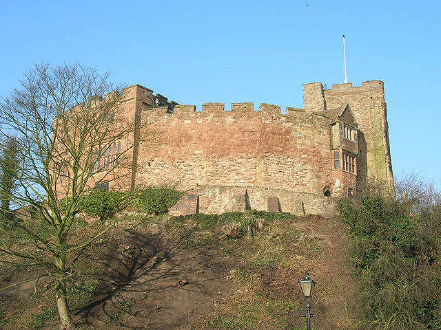
Tamworth (, ) is a market town and borough in Staffordshire, England, north-east of Birmingham. The town borders North Warwickshire to the east and north, Lichfield to the north, south-west and west. The town takes its name from the River Tame, which flows through it. The population of Tamworth borough () was . The wider urban area had a population of 81,964. Tamworth was the principal centre of royal power of the Anglo-Saxon Kingdom of Mercia during the 8th and 9th centuries. It hosts a simple but elevated 12th century castle, a well-preserved medieval church (the Church of St Editha) and a Moat House. Tamworth was historically divided between Warwickshire and Staffordshire until 1889, when the town was placed entirely in Staffordshire. The town's industries include logistics, engineering, clothing, brick, tile and paper manufacture. Until 2001 one of its factories was Reliant, which produced the Reliant Robin three-wheeler car and the Reliant Scimitar sports car. The ... [...More Info...] [...Related Items...] OR: [Wikipedia] [Google] [Baidu] |
Tamworth (borough)
Tamworth (, ) is a market town and borough in Staffordshire, England, north-east of Birmingham. The town borders North Warwickshire to the east and north, Lichfield to the north, south-west and west. The town takes its name from the River Tame, which flows through it. The population of Tamworth borough () was . The wider urban area had a population of 81,964. Tamworth was the principal centre of royal power of the Anglo-Saxon Kingdom of Mercia during the 8th and 9th centuries. It hosts a simple but elevated 12th century castle, a well-preserved medieval church (the Church of St Editha) and a Moat House. Tamworth was historically divided between Warwickshire and Staffordshire until 1889, when the town was placed entirely in Staffordshire. The town's industries include logistics, engineering, clothing, brick, tile and paper manufacture. Until 2001 one of its factories was Reliant, which produced the Reliant Robin three-wheeler car and the Reliant Scimitar sports car. Th ... [...More Info...] [...Related Items...] OR: [Wikipedia] [Google] [Baidu] |
A5 Road (Great Britain)
The A5 (commonly known as the London-Holyhead Trunk Road) is a major road in England and Wales. It runs for about from London to the Irish Sea at the ferry port of Holyhead. In many parts the route follows that of the Roman Iter II route which later took the Anglo-Saxon name Watling Street. History Roman Road The section of the A5 between London and Shrewsbury is roughly contiguous with one of the principal Roman roads in Britain: that between ''Londinium'' and ''Deva'', which diverges from the present-day A5 corridor at Wroxeter (''Viroconium Cornoviorum'') near Shrewsbury. Telford's Holyhead Road The Act of Union 1800, which unified Great Britain and Ireland, gave rise to a need to improve communication links between London and Dublin. A parliamentary committee led to an Act of Parliament of 1815 that authorised the purchase of existing turnpike road interests and, where necessary, the construction of new road, to complete the route between the two capitals. This made i ... [...More Info...] [...Related Items...] OR: [Wikipedia] [Google] [Baidu] |
Staffordshire
Staffordshire (; postal abbreviation Staffs.) is a landlocked county in the West Midlands region of England. It borders Cheshire to the northwest, Derbyshire and Leicestershire to the east, Warwickshire to the southeast, the West Midlands County and Worcestershire to the south and Shropshire to the west. The largest settlement in Staffordshire is Stoke-on-Trent, which is administered as an independent unitary authority, separately from the rest of the county. Lichfield is a cathedral city. Other major settlements include Stafford, Burton upon Trent, Cannock, Newcastle-under-Lyme, Rugeley, Leek, and Tamworth. Other towns include Stone, Cheadle, Uttoxeter, Hednesford, Brewood, Burntwood/Chasetown, Kidsgrove, Eccleshall, Biddulph and the large villages of Penkridge, Wombourne, Perton, Kinver, Codsall, Tutbury, Alrewas, Barton-under-Needwood, Shenstone, Featherstone, Essington, Stretton and Abbots Bromley. Cannock Chase AONB is within the county as well as parts of the ... [...More Info...] [...Related Items...] OR: [Wikipedia] [Google] [Baidu] |
Tamworth Herald
The ''Tamworth Herald'' is a weekly tabloid newspaper published every Thursday in Tamworth, Staffordshire, England, with a cover price of £1.40. The newspaper covers events across Tamworth and south Staffordshire, as well as North Warwickshire. The Herald was named ‘Newspaper of the Year’ at the Midland Media Awards in 2015 and 2016. In November 2018 the Herald celebrated its 150th anniversary with a party in the Town Hall History The newspaper was founded as a broadsheet in 1868 by businessman Daniel Addison, and the original offices were based in Silver Street. A `flyer` introducing the weekly Tamworth Herald advertised as a weekly newspaper for Tamworth with coverage of surrounding districts of Fazeley Wilnecote Glascote Bolehall Polesworth Austrey Newton Clifton Hopwas Hints Wigginton Elford. The first edition of the Tamworth Herald published on 8 August 1868 carried this advertisement on the front page.... Mr Addison continued to publish the paper for n ... [...More Info...] [...Related Items...] OR: [Wikipedia] [Google] [Baidu] |
United Kingdom Census 2001
A nationwide census, known as Census 2001, was conducted in the United Kingdom on Sunday, 29 April 2001. This was the 20th UK census and recorded a resident population of 58,789,194. The 2001 UK census was organised by the Office for National Statistics (ONS) in England and Wales, the General Register Office for Scotland (GROS) and the Northern Ireland Statistics and Research Agency (NISRA). Detailed results by region, council area, ward and output area are available from their respective websites. Organisation Similar to previous UK censuses, the 2001 census was organised by the three statistical agencies, ONS, GROS, and NISRA, and coordinated at the national level by the Office for National Statistics. The Orders in Council to conduct the census, specifying the people and information to be included in the census, were made under the authority of the Census Act 1920 in Great Britain, and the Census Act (Northern Ireland) 1969 in Northern Ireland. In England and Wales these re ... [...More Info...] [...Related Items...] OR: [Wikipedia] [Google] [Baidu] |
Birmingham
Birmingham ( ) is a city and metropolitan borough in the metropolitan county of West Midlands in England. It is the second-largest city in the United Kingdom with a population of 1.145 million in the city proper, 2.92 million in the West Midlands metropolitan county, and approximately 4.3 million in the wider metropolitan area. It is the largest UK metropolitan area outside of London. Birmingham is known as the second city of the United Kingdom. Located in the West Midlands region of England, approximately from London, Birmingham is considered to be the social, cultural, financial and commercial centre of the Midlands. Distinctively, Birmingham only has small rivers flowing through it, mainly the River Tame and its tributaries River Rea and River Cole – one of the closest main rivers is the Severn, approximately west of the city centre. Historically a market town in Warwickshire in the medieval period, Birmingham grew during the 18th century during the Midla ... [...More Info...] [...Related Items...] OR: [Wikipedia] [Google] [Baidu] |
BBC WM
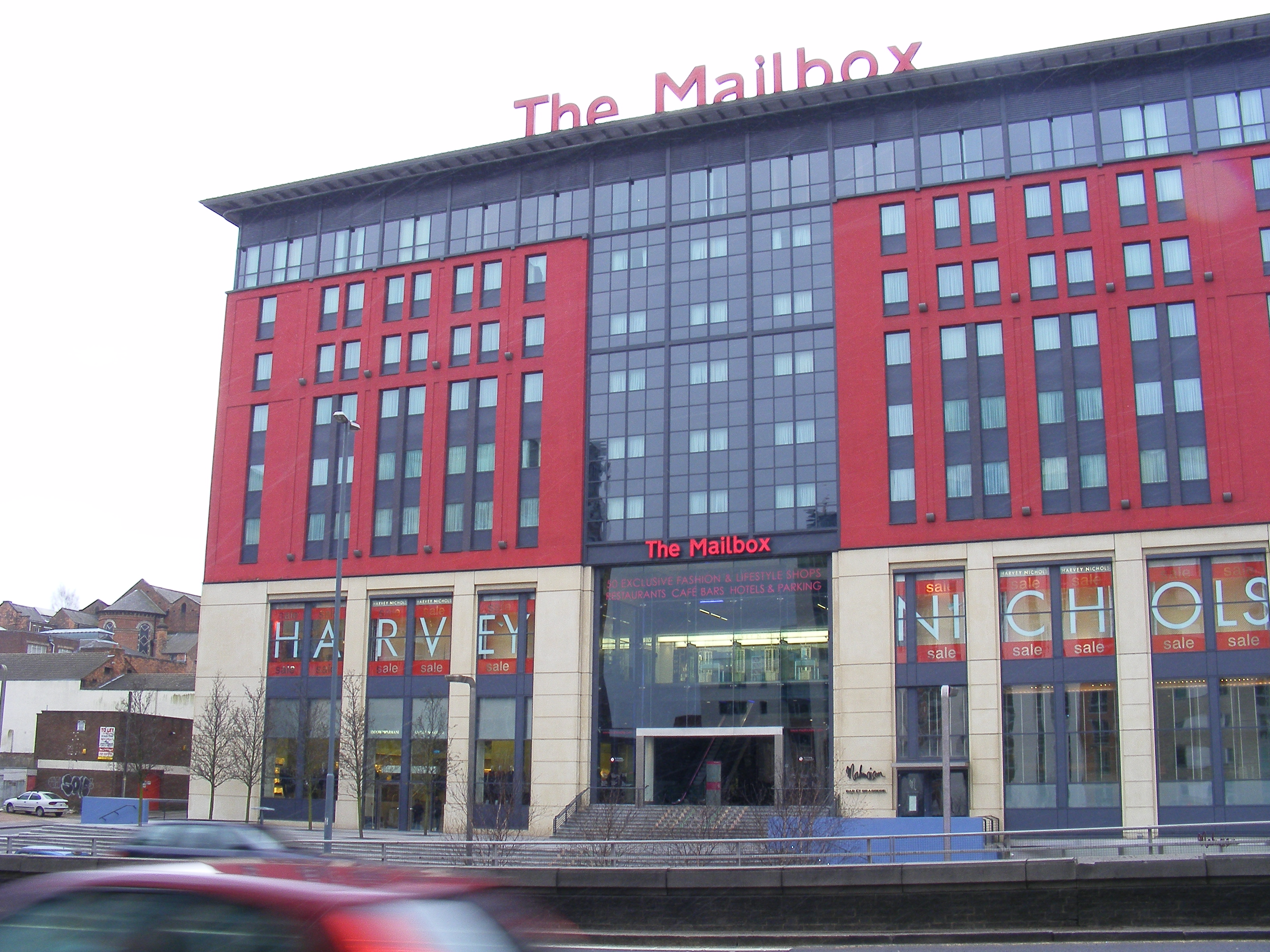
BBC Radio WM is the BBC's local radio station serving the West Midlands. It broadcasts on FM, DAB, digital TV and via BBC Sounds from studios at The Mailbox in Birmingham. According to RAJAR, the station has a weekly audience of 236,000 listeners and a 4.5% share as of September 2022. History Until 2004, BBC WM broadcast from the Pebble Mill studios, in Edgbaston. On 4 July of that year, the station moved to the new BBC Birmingham city centre offices in The Mailbox. Its facilities include two broadcast studios, a talk studio, an operations and production area, and a studio shared with the BBC Asian Network. On 23 November 1981, the station changed its name to BBC WM and had a studio in the back of a shop in New Street. The shop sold trinkets branded with the Radio WM identity. A short-lived service called WM Heartlands ran between early 1989 and 1991 serving the 'Heartlands' area of East Birmingham using the 1458MW frequency. It ran as an experiment, opting out from 080 ... [...More Info...] [...Related Items...] OR: [Wikipedia] [Google] [Baidu] |
BBC Local Radio
BBC Local Radio (also referred to as Local BBC Radio) is the BBC's local and regional radio division for England and the Channel Islands, consisting of forty stations. History The popularity of pirate radio was to challenge a change within the at the time very "stiff" and blinkered management at the BBC. The most prominent concession by the BBC was the creation of BBC Radio 1, to satisfy the ever-demanding new youth culture with their thirst for new, popular music. The other, however, was the fact that these pirate radio stations were, in some cases, local. As a result, BBC Local Radio began as an experiment. Initially, stations had to be co-funded by the BBC and local authorities, which only some Labour-controlled areas proved willing to do. Radio Leicester was the first to launch on 8 November 1967, followed by Leeds, Stoke, Durham, Sheffield, Merseyside, Brighton, and Nottingham. By the early 1970s, the local authority funding requirement was dropped, and stations spread ... [...More Info...] [...Related Items...] OR: [Wikipedia] [Google] [Baidu] |
Touch Radio (Burton, Lichfield And Tamworth)
Touch FM was an independent local radio station broadcasting to Burton, Lichfield, Tamworth and South Derbyshire, England. Centre FM Centre FM was created as the result of work by the Tamworth Community Radio Association. It was formed in 1993 with the purpose of developing a community radio station for the town and its surrounding areas. In 1996, TCRA, with a group of local businessmen and radio presenters, formed Centre Broadcasting Ltd to apply for the commercial broadcasting licence for South East Staffordshire. In addition to this, there was another rival bid from Burton-based Tower FM, who also did reading books for the blind. Considering there was interest in Burton and Swadlincote and Tamworth and Lichfield, both areas were merged by the Radio Authority. Centre FM launched on 6 June 1998, from studios at 5-6 Aldergate, Tamworth. Upon its launch, The board consisted of Ric Simon of TCRA, local business leader Keith Hayes, representatives of Central Independent New ... [...More Info...] [...Related Items...] OR: [Wikipedia] [Google] [Baidu] |
Birmingham Airport
Birmingham Airport , formerly ''Birmingham International Airport'', is an international airport located east-southeast of Birmingham city centre, west-northwest of Coventry slightly north of Bickenhill village, in the Metropolitan Borough of Solihull, England. Officially opened as ''Elmdon Airport'' on 8 July 1939, the airport was requisitioned by the Air Ministry during Second World War and used by both the Royal Air Force (RAF) and the Royal Navy as ''RAF Elmdon''. It was largely used for flight training and wartime production purposes. On 8 July 1946, the aerodrome was reopened to civilian operations. Birmingham Airport currently holds a CAA Public Use Aerodrome Licence (Number P451) that allows flights for the public transport of passengers or for flying instruction. Passenger throughput in 2017 was over 12.9 million, making Birmingham the seventh busiest airport in the UK. The airport offers international flights to destinations in Europe, the Middle East, the Ind ... [...More Info...] [...Related Items...] OR: [Wikipedia] [Google] [Baidu] |
.jpg)


