|
Gillamoor
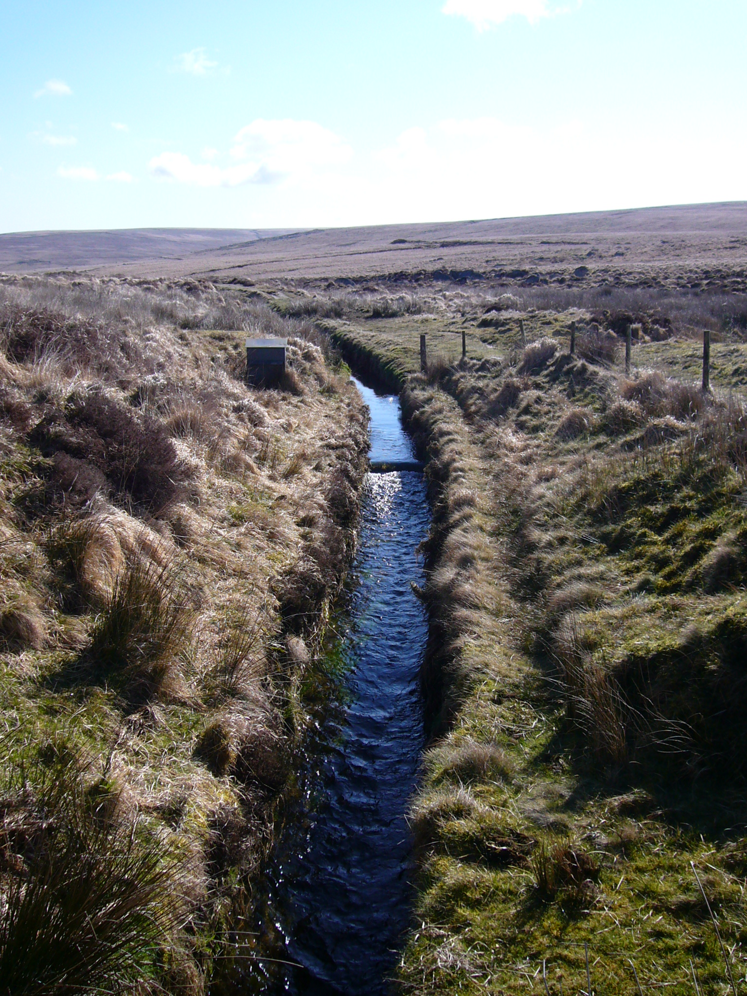
Gillamoor is a village and civil parish in the Ryedale district of the county of North Yorkshire, England. It is situated about north of Kirkbymoorside on the edge of the North York Moors National Park. The population of the parish as taken at the 2001 census was 168, dropping to 156 at the 2011 census was 156. In 2015, North Yorkshire County Council estimated the population of the parish to be 150 people. History The village is mentioned in the Domesday Book as having 15 villagers and seven ploughlands. The name derives from Old English ''Getla's inga mōr''; the moor of Getla's people (Getla being a personal name). In the 12th and 13th centuries, the spelling of the village was ''Gillemore''. In the 18th, 19th and 20th centuries, Gillamoor had water delivered via a channel cut by Joseph Foord. He created many miles of gently sloping leats that carried water from the moors into Fadmoor, Gillamoor and Kirkbymoorside. In 2000, the natural spring in the village was abandoned ... [...More Info...] [...Related Items...] OR: [Wikipedia] [Google] [Baidu] |
Farndale
Farndale is a valley and community in Ryedale district, North Yorkshire, England, which is known for the daffodils which flower each spring along a stretch of the River Dove. The valley is in the North York Moors National Park, some north of Kirkbymoorside, the nearest town. Pickering is some to the south-east and Helmsley to the south-west. The combined population of the civil parishes of Farndale East and Farndale West was 207 in 2011, and was estimated to have dropped to 180 by 2015. Farndale is an isolated, scattered agricultural community with traditional Yorkshire dry stone walls. The valley is popular with walkers due to its famous wild daffodils, which can be seen around Easter time all along the banks of the River Dove. To protect the daffodils the majority of Farndale north of Lowna was created a Local Nature Reserve in 1955. Farndale is home to two hamlets; Church Houses at the top of the valley and Low Mill further down. Low Mill is a tourist honey ... [...More Info...] [...Related Items...] OR: [Wikipedia] [Google] [Baidu] |
Kirkbymoorside
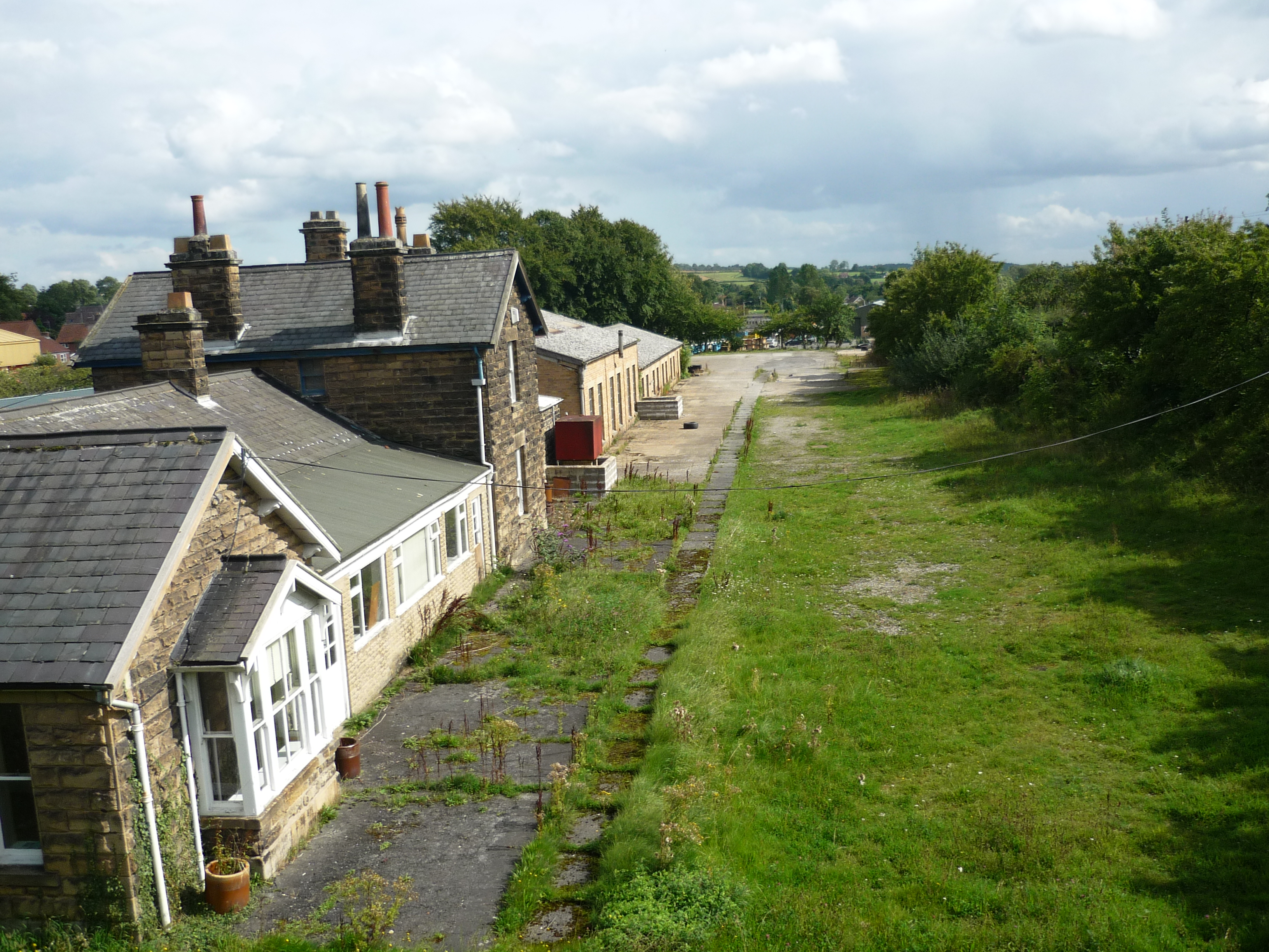
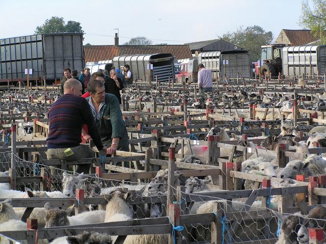
Kirkbymoorside () is a market town and civil parish in the Ryedale district in North Yorkshire, England. It is north of York, It is also midway between Pickering and Helmsley, on the edge of the North York Moors National Park. It had a population of 3,040 in the 2011 census. History Kirkbymoorside is noted as ''Chirchebi'' in the Domesday Book of 1086. It has served as a trading hub at least since 1254, when it became a market town. There are two ancient coaching inns extant, the ''Black Swan'' with its carved porch, and the cruck-framed ''George and Dragon'', which originated in the 13th century. The Georgian façades point to later periods of commercial prosperity on the coaching route between York and Scarborough. Some Ancient British, Viking and Anglo-Saxon remains have been found in the vicinity. The Norman baron Robert de Stuteville built a wooden moated castle on Vivers Hill. The estate passed to the Wake family in the 13th century, who brought prosperity to the town ... [...More Info...] [...Related Items...] OR: [Wikipedia] [Google] [Baidu] |
2011 Census For England And Wales
A census of the population of the United Kingdom is taken every ten years. The 2011 census was held in all countries of the UK on 27 March 2011. It was the first UK census which could be completed online via the Internet. The Office for National Statistics (ONS) is responsible for the census in England and Wales, the General Register Office for Scotland (GROS) is responsible for the census in Scotland, and the Northern Ireland Statistics and Research Agency (NISRA) is responsible for the census in Northern Ireland. The Office for National Statistics is the executive office of the UK Statistics Authority, a non-ministerial department formed in 2008 and which reports directly to Parliament. ONS is the UK Government's single largest statistical producer of independent statistics on the UK's economy and society, used to assist the planning and allocation of resources, policy-making and decision-making. ONS designs, manages and runs the census in England and Wales. In its capacity as t ... [...More Info...] [...Related Items...] OR: [Wikipedia] [Google] [Baidu] |
Domesday Book
Domesday Book () – the Middle English spelling of "Doomsday Book" – is a manuscript record of the "Great Survey" of much of England and parts of Wales completed in 1086 by order of King William I, known as William the Conqueror. The manuscript was originally known by the Latin name ''Liber de Wintonia'', meaning "Book of Winchester", where it was originally kept in the royal treasury. The '' Anglo-Saxon Chronicle'' states that in 1085 the king sent his agents to survey every shire in England, to list his holdings and dues owed to him. Written in Medieval Latin, it was highly abbreviated and included some vernacular native terms without Latin equivalents. The survey's main purpose was to record the annual value of every piece of landed property to its lord, and the resources in land, manpower, and livestock from which the value derived. The name "Domesday Book" came into use in the 12th century. Richard FitzNeal wrote in the ''Dialogus de Scaccario'' ( 1179) that the book ... [...More Info...] [...Related Items...] OR: [Wikipedia] [Google] [Baidu] |
Vale Of Pickering
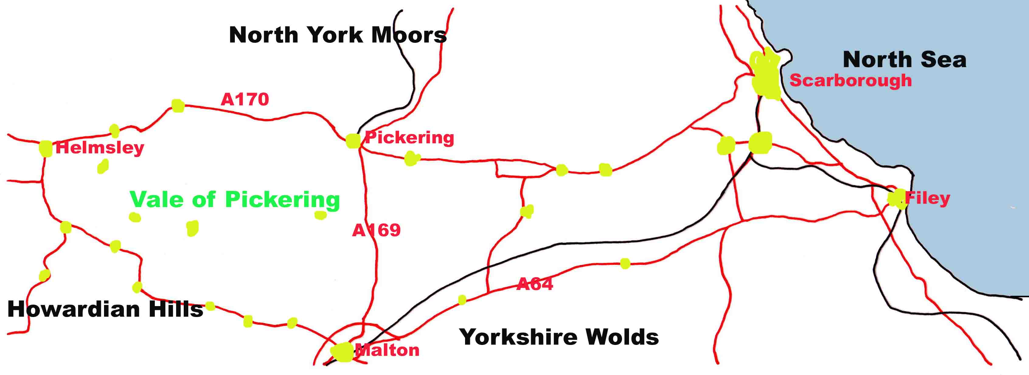
The Vale of Pickering is a low-lying flat area of land in North Yorkshire, England. It is drained by the River Derwent. The landscape is rural with scattered villages and small market towns. It has been inhabited continuously from the Mesolithic period. The present economy is largely agricultural with light industry and tourism playing an increasing role. Location and transport The Vale of Pickering is a low-lying plain, orientated in an east–west direction. It is well defined by the Yorkshire Wolds escarpment to the south, the Corallian limestone foothills of the North York Moors to the north, the North Sea coast to the east and the Howardian Hills to the west. The east–west-orientated main roads ( A64 and A170) in the vale follow the shoreline of the glacial lake, which formed in the vale after the last ice age. The main A169 road crosses the vale in a north–south direction, joining the market towns of Malton and Pickering. At the eastern edge of the vale the A165 ... [...More Info...] [...Related Items...] OR: [Wikipedia] [Google] [Baidu] |
Fadmoor
Fadmoor is a village and civil parish in the Ryedale district of North Yorkshire, England. It is on the border of the North York Moors and north of Kirkbymoorside. The name Fadmoor comes from Old English Old English (, ), or Anglo-Saxon, is the earliest recorded form of the English language, spoken in England and southern and eastern Scotland in the early Middle Ages. It was brought to Great Britain by Anglo-Saxon settlement of Britain, Anglo ... and means ''moor of a man called Fadda''. References External links Villages in North Yorkshire Civil parishes in North Yorkshire {{ryedale-geo-stub ... [...More Info...] [...Related Items...] OR: [Wikipedia] [Google] [Baidu] |
Leat
A leat (; also lete or leet, or millstream) is the name, common in the south and west of England and in Wales, for an artificial watercourse or aqueduct dug into the ground, especially one supplying water to a watermill or its mill pond. Other common uses for leats include delivery of water for hydraulic mining and mineral concentration, for irrigation, to serve a dye works or other industrial plant, and provision of drinking water to a farm or household or as a catchment cut-off to improve the yield of a reservoir. According to the ''Oxford English Dictionary'', ''leat'' is cognate with ''let'' in the sense of "allow to pass through". Other names for the same thing include ''fleam'' (probably a leat supplying water to a mill that did not have a millpool). In parts of northern England, for example around Sheffield, the equivalent word is ''goit''. In southern England, a leat used to supply water for water-meadow irrigation is often called a ''carrier'', ''top carrier'', or ' ... [...More Info...] [...Related Items...] OR: [Wikipedia] [Google] [Baidu] |
St Aidan's Church, Gillamoor - Geograph
ST, St, or St. may refer to: Arts and entertainment * Stanza, in poetry * Suicidal Tendencies, an American heavy metal/hardcore punk band * Star Trek, a science-fiction media franchise * Summa Theologica, a compendium of Catholic philosophy and theology by St. Thomas Aquinas * St or St., abbreviation of "State", especially in the name of a college or university Businesses and organizations Transportation * Germania (airline) (IATA airline designator ST) * Maharashtra State Road Transport Corporation, abbreviated as State Transport * Sound Transit, Central Puget Sound Regional Transit Authority, Washington state, US * Springfield Terminal Railway (Vermont) (railroad reporting mark ST) * Suffolk County Transit, or Suffolk Transit, the bus system serving Suffolk County, New York Other businesses and organizations * Statstjänstemannaförbundet, or Swedish Union of Civil Servants, a trade union * The Secret Team, an alleged covert alliance between the CIA and American indus ... [...More Info...] [...Related Items...] OR: [Wikipedia] [Google] [Baidu] |
Old English
Old English (, ), or Anglo-Saxon, is the earliest recorded form of the English language, spoken in England and southern and eastern Scotland in the early Middle Ages. It was brought to Great Britain by Anglo-Saxon settlement of Britain, Anglo-Saxon settlers in the mid-5th century, and the first Old English literature, Old English literary works date from the mid-7th century. After the Norman conquest of 1066, English was replaced, for a time, by Anglo-Norman language, Anglo-Norman (a langues d'oïl, relative of French) as the language of the upper classes. This is regarded as marking the end of the Old English era, since during this period the English language was heavily influenced by Anglo-Norman, developing into a phase known now as Middle English in England and Early Scots in Scotland. Old English developed from a set of Anglo-Frisian languages, Anglo-Frisian or Ingvaeonic dialects originally spoken by Germanic peoples, Germanic tribes traditionally known as the Angles, Sa ... [...More Info...] [...Related Items...] OR: [Wikipedia] [Google] [Baidu] |
North Yorkshire County Council
North Yorkshire County Council (NYCC) is the county council governing the non-metropolitan county of North Yorkshire; an area composing most of North Yorkshire in England. The council currently consists of 90 councillors. The council is currently controlled by the Conservative Party. The headquarters of the council is county hall in Northallerton. In July 2021 the Ministry of Housing, Communities and Local Government announced that in April 2023, the non-metropolitan county will be reorganised into a unitary authority. The county council will be abolished and its functions transferred to a new authority, North Yorkshire Council. History The council was formed in 1974 when North Riding County Council was abolished. The council occupies County Hall at Northallerton. As a County Council, it is a "top-tier" system that has the responsibility for social care, education and roads. Until 31 March 2023 other functions are the responsibility of seven district councils. Governance ... [...More Info...] [...Related Items...] OR: [Wikipedia] [Google] [Baidu] |
Thirsk And Malton (UK Parliament Constituency)
Thirsk and Malton is a constituency in North Yorkshire represented in the House of Commons of the UK Parliament since 2015 by Kevin Hollinrake, a Conservative. History 2010-date Anne McIntosh, a Conservative, elected for Vale of York in 1997 then in Thirsk and Malton in 2010, having defeated fellow MP John Greenway in the selection, qualified as an advocate and worked for six years as political adviser to the European Democrats group in Brussels, then won election as an MEP for two terms, since 2010 she chaired the Environment, Food and Rural Affairs Select Committee. In 2014 she was deselected as the Conservative candidate. In 2015, Kevin Hollinrake was elected as MP. Political history Traditionally a safe Conservative seat, the main forerunner, Ryedale (abolished in 2010) was taken by Elizabeth Shields for the Liberal Party, following a by-election in 1986, held following the death of MP John Spence, and she held it for one year until the 1987 general election. Thi ... [...More Info...] [...Related Items...] OR: [Wikipedia] [Google] [Baidu] |
United Kingdom Census 2011
A Census in the United Kingdom, census of the population of the United Kingdom is taken every ten years. The 2011 census was held in all countries of the UK on 27 March 2011. It was the first UK census which could be completed online via the Internet. The Office for National Statistics (ONS) is responsible for the census in England and Wales, the General Register Office for Scotland (GROS) is responsible for the census in Scotland, and the Northern Ireland Statistics and Research Agency (NISRA) is responsible for the census in Northern Ireland. The Office for National Statistics is the executive office of the UK Statistics Authority, a non-ministerial department formed in 2008 and which reports directly to Parliament. ONS is the UK Government's single largest statistical producer of independent statistics on the UK's economy and society, used to assist the planning and allocation of resources, policy-making and decision-making. ONS designs, manages and runs the census in England an ... [...More Info...] [...Related Items...] OR: [Wikipedia] [Google] [Baidu] |


