|
Gembrook
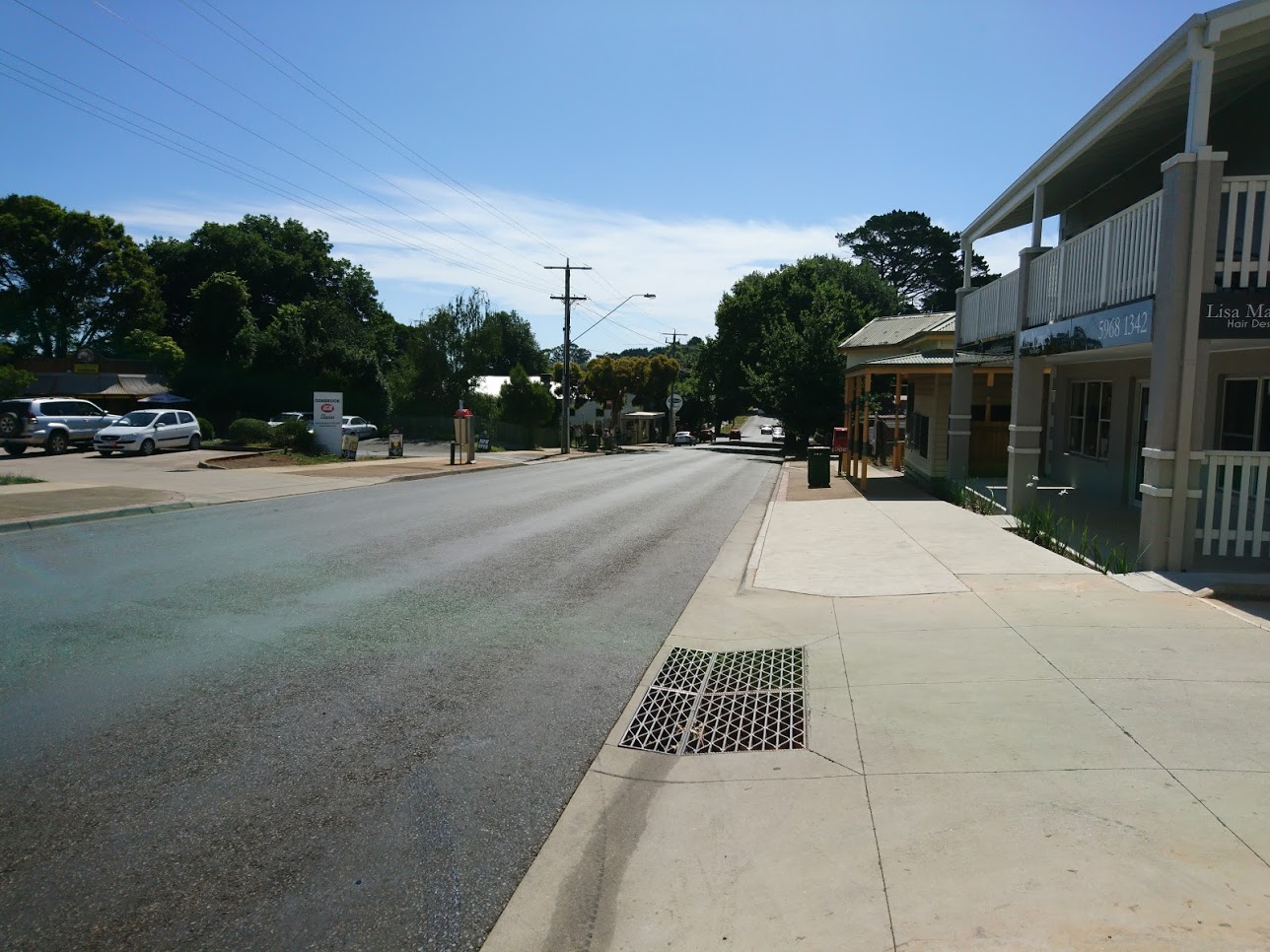
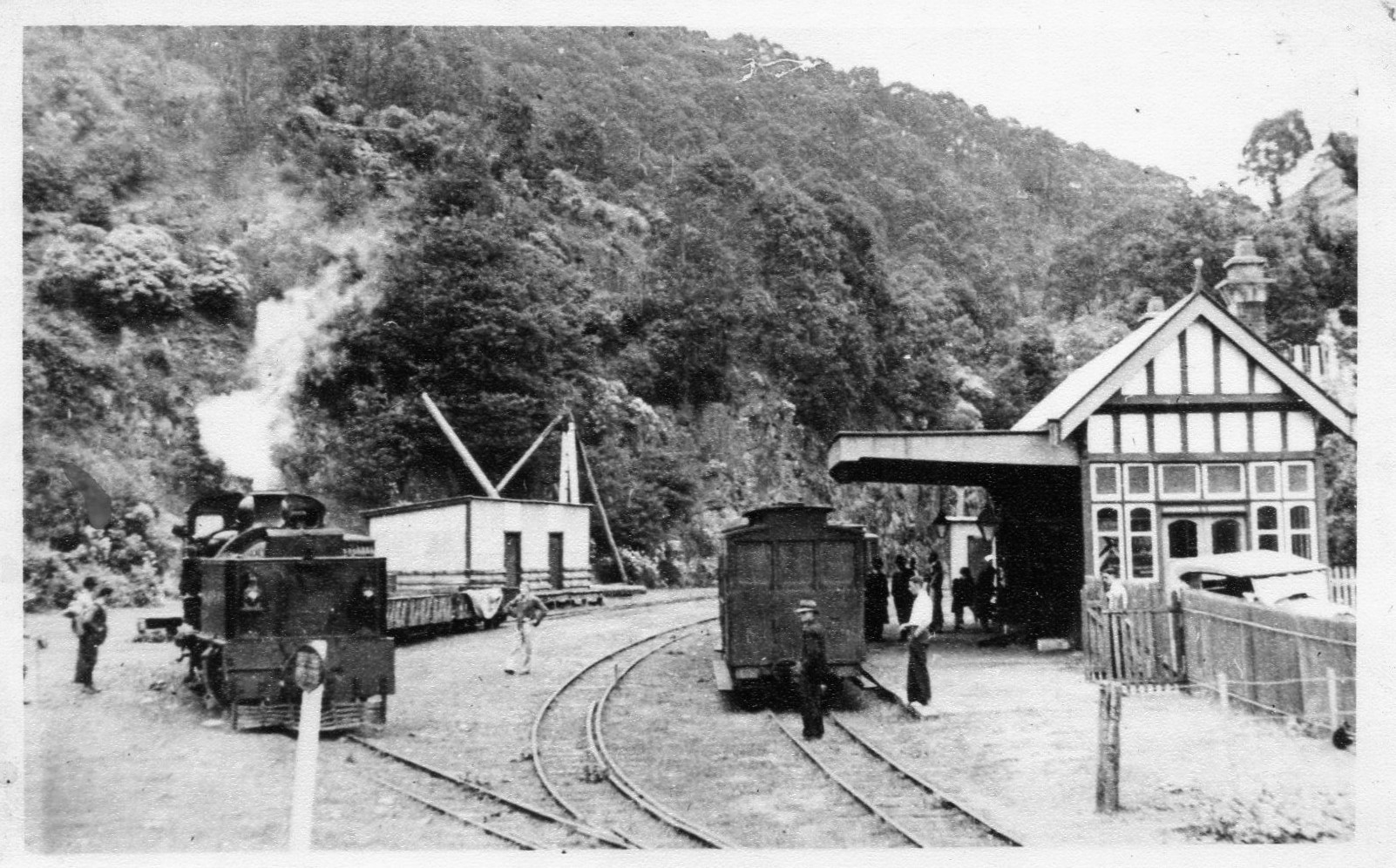
Gembrook is a town in Victoria, Australia, south-east of Melbourne's Central Business District, located within the Shire of Cardinia local government area. Gembrook recorded a population of 2,559 at the 2021 census. Gembrook is a popular destination for the residents of Melbourne as it is less than 1.5 hours drive from the city centre. History Gembrook was settled in 1873 for farming and timber; the surrounding countryside was suitable for both dairy and orchards. Timber provided income while farms were established. The name Gembrook came from the small gems that were found in small creeks and watercourses in the surrounding area. The Post Office opened on 5 October 1877. Puffing Billy railway The Gembrook railway line was opened from Upper Ferntree Gully on 18 December 1900. The narrow gauge line, these days known as Puffing Billy, brought tourists from Melbourne, as well as enabling timber and local produce, including fruit trees and potatoes, to be taken back to ... [...More Info...] [...Related Items...] OR: [Wikipedia] [Google] [Baidu] |
Kurth Kiln
Kurth Kiln was established by the Forests Commission Victoria in 1941 on a site about 7 km north of Gembrook on the Tomahawk Creek. Dr Ernest Edgar Kurth from the University of Tasmania was commissioned to design the kiln with the aim of mass-producing charcoal as an alternative fuel in the response to war-time petrol rationing. Gembrook was selected as the ideal site for the Kurth Kiln because it fully met three essential criteria required for successful operation; # Water - the kiln required 2000 gallons (9,100 litres) of water per day in order for its cooling systems to be effective. # Wood - the kiln burnt about 28 cords (~100 cubic metres) of wood per week. # Gradient - sloping land enabled easier top loading of wood into the kiln. Dr Kurth was paid £5 for the use of his patented design (No 2563/41) and the total cost of establishing the kiln was 1,799 pounds 17 shillings and 2 pence. The kiln commenced operation in March 1942 but transport difficulties combined wi ... [...More Info...] [...Related Items...] OR: [Wikipedia] [Google] [Baidu] |
Narrow Gauge Lines Of The Victorian Railways
The former Victorian Railways, the state railway authority in Victoria, Australia, built a number of experimental narrow-gauge lines around the beginning of the 20th century. Although all were closed by the early 1960s, parts of two have been reopened as heritage railways. Background A depression in the early 1890s brought a halt to the rapid expansion of railways in Victoria. Politicians promoted narrow-gauge lines as a way to link remote communities, particularly in hilly country, without the expense of the railways. Railway officials opposed them, citing the inconvenience and expense of a break-of-gauge. The Parliamentary Standing Committee on Railways examined 14 regions for potential railways: # Bass River District: Without recommending a specific route, the Committee considered a narrow gauge line through the Bass River district to exploit timber resources along the river, coal deposits around Kilcunda and farming around Wonthaggi, eventually recommending examina ... [...More Info...] [...Related Items...] OR: [Wikipedia] [Google] [Baidu] |
Electoral District Of Gembrook
The electoral district of Gembrook was an electoral district of the Victorian Legislative Assembly. It was situated on the edge of metropolitan Melbourne. Included within its boundaries were Emerald, Cockatoo, Gembrook, Beaconsfield, and sizeable parts of Berwick and Pakenham. The district formerly extended north to Yarra Valley communities such as Warburton and Launching Place prior to the seat's redistribution at the 2014 election. The electorate was created in 2002, replacing the abolished electorates of Pakenham (which had its namesake moved into Bass) and Berwick. It was widely considered to be a safe Liberal seat, and was to be contested by Shadow Treasurer Robert Dean, formerly the member for Berwick. However, in a heavily publicised gaffe, it was discovered during the campaign that Dean was ineligible to stand as a candidate because he had not updated his enrolment after moving to his new electorate, and was therefore no longer a registered voter. He was quickly ... [...More Info...] [...Related Items...] OR: [Wikipedia] [Google] [Baidu] |
Cockatoo, Victoria
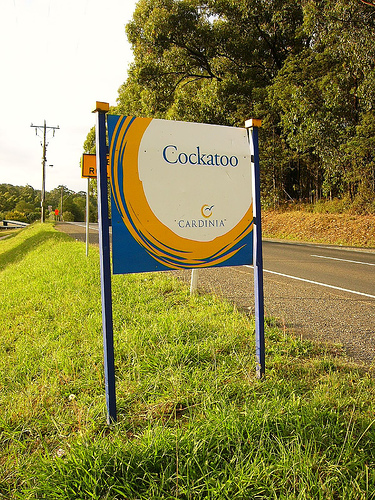
Cockatoo is a town in Victoria (Australia), Victoria, Australia, 48 km south-east of Melbourne, Melbourne's Melbourne central business district, central business district, located within the Shire of Cardinia Local government areas of Victoria, local government area. Cockatoo recorded a population of 4,408 at the 2021 Australian census, 2021 census. Cockatoo is named after Cockatoo Creek, which runs through the town, and which the town was previously named. History Cockatoo was named after Cockatoo Creek. It was first settled in the 1870s but progress was tardy as the land was difficult to clear. A Post Office was not opened until 1 November 1901 when the railway arrived and was known as Cockatoo Creek until 1917. Shortly after the end of the World War I, a large number of immigrants went to live in Cockatoo while working in Melbourne. The most significant wave was made by Italians. Timbergetting was the major source of employment and this industry received a consider ... [...More Info...] [...Related Items...] OR: [Wikipedia] [Google] [Baidu] |
Puffing Billy Railway
The Puffing Billy Railway is a narrow gauge heritage railway in the southern foothills of the Dandenong Ranges in Melbourne, Australia. The railway was one of the five narrow gauge lines of the Victorian Railways which opened around the beginning of the 20th century. It is close to the city of Melbourne and is one of the most popular steam heritage railways in the world, attracting tourists from Australia and overseas. The railway aims to preserve and restore the line as near as possible to how it was in the first three decades of its existence, but with particular emphasis on the early 1920s. The primary starting point is Belgrave station which houses the railway's operations and administration centre. The line runs through Lakeside Station where a visitor information centre provides catering and an indoor interpretive space. The south-eastern terminus is Gembrook railway station. In 2022 the railway also returned the traditional Puffing Billy Railway dangling of legs from ... [...More Info...] [...Related Items...] OR: [Wikipedia] [Google] [Baidu] |
Gembrook Railway Line, Melbourne
The Puffing Billy Railway is a narrow gauge heritage railway in the southern foothills of the Dandenong Ranges in Melbourne, Australia. The railway was one of the five narrow gauge lines of the Victorian Railways which opened around the beginning of the 20th century. It is close to the city of Melbourne and is one of the most popular steam heritage railways in the world, attracting tourists from Australia and overseas. The railway aims to preserve and restore the line as near as possible to how it was in the first three decades of its existence, but with particular emphasis on the early 1920s. The primary starting point is Belgrave station which houses the railway's operations and administration centre. The line runs through Lakeside Station where a visitor information centre provides catering and an indoor interpretive space. The south-eastern terminus is Gembrook railway station. In 2022 the railway also returned the traditional Puffing Billy Railway dangling of legs f ... [...More Info...] [...Related Items...] OR: [Wikipedia] [Google] [Baidu] |
Belgrave, Victoria
Belgrave is a town and outer suburb in Melbourne, Victoria, Australia, 36 km east of Melbourne's central business district, located within the Shire of Yarra Ranges local government area. Belgrave recorded a population of 3,894 at the 2021 census. History Belgrave is situated in the foothills of the Dandenong Ranges, part of the land of the Wurundjeri first nations people. Belgrave was first settled by Europeans in 1851. Belgrave was named after an 1840s chapel in Leeds, Yorkshire, England; the name was carried by Mr and Mrs R.G. Benson when they came to Melbourne in 1856. Their sons, the Benson Brothers, settled in the Belgrave district in the 1870s. Though originally the area was known as "Monbulk" for the reservoir that lay near by, the town wasn't known as Belgrave until around 1903, and another suggested name for the town at that stage was Glassford. A Post Office opened in the area around 1904. Many men from Belgrave went to the two world wars, and there is a war ... [...More Info...] [...Related Items...] OR: [Wikipedia] [Google] [Baidu] |
Belgrave Railway Station
Belgrave railway station is the terminus of the suburban electrified Belgrave line in Victoria, Australia. It serves the eastern Melbourne suburb of Belgrave, and opened on 18 December 1900 as Monbulk. It was renamed Belgrave on 21 November 1904.Belgrave Vicsig The station was originally on the – |
Pakenham Upper, Victoria
Pakenham Upper is a rural locality in Melbourne, Victoria, Australia, south-east of Melbourne's Central Business District, located within the Shire of Cardinia local government area. Pakenham Upper recorded a population of 1,196 at the 2021 census. History Pakenham Upper is situated in the Kulin nation traditional Aboriginal country. The Boon Wurrung people are local custodians within the Kulin nation. The origin of the suburb name is from Sir Edward Pakenham and the geographic position north of the Pakenham main settlement. Originally known as Gembrook South, the settlement of Pakenham Upper is dated from 1872. The Gembrook South post office was established in 1882 and was renamed as the Pakenham Upper post office in 1913. Amenities * Pakenham Upper Community Hall * Pakenham Upper Riding Club * Pakenham Upper Toomuc Cricket Club See also * Shire of Pakenham The Shire of Pakenham was a local government area about southeast of Melbourne, the state capital of Victori ... [...More Info...] [...Related Items...] OR: [Wikipedia] [Google] [Baidu] |
Shire Of Cardinia
The Shire of Cardinia is a local government area in Victoria, Australia, in the south-east of Melbourne between Western Port and the Yarra Ranges on the outskirts of Melbourne. It has an area of 1,283 square kilometres, and had a population of 107,120 in June 2018. Cardinia Shire Council Offices are located in Officer. Prior to 17 November 2014, they were located in Pakenham. History The areas within the present-day boundaries of Cardinia Shire were originally parts of the Cranbourne and Berwick districts, which were incorporated in 1860 and 1862 respectively. The Shire of Fern Tree Gully, later Shire of Sherbrooke, split away in 1889 and included areas to the east of Melbourne. In 1973, the City of Berwick, including Berwick and areas closer to Dandenong, split away from the Shire of Berwick, with the remainder being renamed Shire of Pakenham. Accessed at State Library of Victoria, La Trobe Reading Room. The Shire came into being on 15 December 1994 as the result of statewi ... [...More Info...] [...Related Items...] OR: [Wikipedia] [Google] [Baidu] |
Melbourne
Melbourne ( ; Boonwurrung/Woiwurrung: ''Narrm'' or ''Naarm'') is the capital and most populous city of the Australian state of Victoria, and the second-most populous city in both Australia and Oceania. Its name generally refers to a metropolitan area known as Greater Melbourne, comprising an urban agglomeration of 31 local municipalities, although the name is also used specifically for the local municipality of City of Melbourne based around its central business area. The metropolis occupies much of the northern and eastern coastlines of Port Phillip Bay and spreads into the Mornington Peninsula, part of West Gippsland, as well as the hinterlands towards the Yarra Valley, the Dandenong and Macedon Ranges. It has a population over 5 million (19% of the population of Australia, as per 2021 census), mostly residing to the east side of the city centre, and its inhabitants are commonly referred to as "Melburnians". The area of Melbourne has been home to Aboriginal ... [...More Info...] [...Related Items...] OR: [Wikipedia] [Google] [Baidu] |
Upper Ferntree Gully Railway Station
Upper Ferntree Gully railway station is located on the Belgrave line in Victoria, Australia. It serves the eastern Melbourne suburb of Upper Ferntree Gully, and opened on 4 December 1889. A few services each day originate and terminate at Upper Ferntree Gully. The trains are stabled overnight in six of the seven sidings opposite the station. History Upper Ferntree Gully station opened on 4 December 1889. After December 1900, it became the break-of-gauge station between the broad gauge used in most of Victoria, and the narrow gauge Gembrook line (now the Puffing Billy Railway), one of the five narrow gauge lines of the Victorian Railways. The narrow gauge line was closed in 1954, but the line as far as Belgrave was rebuilt as a broad gauge electrified railway, which opened on 18 February 1962. The current island platform and stabling sidings were provided in 1960. In 1964, a signal panel was installed at the station. It controls the single-track line between Ferntree Gully ... [...More Info...] [...Related Items...] OR: [Wikipedia] [Google] [Baidu] |


