|
GOES 7
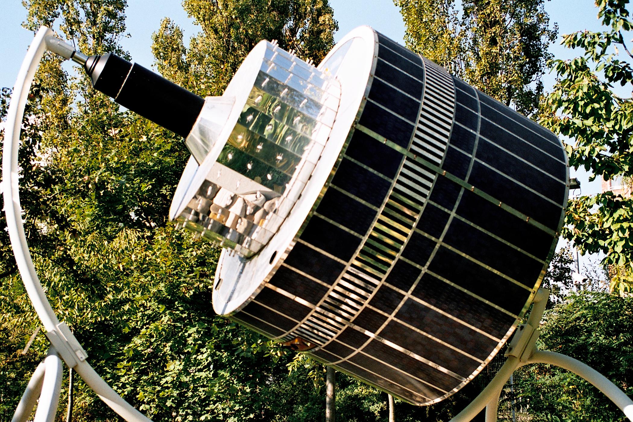
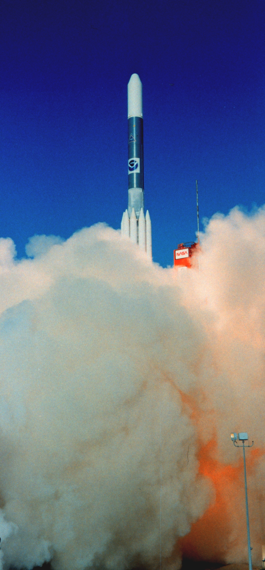
GOES-7, known as GOES-H before becoming operational, is an American satellite. It was originally built as a weather satellite, and formed part of the US National Oceanic and Atmospheric Administration's Geostationary Operational Environmental Satellite system. Originally built as a ground spare, GOES-H was launched in 1987 due to delays with the next series of satellites. It was operated by NOAA until 1999, before being leased to Peacesat, who use it as a communications satellite. As of 2009, it was operational over the Pacific Ocean, providing communications for the Pacific Islands. On April 12, 2012, the spacecraft was finally decommissioned and moved to a graveyard orbit. Launch GOES-H was launched aboard a McDonnell Douglas Delta 3914 rocket, flying from Launch Complex 17A at the Cape Canaveral Air Force Station. The launch occurred at 23:05 GMT on 26 February 1987. The launch had originally been scheduled for late 1986, but was delayed after GOES-G failed to achieve orbi ... [...More Info...] [...Related Items...] OR: [Wikipedia] [Google] [Baidu] |
Weather Satellite
A weather satellite or meteorological satellite is a type of Earth observation satellite that is primarily used to monitor the weather and climate of the Earth. Satellites can be polar orbiting (covering the entire Earth asynchronously), or geostationary (hovering over the same spot on the equator). While primarily used to detect the development and movement of storm systems and other cloud patterns, meteorological satellites can also detect other phenomena such as city lights, fires, effects of pollution, auroras, sand and dust storms, snow cover, ice mapping, boundaries of ocean currents, and energy flows. Other types of environmental information are collected using weather satellites. Weather satellite images helped in monitoring the volcanic ash cloud from Mount St. Helens and activity from other volcanoes such as Mount Etna. Smoke from fires in the western United States such as Colorado and Utah have also been monitored. El Niño and its effects on weather are monitored ... [...More Info...] [...Related Items...] OR: [Wikipedia] [Google] [Baidu] |
Pacific Ocean
The Pacific Ocean is the largest and deepest of Earth's five oceanic divisions. It extends from the Arctic Ocean in the north to the Southern Ocean (or, depending on definition, to Antarctica) in the south, and is bounded by the continents of Asia and Oceania in the west and the Americas in the east. At in area (as defined with a southern Antarctic border), this largest division of the World Ocean—and, in turn, the hydrosphere—covers about 46% of Earth's water surface and about 32% of its total surface area, larger than Earth's entire land area combined .Pacific Ocean . '' Britannica Concise.'' 2008: Encyclopædia Britannica, Inc. The centers of both the |
GOES 12
GOES-12, known as GOES-M before becoming operational, is an American weather satellite, which is part of the US National Oceanic and Atmospheric Administration's Geostationary Operational Environmental Satellite system. It was launched on July 23, 2001, and spent its first 21 months in space as an on-orbit spare. From April 2003, the satellite took over the GOES-East position, providing coverage of the eastern half of the continental United States. In April 2010, GOES-East operations were taken over by GOES-13, and GOES-12 transitioned to the GOES-South location to devote time to South American imagery. It remained at this post until it was decommissioned on August 16, 2013 and subsequently boosted to a graveyard orbit. Launch GOES-M was launched aboard an International Launch Services Atlas IIA rocket, flying from Space Launch Complex 36A at the Cape Canaveral Air Force Station. The launch occurred at 07:23 GMT on 23 July 2001, having previously been delayed eight days; seven ... [...More Info...] [...Related Items...] OR: [Wikipedia] [Google] [Baidu] |
GOES 10
Goes () is a city and municipality in the southwestern Netherlands on Zuid-Beveland, in the province of Zeeland. The city of Goes has approximately 27,000 residents. History Goes was founded in the 10th century on the edge of a creek: de Korte Gos (the Short Gos). The village grew fast, and in the early 12th century it had a market square and a church devoted to Mary Magdalene. By 1300 it had a brick castle, now known as Oostende Castle. In 1405 Goes received city rights from William, Duke of Bavaria, by his right as count of Holland, and in 1417 it was allowed to build town walls. The prosperity of the city was based upon the cloth industry and the production of salt. In the 16th century Goes declined. Its connection to the sea silted up and in 1554 a large fire destroyed part of the city. In the Autumn of 1572, during the course of the Eighty Years' War, Goes, in the Spanish Netherlands, was besieged by Dutch forces with the support of English troops. The siege was relieve ... [...More Info...] [...Related Items...] OR: [Wikipedia] [Google] [Baidu] |
GOES 8
GOES-8, known as GOES-I before becoming operational, was an American weather satellite, which formed part of the US National Oceanic and Atmospheric Administration's Geostationary Operational Environmental Satellite system. It was launched in 1994, and operated until 2004 when it was retired and boosted to a graveyard orbit. At launch, the satellite had a mass of , and an expected operational lifespan of three or five years. It was built by Space Systems/Loral, based on the LS-1300 satellite bus, and was the first of five GOES-I series satellites to be launched. Launch GOES-I was launched aboard a Martin Marietta Atlas I rocket, flying from Launch Complex 36B at the Cape Canaveral Air Force Station. The launch occurred at 06:04 GMT on 13 April 1994, and placed the satellite into a geosynchronous transfer orbit. It was then raised into geostationary orbit by means of an R-4D-11 apogee motor. During the first burn of the apogee motor, an unusually high temperature was detected in o ... [...More Info...] [...Related Items...] OR: [Wikipedia] [Google] [Baidu] |
Eumetsat
The European Organization for the Exploitation of Meteorological Satellites (EUMETSAT) is an intergovernmental organisation created through an international convention agreed by a current total of 30 European Member States. EUMETSAT's primary objective is to establish, maintain and exploit European systems of operational meteorological satellites. EUMETSAT is responsible for the launch and operation of the satellites and for delivering satellite data to end-users as well as contributing to the operational monitoring of climate and the detection of global climate changes. The activities of EUMETSAT contribute to a global meteorological satellite observing system coordinated with other space-faring nations. Satellite observations are an essential input to numerical weather prediction systems and also assist the human forecaster in the diagnosis of potentially hazardous weather developments. Of growing importance is the capacity of weather satellites to gather long-term measure ... [...More Info...] [...Related Items...] OR: [Wikipedia] [Google] [Baidu] |
Meteosat 3
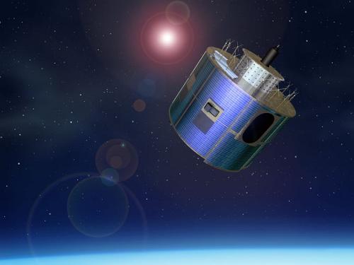
The Meteosat series of satellites are geostationary meteorological satellites operated by EUMETSAT under the Meteosat Transition Programme (MTP) and the Meteosat Second Generation (MSG) program. The MTP program was established to ensure the operational continuity between the end of the successful Meteosat Operational Programme in 1995 and Meteosat Second Generation (MSG), which came into operation at the start of 2004 using improved satellites. The MSG program will provide service until the MTG (Meteosat Third Generation) program takes over. __TOC__ First generation The first generation of Meteosat satellites, Meteosat-1 to Meteosat-7, provided continuous and reliable meteorological observations from space to a large user community. Meteosat-1 to -7 have all now retired. When operational, the Meteosat First Generation provided images every half-hour in three spectral channels (Visible, Infrared) and Water vapor, Water Vapour, via the Meteosat Visible and Infrared Imager (MVIRI ... [...More Info...] [...Related Items...] OR: [Wikipedia] [Google] [Baidu] |
Continental United States
The contiguous United States (officially the conterminous United States) consists of the 48 adjoining U.S. states and the Federal District of the United States of America. The term excludes the only two non-contiguous states, Alaska and Hawaii (also the last ones admitted to the Union), and all other offshore insular areas, such as American Samoa, Guam, the Northern Mariana Islands, Puerto Rico, and the U.S. Virgin Islands. The colloquial term "Lower48" is used also, especially in relation to just Alaska (Hawaii is farther south). The related but distinct term continental United States includes Alaska (which is also on the continent of North America but separated from the 48 states by British Columbia and Yukon of Canada), but excludes the Hawaiian Islands and all U.S. territories in the Caribbean and the Pacific. The greatest distance (on a great-circle route) entirely within the contiguous U.S. is 2,802 miles (4,509 km), between Florida and the State of Washington; th ... [...More Info...] [...Related Items...] OR: [Wikipedia] [Google] [Baidu] |
GOES 6
GOES-6, known as GOES-F before becoming operational, was a geostationary weather satellite which was operated by the United States National Oceanic and Atmospheric Administration as part of the Geostationary Operational Environmental Satellite system. Launched in 1983, it was used for weather forecasting in the United States. GOES-6 was built by Hughes Space and Communications, and was based on the HS-371 satellite bus. At launch it had a mass of , with an expected operational lifespan of around seven years. Launch GOES-F was launched using a Delta 3914 carrier rocket flying from Launch Complex 17A at the Cape Canaveral Air Force Station. The launch occurred at 22:26 GMT on 28 April 1983. Orbit The launch successfully placed GOES-F into a geosynchronous transfer orbit, from which it raised itself to geostationary orbit by means of an onboard Star 27 apogee motor, with insertion occurring on 9 May 1983. Following insertion into geosynchronous orbit, GOES-6 was positioned a ... [...More Info...] [...Related Items...] OR: [Wikipedia] [Google] [Baidu] |
Longitude
Longitude (, ) is a geographic coordinate that specifies the east–west position of a point on the surface of the Earth, or another celestial body. It is an angular measurement, usually expressed in degrees and denoted by the Greek letter lambda (λ). Meridians are semicircular lines running from pole to pole that connect points with the same longitude. The prime meridian defines 0° longitude; by convention the International Reference Meridian for the Earth passes near the Royal Observatory in Greenwich, England on the island of Great Britain. Positive longitudes are east of the prime meridian, and negative ones are west. Because of the Earth's rotation, there is a close connection between longitude and time measurement. Scientifically precise local time varies with longitude: a difference of 15° longitude corresponds to a one-hour difference in local time, due to the differing position in relation to the Sun. Comparing local time to an absolute measure of time allows ... [...More Info...] [...Related Items...] OR: [Wikipedia] [Google] [Baidu] |
Geostationary Orbit
A geostationary orbit, also referred to as a geosynchronous equatorial orbit''Geostationary orbit'' and ''Geosynchronous (equatorial) orbit'' are used somewhat interchangeably in sources. (GEO), is a circular geosynchronous orbit in altitude above Earth's equator ( in radius from Earth's center) and following the direction of Earth's rotation. An object in such an orbit has an orbital period equal to Earth's rotational period, one sidereal day, and so to ground observers it appears motionless, in a fixed position in the sky. The concept of a geostationary orbit was popularised by the science fiction writer Arthur C. Clarke in the 1940s as a way to revolutionise telecommunications, and the first satellite to be placed in this kind of orbit was launched in 1963. Communications satellites are often placed in a geostationary orbit so that Earth-based satellite antennas do not have to rotate to track them but can be pointed permanently at the position in the sky where the sat ... [...More Info...] [...Related Items...] OR: [Wikipedia] [Google] [Baidu] |


.jpg)


