|
Frank Oates
Francis (Frank) Oates (1840–1875) was a British naturalist, explorer, and uncle of Antarctic explorer Lawrence Oates. He was one of the first Europeans to see the Victoria Falls. Early life The second son of Edward Oates (1792–1865), of Meanwoodside, near Leeds, Yorkshire and Furnival's Inn, and his wife Susan (d. 1889), daughter of Edward Grace, J.P., Frank Oates was born at Meanwoodside in 1840. The Oates family were landed gentry, owning land around Leeds and Dewsbury since the 16th century.Burke's Landed Gentry, 17th edition, ed. L. G. Pine, p. 1914, Oates formerly of Gestingthorpe Hall pedigree He was educated at Christ Church, Oxford, which he entered late in 1860, but left before taking a degree. This was due to severe ill health, and he was an invalid for some years after 1864. Oates' first significant expedition was to Central America and North America, and lasted one year, from 1871–1872. Most of this time was spent collecting bird and insect specimens in Guate ... [...More Info...] [...Related Items...] OR: [Wikipedia] [Google] [Baidu] |
Southampton
Southampton () is a port city in the ceremonial county of Hampshire in southern England. It is located approximately south-west of London and west of Portsmouth. The city forms part of the South Hampshire built-up area, which also covers Portsmouth and the towns of Havant, Waterlooville, Eastleigh, Fareham and Gosport. A major port, and close to the New Forest, it lies at the northernmost point of Southampton Water, at the confluence of the River Test and Itchen, with the River Hamble joining to the south. Southampton is classified as a Medium-Port City . Southampton was the departure point for the and home to 500 of the people who perished on board. The Spitfire was built in the city and Southampton has a strong association with the ''Mayflower'', being the departure point before the vessel was forced to return to Plymouth. In the past century, the city was one of Europe's main ports for ocean liners and more recently, Southampton is known as the home port of some of ... [...More Info...] [...Related Items...] OR: [Wikipedia] [Google] [Baidu] |
Inyati
Inyathi (also known as Enyathi, Inyati, UMzinyathi, and Emhlangeni) is a village located in the Bubi District of Matabeleland North, Zimbabwe that grew from colonization by missionaries in the late 19th century. The Mission itself sits upon around of land. Inyathi is about from Bulawayo and has a number of gold mines that have inspired both corporate (including Rio Tinto and Anglo American) and illegal mining. Etymology Inyathi is the Xhosa word for buffalo; the town was named for the nearby Buffalo River. History Pre-colonization Due to colonization, information about pre-colonial Inyathi has largely been lost. Colonialism Reverend Robert Moffat of the London Missionary Society (LMS) traveled from Kuruman with a string of ox-drawn carts to visit King Mzilikazi in 1854, 1857, and 1859 with a proposition to build a Mission on his lands. King Mzilikazi agreed on the terms that they would do so for "non-religious reasons", as the Northern Ndebele people were very devoted to t ... [...More Info...] [...Related Items...] OR: [Wikipedia] [Google] [Baidu] |
Matabeleland
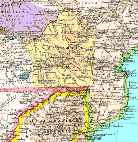
Matabeleland is a region located in southwestern Zimbabwe that is divided into three provinces: Matabeleland North, Bulawayo, and Matabeleland South. These provinces are in the west and south-west of Zimbabwe, between the Limpopo and Zambezi rivers and are further separated from Midlands by the Shangani River in central Zimbabwe. The region is named after its inhabitants, the Ndebele people who were called "Amatabele"(people with long spears - Mzilikazi 's group of people who were escaping the Mfecani wars). Other ethnic groups who inhabit parts of Matabeleland include the Tonga, Bakalanga, Venda, Nambya, Khoisan, Xhosa, Sotho, Tswana, and Tsonga. The population of Matabeleland is just over 20% of the Zimbabwe's total. The capital and largest city is Bulawayo, other notable towns are Plumtree, Victoria Falls, Beitbridge, Lupane, Esigodini, Hwange and Gwanda. The land is fertile but semi arid. This area has coal and gold deposits. Industries include gold and other minera ... [...More Info...] [...Related Items...] OR: [Wikipedia] [Google] [Baidu] |
Tati Concessions Land
The Tati Concession was a land and mining concession created in the western borderlands of the Matabele Kingdom. The concession was originally granted by the Matabele King, Lobengula, son of Mzilikazi, to Sir John Swinburne in exchange for gold and arms. It was administered by the territory known as the Bechuanaland Protectorate after 1893, but was formally annexed to it by Proclamation Number 2 of 1911 by the High Commissioner of Bechuanaland. It was locally administered by a Justice of the Peace. The chief town of this region is Francistown, now one of Botswana's major settlements. Chronology :* 1864: Gold is discovered by Europeans in Tati River area (Tati Goldfields), then part of the Matabele kingdom. :* 1870: Concession granted to Sir John Swinburne's London and Limpopo Mining Company. :* 1880 The concession was revoked for failure to pay the annual fee, and the concession was granted instead to the Northern Light Mining Company, a syndicate formed by Danial Francis, ... [...More Info...] [...Related Items...] OR: [Wikipedia] [Google] [Baidu] |
Bamangwato
The Bamangwato (more correctly BagammaNgwato, and also referred to as the BaNgwato or Ngwato) is one of the eight "principal" Tswana chieftaincies of Botswana. They ruled over a majority Bakalanga population (the largest ethnic group in Central District), with minorities including the Basarwa, Birwa and Tswapong. The modern Bamangwato formed in the Central District, with its main town and capital (after 1902) at Serowe. The paramount chief, a hereditary position, occupies one of the fifteen places in Ntlo ya Dikgosi, the national House of Chiefs. The core population of the Bamangwato are an 18th-century offshoot of the Bakwena people, but members in the Bamangwato kingdom came from many sources, as was the case with all of the major 19th-century African kingdoms. Sir Seretse Khama's paternal forebears, the chiefs of the Bamangwato, had built several prior capitals including Shoshong and Phalatswe, also known as Old Palapye (Before the advent of colonial administration and fixed i ... [...More Info...] [...Related Items...] OR: [Wikipedia] [Google] [Baidu] |
Shoshong
Shoshong is a town in Botswana, formerly the chief settlement of the eastern Bamangwato. Physical location Shoshong is located just north of the Tropic of Capricorn at , in the Central District of Botswana, about west of Mahalapye. The town is situated above sea level in the valley of the Shoshong, an intermittent tributary of the Limpopo. Nearby villages are Tobela, Ikongwe, Kalamare, Mmutlane, and Mosolotshane. Shoshong is encircled by hills used for grazing cattle, and is a windy place. The central kgotla is located by the mouth of the steep valley (kloof) which used to be the source of water for the village. History Shoshong was initially inhabited by BaPhaleng, who were later joined by Bakaa, and later BaNgwato under King Sekgoma I. Oral traditions from the village points that the Baphaleng chief invited Bangwato from Mosu where they were continuously harassed and vulnerable to Matebele attacks. The site of Shoshong was chosen as being easily defensible against the ... [...More Info...] [...Related Items...] OR: [Wikipedia] [Google] [Baidu] |
Pretoria
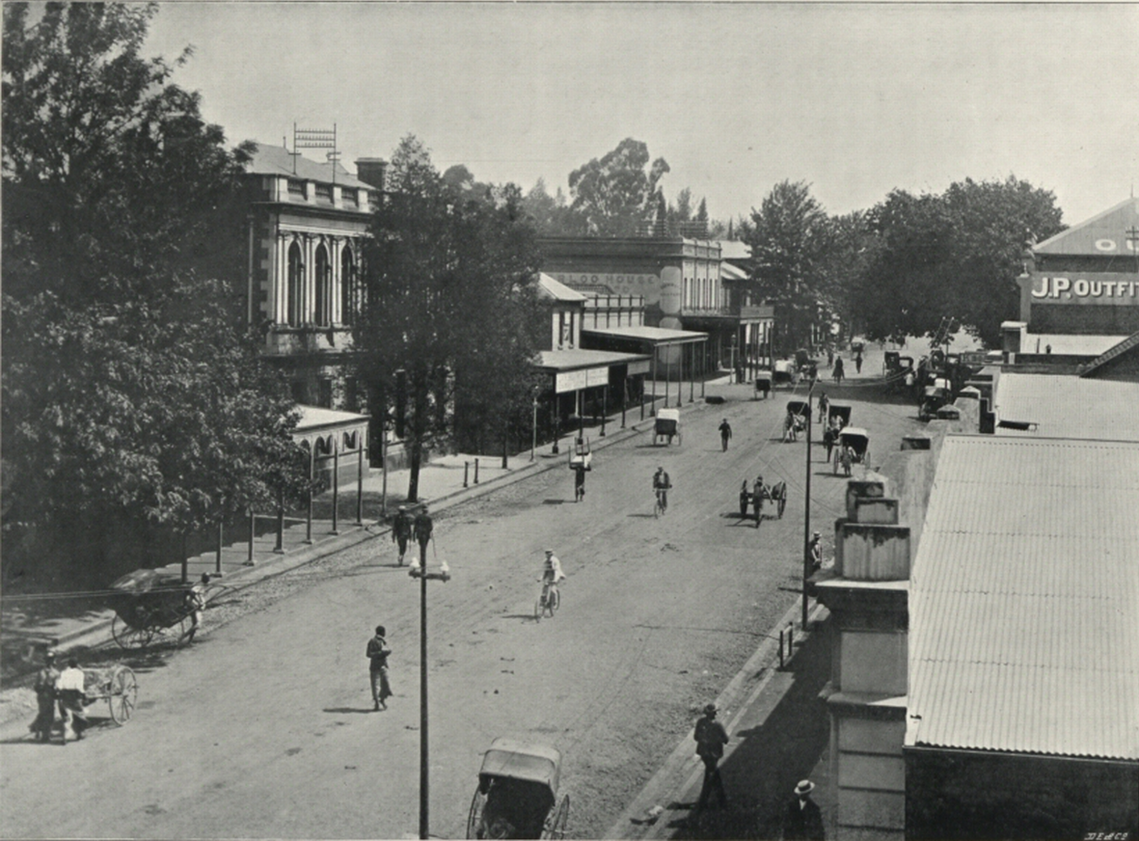
Pretoria () is South Africa's administrative capital, serving as the seat of the Executive (government), executive branch of government, and as the host to all foreign embassies to South Africa. Pretoria straddles the Apies River and extends eastward into the foothills of the Magaliesberg mountains. It has a reputation as an academic city and center of research, being home to the Tshwane University of Technology (TUT), the University of Pretoria (UP), the University of South Africa (UNISA), the Council for Scientific and Industrial Research (CSIR), and the Human Sciences Research Council. It also hosts the National Research Foundation (South Africa), National Research Foundation and the South African Bureau of Standards. Pretoria was one of the host cities of the 2010 FIFA World Cup. Pretoria is the central part of the City of Tshwane Metropolitan Municipality which was formed by the amalgamation of several former local authorities, including Bronkhorstspruit, Centurion, Gaute ... [...More Info...] [...Related Items...] OR: [Wikipedia] [Google] [Baidu] |
South African Republic
The South African Republic ( nl, Zuid-Afrikaansche Republiek, abbreviated ZAR; af, Suid-Afrikaanse Republiek), also known as the Transvaal Republic, was an independent Boer Republic in Southern Africa which existed from 1852 to 1902, when it was annexed into the British Empire as a result of the Second Boer War. The ZAR was established as a result of the 1852 Sand River Convention, in which the Government of the United Kingdom, British government agreed to formally recognise independence of the Boers living north of the Vaal River. Relations between the ZAR and Britain started to deteriorate after the British Cape Colony expanded into the Southern African interior, eventually leading to the outbreak of the First Boer War between the two nations. The Boer victory confirmed the ZAR's independence; however, Anglo-ZAR tensions soon flared up again over various diplomatic issues. In 1899, war again broke out between Britain and the ZAR, which was swiftly occupied by the British mil ... [...More Info...] [...Related Items...] OR: [Wikipedia] [Google] [Baidu] |
Pietermaritzburg
Pietermaritzburg (; Zulu: umGungundlovu) is the capital and second-largest city in the province of KwaZulu-Natal, South Africa. It was founded in 1838 and is currently governed by the Msunduzi Local Municipality. Its Zulu name umGungundlovu is the name used for the district municipality. Pietermaritzburg is popularly called Maritzburg in Afrikaans, English and Zulu alike, and often informally abbreviated to PMB. It is a regionally important industrial hub, producing aluminium, timber and dairy products, as well as the main economic hub of Umgungundlovu District Municipality. The public sector is a major employer in the city due to local, district and provincial governments located here. The city has many schools and tertiary education institutions, including a campus of the University of KwaZulu-Natal. It had a population of 228,549 in 1991; the current population is estimated at over 600,000 residents (including neighbouring townships) and has one of the largest populatio ... [...More Info...] [...Related Items...] OR: [Wikipedia] [Google] [Baidu] |


