|
Fortress Hill
Fortress Hill or Pau Toi Shan () is a hill and an area on the north shore of Hong Kong Island, Hong Kong. Fortress Hill includes the western part of North Point lying west of Oil Street, and the eastern part of Causeway Bay. There are a number of private residential estates, office buildings, hotels and serviced apartments in this area. History The names of Oil Street and Shell Street come from a former oil depot that was established by Royal Dutch (now Royal Dutch Shell) in the area in 1897. The depot was decommissioned in 1981.Royal Dutch ShellOur history in Hong Kong/ref> Features * AIA Tower * Former site of the Royal Hong Kong Yacht Club, at No. 12 Oil Street. The Club moved to its present location in 1938, due to land reclamation. The site is now the seat of Oi!, an organisation that aims to promote visual arts * Newton Hotel Hong Kong * Harbour Grand Hong Kong * iClub Fortress Hill Hotel Transport The area is served by the Fortress Hill station of the MTR rapid tra ... [...More Info...] [...Related Items...] OR: [Wikipedia] [Google] [Baidu] |
Harbour Grand Hong Kong
A harbor (American English), harbour (British English; see spelling differences), or haven is a sheltered body of water where ships, boats, and barges can be docked. The term ''harbor'' is often used interchangeably with ''port'', which is a man-made facility built for loading and unloading vessels and dropping off and picking up passengers. Ports usually include one or more harbors. Alexandria Port in Egypt is an example of a port with two harbors. Harbors may be natural or artificial. An artificial harbor can have deliberately constructed breakwaters, sea walls, or jettys or they can be constructed by dredging, which requires maintenance by further periodic dredging. An example of an artificial harbor is Long Beach Harbor, California, United States, which was an array of salt marshes and tidal flats too shallow for modern merchant ships before it was first dredged in the early 20th century. In contrast, a natural harbor is surrounded on several sides of land. Examples ... [...More Info...] [...Related Items...] OR: [Wikipedia] [Google] [Baidu] |
Oi! (Hong Kong)
Oi! is a Hong Kong government art promotion organisation. It was developed by the Leisure and Cultural Services Department, and aims to promote visual arts by providing a platform for art exhibitions, forums and other art-related activities. It is situated at 12 Oil Street, Causeway Bay, at the corner of Electric Road. Buildings The organisation is housed in a complex that comprises a main and two ancillary buildings. The complex was built in 1908 and served as the Royal Hong Kong Yacht Club headquarters and clubhouse until 1938. Built in the Arts and Crafts style, it was officially opened on 21 March 1908 by the then Governor, Sir Frederick Lugard. The site lost its initial waterfront location due to subsequent reclamation, and the Club headquarters moved to Kellett Island. [...More Info...] [...Related Items...] OR: [Wikipedia] [Google] [Baidu] |
Tathong Channel
Tathong Channel (), also known as Nam Tong Hoi Hap (, originally ), refers to the eastern sea waters in Hong Kong leading into Victoria Harbour through Lei Yue Mun, bounded by Junk Island ( Fat Tong Chau) and Tung Lung Chau in the east, and Hong Kong Island Hong Kong Island is an Islands and peninsulas of Hong Kong, island in the southern part of Hong Kong. Known colloquially and on road signs simply as Hong Kong, the island has a population of 1,289,500 and its population density is 16,390/km ... in the west. References Channels of Hong Kong Sai Kung District Eastern District, Hong Kong Southern District, Hong Kong {{HongKong-geo-stub ... [...More Info...] [...Related Items...] OR: [Wikipedia] [Google] [Baidu] |
Victoria Harbour
Victoria Harbour is a natural landform harbour in Hong Kong separating Hong Kong Island in the south from the Kowloon Peninsula to the north. The harbour's deep, sheltered waters and strategic location on South China Sea were instrumental in Hong Kong's establishment as a British colony in 1841 and its subsequent development as a trading centre. Throughout its history, the harbour has seen numerous reclamation projects undertaken on both shores, many of which have caused controversy in recent years. Environmental concerns have been expressed about the effects of these expansions, in terms of water quality and loss of natural habitat. It has also been proposed that benefits of land reclamation may be less than the effects of decreased harbour width, affecting the number of vessels passing through the harbour. Nonetheless Victoria Harbour still retains its founding role as a port for thousands of international vessels each year. The harbour is a major tourist attraction of ... [...More Info...] [...Related Items...] OR: [Wikipedia] [Google] [Baidu] |
Eastern District, Hong Kong
The Eastern District is one of the 18 districts of Hong Kong. It had a population of 588,094 in 2011. The district has the second highest population while its residents have the third highest median household income among 18 districts. Geography It is located in the north-eastern part of the Hong Kong Island and includes the areas of Fortress Hill, North Point, Braemar Hill, Quarry Bay, Tai Koo Shing, Sai Wan Ho, Shau Kei Wan, Heng Fa Chuen, Chai Wan and Siu Sai Wan. The eastern portion of Causeway Bay and Tin Hau were once in Eastern District. They were moved to Wan Chai District in the new year day of 2016. History Originally a backwater of fishing villages, quarries and dockyards, there are archaeological evidence there were villages and small towns appeared during the Song Dynasty (AD 960–1279). The Eastern District is now mostly residential, with some industrial areas and several large shopping malls. While mostly Home Ownership Scheme and public housing estates ... [...More Info...] [...Related Items...] OR: [Wikipedia] [Google] [Baidu] |
List Of Places In Hong Kong
The following is a list of areashttp://www.lcsd.gov.hk/CE/CulturalService/MusicOffice/download/imts18.pdf of Hong Kong. Hong Kong Island * Central and Western District ** Central District ***Admiralty ** Mid-Levels ***Soho **Sai Wan ***Kennedy Town ***Sai Ying Pun ***Shek Tong Tsui **Sheung Wan * Eastern District **Chai Wan **North Point ***Braemar Hill ***Fortress Hill ***North Point Mid-Levels **Quarry Bay ***Kornhill ***Taikoo Shing **Sai Wan Ho **Shau Kei Wan ***Heng Fa Chuen *** Aldrich Bay ***A Kung Ngam * Southern District **Aberdeen **Ap Lei Chau **Chung Hom Kok **Siu Sai Wan **Cyberport ***Telegraph Bay **Deep Water Bay **Pok Fu Lam *** Sandy Bay ** Shan Ting ***Wah Fu **Tin Wan **Repulse Bay **Stanley **Shek O *** Big Wave Bay **Tai Tam **Wong Chuk Hang ***Nam Long Shan *** Ocean Park *Wan Chai District **Causeway Bay ***Tin Hau ***Caroline Hill ** Happy Valley ***Jardine's Lookout **Tai Hang **Wan Chai Kowloon *Kowloon City District **Ho Man Tin ** ... [...More Info...] [...Related Items...] OR: [Wikipedia] [Google] [Baidu] |
North Point Power Station
North Point Power Station () was a power station in Hong Kong located on Electric Road in North Point and near Fortress Hill, to the west side of where the City Garden housing estate is now located. It was built to replace the inadequate Wan Chai Power Station and was owned and operated by Hongkong Electric. History North Point was chosen as the location for the new power station because at the time of construction it was a long way from the Hong Kong urban area of Victoria City. The project began in 1913 but due to the outbreak of World War I the plant did not become operational until the summer of 1919. On commissioning the plant had a total generating capacity of around . The road in front of the site was renamed Electric Road while the presence of the plant gave nearby "Power Street" (大強街) its name. Battle of Hong Kong In 1941, during the Battle of Hong Kong just prior to the Japanese occupation of Hong Kong the plant was severely damaged during artillery and a ... [...More Info...] [...Related Items...] OR: [Wikipedia] [Google] [Baidu] |
Island Eastern Corridor
The Island Eastern Corridor (IEC) is an expressway built along the northeastern shore of Hong Kong Island in Hong Kong. It starts from Causeway Bay in the west and ends in Chai Wan in the east. It is mostly part of Route 4. The section between Causeway Bay and Quarry Bay consists mainly of viaducts built along Victoria Harbour. History After World War II, the Eastern District of Hong Kong Island developed rapidly. As a result, the major thoroughfare in the area, King's Road, became very congested.Roads and Railways – Hong Kong Trunk Routes 1 ) To relieve the issue of congestion, the idea of constructing an elevated vehicular corridor in the Eastern District was brought out in 1968, as part of the ''Hong Kong Long Term Road Study''. The original plan was to construct an elevated dual carriageway above ... [...More Info...] [...Related Items...] OR: [Wikipedia] [Google] [Baidu] |
Electric Road
An electric road, eroad, or electric road system (ERS) is a road which supplies electric power to vehicles travelling on it. Common implementations are overhead power lines above the road and ground-level power supply through conductive rails or inductive coils embedded in the road. Overhead power lines are limited to commercial vehicles while ground-level power can be used by any vehicle, which allows for public charging through power metering and billing systems. Of the three systems, ground-level conductive rails are estimated to be the most cost-effective. Korea was the first to implement a public electric road with a commercial bus line in 2013 after testing an experimental shuttle service in 2009. Sweden has been performing assessments of various electric road technologies since 2013 and expects to start formulating a national electric road system in 2022 and finish planning by 2033. Technology TRL (formerly Transport Research Laboratory) lists three power delivery types for ... [...More Info...] [...Related Items...] OR: [Wikipedia] [Google] [Baidu] |
King's Road (Hong Kong)
King's Road is a major east–west road along the north of Hong Kong Island, Hong Kong, stretching from Causeway Bay (Tin Hau), where it joins Causeway Road, to Sai Wan Ho, where it joins Shau Kei Wan Road. History Originally part of the Shaukiwan Road, it was renamed in 1935 in honour of the Silver Jubilee of King George V's reign. Features From West to East. In Tin Hau: * No. 1: Park Towers In North Point: * No. 238-240: Fortress Towers and C&MA North Point Church * No. 277-291: Former State Theatre * No. 423: Sunbeam Theatre * ''Note that The boundary between North Point and Quarry Bay is at Man Hong Street / Healthy Street West'' In Quarry Bay: * No. 611: WSD Hong Kong Regional Building * No. 668-702: Healthy Village * No. 740-774: Model Housing Estate * No. 888: North Point Government Primary School * No.979-981: Taikoo Place * No. 986: The Former Quarry Bay School is a Grade III historic building. Currently vacant, it was built in 1924–1926. [...More Info...] [...Related Items...] OR: [Wikipedia] [Google] [Baidu] |
Public Light Bus
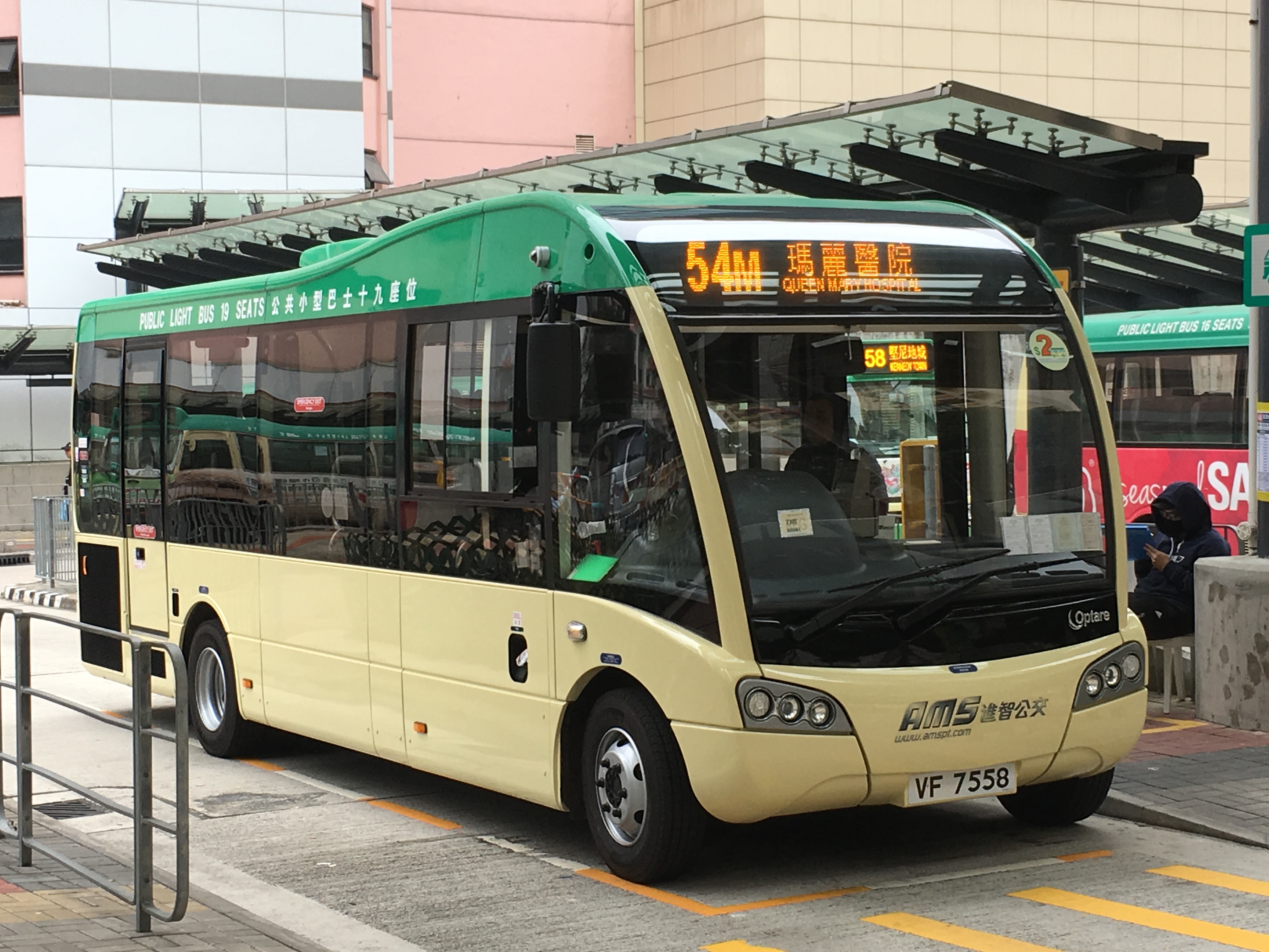
The public light bus or minibus is a public transport service in Hong Kong. It uses minibuses to serve areas that standard Hong Kong bus lines cannot reach efficiently. The vehicles are colloquially known by the code-switch ' (Van Jái) literally "van-ette". Depending on the type of vehicle, minibuses carry a maximum of 16 or 19 seated passengers; no standing passengers are allowed. Minibuses typically offer a faster and more efficient transportation solution due to their small size, limited carrying capacity, frequency and diverse range of routes, although they are generally slightly more expensive than standard buses. The popularity of minibus services in Hong Kong can be attributed to Hong Kong's high population density, as well as their ability to navigate narrow and winding roads which standard buses cannot. Overview Minibuses in Hong Kong are licensed either as Green Minibuses (GMBs) or Public Light Buses (PLBs), the former restricted to fixed-fare, fixed-route operat ... [...More Info...] [...Related Items...] OR: [Wikipedia] [Google] [Baidu] |
Bus Services In Hong Kong
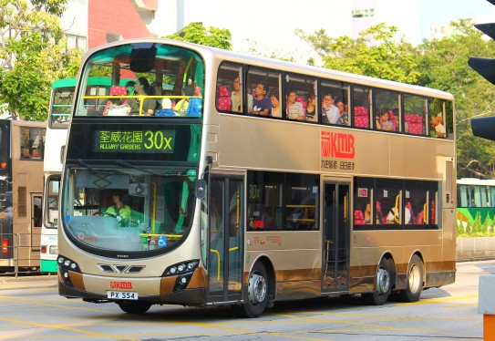
Bus services in Hong Kong have a long history. As of 2016, five companies operate franchised public bus services. There are also a variety of non-franchised public bus services, including feeder bus services to railway stations operated by MTR, and residents' services for residential estates (particularly those in the New Territories). History Current situation Bus services in Hong Kong can be roughly divided into three types: franchised buses, non-franchised buses and public light buses. Franchised bus As of 2014, there are five privately owned bus companies providing franchised bus services across Hong Kong, operating more than 700 routes with some 5,800 buses. Hong Kong is one of the few cities in the world that bus services are not operated or owned by the Government. These are the five franchised bus companies in Hong Kong: * Kowloon Motor Bus Company (1933) Limited Mainly provides service in Kowloon and New Territories, operating about 400 routes with about 3,850 bu ... [...More Info...] [...Related Items...] OR: [Wikipedia] [Google] [Baidu] |


.jpg)

