|
Fakenham
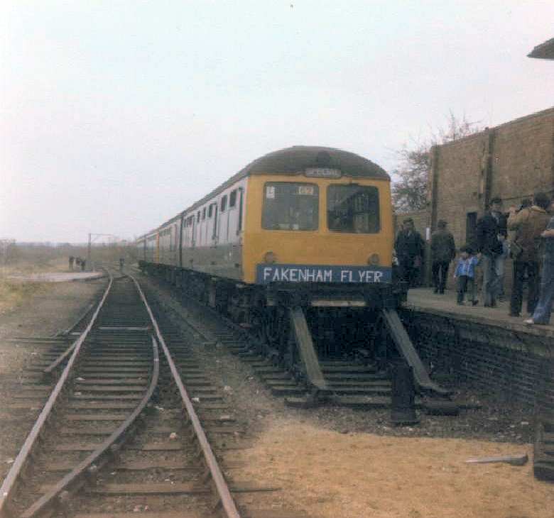
Fakenham is a market town and civil parish in Norfolk, England. It is situated on the River Wensum, about north west of Norwich. The town is the junction of several local roads, including the A148 from King's Lynn to Cromer, the A1067 to Norwich and the A1065 to Swaffham. The civil parish has an area of and in the 2001 census had a population of 7,357 in 3,292 households, the population increasing to 7,617 at the 2011 census. For the purposes of local government, the parish falls within the district of North Norfolk.Office for National Statistics & Norfolk County Council (2001). Census population and household counts for unparished urban areas and all parishes'. Retrieved 2 December 2005. Fakenham has been a market town since 1250, particularly known for its corn, barley and wheat trading, and in the 19th century it became noted for its printing. Fakenham Racecourse is a thoroughbred horse racing venue to the south of Fakenham. The town has a long name of Fakenham Lancaster ... [...More Info...] [...Related Items...] OR: [Wikipedia] [Google] [Baidu] |
Fakenham Racecourse
Fakenham Racecourse is a thoroughbred horse racing venue located south of Fakenham, Norfolk, England. King Charles III is patron. Course The course is left-handed, almost square in shape, with a circumference of about a mile. The steeplechase course is situated to the outside of the hurdle course and consists of six fences per circuit, with the open ditch as the penultimate obstacle. It is also the venue for the West Norfolk Hunt's Point to Point. History Racing first took place at Fakenham on Easter Monday after the West Norfolk Hunt took a committee decision to transfer their race meeting from East Winch, near King's Lynn. The West Norfolk Hunt had run meeting since 1884 at East Winch but because of concerns over continual heavy going at the course, a more suitable, lighter soil site was identified at Fakenham. This first meeting in 1905 attracted 37 runners and considering the travelling difficulties in those days, confirmed the excellent local support for the transfer to ... [...More Info...] [...Related Items...] OR: [Wikipedia] [Google] [Baidu] |
River Wensum
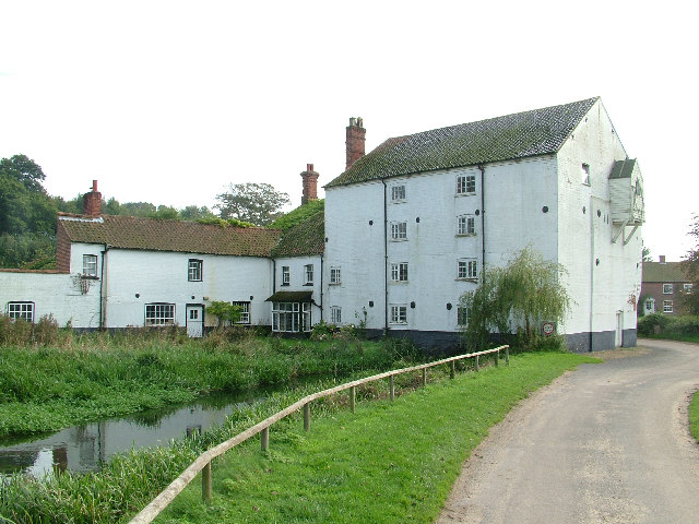
The River Wensum is a chalk river in Norfolk, England and a tributary of the River Yare, despite being the larger of the two rivers. The river is a biological Site of Special Scientific Interest and Special Area of Conservation. The Wensum is the principal river on which the city of Norwich was founded. The river passes Carrow Road, the home of Norwich City F.C.; one end of the ground was originally named ''The River End'' in its honour, a name that still persists among fans. Etymology The river receives its name from the Old English adjective ''wandsum'' or ''wendsum'', meaning "winding". Course Modern Ordnance Survey Maps list the source of the Wensum as lying between the villages of Colkirk and Whissonsett in northwest Norfolk. The reasoning behind this claim is unknown given that other tributaries are further from the mouth; pre-modern maps and other written sources refer to the source to be in West Rudham from springs arising on the aptly named Wensum Farm. From t ... [...More Info...] [...Related Items...] OR: [Wikipedia] [Google] [Baidu] |
North Norfolk
North Norfolk is a local government district in Norfolk, England. Its council is based in Cromer. The population at the 2011 Census was 101,149. History The district was formed on 1 April 1974, under the Local Government Act 1972. It was a merger of Cromer Urban District, North Walsham Urban District, Sheringham Urban District, Wells-next-the-Sea Urban District, Erpingham Rural District, Smallburgh Rural District, and Walsingham Rural District. The district was originally to be called Pastonacres, but changed its name by resolution of the council and permission of the Secretary of State for Environment before it formally came into existence on 1 April 1974. Politics Elections to the district council are held every four years, with all of the seats on the council up for election every fourth year. The council was run by a Conservative administration, the Conservative party having gained a majority of 8 seats at the 2011 elections, which they increased to 18 at the 20 ... [...More Info...] [...Related Items...] OR: [Wikipedia] [Google] [Baidu] |
Walsingham
Walsingham () is a civil parish in North Norfolk, England, famous for its religious shrines in honour of Mary, mother of Jesus. It also contains the ruins of two medieval Christian monasticism, monastic houses.Ordnance Survey (2002). ''OS Explorer Map 251 – Norfolk Coast Central''. . Walsingham is northwest of Norwich. The civil parish includes Little Walsingham and Great Walsingham, together with Egmere medieval settlement, Egmere (a depopulated medieval village at ), and has an area of 1 E7 m², 18.98 km². At the United Kingdom Census 2011, 2011 census, it had a population of 819.Office for National Statistics & Norfolk County Council (2001). Census population and household counts for unparished urban areas and all parishes''. Retrieved 2 December 2005. The village's name means 'Homestead/village of Waels' people'. Walsingham is a major centre of Christian pilgrimage, pilgrimage. In 1061, according to the Walsingham legend, an Anglo-Saxon noblewoman, Richeldis de ... [...More Info...] [...Related Items...] OR: [Wikipedia] [Google] [Baidu] |
Hempton
Hempton is a village and a civil parish in the English county of Norfolk. The village is south west of Fakenham, north west of Norwich and north east of London. The village straddles the A1065 between Fakenham and Swaffham. The nearest railway station is at Sheringham for the Bittern Line which runs between Sheringham, Cromer and Norwich. The nearest airport is Norwich International Airport. The village's name means 'Hemma's farm/settlement'. The Church of the Holy Trinity was built in 1856 by John Henry Hakewill for the Reverend Charles St. Denys Moxon. This church is an important example of a small rural building emerging directly from the Oxford Movement The Oxford Movement was a movement of high church members of the Church of England which began in the 1830s and eventually developed into Anglo-Catholicism. The movement, whose original devotees were mostly associated with the University of O .... It has a painted cross suspended above the high altar that was carv ... [...More Info...] [...Related Items...] OR: [Wikipedia] [Google] [Baidu] |
Pensthorpe Natural Park
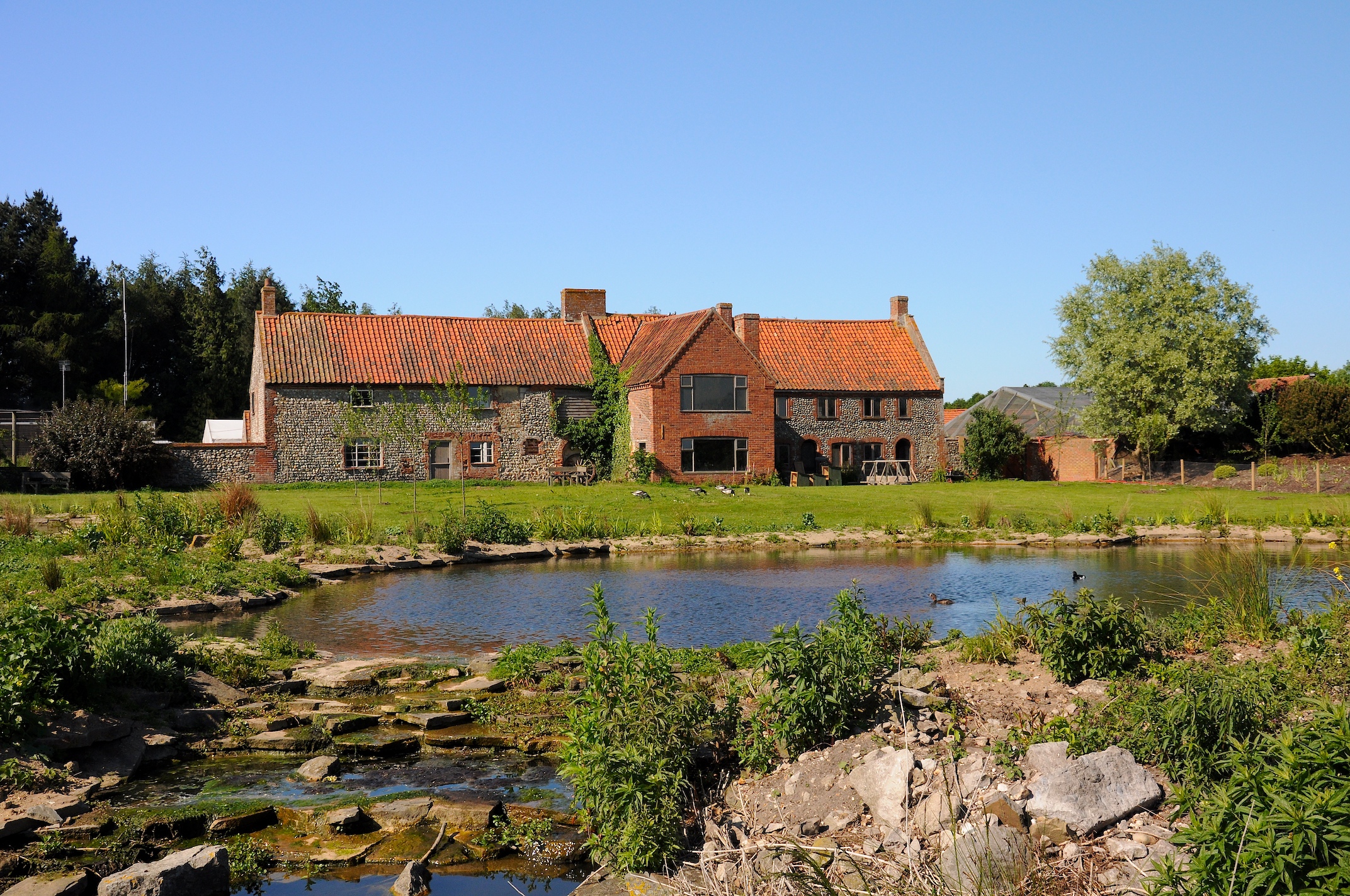
Pensthorpe Natural Park is located in Pensthorpe, Norfolk, England and is approximately one mile from Fakenham and close to the A1067 road. The park covers . The River Wensum, which runs through the site, is a designated Special Area of Conservation (SAC). Pensthorpe Conservation Trust (PCT) was formed in January 2003. It is a charitable trust that works closely with Pensthorpe Natural Park to showcase the importance of species and habitat conservation. The PCT works with partner organisations in national conservation programmes to conserve wetland and farmland bird species. These partnerships include Operation Turtle Dove, The Great Crane Project and re-introduction projects for red squirrels and corncrakes. History The site was created as a nature reserve by Bill Makins in the 1980s, before being bought by Bill and Deb Jordan in 2003, of Jordans cereals. During excavations to create the lakes and wader scrapes, one million tons of aggregates were excavated. The work unco ... [...More Info...] [...Related Items...] OR: [Wikipedia] [Google] [Baidu] |
Norfolk
Norfolk () is a ceremonial and non-metropolitan county in East Anglia in England. It borders Lincolnshire to the north-west, Cambridgeshire to the west and south-west, and Suffolk to the south. Its northern and eastern boundaries are the North Sea, with The Wash to the north-west. The county town is the city of Norwich. With an area of and a population of 859,400, Norfolk is a largely rural county with a population density of 401 per square mile (155 per km2). Of the county's population, 40% live in four major built up areas: Norwich (213,000), Great Yarmouth (63,000), King's Lynn (46,000) and Thetford (25,000). The Broads is a network of rivers and lakes in the east of the county, extending south into Suffolk. The area is protected by the Broads Authority and has similar status to a national park. History The area that was to become Norfolk was settled in pre-Roman times, (there were Palaeolithic settlers as early as 950,000 years ago) with camps along the highe ... [...More Info...] [...Related Items...] OR: [Wikipedia] [Google] [Baidu] |
King's Lynn
King's Lynn, known until 1537 as Bishop's Lynn and colloquially as Lynn, is a port and market town in the borough of King's Lynn and West Norfolk in the county of Norfolk, England. It is located north of London, north-east of Peterborough, north-north-east of Cambridge and west of Norwich. History Toponymy The etymology of King's Lynn is uncertain. The name ''Lynn'' may signify a body of water near the town – the Welsh word means a lake; but the name is plausibly of Anglo-Saxon origin, from ''lean'' meaning a tenure in fee or farm. As the 1085 Domesday Book mentions saltings at Lena (Lynn), an area of partitioned pools may have existed there at the time. Other places with Lynn in the name include Dublin, Ireland. An Dubh Linn....the Black Pool. The presence of salt, which was relatively rare and expensive in the early medieval period, may have added to the interest of Herbert de Losinga and other prominent Normans in the modest parish. The town was named ''Len '' (Bis ... [...More Info...] [...Related Items...] OR: [Wikipedia] [Google] [Baidu] |
Barsham, Norfolk
Barsham is a civil parish in the English county of Norfolk, and includes the villages of East Barsham, North Barsham, West Barsham and Houghton St Giles. The villages are all situated within 2 miles of each other, about 3 miles north of the town of Fakenham and 28 miles north-west of the city of Norwich. The headwaters of the River Stiffkey flow through both East and North Barsham and Houghton St Giles. Originally all four villages had their own parishes, but these were merged to create a single civil parish in 1935. This parish has an area of 7½ square miles and in the 2001 census had a population of 253 in 115 households, the population reducing to 232 at the 2011 census. For the purposes of local government, the parish falls within the district of North Norfolk. There are no shops in Barsham, and the White Horse Inn in East Barsham is the only pub. The mediaeval pilgrimage centre of Walsingham lies only 1¼ miles north of Houghton St Giles, and the Roman Catholic National ... [...More Info...] [...Related Items...] OR: [Wikipedia] [Google] [Baidu] |
Broadland (UK Parliament Constituency)
Broadland is a Norfolk constituency, which has been represented in parliament since the 2019 general election by Jerome Mayhew, a Conservative. History The Boundary Commission for England created the Broadland constituency as the successor seat to Mid Norfolk, which was relocated. It comprised the majority of Mid Norfolk, together with parts of North Norfolk and Norwich North. The name is taken from the local government area Broadland though its boundary does not match that of the district council nor is it coterminous with the Norfolk Broads (waterways and surrounding protected land). Boundaries The District of Broadland wards of Acle, Aylsham, Blofield with South Walsham, Brundall, Burlingham, Buxton, Coltishall, Drayton North, Drayton South, Eynesford, Great Witchingham, Hevingham, Horsford and Felthorpe, Marshes, Plumstead, Reepham, Spixworth with St Faiths, Taverham North, Taverham South, and Wroxham, and the District of North Norfolk wards of Astley, Lancaster North ... [...More Info...] [...Related Items...] OR: [Wikipedia] [Google] [Baidu] |
Norwich
Norwich () is a cathedral city and district of Norfolk, England, of which it is the county town. Norwich is by the River Wensum, about north-east of London, north of Ipswich and east of Peterborough. As the seat of the See of Norwich, with one of the country's largest medieval cathedrals, it is the largest settlement and has the largest urban area in East Anglia. The population of the Norwich City Council local authority area was estimated to be 144,000 in 2021, which was an increase from 143,135 in 2019. The wider built-up area had a population of 213,166 in 2019. Heritage and status Norwich claims to be the most complete medieval city in the United Kingdom. It includes cobbled streets such as Elm Hill, Timber Hill and Tombland; ancient buildings such as St Andrew's Hall; half-timbered houses such as Dragon Hall, The Guildhall and Strangers' Hall; the Art Nouveau of the 1899 Royal Arcade; many medieval lanes; and the winding River Wensum that flows through the city ... [...More Info...] [...Related Items...] OR: [Wikipedia] [Google] [Baidu] |
Swaffham
Swaffham () is a market town and civil parish in the Breckland District and English county of Norfolk. It is situated east of King's Lynn and west of Norwich. The civil parish has an area of and in the 2001 census had a population of 6,935 in 3,130 households, which increased to 7,258, in 3,258 households, at the 2011 census. For the purposes of local government, the parish falls within the district of Breckland. History The name of the town derives from the Old English ''Swǣfa hām'' = "the homestead of the Swabians"; some of them presumably came with the Angles and Saxons. By the 14th and 15th centuries Swaffham had an emerging sheep and wool industry. As a result of this prosperity, the town has a large market place. The market cross here was built by George Walpole, 3rd Earl of Orford and presented to the town in 1783. On the top is the statue of Ceres, the Roman goddess of the harvest. About 8 km to the north of Swaffham can be found the ruins of the fo ... [...More Info...] [...Related Items...] OR: [Wikipedia] [Google] [Baidu] |


