|
Fair Play Man
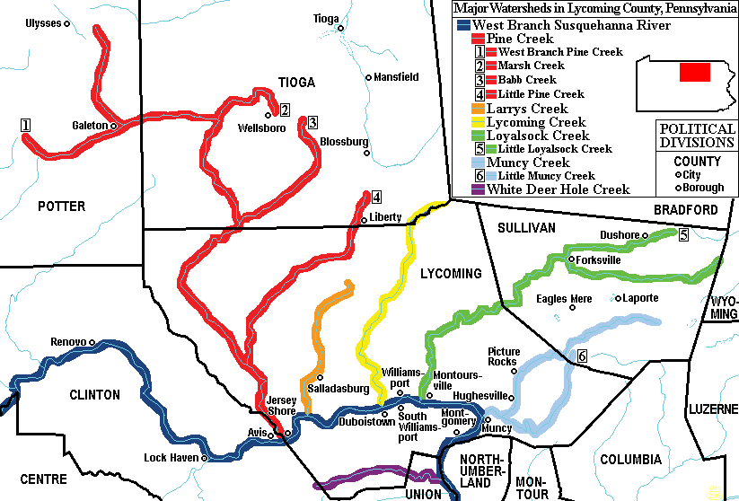
The Fair Play Men were illegal settlers (squatters) who established their own system of self-rule from 1773 to 1785 in the West Branch Susquehanna River valley of Pennsylvania in what is now the United States. Because they settled in territory claimed by Native Americans, they had no recourse to the Pennsylvania colonial government. Accordingly they established what was known as the Fair Play System, with three elected commissioners who ruled on land claims and other issues for the group. In a remarkable coincidence, the Fair Play Men made their own declaration of independence from Britain on July 4, 1776 beneath the "Tiadaghton Elm" on the banks of Pine Creek. The 1768 Treaty of Fort Stanwix The British colonial government purchased land from the Iroquois in the Treaty of Fort Stanwix of 1768, opening new lands in Pennsylvania and New York for settlement, including what is now Lycoming County, Pennsylvania. Lycoming County is about 100 mi (160 km) northwest of Philadelp ... [...More Info...] [...Related Items...] OR: [Wikipedia] [Google] [Baidu] |
Avis, Pennsylvania
Avis is a borough in Clinton County, Pennsylvania, United States. The population was 1,484 at the 2010 census. Geography Avis is located in southeastern Clinton County at (41.185234, -77.316455). It is on the north side of the valley of the West Branch Susquehanna River, which passes to the south. U.S. Route 220, a four-lane freeway, runs along the southern edge of the borough, with access from Exit 118 ( Pennsylvania Route 150) to the south of town and from Exit 120 (Pennsylvania Route 44) to the east. The borough of Jersey Shore is to the east of Avis, and Williamsport is to the east via US 220, while Lock Haven, the Clinton county seat, is to the west. According to the United States Census Bureau, Avis has a total area of , all land. Demographics As of the census of 2000, there were 1,492 people, 633 households, and 417 families residing in the borough. The population density was . There were 652 housing units at an average density of . The racial makeup of the boroug ... [...More Info...] [...Related Items...] OR: [Wikipedia] [Google] [Baidu] |
East-northeast
The points of the compass are a set of horizontal, radially arrayed compass directions (or azimuths) used in navigation and cartography. A compass rose is primarily composed of four cardinal directions—north, east, south, and west—each separated by 90 degrees, and secondarily divided by four ordinal (intercardinal) directions—northeast, southeast, southwest, and northwest—each located halfway between two cardinal directions. Some disciplines such as meteorology and navigation further divide the compass with additional azimuths. Within European tradition, a fully defined compass has 32 'points' (and any finer subdivisions are described in fractions of points). Compass points are valuable in that they allow a user to refer to a specific azimuth in a colloquial fashion, without having to compute or remember degrees. Designations The names of the compass point directions follow these rules: 8-wind compass rose * The four cardinal directions are north (N), east (E), s ... [...More Info...] [...Related Items...] OR: [Wikipedia] [Google] [Baidu] |
United States Declaration Of Independence
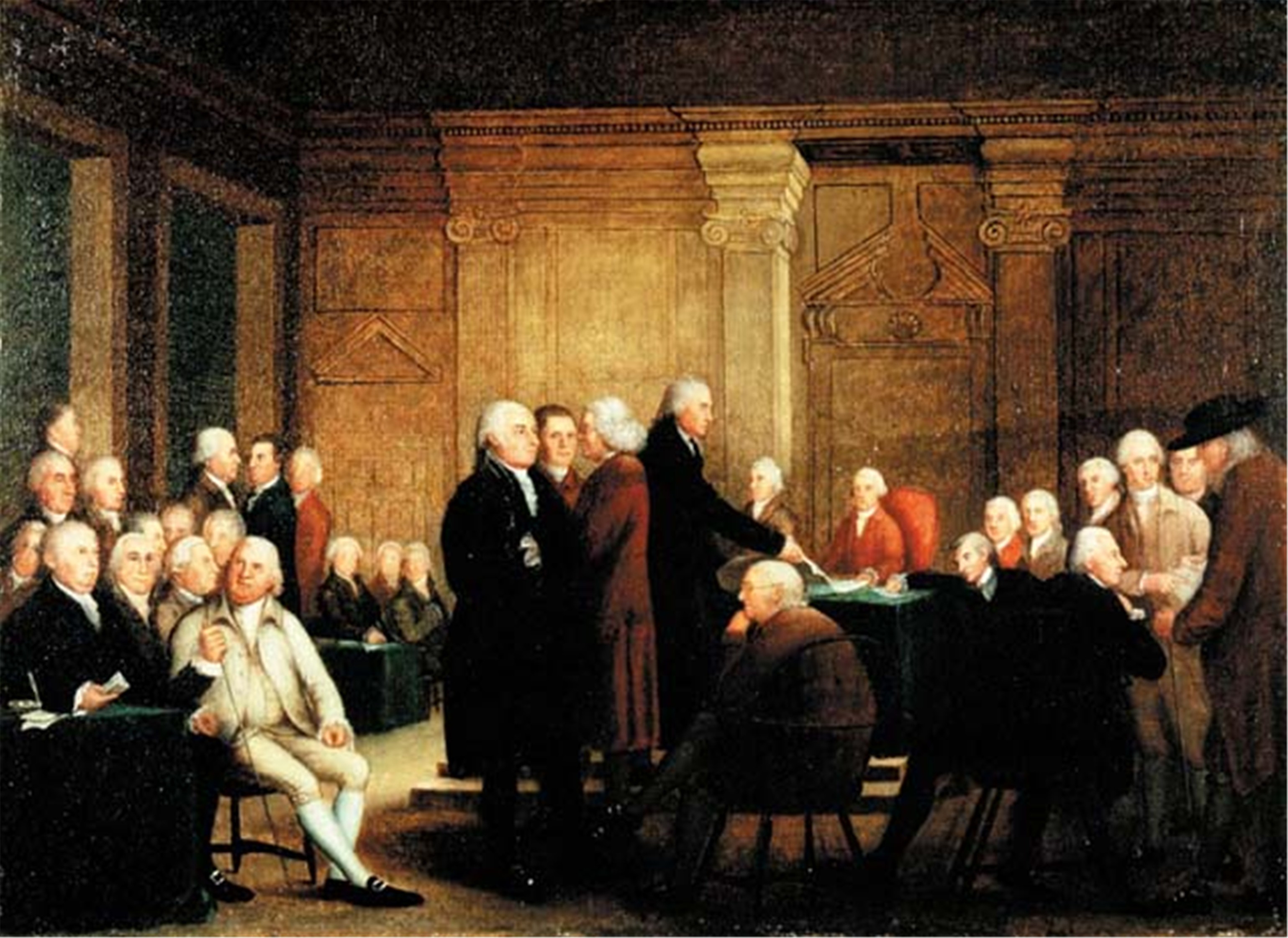
The United States Declaration of Independence, formally The unanimous Declaration of the thirteen States of America, is the pronouncement and founding document adopted by the Second Continental Congress meeting at Pennsylvania State House (later renamed Independence Hall) in Philadelphia, Pennsylvania, on July 4, 1776. Enacted during the American Revolution, the Declaration explains why the Thirteen Colonies at war with the Kingdom of Great Britain regarded themselves as thirteen independent sovereign states, no longer subject to British colonial rule. With the Declaration, these new states took a collective first step in forming the United States of America and, de facto, formalized the American Revolutionary War, which had been ongoing since April 1775. The Declaration of Independence was signed by 56 of America's Founding Fathers, congressional representatives from New Hampshire, Massachusetts Bay, Rhode Island and Providence Plantations, Connecticut, New York, New Jer ... [...More Info...] [...Related Items...] OR: [Wikipedia] [Google] [Baidu] |
Loyalist (American Revolution)
Loyalists were colonists in the Thirteen Colonies who remained loyal to the British Crown during the American Revolutionary War, often referred to as Tories, Royalists or King's Men at the time. They were opposed by the Patriots, who supported the revolution, and called them "persons inimical to the liberties of America." Prominent Loyalists repeatedly assured the British government that many thousands of them would spring to arms and fight for the crown. The British government acted in expectation of that, especially in the southern campaigns in 1780–81. Britain was able to effectively protect the people only in areas where they had military control, and in return, the number of military Loyalists was significantly lower than what had been expected. Due to the conflicting political views, loyalists were often under suspicion of those in the British military, who did not know whom they could fully trust in such a conflicted situation; they were often looked down upon. Pat ... [...More Info...] [...Related Items...] OR: [Wikipedia] [Google] [Baidu] |
Second Continental Congress
The Second Continental Congress was a late-18th-century meeting of delegates from the Thirteen Colonies that united in support of the American Revolutionary War. The Congress was creating a new country it first named "United Colonies" and in 1776 renamed "United States of America." It convened in Philadelphia on May 10, 1775, with representatives from 12 of the colonies. This came shortly after the Battles of Lexington and Concord and was in succession to the First Continental Congress which met from September 5 to October 26, 1774. The Second Congress functioned as a ''de facto'' national government at the outset of the Revolutionary War by raising armies, directing strategy, appointing diplomats, and writing petitions such as the Declaration of the Causes and Necessity of Taking Up Arms and the Olive Branch Petition. All thirteen colonies were represented by the time the Congress adopted the Lee Resolution which declared independence from Britain on July 2, 1776, and the c ... [...More Info...] [...Related Items...] OR: [Wikipedia] [Google] [Baidu] |
Clinton County, Pennsylvania
Clinton County is a county in the Commonwealth of Pennsylvania. As of the 2020 census, the population was 37,450. Its county seat is Lock Haven. The county was created on June 21, 1839, from parts of Centre and Lycoming Counties. Its name is in honor of the seventh Governor of New York, DeWitt Clinton. Some alternate sources suggest the namesake is Henry Clinton. Clinton County comprises the Lock Haven, PA Micropolitan Statistical Area, which is also included in the Williamsport-Lock Haven, PA Combined Statistical Area. Geography According to the U.S. Census Bureau, the county has a total area of , of which is land and (1.0%) is water. The county has a humid continental climate which is warm-summer (''Dfb'') except in lower areas near the West Branch and the Bald Eagle Creek which are hot-summer (''Dfa''). Average monthly temperatures in Lock Haven range from 26.5 °F in January to 72.2 °F in July, while in Renovo they range from 25.6 °F in January to ... [...More Info...] [...Related Items...] OR: [Wikipedia] [Google] [Baidu] |
Continental Army
The Continental Army was the army of the United Colonies (the Thirteen Colonies) in the Revolutionary-era United States. It was formed by the Second Continental Congress after the outbreak of the American Revolutionary War, and was established by a resolution of Congress on June 14, 1775. The Continental Army was created to coordinate military efforts of the Colonies in their war for independence against the British, who sought to keep their American lands under control. General George Washington was the commander-in-chief of the army throughout the war. The Continental Army was supplemented by local militias and volunteer troops that were either loyal to individual states or otherwise independent. Most of the Continental Army was disbanded in 1783 after the Treaty of Paris formally ended the fighting. The 1st and 2nd Regiments of the Army went on to form what was to become the Legion of the United States in 1792. This became the foundation of what is now the United States ... [...More Info...] [...Related Items...] OR: [Wikipedia] [Google] [Baidu] |
American Revolutionary War
The American Revolutionary War (April 19, 1775 – September 3, 1783), also known as the Revolutionary War or American War of Independence, was a major war of the American Revolution. Widely considered as the war that secured the independence of the United States, fighting began on April 19, 1775, followed by the Lee Resolution on July 2, 1776, and the Declaration of Independence on July 4, 1776. The American Patriots were supported by the Kingdom of France and, to a lesser extent, the Dutch Republic and the Spanish Empire, in a conflict taking place in North America, the Caribbean, and the Atlantic Ocean. Established by royal charter in the 17th and 18th centuries, the American colonies were largely autonomous in domestic affairs and commercially prosperous, trading with Britain and its Caribbean colonies, as well as other European powers via their Caribbean entrepôts. After British victory over the French in the Seven Years' War in 1763, tensions between the motherland and he ... [...More Info...] [...Related Items...] OR: [Wikipedia] [Google] [Baidu] |
Work Projects Administration
The Works Progress Administration (WPA; renamed in 1939 as the Work Projects Administration) was an American New Deal agency that employed millions of jobseekers (mostly men who were not formally educated) to carry out public works projects, including the construction of public buildings and roads. It was set up on May 6, 1935, by presidential order, as a key part of the Second New Deal. The WPA's first appropriation in 1935 was $4.9 billion (about $15 per person in the U.S., around 6.7 percent of the 1935 GDP). Headed by Harry Hopkins, the WPA supplied paid jobs to the unemployed during the Great Depression in the United States, while building up the public infrastructure of the US, such as parks, schools, and roads. Most of the jobs were in construction, building more than 620,000 miles (1,000,000 km) of streets and over 10,000 bridges, in addition to many airports and much housing. The largest single project of the WPA was the Tennessee Valley Authority. At its peak ... [...More Info...] [...Related Items...] OR: [Wikipedia] [Google] [Baidu] |
Larrys Creek
Larrys Creek is a U.S. Geological Survey. National Hydrography Dataset high-resolution flowline dataThe National Map , accessed August 8, 2011 tributary of the West Branch Susquehanna River in Lycoming County in the U.S. state of Pennsylvania. A part of the Chesapeake Bay drainage basin, its watershed drains in six townships and a borough. The creek flows south from the dissected Allegheny Plateau to the Ridge-and-valley Appalachians through sandstone, limestone, and shale from the Devonian, Mississippian, and Pennsylvanian periods. The valley's first recorded inhabitants were the Susquehannocks, followed by the Lenape and other tribes. ''Note:'' ISBN refers to the Heritage Books July 1996 reprint. URL is to a scan of the 1892 version with some OCR typos. The Great Shamokin Path crossed the creek near its mouth, where Larry Burt, the first Euro-American settler and the man who gave the creek its present name, also lived by 1769. In the 19th century, the creek and its watershed ... [...More Info...] [...Related Items...] OR: [Wikipedia] [Google] [Baidu] |
Lycoming Creek
Lycoming Creek is a U.S. Geological Survey. National Hydrography Dataset high-resolution flowline dataThe National Map, accessed August 8, 2011 tributary of the West Branch Susquehanna River located in Tioga and Lycoming counties in Pennsylvania in the United States. Geography As the crow flies, Lycoming County is about northwest of Philadelphia and east-northeast of Pittsburgh. Lycoming Creek has its river source in Tioga County and is in length from the Tioga County / Lycoming County line to its confluence with the West Branch Susquehanna River at Williamsport. Smaller streams feeding Lycoming Creek include Pleasant Stream, Grays Run, Roaring Branch, Hoagland Run, and Trout Run. Watershed Approximately 81.5% of the Lycoming Creek watershed is in Lycoming County, with 16.5% in Tioga County, and 1.5% in Sullivan County. The watershed has a total population of 19,978 (as of 2000) and a total area of . Of that area, are forested, are given to agricultural uses, only a ... [...More Info...] [...Related Items...] OR: [Wikipedia] [Google] [Baidu] |
Purchase Line
The Purchase Line is the name commonly given to the line dividing Indian from British Colonial lands established in the Treaty of Fort Stanwix of 1768 in western Pennsylvania. In New York State documents it is referred to as the Line of Property; see that article for the treaty text and other sections. The relevant section of the treaty reads: * "from thence" ( Kittanning) "a direct Line to the nearest Fork of the west branch of Susquehanna" This line was not clearly defined until in a meeting between Indian and Pennsylvania representatives in 1773 at the well-known "Canoe Place" or upper limit of canoe navigation on the Susquehanna at its confluence with Cush Cushion Creek at present-day Cherry Tree, Pennsylvania. This was agreed to as the "nearest point" of the treaty. This became the tri-point between present-day Clearfield, Cambria, and Indiana counties, although the borough of Cherry Tree, Pennsylvania was later included entirely in Indiana for convenience. The line is sti ... [...More Info...] [...Related Items...] OR: [Wikipedia] [Google] [Baidu] |

(cropped).jpg)


