|
Földes
Földes is a large village in Hajdú-Bihar County, in the Northern Great Plain region of eastern Hungary. Location It covers an area of and has a population of 3,960 people (2016). It is located next to the main road 42 between Püspökladány and Berettyóújfalu, 34 km southwest of Debrecen. The Eastern Main Channel is 5 km northeast from Földes. Directly neighboring settlements: Sáp (4 km south), Báránd (10 km southwest), Tetétlen (5 km west), Hajdúszovát (14 km northeast), Derecske (20 km east), Berettyóújfalu (16 km southeast). A bus service connects to Debrecen, Berettyóújfalu, Püspökladány, Kaba, Nagyrábé. The closest train station is located in Sáp. History Early history In 1938, traces of the first human settlement were found during archeological excavations in the Inacs Mound, next to the main road 42, at the western edge of Földes's boundary. It was a Neolithic site where the remains of their pit houses ... [...More Info...] [...Related Items...] OR: [Wikipedia] [Google] [Baidu] |
Földes Inacs-halom-7
Földes is a large village in Hajdú-Bihar County, in the Northern Great Plain region of eastern Hungary. Location It covers an area of and has a population of 3,960 people (2016). It is located next to the main road 42 between Püspökladány and Berettyóújfalu, 34 km southwest of Debrecen. The Eastern Main Channel is 5 km northeast from Földes. Directly neighboring settlements: Sáp (4 km south), Báránd (10 km southwest), Tetétlen (5 km west), Hajdúszovát (14 km northeast), Derecske (20 km east), Berettyóújfalu (16 km southeast). A bus service connects to Debrecen, Berettyóújfalu, Püspökladány, Kaba, Nagyrábé. The closest train station is located in Sáp. History Early history In 1938, traces of the first human settlement were found during archeological excavations in the Inacs Mound, next to the main road 42, at the western edge of Földes's boundary. It was a Neolithic site where the remains of their pit hous ... [...More Info...] [...Related Items...] OR: [Wikipedia] [Google] [Baidu] |
Püspökladány District
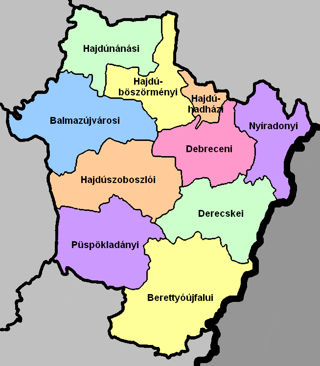
Püspökladány ( hu, Püspökladányi járás) is a district in south-western part of Hajdú-Bihar County. ''Püspökladány'' is also the name of the town where the district seat is found. The district is located in the Northern Great Plain Statistical Region. This district is a part of Hajdúság historical and geographical region. Geography Püspökladány District borders with Hajdúszoboszló District to the north, Derecske District and Berettyóújfalu District to the east, Szeghalom District ''(Békés County)'' to the south, Karcag District ''(Jász-Nagykun-Szolnok County)'' to the west. The number of the inhabited places in Püspökladány District is 12. Municipalities The district has 2 towns, 3 large villages and 7 villages. (ordered by population, as of 1 January 2012) The bolded municipalities are cities, ''italics'' municipalities are large villages. Demographics In 2011, it had a population of 40,426 and the population density was 55/km². Ethnicity Bes ... [...More Info...] [...Related Items...] OR: [Wikipedia] [Google] [Baidu] |
Hajdú-Bihar County
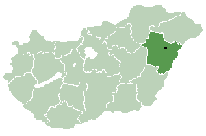
Hajdú-Bihar ( hu, Hajdú-Bihar megye, ) is an administrative county (comitatus or megye) in eastern Hungary, on the border with Romania. It shares borders with the Hungarian counties Szabolcs-Szatmár-Bereg, Borsod-Abaúj-Zemplén, Jász-Nagykun-Szolnok and Békés. The capital of Hajdú-Bihar county is Debrecen. Together with Bihor County in Romania it constitutes the Biharia Euroregion. Geography The area of the county does not form a geographical unit; it shares several features with the neighbouring areas: from northeast the sand hills of the Nyírség spread over the county borders. The western part is the Hortobágy National Park ("Puszta"), a large flat area of the country. The county of Hajdú-Bihar occupies the eastern part of Hungary. Most of its territory is completely flat and is part of the Pannonian Plain region (called the Grand Plain in the country). The highest point hardly rises over 170.5 metres in the north. It seems that the county slopes to the south be ... [...More Info...] [...Related Items...] OR: [Wikipedia] [Google] [Baidu] |
Hungary
Hungary ( hu, Magyarország ) is a landlocked country in Central Europe. Spanning of the Carpathian Basin, it is bordered by Slovakia to the north, Ukraine to the northeast, Romania to the east and southeast, Serbia to the south, Croatia and Slovenia to the southwest, and Austria to the west. Hungary has a population of nearly 9 million, mostly ethnic Hungarians and a significant Romani minority. Hungarian, the official language, is the world's most widely spoken Uralic language and among the few non-Indo-European languages widely spoken in Europe. Budapest is the country's capital and largest city; other major urban areas include Debrecen, Szeged, Miskolc, Pécs, and Győr. The territory of present-day Hungary has for centuries been a crossroads for various peoples, including Celts, Romans, Germanic tribes, Huns, West Slavs and the Avars. The foundation of the Hungarian state was established in the late 9th century AD with the conquest of the Carpathian Basin by Hungar ... [...More Info...] [...Related Items...] OR: [Wikipedia] [Google] [Baidu] |
Countries Of The World
The following is a list providing an overview of sovereign states around the world with information on their status and recognition of their sovereignty. The 206 listed states can be divided into three categories based on membership within the United Nations System: 193 member states of the United Nations, UN member states, 2 United Nations General Assembly observers#Present non-member observers, UN General Assembly non-member observer states, and 11 other states. The ''sovereignty dispute'' column indicates states having undisputed sovereignty (188 states, of which there are 187 UN member states and 1 UN General Assembly non-member observer state), states having disputed sovereignty (16 states, of which there are 6 UN member states, 1 UN General Assembly non-member observer state, and 9 de facto states), and states having a political status of the Cook Islands and Niue, special political status (2 states, both in associated state, free association with New Zealand). Compi ... [...More Info...] [...Related Items...] OR: [Wikipedia] [Google] [Baidu] |
Tetétlen
Tetétlen is a village in Hajdú-Bihar county, in the Northern Great Plain region of eastern Hungary Hungary ( hu, Magyarország ) is a landlocked country in Central Europe. Spanning of the Carpathian Basin, it is bordered by Slovakia to the north, Ukraine to the northeast, Romania to the east and southeast, Serbia to the south, Croatia a .... Geography It covers an area of and has a population of 1455 people (2001). Populated places in Hajdú-Bihar County {{Hajdu-geo-stub ... [...More Info...] [...Related Items...] OR: [Wikipedia] [Google] [Baidu] |
Hajdúszovát
Hajdúszovát is a village in Hajdú-Bihar county, in the Northern Great Plain region of eastern Hungary. Geography It covers an area of and has a population Population typically refers to the number of people in a single area, whether it be a city or town, region, country, continent, or the world. Governments typically quantify the size of the resident population within their jurisdiction using a ... of 3045 people (2015). References Populated places in Hajdú-Bihar County {{Hajdu-geo-stub ... [...More Info...] [...Related Items...] OR: [Wikipedia] [Google] [Baidu] |
Derecske
Derecske is a town in Hajdú-Bihar county, in the Northern Great Plain region of eastern Hungary. History The town was first mentioned in 1291. Geography It covers an area of and has a population Population typically refers to the number of people in a single area, whether it be a city or town, region, country, continent, or the world. Governments typically quantify the size of the resident population within their jurisdiction using a ... of 8734 people (2015). References External links * in Hungarian Populated places in Hajdú-Bihar County {{Hajdu-geo-stub ... [...More Info...] [...Related Items...] OR: [Wikipedia] [Google] [Baidu] |
Kaba, Hungary
Kaba () is a town in eastern Hungary, in the county of Hajdú-Bihar. The town is located along the Hungarian Route 4, approximately 190 km from Budapest, the capital city and 32 km west from Debrecen, the county seat. A meteorite landed near Kaba in 1857. International relations Twin towns – sister cities Kaba is twinned with: * Aleșd, Romania * Cetariu Cetariu ( hu, Hegyközcsatár) is a commune in Bihor County, Crișana, Romania with a population of 2,165 people. It is composed of four villages: Cetariu, Șișterea (''Siter''), Șușturogi (''Sitervölgy'') and Tăutelec (''Hegyköztóttelek''). ..., Romania References External links * in Hungarian Populated places in Hajdú-Bihar County {{Hajdu-geo-stub ... [...More Info...] [...Related Items...] OR: [Wikipedia] [Google] [Baidu] |
Neolithic
The Neolithic period, or New Stone Age, is an Old World archaeological period and the final division of the Stone Age. It saw the Neolithic Revolution, a wide-ranging set of developments that appear to have arisen independently in several parts of the world. This "Neolithic package" included the introduction of farming, domestication of animals, and change from a hunter-gatherer lifestyle to one of settlement. It began about 12,000 years ago when farming appeared in the Epipalaeolithic Near East, and later in other parts of the world. The Neolithic lasted in the Near East until the transitional period of the Chalcolithic (Copper Age) from about 6,500 years ago (4500 BC), marked by the development of metallurgy, leading up to the Bronze Age and Iron Age. In other places the Neolithic followed the Mesolithic (Middle Stone Age) and then lasted until later. In Ancient Egypt, the Neolithic lasted until the Protodynastic period, 3150 BC.Karin Sowada and Peter Grave. Egypt in th ... [...More Info...] [...Related Items...] OR: [Wikipedia] [Google] [Baidu] |
Nagyrábé
Nagyrábé is a village in Hajdú-Bihar county, in the Northern Great Plain region of eastern Hungary. Geography It covers an area of and has a population Population typically refers to the number of people in a single area, whether it be a city or town, region, country, continent, or the world. Governments typically quantify the size of the resident population within their jurisdiction using a ... of 2136 people (2015). Location North lat 47 12.36 East long 21 19.28 References External links * in HungarianFacebook pagein HungarianShort introduction movie from the air Populated places in Hajdú-Bihar County {{Hajdu-geo-stub ... [...More Info...] [...Related Items...] OR: [Wikipedia] [Google] [Baidu] |
Sáp
Sáp is a village in Hajdú-Bihar county, in the Northern Great Plain region of eastern Hungary Hungary ( hu, Magyarország ) is a landlocked country in Central Europe. Spanning of the Carpathian Basin, it is bordered by Slovakia to the north, Ukraine to the northeast, Romania to the east and southeast, Serbia to the south, Croatia a .... Geography It covers an area of and has a population of 1046 people (2001). Populated places in Hajdú-Bihar County {{Hajdu-geo-stub ... [...More Info...] [...Related Items...] OR: [Wikipedia] [Google] [Baidu] |


