|
Franconian Keuper-Lias Land
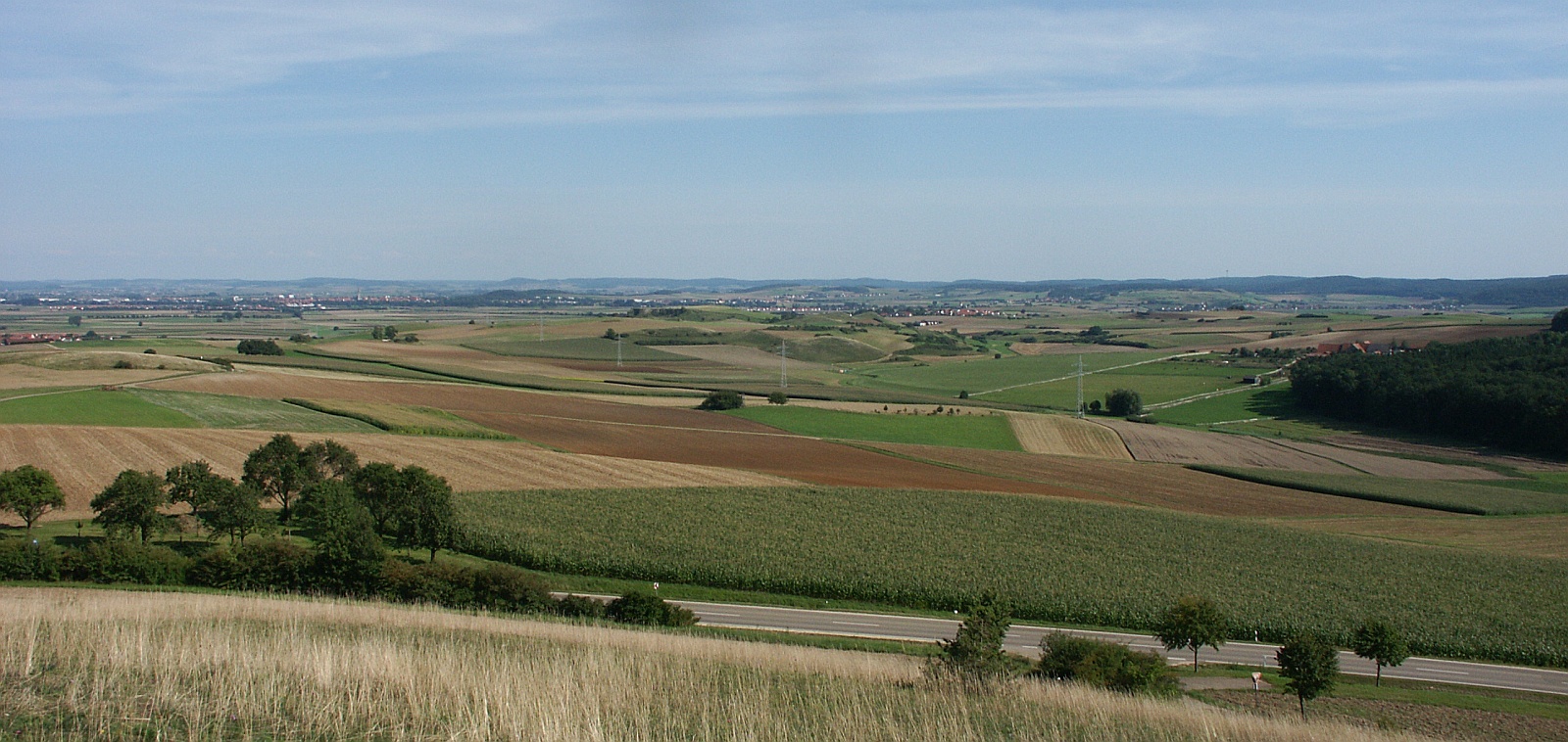
The Franconian Keuper-Lias Plains or Franconian Keuper-Lias LandsDickinson, Robert E (1964). ''Germany: A regional and economic geography'' (2nd ed.). London: Methuen, p. 83. . (german: Fränkische Keuper-Lias-Land) are a major natural region in the South German Scarplands in Upper Franconia and to a lesser extent in the north, in the Thuringian district of Landkreis Hildburghausen, Hildburghausen. As the name indicates, the term embraces both the Keuper landscapes (including the well-known parts of the Keuper Upland Haßberge Park, Haßberge, Steigerwald and Franconian Heights) and Lias Group, lias landscapes (Black Jurassic) in Franconia. In addition, the fore-land of the Franconian Jura (''Vorland der Fränkischen Alb''), in which part of the Brown Jurassic occurs, as well as parts of the former volcanic region of Heldburger Gangschar belong to this region. The highest elevation in the area is the unique Hesselberg (689 m) immediately north of the crater of the Nördlinger Rie ... [...More Info...] [...Related Items...] OR: [Wikipedia] [Google] [Baidu] |
Natural Region
A natural region (landscape unit) is a basic geographic unit. Usually, it is a region which is distinguished by its common natural features of geography, geology, and climate. From the ecology, ecological point of view, the naturally occurring flora and fauna of the region are likely to be influenced by its geographical and geological factors, such as soil and water resources, water availability, in a significant manner. Thus most natural regions are homogeneous ecosystems. Human impact can be an important factor in the shaping and destiny of a particular natural region. Main terms The concept "natural region" is a large basic geographical unit, like the vast boreal forest region. The term may also be used generically, like in alpine tundra, or specifically to refer to a particular place. The term is particularly useful where there is no corresponding or coterminous official region. The Fens of eastern England, the Thai highlands, and the Pays de Bray in Normandy, are examples o ... [...More Info...] [...Related Items...] OR: [Wikipedia] [Google] [Baidu] |
Nördlinger Ries
The Nördlinger Ries is an impact crater and large circular depression in western Bavaria and eastern Baden-Württemberg. It is located north of the Danube in the district of Donau-Ries. The city of Nördlingen is located within the depression, about south-west of its centre. Etymology "Ries" is derived from Raetia, since the tribe of Raetians lived in the area in pre-Roman times. Description The depression is a meteorite impact crater formed 14.808 ± 0.038 million years ago in the Miocene. The crater is most commonly referred to simply as ''Ries crater'' or ''the Ries''. The original crater rim had an estimated diameter of . The present floor of the depression is about below the eroded remains of the rim. It was originally assumed that the Ries was of volcanic origin. In 1960 Eugene Shoemaker and Edward C. T. Chao showed that the depression was caused by meteorite impact. The key evidence was the presence of coesite, which, in unmetamorphosed rocks, can only be fo ... [...More Info...] [...Related Items...] OR: [Wikipedia] [Google] [Baidu] |
Bamberg
Bamberg (, , ; East Franconian: ''Bambärch'') is a town in Upper Franconia, Germany, on the river Regnitz close to its confluence with the river Main. The town dates back to the 9th century, when its name was derived from the nearby ' castle. Cited as one of Germany's most beautiful towns, with medieval streets and Europe's largest intact old city wall, the old town of Bamberg has been a UNESCO World Heritage Site since 1993. From the 10th century onwards, Bamberg became a key link with the Slav peoples, notably those of Poland and Pomerania. It experienced a period of great prosperity from the 12th century onwards, during which time it was briefly the centre of the Holy Roman Empire. Emperor Henry II was also buried in the old town, alongside his wife Kunigunde. The town's architecture from this period strongly influenced that in Northern Germany and Hungary. From the middle of the 13th century onwards, the bishops were princes of the Empire and ruled Bamberg, overseeing the c ... [...More Info...] [...Related Items...] OR: [Wikipedia] [Google] [Baidu] |
Erlangen
Erlangen (; East Franconian German, East Franconian: ''Erlang'', Bavarian language, Bavarian: ''Erlanga'') is a Middle Franconian city in Bavaria, Germany. It is the seat of the administrative district Erlangen-Höchstadt (former administrative district Erlangen), and with 116,062 inhabitants (as of 30 March 2022), it is the smallest of the eight major cities (''Town#Germany, Großstadt'') in Bavaria. The number of inhabitants exceeded the threshold of 100,000 in 1974, making Erlangen a major city according to the statistical definition officially used in Germany. Together with Nuremberg, Fürth, and Schwabach, Erlangen forms one of the three metropolises in Bavaria. With the surrounding area, these cities form the Nuremberg Metropolitan Region, European Metropolitan Region of Nuremberg, one of 11 metropolitan areas in Germany. The cities of Nuremberg, Fürth, and Erlangen also form a triangle on a map, which represents the heartland of the Nuremberg conurbation. An element of th ... [...More Info...] [...Related Items...] OR: [Wikipedia] [Google] [Baidu] |
Fürth
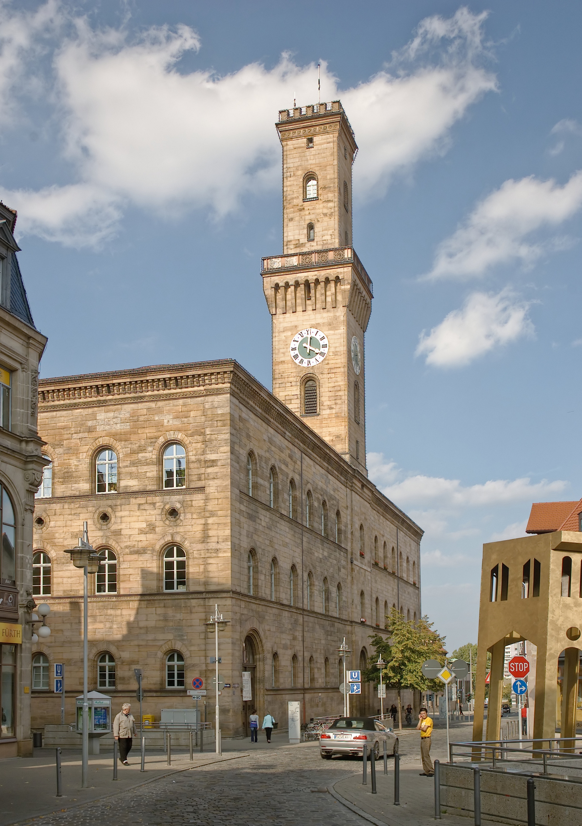
Fürth (; East Franconian: ; yi, פיורדא, Fiurda) is a city in northern Bavaria, Germany, in the administrative division (''Regierungsbezirk'') of Middle Franconia. It is now contiguous with the larger city of Nuremberg, the centres of the two cities being only apart. Fürth is one of 23 "major centres" in Bavaria. Fürth, Nuremberg, Erlangen and some smaller towns form the "Middle Franconian Conurbation", which is one of the 11 German metropolitan regions. Fürth celebrated its thousand year anniversary in 2007, its first mention being on 1 November 1007. Geography The historic centre of the town is to the east and south of the rivers Rednitz and Pegnitz, which join to form the Regnitz to the northwest of the Old Town. To the west of the town, on the far side of the Main-Danube Canal, is the Fürth municipal forest (''Fürther Stadtwald''). To the east of Fürth, at roughly the same latitude, lies Nuremberg, and to the north is the fertile market-gardening area know ... [...More Info...] [...Related Items...] OR: [Wikipedia] [Google] [Baidu] |
Nuremberg
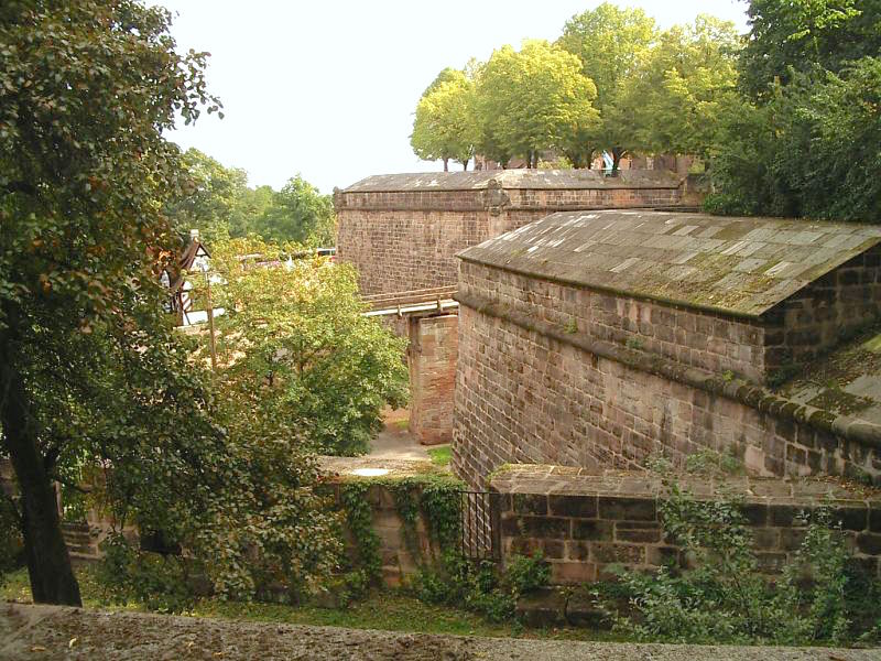
Nuremberg ( ; german: link=no, Nürnberg ; in the local East Franconian dialect: ''Nämberch'' ) is the second-largest city of the German state of Bavaria after its capital Munich, and its 518,370 (2019) inhabitants make it the 14th-largest city in Germany. On the Pegnitz River (from its confluence with the Rednitz in Fürth onwards: Regnitz, a tributary of the River Main) and the Rhine–Main–Danube Canal, it lies in the Bavarian administrative region of Middle Franconia, and is the largest city and the unofficial capital of Franconia. Nuremberg forms with the neighbouring cities of Fürth, Erlangen and Schwabach a continuous conurbation with a total population of 800,376 (2019), which is the heart of the urban area region with around 1.4 million inhabitants, while the larger Nuremberg Metropolitan Region has approximately 3.6 million inhabitants. The city lies about north of Munich. It is the largest city in the East Franconian dialect area (colloquially: "F ... [...More Info...] [...Related Items...] OR: [Wikipedia] [Google] [Baidu] |
Upper Palatine-Bavarian Forest
The Upper Palatine-Bavarian Forest (german: Oberpfälzisch-Bayerische Wald), (no. D63 or 40) is a natural region in Germany in the northeast of Bavaria. It mainly comprises the low mountain ranges of the Bavarian Forest and Upper Palatine Forest which are up to 1456 m high and border on the Bohemian Massif immediately inside the Czech Republic's southwestern border with Germany. Division into geographical units *40 (=D63) Upper Palatine-Bavarian Forest **400 Upper Palatine Forest - East **401 Upper Palatine Forest - West **402 Cham-Furth Depression **403 Bavarian Forest - North **404 Regen Depression **405 Bavarian Forest - South **406 Falkensteiner Vorwald **407 Lallinger Winkel **408 Passau Abteiland and Neuburg Forest **409 Wegscheid Plateau Neighbouring main unit groups are: * 39 (= D48) Thuringian-Franconian Highlands * 08 (= D61) Franconian Jura * 07 (= D62) Upper Palatine-Upper Main Hills * 06 Lower Bavarian Hills The Lower Bavarian Upland, Lower Bavarian Hill ... [...More Info...] [...Related Items...] OR: [Wikipedia] [Google] [Baidu] |
Upper Main Hills
Upper may refer to: * Shoe upper or ''vamp'', the part of a shoe on the top of the foot * Stimulant, drugs which induce temporary improvements in either mental or physical function or both * ''Upper'', the original film title for the 2013 found footage film ''The Upper Footage ''The Upper Footage'' (also known as ''Upper'') is a 2013 found footage film written and directed by Justin Cole. First released on January 31, 2013 to a limited run of midnight theatrical screenings at Landmark’s Sunshine Cinema in New York Cit ...'' See also {{Disambiguation ... [...More Info...] [...Related Items...] OR: [Wikipedia] [Google] [Baidu] |
Upper Palatine-Upper Main Hills
The Upper Palatine-Upper Main Hills (german: Oberpfälzisch-Obermainisches Hügelland), also called the Upper Palatine-Upper Main Hills and Uplands (''Oberpfälzisch-Obermainisches Hügel- und Bergland'') form a landscape of low, rolling hills between the Franconian Jura in the southwest and (from northwest to southeast) the Franconian Forest, Fichtel Mountains and Upper Palatine Forest in the northeast. The region runs from northwest to southeast and is about 170 kilometres long, but only 7 to 35 kilometres wideE. Meynen und J. Schmithüsen: Handbuch der naturräumlichen Gliederung Deutschlands – Bundesanstalt für Landeskunde, Remagen/Bad Godesberg 1953-1962 (9 Lieferungen in 8 Büchern, aktualisierte Karte 1:1.000.000 mit Haupteinheiten 1960) and lies mainly in the Bavarian administrative provinces of Upper Franconia and Upper Palatinate; small elements, however, also lie within the Thuringian county of Sonneberg. Its best known settlements are (from northwest to southeast) S ... [...More Info...] [...Related Items...] OR: [Wikipedia] [Google] [Baidu] |
Malm (geology)
The Late Jurassic is the third epoch of the Jurassic Period, and it spans the geologic time from 163.5 ± 1.0 to 145.0 ± 0.8 million years ago (Ma), which is preserved in Upper Jurassic strata.Owen 1987. In European lithostratigraphy, the name "Malm" indicates rocks of Late Jurassic age. In the past, ''Malm'' was also used to indicate the unit of geological time, but this usage is now discouraged to make a clear distinction between lithostratigraphic and geochronologic/chronostratigraphic units. Subdivisions The Late Jurassic is divided into three ages, which correspond with the three (faunal) stages of Upper Jurassic rock: Paleogeography During the Late Jurassic Epoch, Pangaea broke up into two supercontinents, Laurasia to the north, and Gondwana to the south. The result of this break-up was the spawning of the Atlantic Ocean. However, at this time, the Atlantic Ocean was relatively narrow. Life forms of the epoch This epoch is well known for many famous types of dinosaurs, ... [...More Info...] [...Related Items...] OR: [Wikipedia] [Google] [Baidu] |
Swabian Keuper-Lias Plains
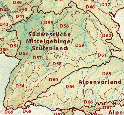
The Swabian Keuper-Lias Plains (german: Schwäbisches Keuper-Lias-Land) is a major natural region in southwest Germany and includes the southwesternmost part of the Keuper Uplands, which is bordered immediately to the north by the Swabian Jura. Natural regions The Swabian Keuper lands are divided into three natural regional groups and their 3-figure major units which are given 3-figure numbers: Map of the major natural regional groups with a list of the main units (German) * 10 (=D58) Swabian Keuper-Lias Plains ** 100 Foreland of the western Swabian Jura (''Vorland der mittleren Schwäbischen Alb'') ** 101 Foreland of the central Swabian Jura (''Vorland der mittleren Schwäbischen Alb'') ** 102 Foreland of the eastern Swabian Jura (''Vorland der östlichen ... [...More Info...] [...Related Items...] OR: [Wikipedia] [Google] [Baidu] |
Gäu Plateaus
The Gäu PlateausElkins, T.H. (1972). ''Germany'' (3rd ed.). London: Chatto & Windus, 1972, pp 186-188. ASIN B0011Z9KJA. (german: Neckar- und Taubergäuplatten) form the largest natural region in the German state of Baden-Württemberg. Not surprisingly, the individual geographical units of this large region show considerable variations in climate and soil types. A common feature of the region, however, is its landscape of flat-topped hills of Muschelkalk, gently rolling tracts of loess and plateaus in which the layers of Muschelkalk have been covered by sediments of Gipskeuper and Lettenkeuper. The Gäu Plateaus are the northwestern part of the Southern Scarplands. Location and geology The Gäu Plateaus extend from the Upper Rhine to the Tauber valley. They are bordered to the west by the Black Forest and the Upper Rhine Plain, to the north by the Odenwald and the Mainfranken Plateaus, to the east by the Franconian and Swabian Keuper-Lias Lands and the Swabian Jura. ... [...More Info...] [...Related Items...] OR: [Wikipedia] [Google] [Baidu] |


