|
Flat Tops Wilderness Area
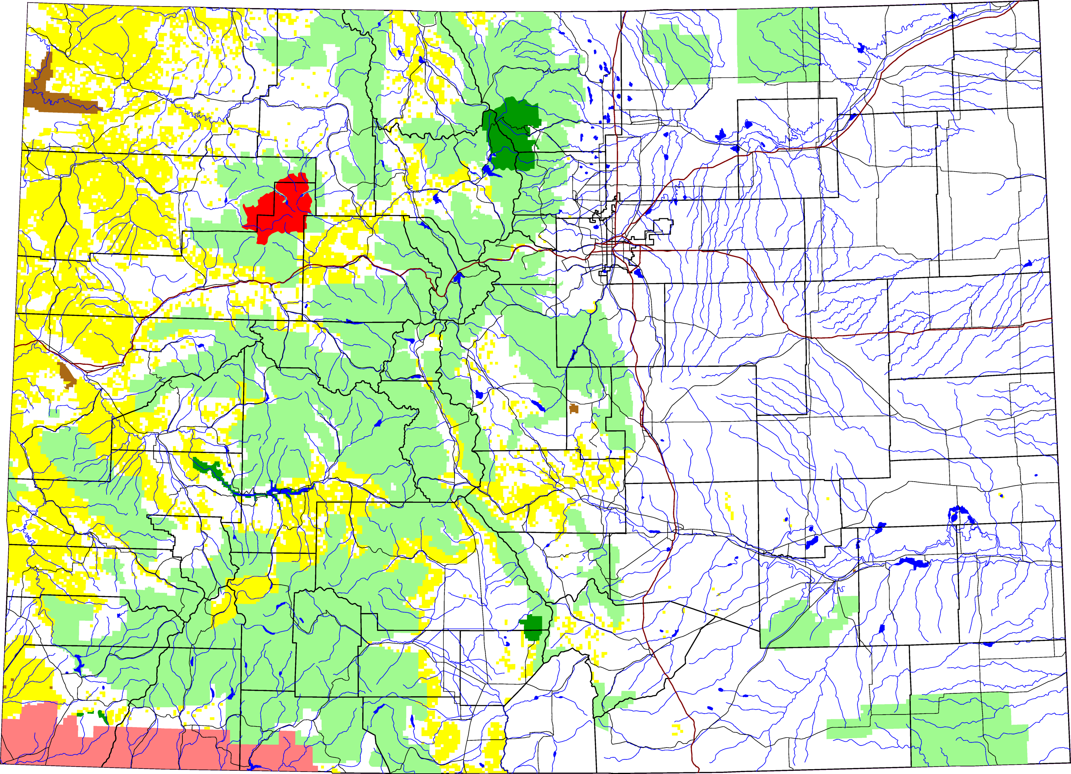
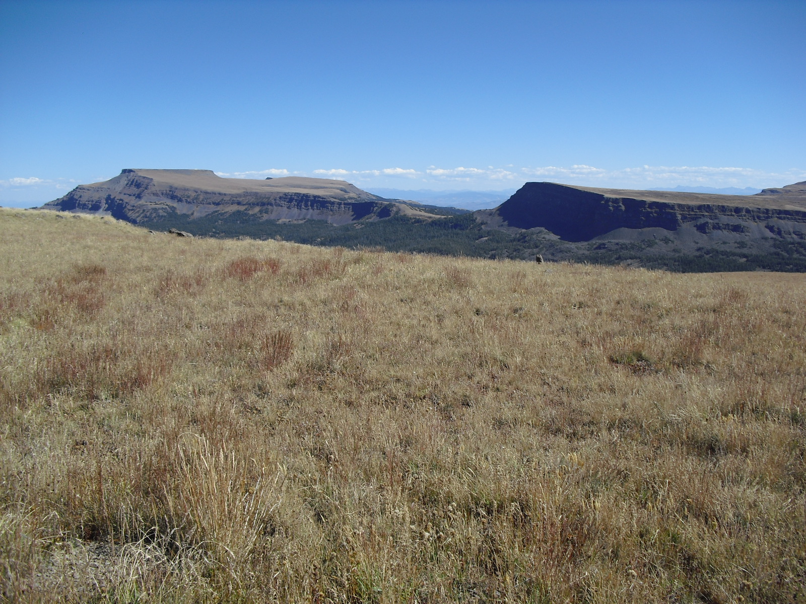
Flat Tops Wilderness Area is the second largest U.S. Wilderness Area in Colorado. It is , with in Routt National Forest and in White River National Forest. It was designated a wilderness area in 1975. Trappers Lake, located in the north of the area, was the lake that inspired Arthur Carhart, a United States Forest Service official, to plead for wilderness preservation. Description The dominant feature of the Wilderness is the high plateau from which the peaks arise. The plateau forms the northeastern portion of the White River Uplift capped by horizontal basalt flows from tertiary volcanic activity and is bounded by steep drops to valleys carved out by subsequent glaciation. The resulting mix of areas of treeless plateau at an elevation of 11,000 to 12,000 feet interspersed with verdant valleys is unique among Colorado mountain ranges. The area contains approximately one hundred and ten ponds and lakes and is home to a wide variety of plants and animals, including many large ma ... [...More Info...] [...Related Items...] OR: [Wikipedia] [Google] [Baidu] |
Garfield County, Colorado
Garfield County is a county located in the U.S. state of Colorado. As of the 2020 census, the population was 61,685. The county seat is Glenwood Springs. The county is named in honor of United States President James A. Garfield. Garfield County is included in the Glenwood Springs, CO Micropolitan Statistical Area, which is also included in the Edwards-Glenwood Springs, CO Combined Statistical Area. Geography According to the U.S. Census Bureau, the county has a total area of , of which is land and (0.3%) is water. Adjacent counties * Rio Blanco County - north *Routt County - northeast *Eagle County - east *Pitkin County - southeast * Mesa County - south *Grand County, Utah - southwest *Uintah County, Utah - northwest Major highways * Interstate 70 * * * U.S. Highway 6 * State Highway 13 * State Highway 82 * State Highway 133 * State Highway 139 * State Highway 325 Protected areas * Flat Tops Wilderness *Grand Mesa National Forest *Harvey Gap State Park *Rifle ... [...More Info...] [...Related Items...] OR: [Wikipedia] [Google] [Baidu] |
Moose
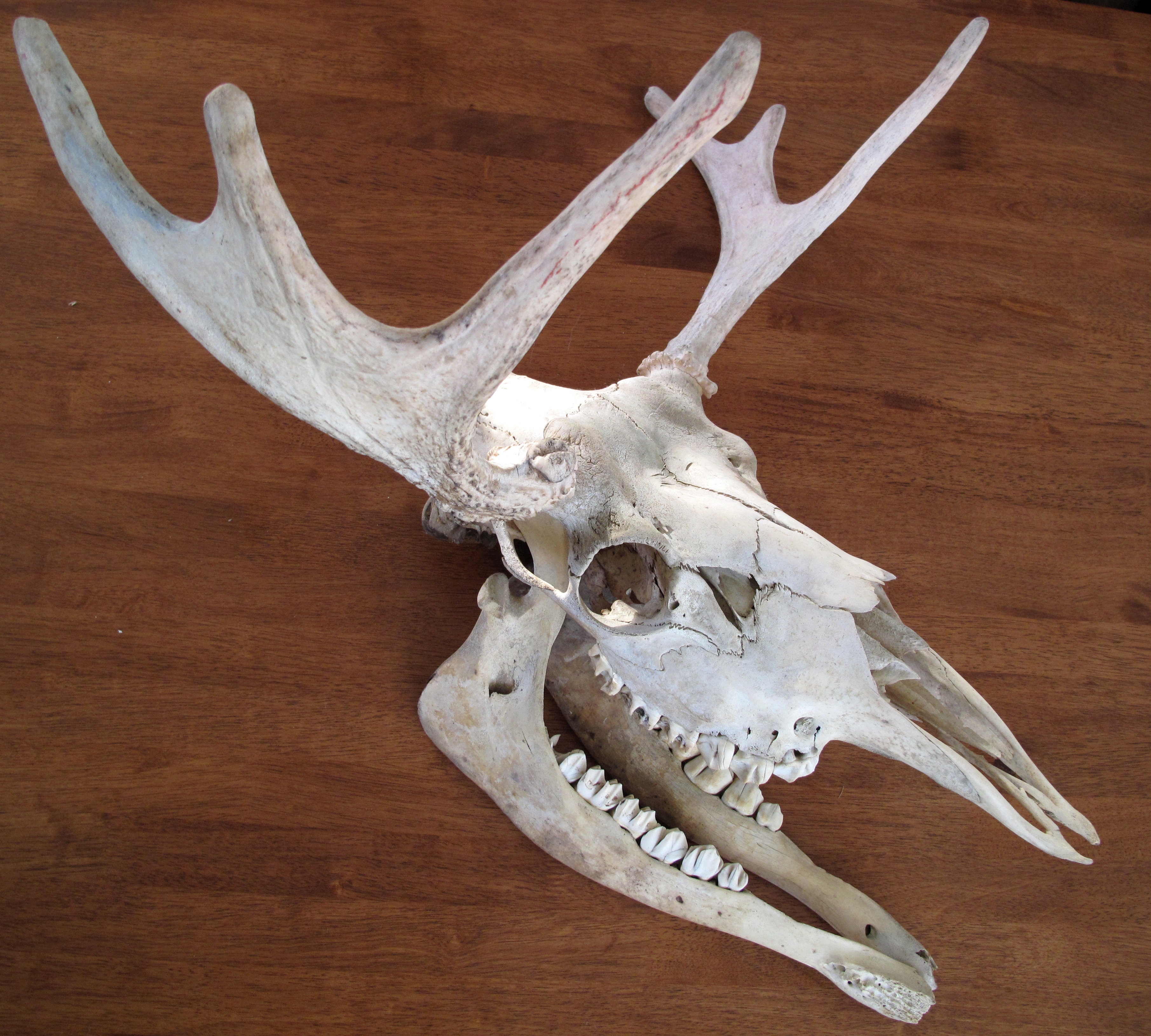
The moose (in North America) or elk (in Eurasia) (''Alces alces'') is a member of the New World deer subfamily and is the only species in the genus ''Alces''. It is the largest and heaviest extant species in the deer family. Most adult male moose have distinctive broad, palmate ("open-hand shaped") antlers; most other members of the deer family have antlers with a dendritic ("twig-like") configuration. Moose typically inhabit boreal forests and temperate broadleaf and mixed forests of the Northern Hemisphere The Northern Hemisphere is the half of Earth that is north of the Equator. For other planets in the Solar System, north is defined as being in the same celestial hemisphere relative to the invariable plane of the solar system as Earth's Nort ... in temperate to subarctic climates. Hunting and other human activities have caused a reduction in the size of the moose's range over time. It has been reintroduced to some of its former habitats. Currently, most moose occ ... [...More Info...] [...Related Items...] OR: [Wikipedia] [Google] [Baidu] |
Oil Shale
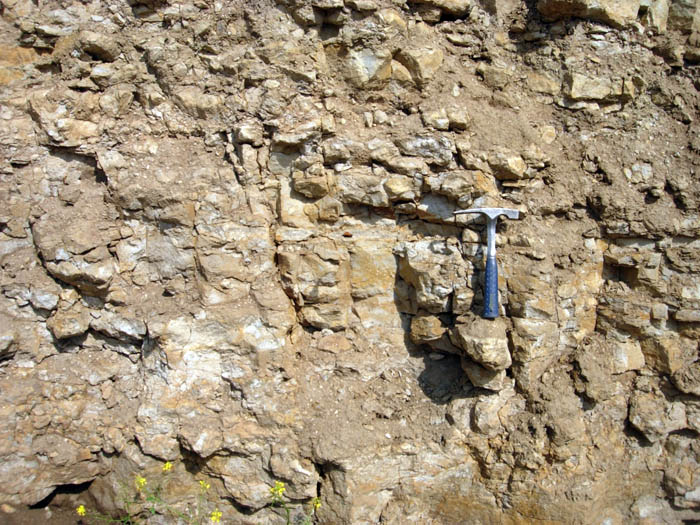
Oil shale is an organic-rich fine-grained sedimentary rock containing kerogen (a solid mixture of organic chemical compounds) from which liquid hydrocarbons can be produced. In addition to kerogen, general composition of oil shales constitutes inorganic substance and bitumens. Based on their deposition environment, oil shales are classified as marine, lacustrine and terrestrial oil shales. Oil shales differ from oil-''bearing'' shales, shale deposits that contain petroleum (tight oil) that is sometimes produced from drilled wells. Examples of oil-''bearing'' shales are the Bakken Formation, Pierre Shale, Niobrara Formation, and Eagle Ford Formation. Accordingly, shale oil produced from oil shale should not be confused with tight oil, which is also frequently called shale oil. Deposits of oil shale occur around the world, including major deposits in the United States. A 2016 estimate of global deposits set the total world resources of oil shale equivalent of of oil in place. ... [...More Info...] [...Related Items...] OR: [Wikipedia] [Google] [Baidu] |
White River (Green River)
White River is a river, approximately long, in the U.S. states of Colorado and Utah and is a tributary of the Green River (which flows into the Colorado River). Description The river rises in two forks in northwestern Colorado in northeastern Garfield County in the Flat Tops Wilderness Area in the White River National Forest. The North Fork rises in Wall Lake and flows northwest, then southwest. The South Fork rises ten miles south of the north, flows southwest, then northwest, past Spring Cave. The two forks join near Buford in eastern Rio Blanco County, forming the White. It flows west, then northwest, past Meeker (site of the White River Museum), and across the broad valley between the Danforth Hills on the north and the Roan Plateau on the south. Downstream from Meeker, it is joined by Piceance Creek and Yellow Creek. In western Rio Blanco County, it turns southwest, flows past Rangely, where it is joined by Douglas Creek, and into Uintah County, Utah, where ... [...More Info...] [...Related Items...] OR: [Wikipedia] [Google] [Baidu] |
Primitive Area
A Primitive Area is a land designation previously used by the United States Forest Service. Although there are still lands with this title, most are now known as wilderness areas. The Forest Service began this new designation in 1929 with the L-20 regulations. The L-20 regulations defined three types of areas: Natural Area, Experimental Forest and Range, and Primitive Area. The L-20 section on Primitive Area read, "to maintain primitive conditions of transportation, subsistence, habitation, and environment to the fullest degree compatible with their highest public use." as stated by M. Rupert Cutler, in a briefing before the Subcommittee on Public Lands of the Committee on Interior and Insular Affairs, U.S. House of Representatives on July 24. 1979. The US Forest Service, along with preservationist Bob Marshall, continued to add acreage to the fledgling wilderness system. arshall'stotal acreage recommendation to the Forest Service for primitive classification was ... [...More Info...] [...Related Items...] OR: [Wikipedia] [Google] [Baidu] |
Wilderness Act
The Wilderness Act of 1964 () was written by Howard Zahniser of The Wilderness Society. It created the legal definition of wilderness in the United States, and protected 9.1 million acres (37,000 km²) of federal land. The result of a long effort to protect federal wilderness and to create a formal mechanism for designating wilderness, the Wilderness Act was signed into law by President Lyndon B. Johnson on September 3, 1964 after over sixty drafts and eight years of work. The Wilderness Act is well known for its succinct and poetic definition of wilderness: "A wilderness, in contrast with those areas where man and his own works dominate the landscape, is hereby recognized as an area where the earth and its community of life are untrammeled by man, where man himself is a visitor who does not remain." – Howard Zahniser When Congress passed and President Lyndon B. Johnson signed the Wilderness Act on September 3, 1964, it created the National Wilderness Preservation Sys ... [...More Info...] [...Related Items...] OR: [Wikipedia] [Google] [Baidu] |
Routt County, Colorado
Routt County is a county located in the U.S. state of Colorado. As of the 2020 United States Census, 2020 census, the population was 24,829. The county seat is Steamboat Springs, Colorado, Steamboat Springs. Routt County comprises the Steamboat Springs, CO Micropolitan Statistical Area. History Placer gold was found near Hahns Peak in 1864 as part of the Colorado Gold Rush.Voynick, S.M., 1992, Colorado Gold, Missoula: Mountain Press Publishing Company, Routt County was created out of the western portion of Grand County, Colorado, Grand County on January 29, 1877. It was named in honor of John Long Routt, the last territorial and first state governor of Colorado. The western portion of Routt County was split off to form Moffat County, Colorado, Moffat County on February 27, 1911. Geography According to the U.S. Census Bureau, the county has a total area of , of which is land and (0.3%) is water. Adjacent counties *Carbon County, Wyoming, Carbon County, Wyoming - north *Jac ... [...More Info...] [...Related Items...] OR: [Wikipedia] [Google] [Baidu] |
Flat Top Mountain (Colorado)
Flat Top Mountain is the highest summit of the Flat Tops in the Rocky Mountains of North America. The prominent peak is located in the Flat Tops Wilderness, south-southwest ( bearing 201°) of the Town of Oak Creek, Colorado, United States, on the drainage divide between Routt National Forest and White River National Forest. The summit of Flat Top Mountain is the highest point in Garfield County, Colorado. Climate Flat Top Mountain has a subalpine climate (Köppen ''Dfc''), bordering on Alpine climate (''ET''), with only one month averaging over 10°C. See also *List of mountain peaks of Colorado **List of the most prominent summits of Colorado **List of Colorado county high points This is a list of all 64 counties of the U.S. State of Colorado by their points of highest elevation. Of the 50 highest county high points in the United States, 30 are located in Colorado. The highest point in Colorado is the summit of Mount ... References External links ... [...More Info...] [...Related Items...] OR: [Wikipedia] [Google] [Baidu] |
Alpine Tundra
Alpine tundra is a type of natural region or biome that does not contain trees because it is at high elevation, with an associated alpine climate, harsh climate. As the latitude of a location approaches the poles, the threshold elevation for alpine tundra gets lower until it reaches sea level, and alpine tundra merges with tundra#Arctic tundra, polar tundra. The high elevation causes an adverse climate, which is too cold and windy to support tree growth. Alpine tundra ecotone, transitions to sub-alpine forests below the tree line; stunted forests occurring at the forest-tundra ecotone are known as ''Krummholz''. With increasing elevation it ends at the snow line where snow and ice persist through summer. Alpine tundra occurs in mountains worldwide. The flora of the alpine tundra is characterized by dwarf shrubs close to the ground. The cold climate of the alpine tundra is caused by adiabatic cooling of air, and is similar to polar climate. Geography Alpine tundra occurs at hi ... [...More Info...] [...Related Items...] OR: [Wikipedia] [Google] [Baidu] |
Lodgepole Pine
''Pinus contorta'', with the common names lodgepole pine and shore pine, and also known as twisted pine, and contorta pine, is a common tree in western North America. It is common near the ocean shore and in dry montane forests to the subalpine, but is rare in lowland rain forests. Like all pines (member species of the genus ''Pinus''), it is an evergreen conifer. Description Depending on subspecies, ''Pinus contorta'' grows as an evergreen shrub or tree. The shrub form is krummholz and is approximately high. The thin and narrow-crowned tree can grow high and achieve up to in diameter at chest height. The ''murrayana'' subspecies is the tallest. The crown is rounded and the top of the tree is flattened. In dense forests, the tree has a slim, conical crown. The formation of twin trees is common in some populations in British Columbia. The elastic branches stand upright or overhang and are difficult to break. The branches are covered with short shoots that are easy to remove. ... [...More Info...] [...Related Items...] OR: [Wikipedia] [Google] [Baidu] |
Subalpine Fir
''Abies lasiocarpa'', the subalpine fir or Rocky Mountain fir, is a western North American fir tree. Description ''Abies lasiocarpa'' is a medium-sized evergreen conifer with a very narrow conic crown, growing to tall, exceptionally , with a trunk up to thick, exceptionally . The bark on young trees is smooth, gray, and with resin blisters, becoming rough and fissured or scaly on old trees. The lowest branches can be observed growing above ground level. The leaves are flat and needle-like, long, glaucous green above with a broad stripe of stomata, and two blue-white stomatal bands below; the fresh leaf scars are reddish (tan on the inland variety). They are arranged spirally on the shoot, but with the leaf bases twisted to be arranged to the sides of and above the shoot, with few or none below the shoot. The cones are erect, long, dark purple with fine yellow-brown pubescence, ripening brown and disintegrating to release the winged seeds in early fall. Taxonomy There are ... [...More Info...] [...Related Items...] OR: [Wikipedia] [Google] [Baidu] |
Engelmann Spruce
''Picea engelmannii'', with the common names Engelmann spruce, white spruce, mountain spruce, and silver spruce, is a species of spruce native to western North America. It is mostly a high-altitude mountain tree but also appears in watered canyons. Description ''Picea engelmannii'' is a medium-sized to large evergreen tree growing to tall, exceptionally to tall, and with a trunk diameter of up to . The reddish bark is thin and scaly, flaking off in small circular plates across. The crown is narrow conic in young trees, becoming cylindric in older trees. The shoots are buff-brown to orange-brown, usually densely pubescent, and with prominent pulvini. The leaves are needle-like, long, flexible, rhombic in cross-section, glaucous blue-green above with several thin lines of stomata, and blue-white below with two broad bands of stomata. The needles have a pungent odour when crushed. Purple cones of about 1 cm appear in spring, releasing yellow pollen when windy. The cones are ... [...More Info...] [...Related Items...] OR: [Wikipedia] [Google] [Baidu] |


