|
Flat Top Mountain (Utah)
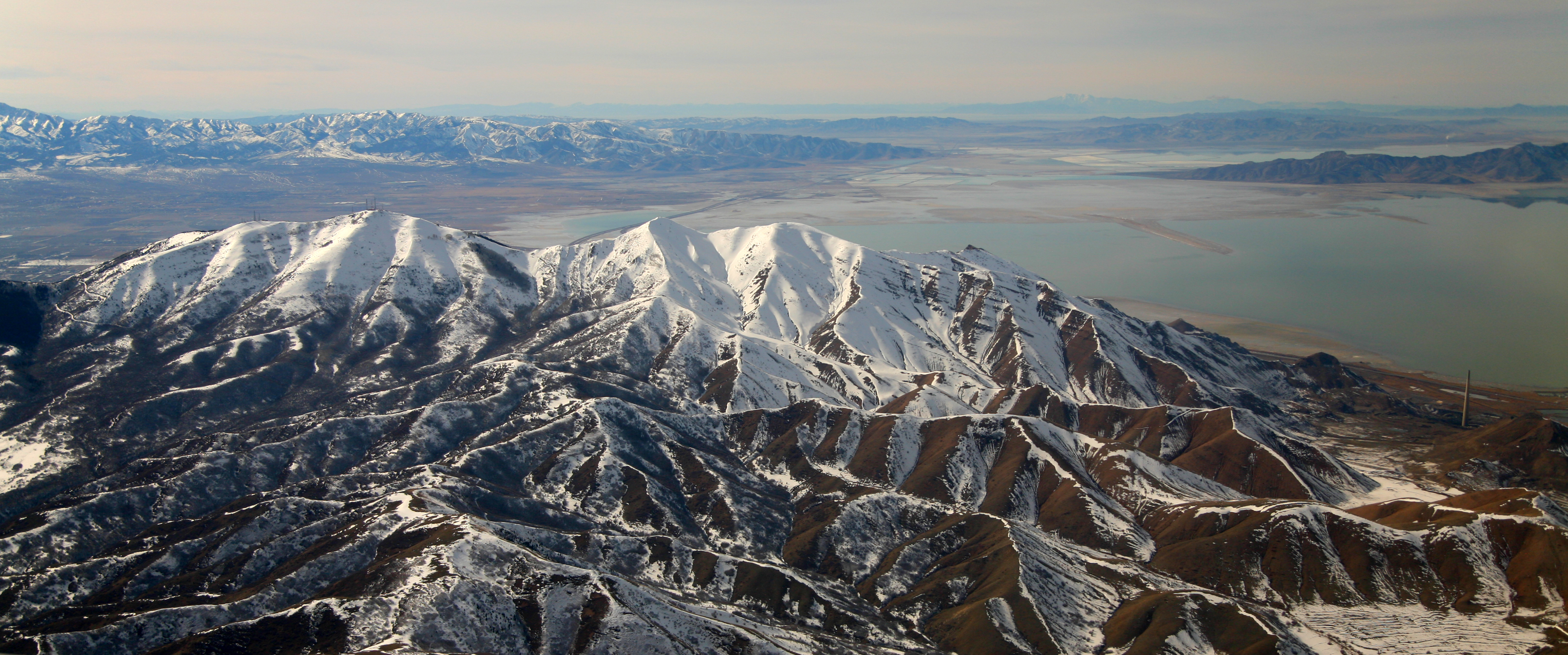
Flat Top Mountain is a peak in Utah and Tooele Counties, Utah in the United States, about to the east of Rush Valley. With a prominence of approximately , it is the sixth most prominent peak in Utah. It is the highest point of the Oquirrh Mountains. Flat Top Mountain overlooks Lehi, American Fork and the entire northern Utah county area. It can be seen everywhere in the greater Salt Lake Basin area. See also *List of mountain peaks of Utah This article comprises three sortable tables of major mountain peaksThis article defines a significant summit as a summit with at least of topographic prominence, and a major summit as a summit with at least of topographic prominence. All ... * List of Ultras of the United States References {{Utah-geo-stub Mountains of Utah County, Utah Mountains of Tooele County, Utah ... [...More Info...] [...Related Items...] OR: [Wikipedia] [Google] [Baidu] |
Utah County, Utah
Utah County is the second-most populous County (United States), county in the U.S. state of Utah. The county seat and largest city is Provo, Utah, Provo, which is the state's third-largest city, and the largest outside of Salt Lake County. As of the 2020 United States Census, the population was 665,665. Utah County is one of Juab County, Utah, two counties forming the Provo-Orem, Utah, Orem Provo-Orem metropolitan area, metropolitan statistical area, and is part of the larger Salt Lake City-Provo-Orem, UT Salt Lake City metropolitan area#Combined Statistical Area, Combined Statistical Area. In 2010, the center of population of Utah was in Utah County, in the city of Saratoga Springs, Utah, Saratoga Springs. Utah County is one of the fastest-growing counties in the United States, ranking among the top ten counties in numerical growth. Correspondingly, Provo-Orem is among the top eight metropolitan areas by percentage growth in the country. Utah County is one of seven counties in ... [...More Info...] [...Related Items...] OR: [Wikipedia] [Google] [Baidu] |
Tooele County, Utah
Tooele County ( ) is a County (United States), county in the U.S. state of Utah. As of the 2010 United States Census, the population was 58,218. Its county seat and largest city is Tooele, Utah, Tooele. The county was created in 1850 and organized the following year. Tooele County is part of the Salt Lake City, UT Salt Lake City metropolitan area, Metropolitan Statistical Area. A 2008 CNNMoney.com article identified Tooele as the County (United States), U.S. county experiencing the greatest job growth since 2000. The western half is mostly covered by the Great Salt Lake Desert and includes the city of Wendover, Utah, Wendover (the immediate neighbor of West Wendover, Nevada) and Ibapah, Utah, Ibapah. Within the central section lies Skull Valley, between the Cedar Mountains (Tooele County, Utah), Cedar and the Stansbury Mountains. It contains a few small towns as well as the Dugway Proving Ground. The population centers are on the eastern edge in the Tooele Valley, between the S ... [...More Info...] [...Related Items...] OR: [Wikipedia] [Google] [Baidu] |
Utah
Utah ( , ) is a state in the Mountain West subregion of the Western United States. Utah is a landlocked U.S. state bordered to its east by Colorado, to its northeast by Wyoming, to its north by Idaho, to its south by Arizona, and to its west by Nevada. Utah also touches a corner of New Mexico in the southeast. Of the fifty U.S. states, Utah is the 13th-largest by area; with a population over three million, it is the 30th-most-populous and 11th-least-densely populated. Urban development is mostly concentrated in two areas: the Wasatch Front in the north-central part of the state, which is home to roughly two-thirds of the population and includes the capital city, Salt Lake City; and Washington County in the southwest, with more than 180,000 residents. Most of the western half of Utah lies in the Great Basin. Utah has been inhabited for thousands of years by various indigenous groups such as the ancient Puebloans, Navajo and Ute. The Spanish were the first Europe ... [...More Info...] [...Related Items...] OR: [Wikipedia] [Google] [Baidu] |
Deseret Peak
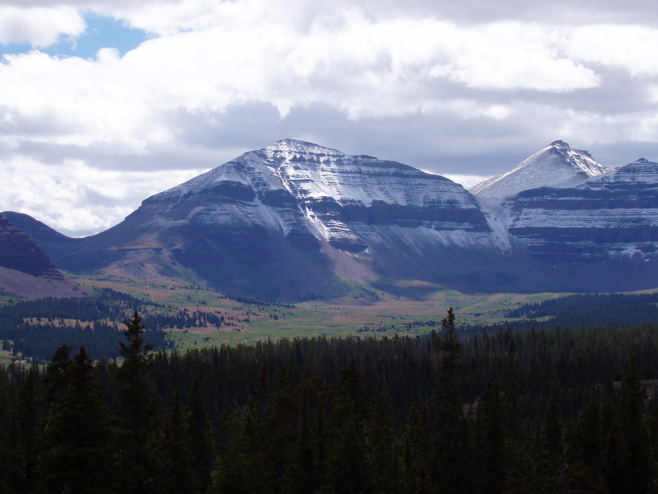
Deseret Peak is the highest peak in the Stansbury Mountains with an elevation of 11,035 ft. It is located in the Deseret Peak Wilderness area west of Grantsville, Utah and east of Skull Valley Indian Reservation. It is the fourth most topographically prominent peak in the state of Utah. The site is a popular destination for hikers and backcountry skiers as the area is a contrast of the alpine wilderness with the surrounding desert basin. The trail that leads to the peak is easily accessible from Salt Lake City. The mountain offers views of the Bonneville Salt Flats, the Great Salt Lake, and the surrounding towns and mountain ranges. On a clear day, it is possible to see Mount Nebo, the highest peak in the adjacent Wasatch Mountains. Access From Salt Lake City: #Take Interstate 80 west from the city to Exit 88 (Grantsville) #Take Burmeister Road south from Exit 88 to Grantsville's Main Street (Utah State Route 138) #Take Grantsville Main Street west to 200 West, also known ... [...More Info...] [...Related Items...] OR: [Wikipedia] [Google] [Baidu] |
Oquirrh Mountains
The Oquirrh Mountains is a mountain range that runs north-south for approximately 30 miles (50 km) to form the west side of Utah's Salt Lake Valley, separating it from Tooele Valley. The range runs from northwestern Utah County–central & eastern Tooele County, to the south shore of the Great Salt Lake. The highest elevation is Flat Top Mountain at 10,620 ft (3,237 m). The name Oquirrh was taken from the Goshute word meaning "wood sitting."William Bright, ed. ''Native American Placenames of the United States'' (2004, University of Oklahoma Press) The Oquirrh Mountains have been mined for gold, silver, lead, and most famously for copper, as home of the porphyry copper deposit at Bingham Canyon Mine The Bingham Canyon Mine, more commonly known as Kennecott Copper Mine among locals, is an open-pit mining operation extracting a large porphyry copper deposit southwest of Salt Lake City, Utah, in the Oquirrh Mountains. The mine is the largest m ..., one of the worl ... [...More Info...] [...Related Items...] OR: [Wikipedia] [Google] [Baidu] |
United States
The United States of America (U.S.A. or USA), commonly known as the United States (U.S. or US) or America, is a country primarily located in North America. It consists of 50 states, a federal district, five major unincorporated territories, nine Minor Outlying Islands, and 326 Indian reservations. The United States is also in free association with three Pacific Island sovereign states: the Federated States of Micronesia, the Marshall Islands, and the Republic of Palau. It is the world's third-largest country by both land and total area. It shares land borders with Canada to its north and with Mexico to its south and has maritime borders with the Bahamas, Cuba, Russia, and other nations. With a population of over 333 million, it is the most populous country in the Americas and the third most populous in the world. The national capital of the United States is Washington, D.C. and its most populous city and principal financial center is New York City. Paleo-Americ ... [...More Info...] [...Related Items...] OR: [Wikipedia] [Google] [Baidu] |
Rush Valley, Utah
Rush Valley is a town in Tooele County, Utah, United States, located in the northwest of Rush Valley. It is part of the Salt Lake City, Utah Metropolitan Statistical Area. The population was 447 at the 2010 census, with an estimate population of 494 in 2019. Geography According to the United States Census Bureau, the town has a total area of 18.3 square miles (47.5 km2), all land. Climate According to the Köppen Climate Classification system, Rush Valley has a semi-arid climate, abbreviated "BSk" on climate maps. History This area was first settled beginning in 1856. In 1934, a large area of some , comprising the settlements of Clover, St. John, and Vernon, was incorporated into a town called Onaqui. The incorporation was essentially a bureaucratic tactic to secure federal aid for development of municipal infrastructure, including from the Rural Electrification Administration. When the people of Vernon were granted a petition to incorporate separately on February 2 ... [...More Info...] [...Related Items...] OR: [Wikipedia] [Google] [Baidu] |
Topographic Prominence
In topography, prominence (also referred to as autonomous height, relative height, and shoulder drop in US English, and drop or relative height in British English) measures the height of a mountain or hill's summit relative to the lowest contour line encircling it but containing no higher summit within it. It is a measure of the independence of a summit. A peak's ''key col'' (the highest col surrounding the peak) is a unique point on this contour line and the ''parent peak'' is some higher mountain, selected according to various criteria. Definitions The prominence of a peak may be defined as the least drop in height necessary in order to get from the summit to any higher terrain. This can be calculated for a given peak in the following way: for every path connecting the peak to higher terrain, find the lowest point on the path; the ''key col'' (or ''key Saddle point, saddle'', or ''linking col'', or ''link'') is defined as the highest of these points, along all connecting pat ... [...More Info...] [...Related Items...] OR: [Wikipedia] [Google] [Baidu] |
Lehi, Utah
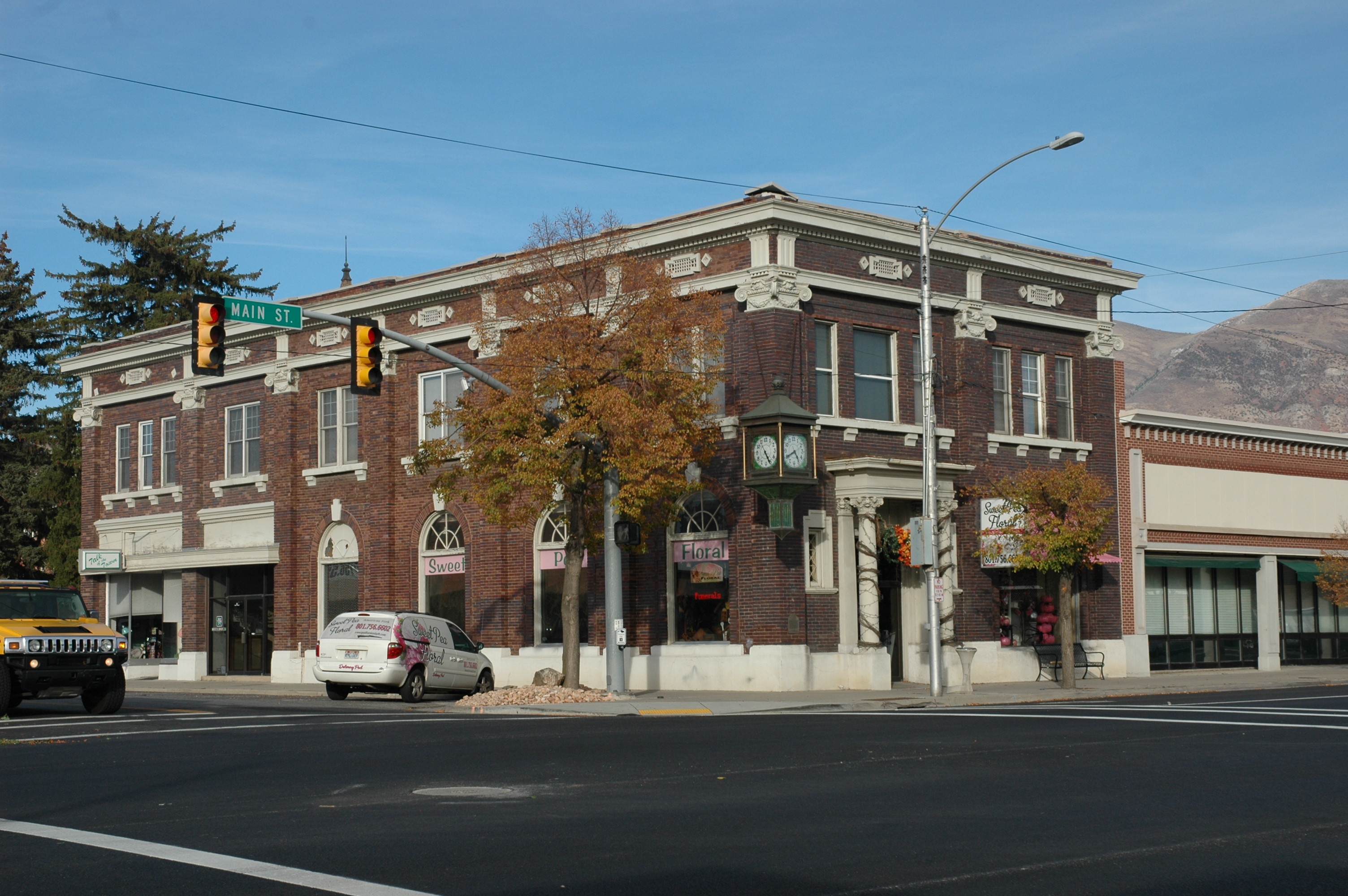
Lehi ( ) is a city in Utah County, Utah, United States. It is named after Lehi, a prophet in the Book of Mormon. The population was 75,907 at the 2020 census, up from 47,407 in 2010. The rapid growth in Lehi is due, in part, to the rapid development of the tech industry region known as Silicon Slopes. The center of population of Utah is located in Lehi. Lehi is part of the Provo–Orem metropolitan area. History A group of Mormon pioneers settled the area now known as Lehi in the fall of 1850 at a place called Dry Creek in the northernmost part of Utah Valley. It was renamed Evansville in 1851 after David Evans, a local bishop in the Church of Jesus Christ of Latter-day Saints. Other historical names include Sulphur Springs and Snow's Springs. The land was organized into parcels of and new settlers received a plot of this size until the entire tract was exhausted. There was little water to irrigate the rich soil, so it became necessary to divert a portion of American Fork ... [...More Info...] [...Related Items...] OR: [Wikipedia] [Google] [Baidu] |
American Fork, Utah
American Fork is a city in north-central Utah County, Utah, United States, at the foot of Mount Timpanogos in the Wasatch Range, north from Utah Lake. This city is thirty-two miles southeast of Salt Lake City. It is part of the Provo–Orem Metropolitan Statistical Area. The population was 33,337 in 2020. The city has grown rapidly since the 1970s. History The area around Utah Lake was used as a seasonal hunting and fishing ground by the Ute Indians. American Fork was settled in 1850 by Mormon pioneers and incorporated as Lake City in 1852. The first settlers were Arza Adams,Arza Adams at SUP Pioneer Stories followed by Stephen Chipman (grandfather of , a prominent citiz ... [...More Info...] [...Related Items...] OR: [Wikipedia] [Google] [Baidu] |
List Of Mountain Peaks Of Utah
This article comprises three sortable tables of major mountain peaksThis article defines a significant summit as a summit with at least of topographic prominence, and a major summit as a summit with at least of topographic prominence. All summits in this article have at least 500 meters of topographic prominence. An ultra-prominent summit is a summit with at least of topographic prominence. of the U.S. State of Utah. The summit of a mountain or hill may be measured in three principal ways: #The topographic elevation of a summit measures the height of the summit above a geodetic sea level.All elevations in this article include an elevation adjustment from the National Geodetic Vertical Datum of 1929 (NGVD 29) to the North American Vertical Datum of 1988 (NAVD 88). For further information, please see this United States National Geodetic Surveybr>noteIf the elevation or prominence of a summit is calculated as a range of values, the arithmetic mean is shown. The firs ... [...More Info...] [...Related Items...] OR: [Wikipedia] [Google] [Baidu] |
List Of Ultras Of The United States
The following sortable table comprises the 200 most topographically prominent mountain peaks of the United States of America. The summit of a mountain or hill may be measured in three principal ways: #The topographic elevation of a summit measures the height of the summit above a geodetic sea level.All elevations in the 48 states of the contiguous United States include an elevation adjustment from the National Geodetic Vertical Datum of 1929 (NGVD 29) to the North American Vertical Datum of 1988 (NAVD 88). For further information, please see this United States National Geodetic Surveybr>noteIf the elevation or prominence of a summit is calculated as a range of values, the arithmetic mean is shown. #The topographic prominence of a summit is a measure of how high the summit rises above its surroundings.The topographic prominence of a summit is the topographic elevation difference between the summit and its highest or key col to a higher summit. The summit may be near its ke ... [...More Info...] [...Related Items...] OR: [Wikipedia] [Google] [Baidu] |
.jpg)


