|
Fishing Harbour Visakhapatnam
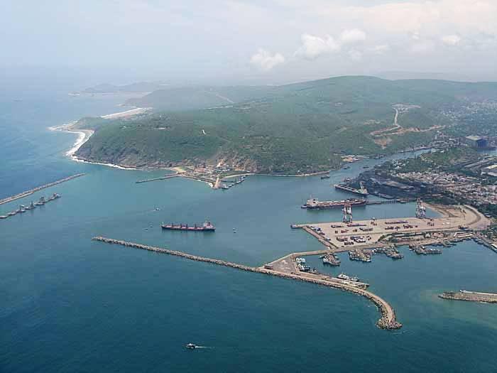
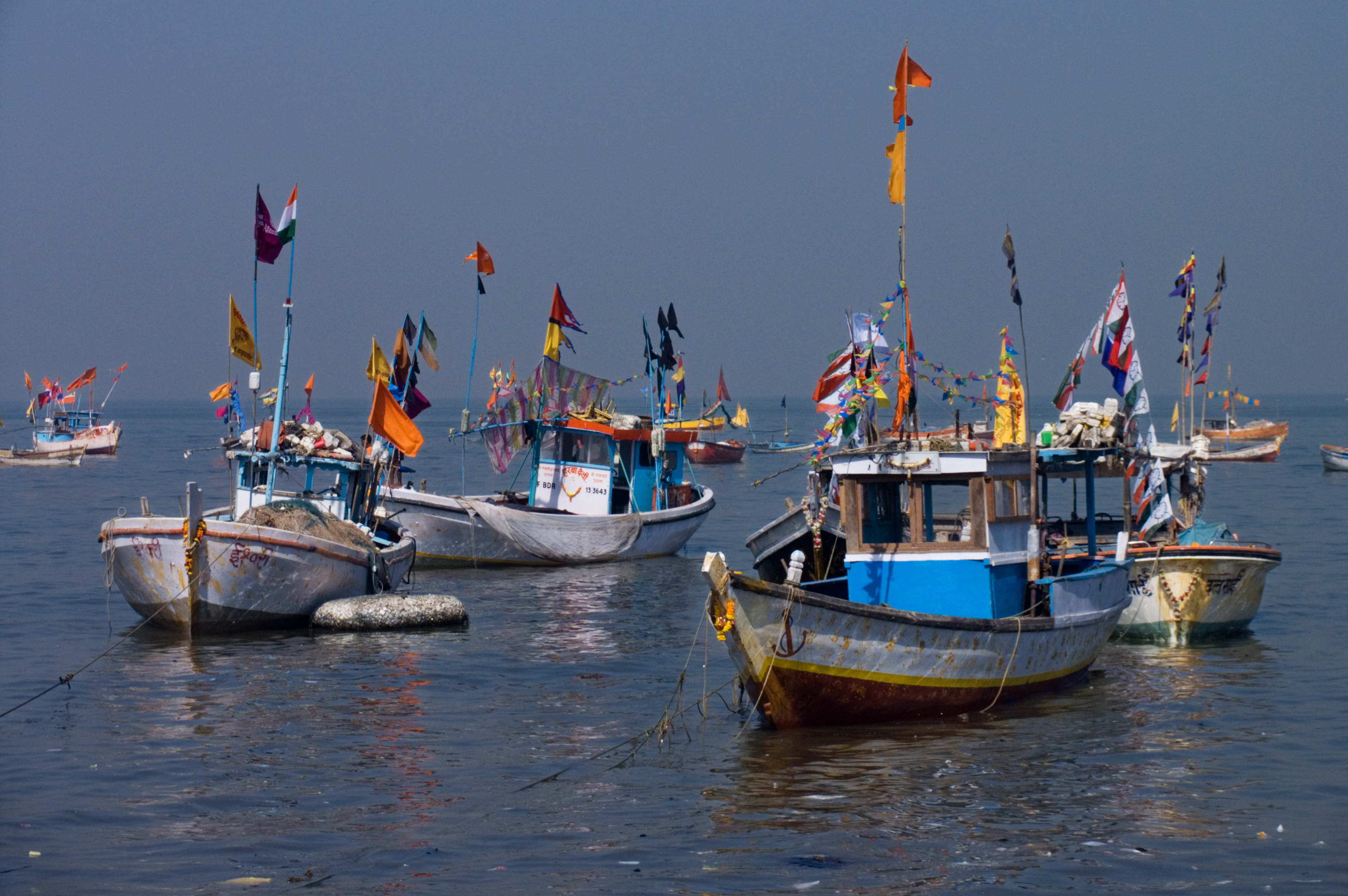
Visakhapatnam Fishing Harbour is a harbour in Visakhapatnam. It opened in 1976 beside Visakhapatnam Port. The harbour spreads over 26 hectares. It is operated by the Visakhapatnam Port Trust. Its capacity is 700 mechanised boats and 300 beach landing crafts, with an annual turnover of 7,500 crores. See also * Visakhapatnam Port Visakhapatnam Port is one of 13 major ports in India and the only major port of Andhra Pradesh. It is India's third largest state-owned port by volume of cargo handled and largest on the Eastern Coast. It is located midway between the Chennai a ... References External links * Ports and harbours of Andhra Pradesh Bay of Bengal Fishing in India Economy of Visakhapatnam Transport in Visakhapatnam 1976 establishments in Andhra Pradesh {{Visakhapatnam-geo-stub ... [...More Info...] [...Related Items...] OR: [Wikipedia] [Google] [Baidu] |
Visakhapatnam
, image_alt = , image_caption = From top, left to right: Visakhapatnam aerial view, Vizag seaport, Simhachalam Temple, Aerial view of Rushikonda Beach, Beach road, Novotel, Novotel Visakhapatnam, INS Kursura (S20), INS Kursura submarine museum, Vizag skyline, Kambalakonda wildlife sanctuary , etymology = , nickname = The City of DestinyThe Jewel of the East Coast , image_map = , map_caption = , pushpin_map = India Visakhapatnam#India Andhra Pradesh#India#Asia#Earth , pushpin_label_position = left , pushpin_map_alt = , pushpin_map_caption = , coordinates = {{coord, 17, 42, 15, N, 83, 17, 52, E, display=inline,title , subdivision_type = Country , subdivision_name = {{flag, India , subdivision_type1 = States and union territories of India, State , subdivision_name1 = Andhra Pradesh , subdivision_type2 = ... [...More Info...] [...Related Items...] OR: [Wikipedia] [Google] [Baidu] |
Visakhapatnam Port
Visakhapatnam Port is one of 13 major ports in India and the only major port of Andhra Pradesh. It is India's third largest state-owned port by volume of cargo handled and largest on the Eastern Coast. It is located midway between the Chennai and Kolkata Ports on the Bay of Bengal. History Although the need for building a port on the east coast to access Central Provinces was felt by the British in the 19th century, the proposal of Col. H.Cartwright Reid of British Admiralty for constructing a harbour at Visakhapatnam was approved by the Government only after the First World War. The Inner Harbour was built by the Bengal Nagpur Railway between 1927 and 1933 to facilitate the export of manganese ore from the Central Provinces. The port, built at a cost of 378 lakhs was inaugurated by Lord Willingdon on 19 December 1933. During the Second World War, the military significance of the port increased. After India's independence, the port witnessed growth under the various Five ... [...More Info...] [...Related Items...] OR: [Wikipedia] [Google] [Baidu] |
Ports And Harbours Of Andhra Pradesh
Andhra Pradesh has the 2nd longest coastline of 974 km in the eastern peninsular India, which accounts for 12% of the country's total coastline with one major (Operational) and 14 non–major (5 Operational) ports, with six ports under development in the PPP mode. Cargo handling The state's ports handled 73 million tons of cargo in financial year 2015–16. The state of Andhra Pradesh is the second maritime state (after Gujarat) in terms of cargo handled by Non-Major Ports and the third maritime state (after Gujarat and Maharashtra) in terms of overall cargo handled including Visakhapatnam port trust . Exports and imports Exported products are Rice, Wheat, Maize, Soya bean meal and retraction, Rice bran extraction, Bentonite, Fibre, Fish Meal, Tobacco, Sand, Cement Iron ore, Cement clinker, Minerals etc. Some of the imports include Murate of Potash, Rock phosphate, Urea, Crude Palm Oil, Edible oils, Chemicals, Gases, Wood pulp, Machineries etc. Lighter ... [...More Info...] [...Related Items...] OR: [Wikipedia] [Google] [Baidu] |
Bay Of Bengal
The Bay of Bengal is the northeastern part of the Indian Ocean, bounded on the west and northwest by India, on the north by Bangladesh, and on the east by Myanmar and the Andaman and Nicobar Islands of India. Its southern limit is a line between Sangaman Kanda, Sri Lanka, and the north westernmost point of Sumatra, Indonesia. It is the largest water region called a bay in the world. There are countries dependent on the Bay of Bengal in South Asia and Southeast Asia. During the existence of British India, it was named as the Bay of Bengal after the historic Bengal region. At the time, the Port of Kolkata served as the gateway to the Crown rule in India. Cox's Bazar, the longest sea beach in the world and Sundarbans, the largest mangrove forest and the natural habitat of the Bengal tiger, are located along the bay. The Bay of Bengal occupies an area of . A number of large rivers flow into the Bay of Bengal: the Ganges– Hooghly, the Padma, the Brahmaputra–Yamuna, the Barak� ... [...More Info...] [...Related Items...] OR: [Wikipedia] [Google] [Baidu] |
Fishing In India
Fishing in India is a major sector within the economy of India contributing 1.07% of its total GDP. The fishing sector in India supports the livelihood of over 28 million people in the country, especially within the marginalized and vulnerable communities. India is the third largest fish producing country in the world accounting for 7.96% of the global production and second largest producer of fish through aquaculture, after China. The total fish production during the 2020-21 is estimated at 14.73 million metric tonnes. According to the National Fisheries Development Board the Fisheries Industry generates an export earnings of Rs 334.41 billion. Centrally sponsored schemes will increase exports by Rs 1 lakh crore in FY25. 65,000 fishermen have been trained under these schemes from 2017 to 2020. Freshwater fishing consists of 55% of total fish production. According to the Ministry of Fisheries, Animal Husbandry, Dairying, fish production increased from 7.52 lakh tonnes in ye ... [...More Info...] [...Related Items...] OR: [Wikipedia] [Google] [Baidu] |
Economy Of Visakhapatnam
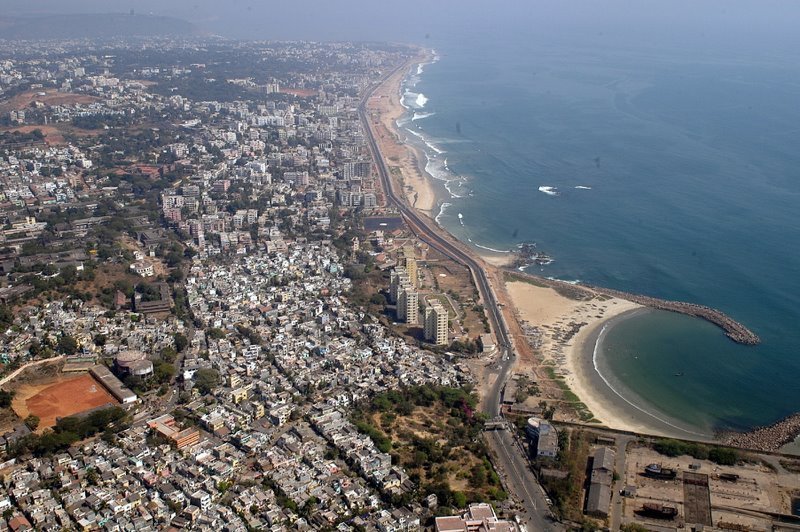
Visakhapatnam is the largest city of Andhra Pradesh. Visakhapatnam has a GDP of $43.5 billion. It is the 9th richest city in India. Fishing industry, road–rail connectivity, many heavy industries like Hindustan Petroleum, Visakhapatnam Steel Plant, Hindustan Shipyard, Visakhapatnam Port Trust, National Thermal Power, Bharat Heavy Electricals, BARC, Naval Science and Technological Laboratory, Naval Dockyard, Dredging Corporation of India, Strategic Petroleum Reserve, NMDC, CONCOR, Andhra Pradesh Medtech Zone etc.. Private sector like Coromandel International, Ferro Alloys Corporation, Gangavaram Port, etc., are the factors that made the city into an industrial hub, from a small hamlet. Tourism also plays an important role in generating revenue, with numerous tourist destinations in and around the city. Blessed with a natural harbour and one of the largest ports of India, sea trade was made possible with other countries which also boosts the economy. The service sector con ... [...More Info...] [...Related Items...] OR: [Wikipedia] [Google] [Baidu] |
Transport In Visakhapatnam
Transport in Visakhapatnam is the network of roads, railways, rapid transit system in the largest city of Andhra Pradesh . The city of Visakhapatnam also serves as the central hub of transport and logistics on the East coast of India and hence it is called as City Of Destiny. There are various modes of transportation available in Visakhapatnam. It includes auto rickshaws, bicycles to mass transit systems such as buses and trains. Visakhapatnam is also home for a Seaport and an International Airport. Roadways Visakhapatnam is integrated into the National Highway Network of India through NH 16, NH 516C, NH 516D, NH 516E, while two State Highways SH38, SH39 originate/terminate in Vizag. Visakhapatnam has a vehicle population of nearly 12 lakhs and is the highest in the state. The city has a total road length of , covering of municipal roads, of Roads & Buildings department roads and of National highways. There are several arterial roads and ten junctions in the city, where ... [...More Info...] [...Related Items...] OR: [Wikipedia] [Google] [Baidu] |


