|
Fiq, Ethiopia
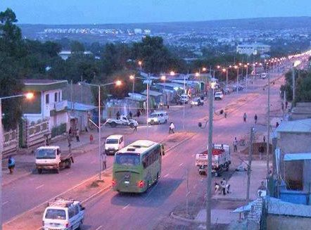
Fiq is a town in eastern Ethiopia. Located in the Erer Zone of the Somali Region, this town has a latitude and longitude of with an elevation of 1229 meters above sea level."Local History in Ethiopia" The Nordic Africa Institute website (accessed 19 December 2007) History The ''Guida dell'Africa Orientale Italiana'' described Fiq in 1904 as a place where the ogaden Somali would gather during certain months. Travel by motorcar between Fiq and Babille was possible by a track. Administrative buildings present at the time included a post office, telegraph office and an infirmary.< ...[...More Info...] [...Related Items...] OR: [Wikipedia] [Google] [Baidu] |
Images (2)
An image is a visual representation of something. It can be two-dimensional, three-dimensional, or somehow otherwise feed into the visual system to convey information. An image can be an artifact, such as a photograph or other two-dimensional picture, that resembles a subject. In the context of signal processing, an image is a distributed amplitude of color(s). In optics, the term “image” may refer specifically to a 2D image. An image does not have to use the entire visual system to be a visual representation. A popular example of this is of a greyscale image, which uses the visual system's sensitivity to brightness across all wavelengths, without taking into account different colors. A black and white visual representation of something is still an image, even though it does not make full use of the visual system's capabilities. Images are typically still, but in some cases can be moving or animated. Characteristics Images may be two or three-dimensional, such as a ... [...More Info...] [...Related Items...] OR: [Wikipedia] [Google] [Baidu] |
Ethiopia
Ethiopia, , om, Itiyoophiyaa, so, Itoobiya, ti, ኢትዮጵያ, Ítiyop'iya, aa, Itiyoppiya officially the Federal Democratic Republic of Ethiopia, is a landlocked country in the Horn of Africa. It shares borders with Eritrea to the north, Djibouti to the northeast, Somalia to the east and northeast, Kenya to the south, South Sudan to the west, and Sudan to the northwest. Ethiopia has a total area of . As of 2022, it is home to around 113.5 million inhabitants, making it the 13th-most populous country in the world and the 2nd-most populous in Africa after Nigeria. The national capital and largest city, Addis Ababa, lies several kilometres west of the East African Rift that splits the country into the African and Somali tectonic plates. Anatomically modern humans emerged from modern-day Ethiopia and set out to the Near East and elsewhere in the Middle Paleolithic period. Southwestern Ethiopia has been proposed as a possible homeland of the Afroasiatic langua ... [...More Info...] [...Related Items...] OR: [Wikipedia] [Google] [Baidu] |
Somali Region
The Somali Region ( so, Deegaanka Soomaalida, am, ሱማሌ ክልል, Sumalē Kilil, ar, المنطقة الصومالية), also known as Soomaali Galbeed (''Western Somalia'') and officially the Somali Regional State, is a regional state in eastern Ethiopia. Its territory is the largest after Oromia Region. The regional state borders the Ethiopian regions of Afar and Oromia and the chartered city Dire Dawa (Dire Dhawa) to the west, as well as Djibouti to the north, Somaliland to the northeast, Somalia to the south; and Kenya to the southwest. Jijiga is the capital of the Somali Region. The capital was formerly Gode, until Jijiga became the capital in 1995 on account of political considerations. The Somali regional government is composed of the executive branch, led by the President; the legislative branch, which comprises the State Council; and the judicial branch, which is led by the State Supreme Court. Overview The Somali Region formed a large part of the pre-19 ... [...More Info...] [...Related Items...] OR: [Wikipedia] [Google] [Baidu] |
Fiq (woreda)
Fiq ( so, Fiiq) is a woreda in Somali Region, Ethiopia, named after its major town, Fiq. Part of the Fiq Zone, Fiq is bordered on the south by Hamero, on the western Qubi ,on the west by Mayumuluka, on the north by the Jijiga Zone, on the east by the Degehabur Zone, and on the southeast by Segeg; the woreda's western boundary is defined by the Erer River. The average elevation in this woreda is 1035 meters above sea level. , Ayesha has 40 kilometers of all-weather gravel road and 451 kilometers of community roads; about 9.11% of the total population has access to drinking water. Demographics Based on the 2007 Census conducted by the Central Statistical Agency of Ethiopia (CSA), this woreda has a total population of 68,047, of whom 36,037 are men and 32,011 are women and 68,060 women. While 9.31% are urban inhabitants, a further 56.68% are pastoralists. 99.3% of the population said they were Muslim. This woreda is primarily inhabited by the Ogaden malingour clan. The 1997 na ... [...More Info...] [...Related Items...] OR: [Wikipedia] [Google] [Baidu] |
East Africa Time
East Africa Time, or EAT, is a time zone used in eastern Africa. The time zone is three hours ahead of UTC ( UTC+03:00), which is the same as Moscow Time, Arabia Standard Time, Further-eastern European Time and Eastern European Summer Time. As this time zone is predominantly in the equatorial region, there is no significant change in day length throughout the year and so daylight saving time is not observed. East Africa Time is observed by the following countries: * * * * * * * * * See also *Moscow Time, an equivalent time zone covering Belarus, Turkey and most of European Russia, also at UTC+03:00 *Arabia Standard Time, an equivalent time zone covering Bahrain, Iraq, Kuwait, Qatar, Saudi Arabia and Yemen, also at UTC+03:00 *Eastern European Summer Time, an equivalent time zone covering European and Middle Eastern countries during daylight saving, also at UTC+03:00 *Israel Summer Time, an equivalent time zone covering the State of Israel during daylight saving, also at U ... [...More Info...] [...Related Items...] OR: [Wikipedia] [Google] [Baidu] |
Erer Zone
Erer is a zone of Somali Region in Ethiopia. See also * List of zones of Ethiopia The regions of Ethiopia are administratively divided into 68 or more zones ( am, ዞን, ''zonə''). References {{coord missing, Ethiopia Zones of Ethiopia Somali Region ...[...More Info...] [...Related Items...] OR: [Wikipedia] [Google] [Baidu] |
Somali People
The Somalis ( so, Soomaalida 𐒈𐒝𐒑𐒛𐒐𐒘𐒆𐒖, ar, صوماليون) are an ethnic group native to the Horn of Africa who share a common ancestry, culture and history. The Lowland East Cushitic Somali language is the shared mother tongue of ethnic Somalis, which is part of the Cushitic branch of the Afroasiatic language family, and are predominantly Sunni Muslim.Mohamed Diriye Abdullahi, ''Culture and Customs of Somalia'', (Greenwood Press: 2001), p.1 They form one of the largest ethnic groups on the African continent, and cover one of the most expansive landmasses by a single ethnic group in Africa. According to most scholars, the ancient Land of Punt and its native inhabitants formed part of the ethnogenesis of the Somali people. An ancient historical kingdom where a great portion of their cultural traditions and ancestry has been said to derive from.Egypt: 3000 Years of Civilization Brought to Life By Christine El MahdyAncient perspectives on Egypt By Ro ... [...More Info...] [...Related Items...] OR: [Wikipedia] [Google] [Baidu] |
Babille, Ethiopia
Babile ( om, Baabbile; am, ባቢሌ) is a town located in East Hararghe, Oromia. It is inhabited mostly by Oromo peoples. The town has a latitude and longitude of with an elevation of 1648 meters above sea level. It's the administrative center of Babille woreda. Babille woreda is located 700 90' North Latitude and 430 00' East Longitude. It shares boundary with other woredas of the Somali region and Fadis Woreda of Oromia regional state. The total size of the Woreda is about 1,325 km2. It is divided into 17 kebeles and 42 sub-kebeles. The average temperature is 26.5 Celsius with uneven rainfall distribution. Babille is known for its hot springs, mineral water and elephant sanctuary. Often, the inhabitants come into conflicts with the neighboring Somali communities over the control of the sanctuary. Overview Located on the main road between Harar and Jigjiga, Babille is reported to have had telephone service by 1967. [...More Info...] [...Related Items...] OR: [Wikipedia] [Google] [Baidu] |
Ogaden War
The Ogaden War, or the Ethio-Somali War (, am, የኢትዮጵያ ሶማሊያ ጦርነት, ye’ītiyop’iya somalīya t’orineti), was a military conflict fought between Somalia and Ethiopia from July 1977 to March 1978 over the Ethiopian region of Ogaden. Somalia's invasion of the region, precursor to the wider war,. met with the Soviet Union's disapproval, leading the superpower to end its support of Somalia and support Ethiopia instead. Ethiopia was saved from defeat and permanent loss of territory through a massive airlift of military supplies worth $1 billion, the arrival of more than 12,000 Cuban soldiers and airmen sent by Fidel Castro to win a second African victory (after his first success in Angola in 1975–76), and 1,500 Soviet advisors, led by General Vasily Petrov. On 23 January 1978, Cuban armored brigades inflicted the worst losses the Somali forces had ever taken in a single action since the start of the war. The Cubans (equipped with 300 tanks ... [...More Info...] [...Related Items...] OR: [Wikipedia] [Google] [Baidu] |
Somalia
Somalia, , Osmanya script: 𐒈𐒝𐒑𐒛𐒐𐒘𐒕𐒖; ar, الصومال, aṣ-Ṣūmāl officially the Federal Republic of SomaliaThe ''Federal Republic of Somalia'' is the country's name per Article 1 of thProvisional Constitution, (; ), is a country in the Horn of Africa. The country is bordered by Ethiopia to the west, Djibouti to the northwest, the Gulf of Aden to the north, the Indian Ocean to the east, and Kenya to the southwest. Somalia has the longest coastline on Africa's mainland. Its terrain consists mainly of plateaus, plains, and highlands. Hot conditions prevail year-round, with periodic monsoon winds and irregular rainfall. Somalia has an estimated population of around million, of which over 2 million live in the capital and largest city Mogadishu, and has been described as Africa's most culturally homogeneous country. Around 85% of its residents are ethnic Somalis, who have historically inhabited the country's north. Ethnic minorities are ... [...More Info...] [...Related Items...] OR: [Wikipedia] [Google] [Baidu] |
Jijiga
Jijiga (, am, ጅጅጋ, ''Jijiga'') is the capital city of Somali Region, Ethiopia. It became the capital of the Somali Region in 1995 after it was moved from Gode. Located in the Fafan Zone with 70 km (37 mi) west of the border with Somalia, the city has an elevation of 1,634 metres above sea level. Jigjiga is traditionally the seat of the Bartire Garad Wiil-Waal of the Jidwaaq Absame. The International airport is named after him. History The region around Jijiga is believed to be associated with the ancient Gidaya state which existed as early as thirteenth century. Jijiga was mentioned by W.C. Barker in 1842 as one of the ''mahalla'' or halting-places of the caravan route between Zeila and Harar. One of the earliest detailed references to Jijiga comes from British hunter Colonel Swayne, who passed through Jijiga in February 1893, which he described as a stockaded fort with a garrison of 25 men next to a group of wells. According to I. M. Lewis, the Dervish in ... [...More Info...] [...Related Items...] OR: [Wikipedia] [Google] [Baidu] |


