|
Falconbrook
The Falconbrook was a stream that rose in Balham and Tooting, draining much of those parishes then the south and west of the larger district of Battersea including Clapham Junction to enter the Tideway, London reaches of the Thames. Before doing so it briefly formed the border of Wandsworth Town, reflected in the SW postcode area, SW11/SW18 boundary today. The river was culverted in the 1860s and has become an important combined sewer. In 2007 heavy rain caused this to flood, to low but still property-damaging depth, at Falcon Road near Clapham Junction station. Course The Falconbrook, once a southwest London brook has been slightly replaced by surface water drains. Mainly, however, its course forms a gentle valley Nappy Valley, with an occasional colloquial name and hosts a mid-Victorian solution to the then extent of urbanisation. When London's later growth is considered this solution, a combined sewer, leads to the Thames-side Southern Low Level Sewer in the London sewerage ... [...More Info...] [...Related Items...] OR: [Wikipedia] [Google] [Baidu] |
Thames Tideway Tunnel
The Thames Tideway Tunnel is a combined sewer under construction running mostly under Tideway, the tidal section (estuary) of the River Thames across Inner London to capture, store and convey almost all the raw sewage and rainwater that currently overflows into the estuary. These events occur when rainfall volumes exceed the capacity of Joseph Bazalgette, Bazalgette's and other engineers' London sewerage system. The tunnelling phase of the project was completed in April 2022. Bazalgette Tunnel Limited (BTL) is the licensed infrastructure provider for its finance, building, maintenance and operation. It has as investors: Allianz, Amber Infrastructure, Dalmore Capital and DIF. Since the licence award, it also trades as Tideway. On 3 November 2015, the award was made by Ofwat, ensuring the start of the project. Started in 2016, the construction aimed to be completed by 2024. The COVID-19 pandemic in the United Kingdom, COVID-19 pandemic has delayed this to early 2025. Once cons ... [...More Info...] [...Related Items...] OR: [Wikipedia] [Google] [Baidu] |
Battersea
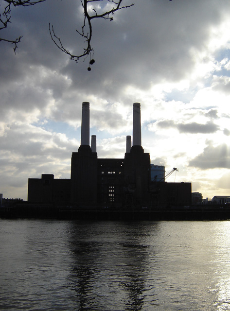
Battersea is a large district in south London, part of the London Borough of Wandsworth, England. It is centred southwest of Charing Cross and extends along the south bank of the River Thames. It includes the Battersea Park. History Battersea is mentioned in the few surviving Anglo-Saxon geographical accounts as ''Badrices īeg'' meaning "Badric's Island" and later "Patrisey". As with many former parishes beside tidal flood plains the lowest land was reclaimed for agriculture by draining marshland and building culverts for streams. Alongside this was the Heathwall tide mill in the north-east with a very long mill pond regularly draining and filling to the south. The settlement appears in the Domesday Book of 1086 as ''Patricesy'', a vast manor held by St Peter's Abbey, Westminster. Its ''Domesday'' Assets were: 18 hides and 17 ploughlands of cultivated land; 7 mills worth £42 9s 8d per year, of meadow, woodland worth 50 hogs. It rendered (in total): £75 9s 8d. The p ... [...More Info...] [...Related Items...] OR: [Wikipedia] [Google] [Baidu] |
Nappy Valley
Nappy Valley is a colloquial epithet applied to pleasant places with high (demographic) reproduction. It resonates linguistically with Happy Valley such as that in Kenya, noted for its wealthy white population before 1963 independence where much of the film '' White Mischief'' is set. It also linguistically tied to Napa Valley a successful wine region of California. Battersea, SW11, London, England The term is applied to the south of Battersea, between Clapham Common and Wandsworth Common, South London with a " café culture" of middle-class, affluent families. Its focal Northcote Road runs along the foot of a small vale, that of the Falconbrook. The street is labelled 'Nappy Valley' by Will Self in his February 2010 London Review of Books Diary entry. Tuggeranong Valley, Australian Capital Territory Tuggeranong is the southernmost town centre of Canberra, the capital city of Australia. It comprises 19 suburbs with a total of 31,819 dwellings, housing 87,119 people of the 324, ... [...More Info...] [...Related Items...] OR: [Wikipedia] [Google] [Baidu] |
Falcon Road, SW11 (1) - Geograph
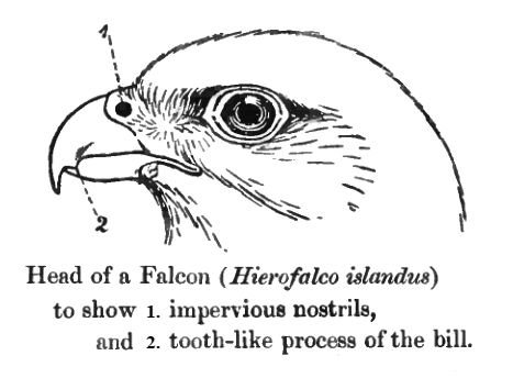
Falcons () are birds of prey in the genus ''Falco'', which includes about 40 species. Falcons are widely distributed on all continents of the world except Antarctica, though closely related raptors did occur there in the Eocene. Adult falcons have thin, tapered wings, which enable them to fly at high speed and change direction rapidly. Fledgling falcons, in their first year of flying, have longer flight feathers, which make their configuration more like that of a general-purpose bird such as a broad wing. This makes flying easier while learning the exceptional skills required to be effective hunters as adults. The falcons are the largest genus in the Falconinae subfamily of Falconidae, which itself also includes another subfamily comprising caracaras and a few other species. All these birds kill with their beaks, using a tomial "tooth" on the side of their beaks—unlike the hawks, eagles, and other birds of prey in the Accipitridae, which use their feet. The largest falcon ... [...More Info...] [...Related Items...] OR: [Wikipedia] [Google] [Baidu] |
Ordnance Survey
, nativename_a = , nativename_r = , logo = Ordnance Survey 2015 Logo.svg , logo_width = 240px , logo_caption = , seal = , seal_width = , seal_caption = , picture = , picture_width = , picture_caption = , formed = , preceding1 = , dissolved = , superseding = , jurisdiction = Great BritainThe Ordnance Survey deals only with maps of Great Britain, and, to an extent, the Isle of Man, but not Northern Ireland, which has its own, separate government agency, the Ordnance Survey of Northern Ireland. , headquarters = Southampton, England, UK , region_code = GB , coordinates = , employees = 1,244 , budget = , minister1_name = , minister1_pfo = , chief1_name = Steve Blair , chief1_position = CEO , agency_type = , parent_agency = , child1_agency = , keydocument1 = , website = , footnotes = , map = , map_width = , map_caption = Ordnance Survey (OS) is the national mapping agency for Great Britain. The agency's name indicates its original military purpose (se ... [...More Info...] [...Related Items...] OR: [Wikipedia] [Google] [Baidu] |
English Heritage
English Heritage (officially the English Heritage Trust) is a charity that manages over 400 historic monuments, buildings and places. These include prehistoric sites, medieval castles, Roman forts and country houses. The charity states that it uses these properties to "bring the story of England to life for over 10 million people each year". Within its portfolio are Stonehenge, Dover Castle, Tintagel Castle and the best preserved parts of Hadrian's Wall. English Heritage also manages the London Blue Plaque scheme, which links influential historical figures to particular buildings. When originally formed in 1983, English Heritage was the operating name of an executive non-departmental public body of the British Government, officially titled the Historic Buildings and Monuments Commission for England, that ran the national system of heritage protection and managed a range of historic properties. It was created to combine the roles of existing bodies that had emerged from a long ... [...More Info...] [...Related Items...] OR: [Wikipedia] [Google] [Baidu] |
Cartularium Saxonicum
''Cartularium Saxonicum'' is a three volume collection of Anglo-Saxon charters published from 1885 to 1893 by Walter de Gray Birch (1842-1924), then working in the Department of Manuscripts at the British Library. The most recent edition was released on May 24, 2012 by Cambridge University Press Cambridge University Press is the university press of the University of Cambridge. Granted letters patent by King Henry VIII in 1534, it is the oldest university press in the world. It is also the King's Printer. Cambridge University Pre .... References 1885 books 1890s books Anglo-Saxon reference works Reference works in the public domain {{ref-book-stub ... [...More Info...] [...Related Items...] OR: [Wikipedia] [Google] [Baidu] |
Clapham
Clapham () is a suburb in south west London, England, lying mostly within the London Borough of Lambeth, but with some areas (most notably Clapham Common) extending into the neighbouring London Borough of Wandsworth. History Early history The present day Clapham High Street is on the route of a Roman road. The road is recorded on a Roman monumental stone found nearby. According to its inscription, the stone was erected by a man named Vitus Ticinius Ascanius. It is estimated to date from the 1st century. (The stone was discovered during building works at Clapham Common South Side in 1912. It is now placed by the entrance of the former Clapham Library, in the Old Town.) According to the history of the Clapham family, maintained by the College of Heralds, in 965 King Edgar of England gave a grant of land at Clapham to Jonas, son of the Duke of Lorraine, and Jonas was thenceforth known as Jonas "de fClapham". The family remained in possession of the land until Jonas's great- ... [...More Info...] [...Related Items...] OR: [Wikipedia] [Google] [Baidu] |
Hide (unit)
The hide was an English unit of land measurement originally intended to represent the amount of land sufficient to support a household. It was traditionally taken to be , but was in fact a measure of value and tax assessment, including obligations for food-rent ('), maintenance and repair of bridges and fortifications, manpower for the army ('), and (eventually) the ' land tax. The hide's method of calculation is now obscure: different properties with the same hidage could vary greatly in extent even in the same county. Following the Norman Conquest of England, the hidage assessments were recorded in the Domesday Book of 1086, and there was a tendency for land producing £1 of income per year to be assessed at 1 hide. The Norman kings continued to use the unit for their tax assessments until the end of the 12th century. The hide was divided into 4 yardlands or virgates. It was hence nominally equivalent in area to a carucate, a unit used in the Danelaw. Original meaning The An ... [...More Info...] [...Related Items...] OR: [Wikipedia] [Google] [Baidu] |
Bec Abbey
Bec Abbey, formally the Abbey of Our Lady of Bec (french: Abbaye Notre-Dame du Bec), is a Benedictine monastic foundation in the Eure ''département'', in the Bec valley midway between the cities of Rouen and Bernay. It is located in Le Bec Hellouin, Normandy, France, and was the most influential abbey of the 12th-century Anglo- Norman kingdom. Like all abbeys, Bec maintained annals of the house but uniquely its first abbots also received individual biographies, brought together by the monk of Bec, Milo Crispin. Because of the abbey's cross-Channel influence, these hagiographic lives sometimes disclose historical information of more than local importance. Name The name of the abbey derives from the bec, or stream, that runs nearby. The word derives from the Scandinavian root, ''bekkr''. First foundation The abbey was founded in 1034 by Saint Herluin, whose life was written by Gilbert Crispin, Abbot of Westminster, formerly of Bec, and collated with three other lives by Mi ... [...More Info...] [...Related Items...] OR: [Wikipedia] [Google] [Baidu] |
Weir
A weir or low head dam is a barrier across the width of a river that alters the flow characteristics of water and usually results in a change in the height of the river level. Weirs are also used to control the flow of water for outlets of lakes, ponds, and reservoirs. There are many weir designs, but commonly water flows freely over the top of the weir crest before cascading down to a lower level. Etymology There is no single definition as to what constitutes a weir and one English dictionary simply defines a weir as a small dam, likely originating from Middle English ''were'', Old English ''wer'', derivative of root of ''werian,'' meaning "to defend, dam". Function Commonly, weirs are used to prevent flooding, measure water discharge, and help render rivers more navigable by boat. In some locations, the terms dam and weir are synonymous, but normally there is a clear distinction made between the structures. Usually, a dam is designed specifically to impound water behind ... [...More Info...] [...Related Items...] OR: [Wikipedia] [Google] [Baidu] |
Surrey Archaeological Society
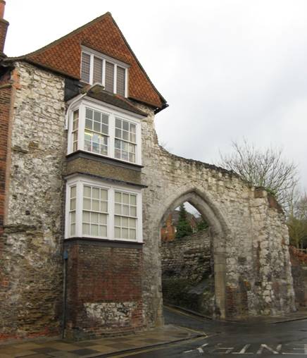
Surrey Archaeological Society is a county archaeological society, founded in 1854 for "the investigation of subjects connected with the history and antiquities of the County of Surrey" in England. Remit The Society concerns itself with "the County of Surrey within the boundaries existing in 1854 … and as may be enlarged by any extension of the present Administrative County". Its geographical interests therefore cover, in addition to the modern administrative county of Surrey, the areas now forming the London boroughs of Lambeth, Wandsworth, Southwark, Croydon, Kingston, Merton, Sutton, and Richmond; as well as the district of Spelthorne, which became part of the county only in 1965. Where appropriate, however, the Society works in close cooperation with other archaeological agencies, such as Museum of London Archaeology. Headquarters and activities The Society's headquarters, which include an extensive library, are located at Castle Arch, Guildford. The building also houses ... [...More Info...] [...Related Items...] OR: [Wikipedia] [Google] [Baidu] |
_-_geograph.org.uk_-_143567.jpg)


.jpg)


