|
FM 1764
Farm to Market Road 1764 (FM 1764) is a state highway in the U.S. state of Texas. It is a farm to market road existing entirely within Galveston County that connects Santa Fe to Texas City via a short stretch of freeway known as the Emmett F. Lowry Expressway. The highway was designated in the 1950s. Route description The western terminus of FM 1764 is at State Highway 6 (SH 6) in Santa Fe. From there, the route heads north slightly and then east, through farmland approximately towards junctions with FM 2004 and Interstate 45 (I-45) near Texas City. At this point, FM 1764 transitions to a freeway segment which serves as a spur from I-45 into Texas City from points north—continuous travel between the western and eastern segments of FM 1764 requires use of frontage roads at the I-45 junction as there is no direct access. The freeway section, complete with frontage roads, is known as the Emmett F. Lowry Expressway and runs approximately between I-45 and SH 146 in Texas ... [...More Info...] [...Related Items...] OR: [Wikipedia] [Google] [Baidu] |
Santa Fe, Texas
Santa Fe ( en, Holy Faith) is a city in Galveston County, Texas. It is named for the Santa Fe Railroad (now part of BNSF Railway) which runs through the town alongside State Highway 6. The population of Santa Fe at the 2010 census was 12,222. History In 1877, the Gulf, Colorado and Santa Fe Railway was built through the western part of Galveston county. By the turn of the century, three small, unincorporated towns had formed along the railway: Alta Loma, Arcadia and Algoa. The Santa Fe Independent School District, named after the railway, was established shortly afterward to serve the area. In the mid-1970s, the neighboring city of Hitchcock attempted to annex an area in eastern Alta Loma known as the Morningview neighborhood. Amid intense opposition to becoming part of Hitchcock, residents began a petitioning effort to incorporate the area into a new city. On January 21, 1978, a ballot proposal to incorporate Alta Loma and parts of Arcadia passed by a wide margin and the ... [...More Info...] [...Related Items...] OR: [Wikipedia] [Google] [Baidu] |
Texas City, Texas
Texas City is a city in Galveston County, Texas, Galveston County in the U.S. state of Texas. Located on the southwest shoreline of Galveston Bay, Texas City is a busy deepwater port on Texas's Gulf Coast, as well as a petroleum-refining and petrochemical-manufacturing center. The population was 51,898 at the 2020 census, making it the third-largest city in Galveston County, behind League City and Galveston. It is a part of the Houston metropolitan area. The city is notable as the site of a Texas City disaster, major explosion in 1947 that demolished the port and much of the city. History Three duck hunters in 1891 noted that a location along Galveston Bay, known locally as Shoal Point, had the potential to become a major port. Shoal Point had existed since the 1830s, when veterans of the Texas Revolution (1835–1836) were awarded land for their services. The name was applied to the community when a post office opened in 1878. The duck hunters were three brothers from Dul ... [...More Info...] [...Related Items...] OR: [Wikipedia] [Google] [Baidu] |
State Highway
A state highway, state road, or state route (and the equivalent provincial highway, provincial road, or provincial route) is usually a road that is either ''numbered'' or ''maintained'' by a sub-national state or province. A road numbered by a state or province falls below numbered national highways (Canada being a notable exception to this rule) in the hierarchy (route numbers are used to aid navigation, and may or may not indicate ownership or maintenance). Roads maintained by a state or province include both nationally numbered highways and un-numbered state highways. Depending on the state, "state highway" may be used for one meaning and "state road" or "state route" for the other. In some countries such as New Zealand, the word "state" is used in its sense of a sovereign state or country. By this meaning a state highway is a road maintained and numbered by the national government rather than local authorities. Countries Australia Australia's State Route system covers u ... [...More Info...] [...Related Items...] OR: [Wikipedia] [Google] [Baidu] |
Texas
Texas (, ; Spanish language, Spanish: ''Texas'', ''Tejas'') is a state in the South Central United States, South Central region of the United States. At 268,596 square miles (695,662 km2), and with more than 29.1 million residents in 2020, it is the second-largest U.S. state by both List of U.S. states and territories by area, area (after Alaska) and List of U.S. states and territories by population, population (after California). Texas shares borders with the states of Louisiana to the east, Arkansas to the northeast, Oklahoma to the north, New Mexico to the west, and the Mexico, Mexican States of Mexico, states of Chihuahua (state), Chihuahua, Coahuila, Nuevo León, and Tamaulipas to the south and southwest; and has a coastline with the Gulf of Mexico to the southeast. Houston is the List of cities in Texas by population, most populous city in Texas and the List of United States cities by population, fourth-largest in the U.S., while San Antonio is the second most pop ... [...More Info...] [...Related Items...] OR: [Wikipedia] [Google] [Baidu] |
Farm To Market Road
In the United States, a farm-to-market road or ranch-to-market road (sometimes farm road or ranch road for short) is a state highway or county road that connects rural or agricultural areas to market towns. These are better quality roads, usually a highway, that farmers and ranchers use to transport products to market towns or distribution centers. Historically used throughout the country, today the term is primarily associated with a large state-maintained highway system in Texas. History By 1930, counties and townships across the U.S. had built a large number of farm-to-market roads, many of which were in need of repairs and safety improvements. The Chief of the Bureau of Public Roads, Thomas Harris MacDonald, considered this need to be driven not by insufficient funding but by inefficient planning and inadequate equipment on the part of thousands of counties. He advocated for an expansion of state-maintained highway systems through the federal-aid highway program, so that count ... [...More Info...] [...Related Items...] OR: [Wikipedia] [Google] [Baidu] |
Galveston County, Texas
Galveston County ( ) is a County (United States), county in the U.S. state of Texas, located along the Gulf Coast of the United States, Gulf Coast adjacent to Galveston Bay. As of the 2020 United States census, 2020 census, the population was 350,682. The county was founded in 1838. The county seat is the Galveston, Texas, City of Galveston, founded the following year of 1839, located on Galveston Island. The most populous municipality in the county is League City, Texas, League City, a suburb of Houston at the northern end of the county, which surpassed Galveston in population during the early 2000s. Galveston County is part of the nine-county Greater Houston, Houston–The Woodlands–Sugar Land (Greater Houston) metropolitan statistical area. History Sixteenth-century Spanish explorers knew Galveston Island as the Isla de Malhado, the "Isle of Misfortune", or Isla de Culebras, the "Isle of Snakes". In 1519, the expedition led by Alonso Álvarez de Pineda actually sailed past ... [...More Info...] [...Related Items...] OR: [Wikipedia] [Google] [Baidu] |
Texas State Highway 6
State Highway 6 (SH 6) runs from the Red River, the Texas–Oklahoma state line, to northwest of Galveston, where it is known as the Old Galveston Highway. In Sugar Land and Missouri City, it is known as Alvin-Sugarland Road and runs perpendicular to Interstate 69/ U.S. Highway 59 (I-69/US 59). In the Houston area, it runs north to Farm to Market Road 1960 (FM 1960), then northwest along USS 290 to Hempstead, and south to Westheimer Road and Addicks, and is known as Addicks Satsuma Road. In the Bryan– College Station area, it is known as the Earl Rudder Freeway. In Hearne, it is known as Market Street. In Calvert, it is known as Main Street. For most of its length, SH 6 is not a limited-access road. In 1997, the Texas Legislature designated SH 6 as the Texas Korean War Veterans Memorial Highway. History Historic routes SH 6 was one of the original 25 state highways proposed on June 21, 1917, overlaying the King of Trails Hi ... [...More Info...] [...Related Items...] OR: [Wikipedia] [Google] [Baidu] |
Farm To Market Road 2004
Farm to Market Road 2004 (FM 2004) is a farm to market road in Brazoria and Galveston counties, Texas. Route description FM 2004 begins near the village of Jones Creek and the TDCJ Clemens Unit prison, at an intersection with SH 36; the roadway past SH 36 is FM 2611. The route travels to the northeast, crossing the Brazos River and entering Lake Jackson, where it intersects SH 332 and then the SH 288 expressway north of Brazos Mall. FM 2004 travels through Richwood before entering unincorporated areas of Brazoria County, south of Danbury and Liverpool, and north of the Brazoria National Wildlife Refuge. The highway crosses a steep bridge over Chocolate Bayou and passes chemical plants before entering Galveston County. The route turns more to the north, crossing SH 6 in Hitchcock. The route begins a brief concurrency with FM 1764 in La Marque just prior to a junction with I-45. FM 1764 turns to the east past the I-45 junction, while FM 2 ... [...More Info...] [...Related Items...] OR: [Wikipedia] [Google] [Baidu] |
Interstate 45
Interstate 45 (I-45) is a major Interstate Highway located entirely within the US state of Texas. While most Interstate routes which have numbers ending in "5" are cross-country north–south routes, I-45 is comparatively short, with the entire route located in Texas. Additionally, it has the shortest length of all the interstates that end in a "5." It connects the cities of Dallas and Houston, continuing southeast from Houston to Galveston over the Galveston Causeway to the Gulf of Mexico. I-45 replaced U.S. Highway 75 (US 75) over its entire length, although portions of US 75 remained parallel to I-45 until its elimination south of Downtown Dallas in 1987. At the south end of I-45, State Highway 87 (SH 87, formerly part of US 75) continues into downtown Galveston. The north end is at I-30 in Downtown Dallas, where US 75 used the Good-Latimer Expressway. A short continuation, known by traffic reporters as the I-45 overhead, signed as p ... [...More Info...] [...Related Items...] OR: [Wikipedia] [Google] [Baidu] |
Texas State Highway 146
State Highway 146 (SH 146) is a north–south highway in southeastern Texas beginning at I-45 near La Marque and Texas City. It then crosses over the Fred Hartman Bridge over the Houston Ship Channel which carries SH 146 traffic. It then continues north towards Dayton, where it meets US 90 and then heads north and terminates in Livingston at US 59 (Future I-69). History SH 146 was designated on March 19, 1930, from SH 6/ US 75 northward to Texas City as a renumbering of SH 6A. On July 2, 1932, SH 146 was extended north to Dayton. On August 3, 1932, SH 146 was extended north to Cleveland (the plan was to delete SH 132 when this extension was completed). On September 22, 1932, this extension was canceled, and SH 146 was instead extended north to Livingston, replacing SH 132. On December 16, 1967, SH 146 was relocated east of Liberty. On February 21, 1984, SH 146 was extended south from SH 3 to I-45. On Marc ... [...More Info...] [...Related Items...] OR: [Wikipedia] [Google] [Baidu] |
Houston Chronicle
The ''Houston Chronicle'' is the largest daily newspaper in Houston, Texas, United States. , it is the third-largest newspaper by Sunday circulation in the United States, behind only ''The New York Times'' and the ''Los Angeles Times''. With its 1995 buy-out of long-time rival the ''Houston Post'', the ''Chronicle'' became Houston's newspaper of record. The ''Houston Chronicle'' is the largest daily paper owned and operated by the Hearst Corporation, a privately held multinational corporate media conglomerate with $10 billion in revenues. The paper employs nearly 2,000 people, including approximately 300 journalists, editors, and photographers. The ''Chronicle'' has bureaus in Washington, D.C. and Austin. It reports that its web site averages 125 million page views per month. The publication serves as the " newspaper of record" of the Houston area. Previously headquartered in the Houston Chronicle Building at 801 Texas Avenue, Downtown Houston, the ''Houston Chronicle'' i ... [...More Info...] [...Related Items...] OR: [Wikipedia] [Google] [Baidu] |
Arcadia, Santa Fe, Texas
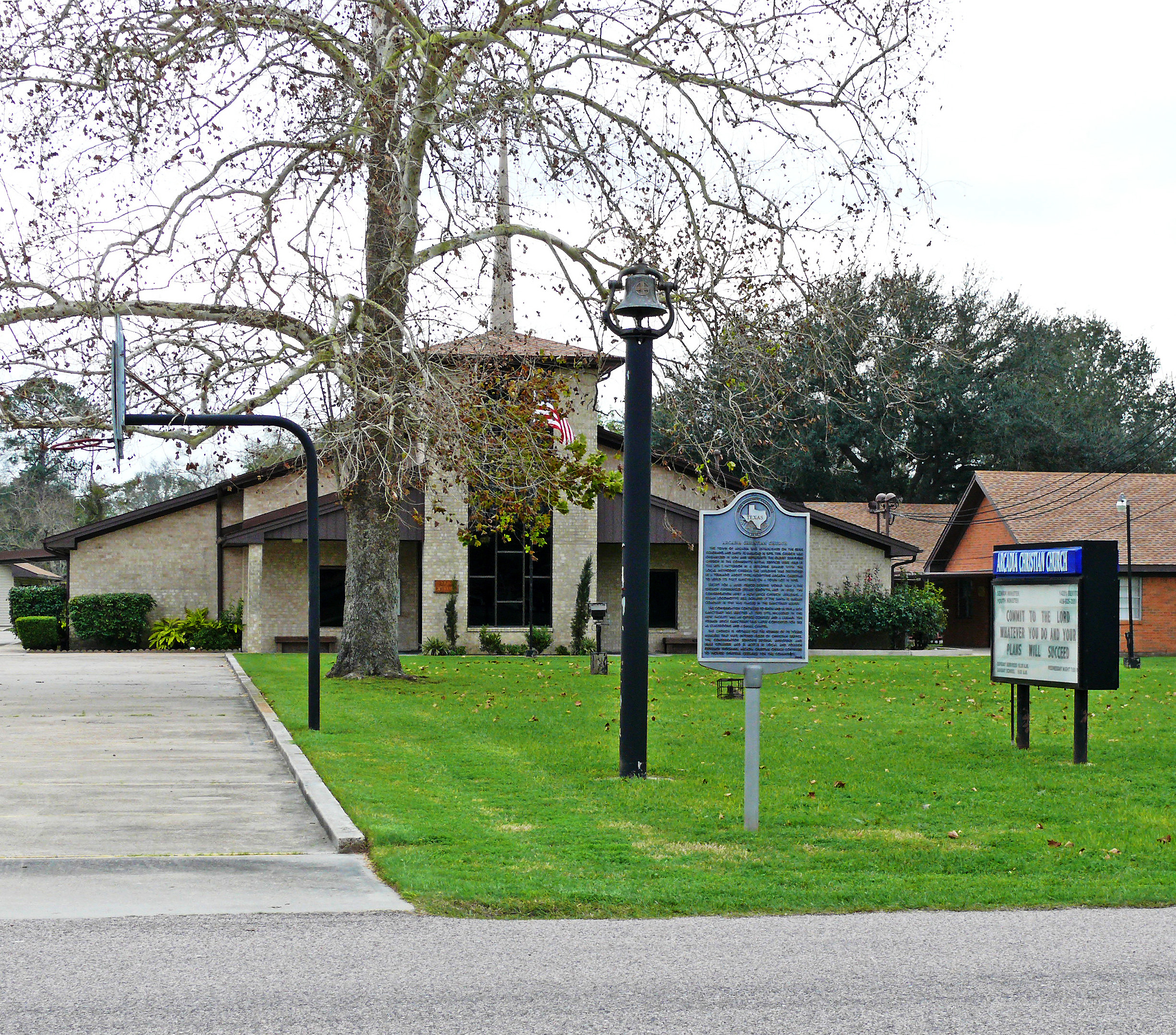
Arcadia was an unincorporated area in Galveston County, Texas, United States, which is now a neighborhood of the city of Santa Fe. It sits at an elevation of 30 feet (9 m). History Arcadia was established around 1889 near Hall's Bayou on the Gulf, Colorado and Santa Fe Railway. It was named after Arcadia, Louisiana. Henry Runge plated the town in 1890 as Hall's Station on Stephen F. Austin's fourth land grant. The Coaque people were native to the area, which was later explored by Álvar Núñez Cabeza de Vaca Álvar Núñez Cabeza de Vaca (; 1488/90/92"Cabeza de Vaca, Alvar Núñez (1492?-1559?)." American Eras. Vol. 1: Early American Civilizations and Exploration to 1600. Detroit: Gale, 1997. 50-51. Gale Virtual Reference Library. Web. 10 Decembe .... The town became a part of Santa Fe, Texas, in the 1980s. References External links * Santa Fe, Texas Neighborhoods in Texas Geography of Galveston County, Texas {{GalvestonCountyTX-geo-stub ... [...More Info...] [...Related Items...] OR: [Wikipedia] [Google] [Baidu] |


