|
El Kharga
The Kharga Oasis (Arabic: , ) ; Coptic: ( "Oasis of Hib", "Oasis of Psoi") is the southernmost of Egypt's five western oases. It is located in the Western Desert, about 200 km (125 miles) to the west of the Nile valley. "Kharga" or "El Kharga" is also the name of a major town located in the oasis, the capital of New Valley Governorate. The oasis, which was known as the 'Southern Oasis' to the Ancient Egyptians and Oasis Magna to the Romans, is the largest of the oases in the Libyan desert of Egypt. It is in a depression about 160 km (100 miles) long and from 20 km (12 miles) to 80 km (50 miles) wide. Its population is 67,700 (2012). Overview Kharga is the most modernised of Egypt's western oases. The main town is highly functional with all modern facilities, and virtually nothing left of old architecture. Although framed by the oasis, there is no oasis feeling to it, unlike all other oases in this part of Egypt. There is extensive thorn palm, acacia ... [...More Info...] [...Related Items...] OR: [Wikipedia] [Google] [Baidu] |
Temple Of Hibis
The Temple of Hibis is the largest and best preserved ancient Egyptian temple in the Kharga Oasis, as well as the only structure in Egypt dating to the Saite-Persian period (664–404 BCE) which has come down to modern times in relatively good condition. Located about 2 km north of Kharga, it was devoted to a syncretism of two local forms of the deity Amun: "Amun of Hibis" and "Amun- Ra of Karnak who dwells in Hibis". It is alternatively believed to be dedicated to Amun and Osiris, its sanctuary contains depictions of hundreds of Egyptian deities. History The temple of Hibis was once surrounded by the city of Hibis (Egyptian: ''Hebet'', meaning "the plough"), which nowadays lies under the crops. Construction of the temple started during the 26th Dynasty, most likely under Pharaoh Psamtik II, or possibly even earlier, during the 25th Dynasty. Archaeological evidences suggest that an older temple, dating back to the New Kingdom, was already present in the same place. Severa ... [...More Info...] [...Related Items...] OR: [Wikipedia] [Google] [Baidu] |
Acacia
''Acacia'', commonly known as the wattles or acacias, is a large genus of shrubs and trees in the subfamily Mimosoideae of the pea family Fabaceae. Initially, it comprised a group of plant species native to Africa and Australasia. The genus name is New Latin, borrowed from the Greek (), a term used by Dioscorides for a preparation extracted from the leaves and fruit pods of ''Vachellia nilotica'', the original type of the genus. In his ''Pinax'' (1623), Gaspard Bauhin mentioned the Greek from Dioscorides as the origin of the Latin name. In the early 2000s it had become evident that the genus as it stood was not monophyletic and that several divergent lineages needed to be placed in separate genera. It turned out that one lineage comprising over 900 species mainly native to Australia, New Guinea, and Indonesia was not closely related to the much smaller group of African lineage that contained ''A. nilotica''—the type species. This meant that the Australasian lineage (by ... [...More Info...] [...Related Items...] OR: [Wikipedia] [Google] [Baidu] |
Selima Oasis
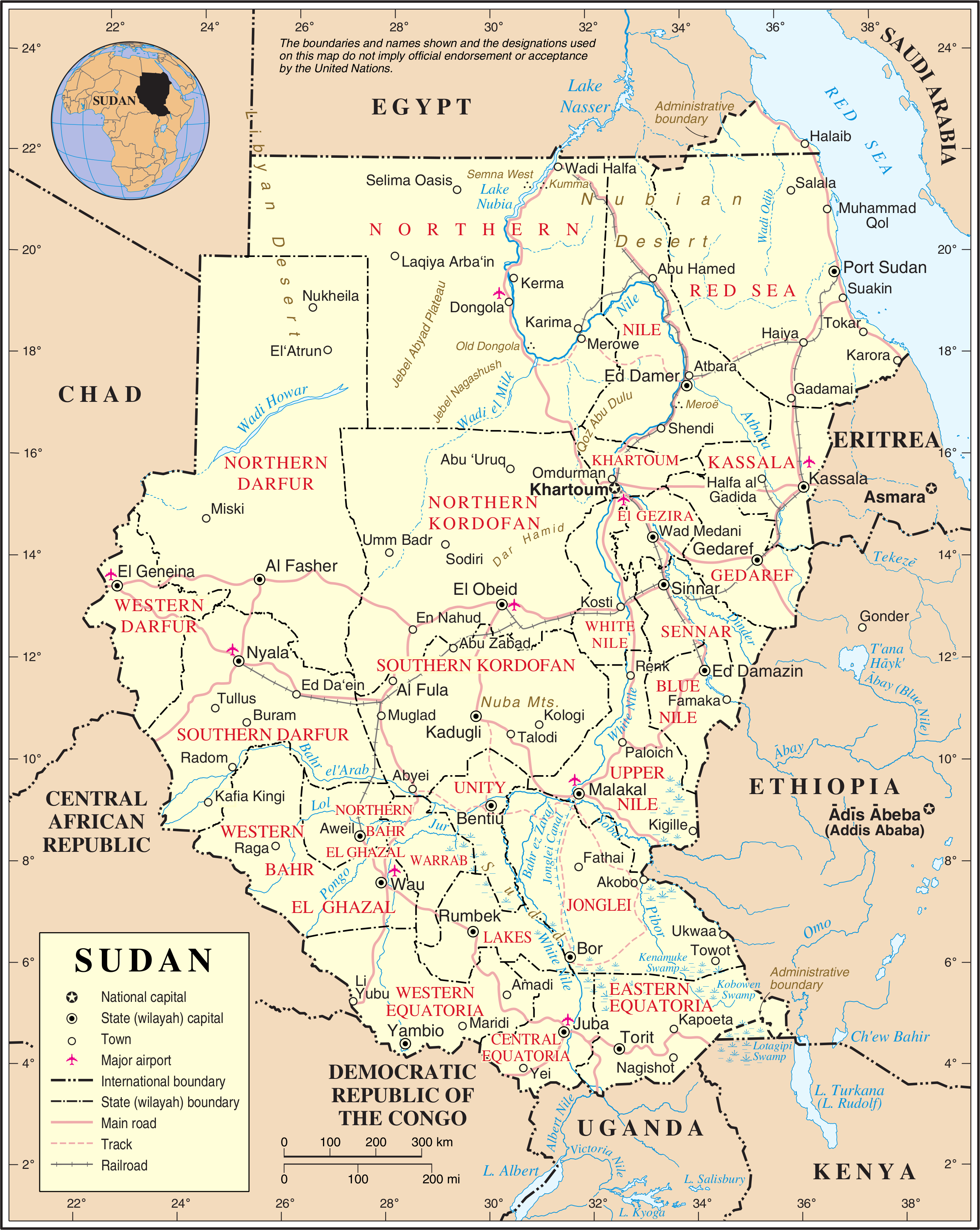
Selima Oasis is an oasis in the Sudan located west of the Third Cataract of the Nile and the ancient site of Amara West. It lies along the Darb al-Arbaʿīn (Forty Days' Road), a desert track linking Kordofan with Egypt. Just to the north of Selima, the track splits into a northern route going to Kharga Oasis and a northwestern route going to Dunqul Oasis.Richard Lobban, ''Historical Dictionary of Ancient and Medieval Nubia'' (Scarecrow Press, 2004), p. 347. Geography Selima lies at the base of an escarpment of Jurassic and Cretaceous rock. Around 8300 BC, a freshwater lake formed over the site with depths of . The surrounding vegetation was savannah at the time. The remains of lacustrine fauna and of Palaeolithic artefacts have been recovered from the site. Around 4300, it transitioned to a saltwater ''sabkha'' and by 2700 it had dried up. Today it lies over the Nubian Sandstone Aquifer System.Friederike Jesse, Coralie Gradel and Franck Derrien"Archaeology at Selima Oasis, Nor ... [...More Info...] [...Related Items...] OR: [Wikipedia] [Google] [Baidu] |
Asyut
AsyutAlso spelled ''Assiout'' or ''Assiut'' ( ar, أسيوط ' , from ' ) is the capital of the modern Asyut Governorate in Egypt. It was built close to the ancient city of the same name, which is situated nearby. The modern city is located at , while the ancient city is located at . The city is home to one of the largest Coptic Catholic churches in the country. History Names and etymology The name of the city is derived from early Egyptian Zawty (''Z3JW.TJ'') (late Egyptian, Səyáwt) adopted into the Coptic as Syowt , which means "''Guardian''" of the northern approach of Upper Egypt. In Graeco-Roman Egypt, it was called Lycopolis or Lykopolis ( el, Λυκόπολις, ""), ('wolf city') Lycon, or Lyco. Ancient Asyut Ancient Asyut was the capital of the Thirteenth Nome of Upper Egypt (''Lycopolites Nome'') around 3100 BC. It was located on the western bank of the Nile. The two most prominent gods of ancient Egyptian Asyut were Anubis and Wepwawet, both funerary deit ... [...More Info...] [...Related Items...] OR: [Wikipedia] [Google] [Baidu] |
Al-Fashir
Al Fashir, Al-Fashir or El Fasher ( ar, الفاشر) is the capital city of North Darfur, Sudan. It is a large town in the Darfur region of northwestern Sudan, northeast of Nyala, Sudan. "Al-Fashir" (description) ''Encyclopædia Britannica'', 2007, webpage: A historical caravan post, Al-Fashir is located at an elevation of about . The town serves as an agricultural marketing point for the cereals and fruits grown in the surrounding region. Al-Fashir is linked by road with both Geneina and Umm Keddada. Al-Fashir had 264,734 residents , an increase from 2001, when the population was estimated to be 178,500. Al Fashir University was created in 1990 by decree of President Omar Hassan Ahmed Bashir, and was officially opened in February 1991 in premises west of El Fasher Airport and south of the El Fashir School. History Late in the 18th century, Sultan 'Abd al-Rahman al-Rashed of the Darfur Sultanate moved his itinerant court (''fashir'') to a site called Rahad Tend ... [...More Info...] [...Related Items...] OR: [Wikipedia] [Google] [Baidu] |
The Sudan
Sudan ( or ; ar, السودان, as-Sūdān, officially the Republic of the Sudan ( ar, جمهورية السودان, link=no, Jumhūriyyat as-Sūdān), is a country in Northeast Africa. It shares borders with the Central African Republic to the southwest, Chad to the west, Egypt to the north, Eritrea to the northeast, Ethiopia to the southeast, Libya to the northwest, South Sudan to the south and the Red Sea. It has a population of 45.70 million people as of 2022 and occupies 1,886,068 square kilometres (728,215 square miles), making it Africa's third-largest country by area, and the third-largest by area in the Arab League. It was the largest country by area in Africa and the Arab League until the secession of South Sudan in 2011, since which both titles have been held by Algeria. Its capital is Khartoum and its most populated city is Omdurman (part of the metropolitan area of Khartoum). Sudan's history goes back to the Pharaonic period, witnessing the Kingdom of Kerma ... [...More Info...] [...Related Items...] OR: [Wikipedia] [Google] [Baidu] |
Middle Egypt
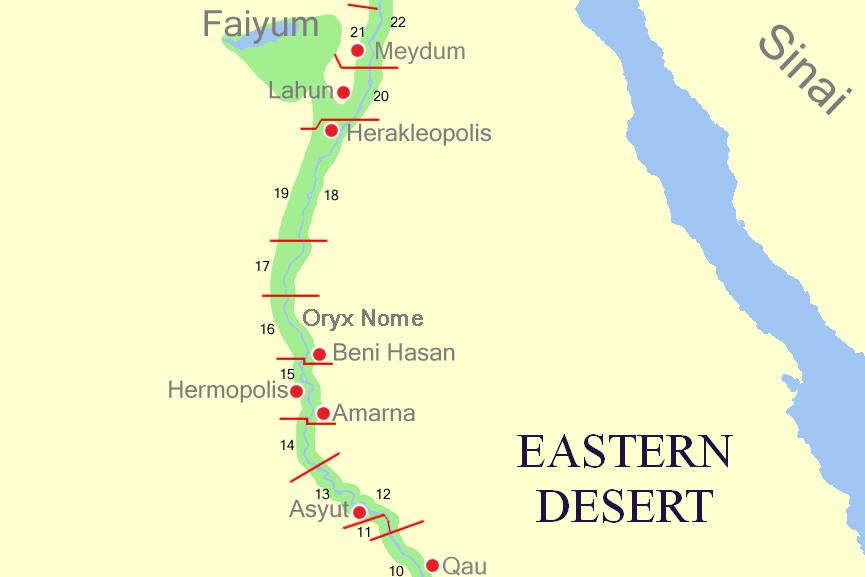
Middle Egypt () is the section of land between Lower Egypt (the Nile Delta) and Upper Egypt, stretching upstream from Asyut in the south to Memphis in the north. At the time, Ancient Egypt was divided into Lower and Upper Egypt, though Middle Egypt was technically a subdivision of Upper Egypt. It was not until the 19th century that archaeologists felt the need to divide Upper Egypt in two. As a result, they coined the term "Middle Egypt" for the stretch of river between Cairo and the Qena Bend. It was also associated with a region termed "Heptanomis" (; Greek: , in Ptol. iv. 5. § 55; more properly or , in Dionysius Periegetes 251; and sometimes ; meaning "Seven Nomes", a " nome" being a subdivision of ancient Egypt), generally as the district which separates the Thebaïd from the Delta. Middle Egypt today can be identified as the part of the Nile Valley that, while geographically part of Upper Egypt, is culturally closer to Lower Egypt. For instance, in terms of language, the ... [...More Info...] [...Related Items...] OR: [Wikipedia] [Google] [Baidu] |
Darb El Arba'īn
Darb El Arba'īn ( ar, درب الاربعين) (also called the Forty Days Road, for the number of days the journey was said to take in antiquity) is the easternmost of the great north-south Trans-Saharan trade routes. The Darb El Arba'īn route was used to move trade goods, livestock (camels, donkeys, cattle, horses) and slaves via a chain of oases from the interior of Africa to portage on the Nile River and thence to the rest of the world. The journey from what is now North Darfur, Sudan to what is now Asyut Governorate, Egypt is approximately and usually took closer to 60 days due to the need to rest and water the herd. Traveling by the desert route was more direct, less expensive and safer than the Nile route. The desert between the Yellow Nile riverbed in north Sudan and the limestone plateau of Middle Egypt receives average annual precipitation of less than 5 mm a year “and a frequency of 30 to 40 years between significant rainfall events, eaningit is very l ... [...More Info...] [...Related Items...] OR: [Wikipedia] [Google] [Baidu] |
Trade Route
A trade route is a logistical network identified as a series of pathways and stoppages used for the commercial transport of cargo. The term can also be used to refer to trade over bodies of water. Allowing goods to reach distant markets, a single trade route contains long-distance arteries, which may further be connected to smaller networks of commercial and noncommercial transportation routes. Among notable trade routes was the Amber Road, which served as a dependable network for long-distance trade. Maritime trade along the Spice Route became prominent during the Middle Ages, when nations resorted to military means for control of this influential route. During the Middle Ages, organizations such as the Hanseatic League, aimed at protecting interests of the merchants and trade became increasingly prominent. In modern times, commercial activity shifted from the major trade routes of the Old World to newer routes between modern nation-states. This activity was sometimes carried ... [...More Info...] [...Related Items...] OR: [Wikipedia] [Google] [Baidu] |
AMS - Series P502 - North Africa - NG-36-09 Al Kharijah
AMS or Ams may refer to: Organizations Companies * Alenia Marconi Systems * American Management Systems * AMS (Advanced Music Systems) * ams AG, semiconductor manufacturer * AMS Pictures * Auxiliary Medical Services Educational institutions * Arthur Morgan School, North Carolina, US * Hanoi – Amsterdam High School, Hanoi, Vietnam * Army Medical School, US * Academy of Military Science (People's Republic of China) * Academy of Military Science (United States) * Association of Muslim Schools, global * Antwerp Management School Government agencies * Agricultural Marketing Service, US * Army Map Service, US, later National Geospatial-Intelligence Agency * Army Medical Services, UK Societies and associations * Alma Mater Society of Queen's University, student society, Canada * Alma Mater Society of the University of British Columbia, student society, Canada * American Mathematical Society * American Meteor Society * American Meteorological Society * American Montessori So ... [...More Info...] [...Related Items...] OR: [Wikipedia] [Google] [Baidu] |
National Oceanic And Atmospheric Administration
The National Oceanic and Atmospheric Administration (abbreviated as NOAA ) is an United States scientific and regulatory agency within the United States Department of Commerce that forecasts weather, monitors oceanic and atmospheric conditions, charts the seas, conducts deep sea exploration, and manages fishing and protection of marine mammals and endangered species in the U.S. exclusive economic zone. Purpose and function NOAA's specific roles include: * ''Supplying Environmental Information Products''. NOAA supplies to its customers and partners information pertaining to the state of the oceans and the atmosphere, such as weather warnings and forecasts via the National Weather Service. NOAA's information services extend as well to climate, ecosystems, and commerce. * ''Providing Environmental Stewardship Services''. NOAA is a steward of U.S. coastal and marine environments. In coordination with federal, state, local, tribal and international authorities, NOAA manages the ... [...More Info...] [...Related Items...] OR: [Wikipedia] [Google] [Baidu] |
Hot Desert Climate
The desert climate or arid climate (in the Köppen climate classification ''BWh'' and ''BWk''), is a dry climate sub-type in which there is a severe excess of evaporation over precipitation. The typically bald, rocky, or sandy surfaces in desert climates are dry and hold little moisture, quickly evaporating the already little rainfall they receive. Covering 14.2% of earth's land area, hot deserts are the second most common type of climate on earth after the polar climate. There are two variations of a desert climate according to the Köppen climate classification: a hot desert climate (''BWh''), and a cold desert climate (''BWk''). To delineate "hot desert climates" from "cold desert climates", there are three widely used isotherms: most commonly a mean annual temperature of , or sometimes the coldest month's mean temperature of , so that a location with a ''BW'' type climate with the appropriate temperature above whichever isotherm is being used is classified as "hot arid sub ... [...More Info...] [...Related Items...] OR: [Wikipedia] [Google] [Baidu] |


