|
Eccleston, Lancashire
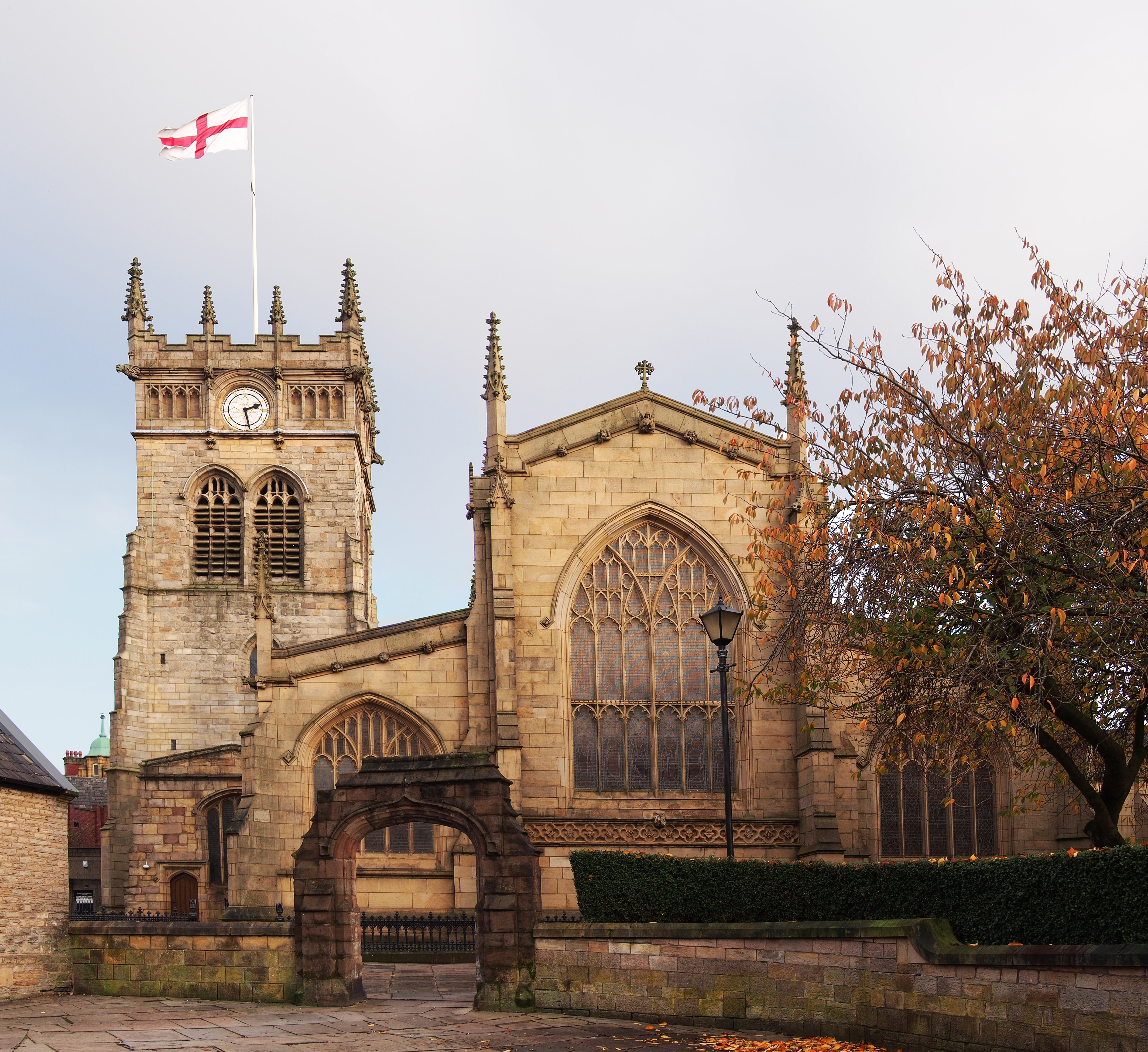
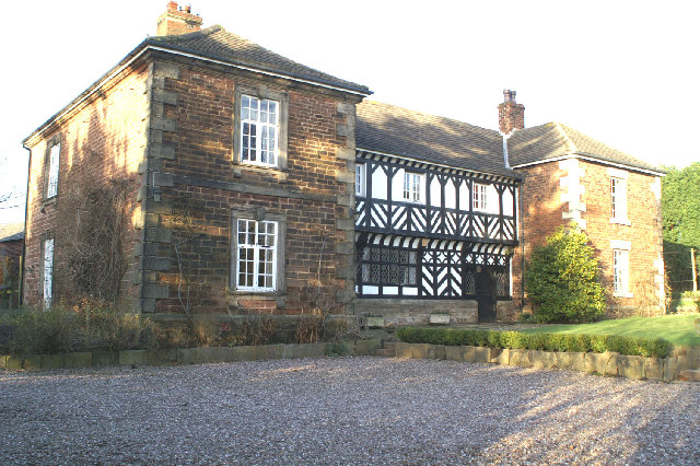
Eccleston is a village and civil parish of the Borough of Chorley in Lancashire, England. It is beside the River Yarrow, and was formerly an agricultural and later a weaving settlement. History Its name came from the Celtic word ''"eglēs"'' meaning a church, and the Old English word ''"tūn"'' meaning a farmstead or settlement, i.e. a settlement by a Romano-British church. Evidence of the settlement dates back hundreds of years; St. Mary's Church dates back to the 14th century AD. The village was mentioned in the Domesday Book of 1086, the book ordered by William the Conqueror, to detail all settlements and farms in England for the purpose of tax collection. Ingrave Farm, located on the northern side of the River Yarrow, is built on a moated site of an earlier building thought to date from the medieval period. The partly waterlogged moat about is wide and deep in places. About to the west is a smaller site about square, the moat of which has since been infilled. It was ... [...More Info...] [...Related Items...] OR: [Wikipedia] [Google] [Baidu] |
United Kingdom Census 2011
A Census in the United Kingdom, census of the population of the United Kingdom is taken every ten years. The 2011 census was held in all countries of the UK on 27 March 2011. It was the first UK census which could be completed online via the Internet. The Office for National Statistics (ONS) is responsible for the census in England and Wales, the General Register Office for Scotland (GROS) is responsible for the census in Scotland, and the Northern Ireland Statistics and Research Agency (NISRA) is responsible for the census in Northern Ireland. The Office for National Statistics is the executive office of the UK Statistics Authority, a non-ministerial department formed in 2008 and which reports directly to Parliament. ONS is the UK Government's single largest statistical producer of independent statistics on the UK's economy and society, used to assist the planning and allocation of resources, policy-making and decision-making. ONS designs, manages and runs the census in England an ... [...More Info...] [...Related Items...] OR: [Wikipedia] [Google] [Baidu] |
Chorley (UK Parliament Constituency)
Chorley is a constituency in Lancashire represented in the House of Commons of the UK Parliament since 1997 by Lindsay Hoyle. Hoyle was originally elected for the Labour Party, but in 2019 became the Speaker, making him unaffiliated. Constituency profile Chorley constituency consists of the majority of the borough of Chorley. As well as the central market town of Chorley itself, the seat extends into southern Lancashire rural hinterland with three major villages and minor villages. Chorley's expansion is assured with the building of Buckshaw Village, an urban development sprawling over the former Royal Ordnance Site east of Leyland in the seat. Boundaries 1885–1918: The Sessional Division of Leyland Hundred, and part of the Sessional Division of Leyland. 1918–1950: The Municipal Borough of Chorley, the Urban Districts of Adlington, Croston, Leyland, and Withnell, the Rural District of Chorley, and in the Rural District of Wigan the civil parishes of Haigh, Parbold, ... [...More Info...] [...Related Items...] OR: [Wikipedia] [Google] [Baidu] |
Ulnes Walton
Ulnes Walton is a village and civil parish of the Borough of Chorley in Lancashire, England. According to the United Kingdom Census 2011 it had a population of 2,672. The village is also the location of two prisons. Garth Prison, holds Category B adult males, while Wymott Prison holds Category C adult males. History Due to variations in spelling over time, the pronunciation of the name of this village has varied. It is known to have been Oves Walton and Oos Walton. There is much of interest in this small township, a part of Chorley Rural District until 1974, situated about south west of Preston between Croston and Leyland, with the ecclesiastical parishes of Croston and St James, Leyland, within its boundaries. In the 13th century the manor of Walton was in the possession of Ulf of Walton, and was part of the barony of Penwortham. Legend has it that the original UIf was a Danish pirate who sailed up the river Douglas, into the river Lostock and settled at Littlewood. Ulf ... [...More Info...] [...Related Items...] OR: [Wikipedia] [Google] [Baidu] |
Euxton Balshaw Lane Railway Station
Euxton Balshaw Lane is one of two railway stations situated in Euxton , Lancashire, England. It is a local station on the West Coast Main Line on the stretch between Wigan and . History The railway line between Wigan and was opened by the North Union Railway (NUR) on 31 October 1838, and among the original stations was one at Euxton, close to the Bay Horse public house on the south side of Euxton Lane. The NUR was split up in 1888, part of it (including Euxton station) becoming wholly owned by the London and North Western Railway (LNWR). Euxton station closed on 2 September 1895 at the behest of the Anderton Family. A new station named ''Balshaw Lane and Euxton'', between and and about south of the original Euxton station, was opened by the LNWR on 2 September 1905. Balshaw Lane & Euxton station was closed by British Rail on 6 October 1969 as part of the Beeching review of the UK railway network. Euxton also had a station at the Royal Ordnance Factory site, ROF Chorley ... [...More Info...] [...Related Items...] OR: [Wikipedia] [Google] [Baidu] |
Croston Railway Station
Croston railway station serves the small village of Croston, near Chorley in Lancashire, England; the station is on the Ormskirk Branch Line south west of . It is unstaffed and the old station buildings are now privately occupied. The station was built & opened by the Liverpool, Ormskirk and Preston Railway (later taken over by the Lancashire and Yorkshire Railway) along with the line in April 1849. "Line" is the suitable word here, as along the way are clear signs of the former double track trunk route from Preston to Liverpool Exchange, which was severely rationalised (including the reduction to single line working) in 1970. The line once carried numerous express trains to Edinburgh, and the Lake District, though Croston was usually served only by local stopping services from Liverpool to Preston and . Trains connect at with Merseyrail services to Liverpool Central. Croston enjoys bus connections to nearby Leyland, Chorley, Southport, and Preston. It is on the B5 ... [...More Info...] [...Related Items...] OR: [Wikipedia] [Google] [Baidu] |
Croston
Croston is a village and civil parish near Chorley in Lancashire, England. The River Yarrow flows through the village. The population of the civil parish taken at the 2011 census was 2,917. History Croston was founded in the 7th century when St Aidan arrived at the riverside settlements. In the absence of a church, a cross was erected as a place of worship. The name is derived from the two Old English words 'cross' and 'tūn' (town/homestead/village) and is unique to the village. The parish of Croston was formerly far larger than it is today. It included Chorley, Much Hoole, Rufford, Bretherton, Mawdesley, Tarleton, Hesketh Bank, Bispham, Walmer Bridge and Ulnes Walton. These became independent parishes as a result of a series of separations between 1642 and 1821. A charter granted by Edward I in 1283 permitted an annual medieval fair and market to be held on the village green. Pre-20th Century maps also depict a castle which is believed to have been of a wooden constructio ... [...More Info...] [...Related Items...] OR: [Wikipedia] [Google] [Baidu] |
Preston, Lancashire
Preston () is a city on the north bank of the River Ribble in Lancashire, England. The city is the administrative centre of the county of Lancashire and the wider City of Preston local government district. Preston and its surrounding district obtained city status in 2002, becoming England's 50th city in the 50th year of Queen Elizabeth II's reign. Preston has a population of 114,300, the City of Preston district 132,000 and the Preston Built-up Area 313,322. The Preston Travel To Work Area, in 2011, had a population of 420,661, compared with 354,000 in the previous census. Preston and its surrounding area have provided evidence of ancient Roman activity, largely in the form of a Roman road that led to a camp at Walton-le-Dale. The Angles established Preston; its name is derived from the Old English meaning "priest's settlement" and in the ''Domesday Book'' is recorded as "Prestune". In the Middle Ages, Preston was a parish and township in the hundred of Amounderness an ... [...More Info...] [...Related Items...] OR: [Wikipedia] [Google] [Baidu] |
Wigan
Wigan ( ) is a large town in Greater Manchester, England, on the River Douglas, Lancashire, River Douglas. The town is midway between the two cities of Manchester, to the south-east, and Liverpool, to the south-west. Bolton lies to the north-east and Warrington to the south. It is the largest settlement in the Metropolitan Borough of Wigan and is its administrative centre. The town has a population of 107,732 and the wider borough of 330,713. Wigan was formerly within the Historic counties of England, historic county of Lancashire. Wigan was in the territory of the Brigantes, an ancient Celtic tribe that ruled much of what is now northern England. The Brigantes were subjugated in the Roman conquest of Britain and the Roman settlement of ''Coccium'' was established where Wigan lies. Wigan was incorporated as a Borough status in the United Kingdom, borough in 1246, following the issue of a charter by Henry III of England, King Henry III of England. At the end of the Middle ... [...More Info...] [...Related Items...] OR: [Wikipedia] [Google] [Baidu] |
Textile Mill
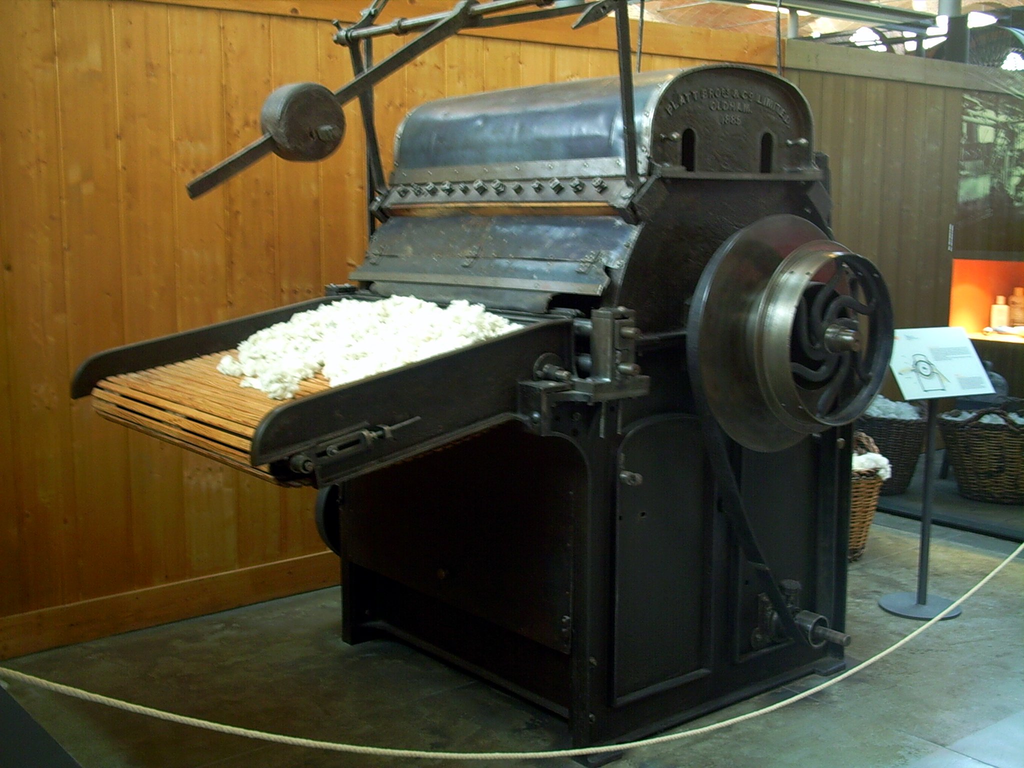
Textile Manufacturing or Textile Engineering is a major industry. It is largely based on the conversion of fibre into yarn, then yarn into fabric. These are then dyed or printed, fabricated into cloth which is then converted into useful goods such as clothing, household items, upholstery and various industrial products. Different types of fibres are used to produce yarn. Cotton remains the most widely used and common natural fiber making up 90% of all-natural fibers used in the textile industry. People often use cotton clothing and accessories because of comfort, not limited to different weathers. There are many variable processes available at the spinning and fabric-forming stages coupled with the complexities of the finishing and colouration processes to the production of a wide range of products. History Textile manufacturing in the modern era is an evolved form of the art and craft industries. Until the 18th and 19th centuries, the textile industry was a household work. ... [...More Info...] [...Related Items...] OR: [Wikipedia] [Google] [Baidu] |
2002 Chorley Borough Council Election
Elections to Chorley Borough Council were held on 2 May 2002. The whole council was up for election with boundary changes since the last election in 2000 reducing the number of seats by one. The council stayed under no overall control. After the election the composition of the council was: Election result Ward results Adlington and Anderton Astley and Buckshaw Brindle and Hoghton Chisnall Chorley East Chorley North East Chorley North West Chorley South East Chorley South West Clayton-le-Woods and Whittle-le-Woods Clayton-le-Woods North Clayton-le-Woods West and Cuerden Coppull Eccleston and Mawdesley Euxton North Euxton South Heath Charnock and Rivington Lostock Pennine Wheelton and Withnell Withnell is a village and civil parish in the Borough of Chorley, Lancashire, ... [...More Info...] [...Related Items...] OR: [Wikipedia] [Google] [Baidu] |
Mawdesley
Mawdesley is a village and civil parish in Lancashire, England, which had a population of 1,702 at the 2011 Census. History The name Mawdesley is thought to have originated in the reign of Edward I (1272–1308). The suffix -''ley'' describes a field, meadow or clearing. Records show that a manor existed in 1250 AD on the site of the present Mawdesley Hall. Mawdesley Hall is a small hall on a back road leading into the village. It was built by William Mawdesley in 1625, but altered towards the end of the 18th century. Transport The village is isolated from public transport services. No main roads pass through the enclave. An infrequent day time bus service runs from the centre of the village to Chorley and Southport. The nearest railway station is three miles away at Rufford. The local roads are minor back lanes, mostly narrow, unlit, lacking pavements, poorly maintained and generally unsuitable for the high volume of large 4x4 commuter vehicles and heavy farm traffic t ... [...More Info...] [...Related Items...] OR: [Wikipedia] [Google] [Baidu] |
2021 Chorley Borough Council Election
Council elections for the Borough of Chorley were held on 6 May 2021 as part of the 2021 United Kingdom local elections. Due to new boundaries for the district, all wards elected three councillors at this election before returning to its normal cycle of electing a third of councillors each year. The result was a hold for the ruling Labour group. Results summary The results of the 2021 elections are summarised below. [...More Info...] [...Related Items...] OR: [Wikipedia] [Google] [Baidu] |


