|
Croston Railway Station
Croston railway station serves the small village of Croston, near Chorley in Lancashire, England; the station is on the Ormskirk Branch Line south west of . It is unstaffed and the old station buildings are now privately occupied. The station was built & opened by the Liverpool, Ormskirk and Preston Railway (later taken over by the Lancashire and Yorkshire Railway) along with the line in April 1849. "Line" is the suitable word here, as along the way are clear signs of the former double track trunk route from Preston to Liverpool Exchange, which was severely rationalised (including the reduction to single line working) in 1970. The line once carried numerous express trains to Edinburgh, and the Lake District, though Croston was usually served only by local stopping services from Liverpool to Preston and . Trains connect at with Merseyrail services to Liverpool Central. Croston enjoys bus connections to nearby Leyland, Chorley, Southport, and Preston. It is on the B5 ... [...More Info...] [...Related Items...] OR: [Wikipedia] [Google] [Baidu] |
Croston
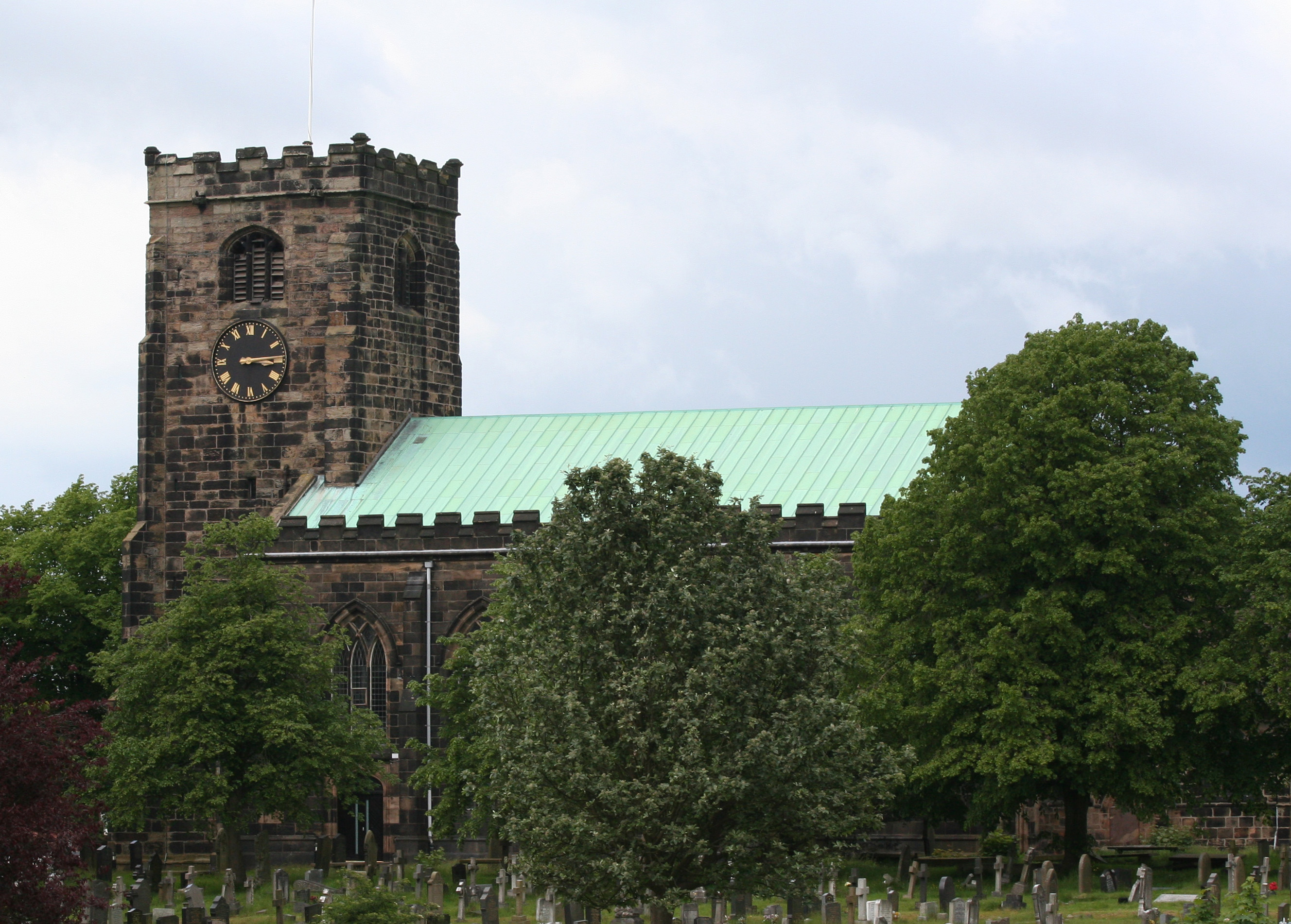
Croston is a village and civil parish near Chorley in Lancashire, England. The River Yarrow flows through the village. The population of the civil parish taken at the 2011 census was 2,917. History Croston was founded in the 7th century when St Aidan arrived at the riverside settlements. In the absence of a church, a cross was erected as a place of worship. The name is derived from the two Old English words 'cross' and 'tūn' (town/homestead/village) and is unique to the village. The parish of Croston was formerly far larger than it is today. It included Chorley, Much Hoole, Rufford, Bretherton, Mawdesley, Tarleton, Hesketh Bank, Bispham, Walmer Bridge and Ulnes Walton. These became independent parishes as a result of a series of separations between 1642 and 1821. A charter granted by Edward I in 1283 permitted an annual medieval fair and market to be held on the village green. Pre-20th Century maps also depict a castle which is believed to have been of a wooden constructio ... [...More Info...] [...Related Items...] OR: [Wikipedia] [Google] [Baidu] |
Edinburgh
Edinburgh ( ; gd, Dùn Èideann ) is the capital city of Scotland and one of its 32 Council areas of Scotland, council areas. Historically part of the county of Midlothian (interchangeably Edinburghshire before 1921), it is located in Lothian on the southern shore of the Firth of Forth. Edinburgh is Scotland's List of towns and cities in Scotland by population, second-most populous city, after Glasgow, and the List of cities in the United Kingdom, seventh-most populous city in the United Kingdom. Recognised as the capital of Scotland since at least the 15th century, Edinburgh is the seat of the Scottish Government, the Scottish Parliament and the Courts of Scotland, highest courts in Scotland. The city's Holyrood Palace, Palace of Holyroodhouse is the official residence of the Monarchy of the United Kingdom, British monarchy in Scotland. The city has long been a centre of education, particularly in the fields of medicine, Scots law, Scottish law, literature, philosophy, the sc ... [...More Info...] [...Related Items...] OR: [Wikipedia] [Google] [Baidu] |
Northern Franchise Railway Stations
Northern may refer to the following: Geography * North, a point in direction * Northern Europe, the northern part or region of Europe * Northern Highland, a region of Wisconsin, United States * Northern Province, Sri Lanka * Northern Range, a range of hills in Trinidad Schools * Northern Collegiate Institute and Vocational School (NCIVS), a school in Sarnia, Canada * Northern Secondary School, Toronto, Canada * Northern Secondary School (Sturgeon Falls), Ontario, Canada * Northern University (other), various institutions * Northern Guilford High School, a public high school in Greensboro, North Carolina Companies * Arriva Rail North, a former train operating company in northern England * Northern Bank, commercial bank in Northern Ireland * Northern Foods, based in Leeds, England * Northern Pictures, an Australian-based television production company * Northern Rail, a former train operating company in northern England * Northern Railway of Canada, a defunct railway in ... [...More Info...] [...Related Items...] OR: [Wikipedia] [Google] [Baidu] |
Former Lancashire And Yorkshire Railway Stations
A former is an object, such as a template, gauge or cutting die, which is used to form something such as a boat's hull. Typically, a former gives shape to a structure that may have complex curvature. A former may become an integral part of the finished structure, as in an aircraft fuselage, or it may be removable, being using in the construction process and then discarded or re-used. Aircraft formers Formers are used in the construction of aircraft fuselage, of which a typical fuselage has a series from the nose to the empennage, typically perpendicular to the longitudinal axis of the aircraft. The primary purpose of formers is to establish the shape of the fuselage and reduce the column length of stringers to prevent instability. Formers are typically attached to longerons, which support the skin of the aircraft. The "former-and-longeron" technique (also called stations and stringers) was adopted from boat construction, and was typical of light aircraft built until the ... [...More Info...] [...Related Items...] OR: [Wikipedia] [Google] [Baidu] |
DfT Category F2 Stations
The Department for Transport (DfT) is a department of His Majesty's Government responsible for the English transport network and a limited number of transport matters in Scotland, Wales and Northern Ireland that have not been devolved. The department is run by the Secretary of State for Transport, currently (since 25 October 2022) Mark Harper. The expenditure, administration and policy of the Department for Transport are scrutinised by the Transport Committee. History The Ministry of Transport was established by the Ministry of Transport Act 1919 which provided for the transfer to the new ministry of powers and duties of any government department in respect of railways, light railways, tramways, canals and inland waterways, roads, bridges and ferries, and vehicles and traffic thereon, harbours, docks and piers. In September 1919, all the powers of the Road Board, the Ministry of Health, and the Board of Trade in respect of transport, were transferred to the new ministry. ... [...More Info...] [...Related Items...] OR: [Wikipedia] [Google] [Baidu] |
Railway Stations In Chorley
Rail transport (also known as train transport) is a means of transport that transfers passengers and goods on wheeled vehicles running on rails, which are incorporated in tracks. In contrast to road transport, where the vehicles run on a prepared flat surface, rail vehicles (rolling stock) are directionally guided by the tracks on which they run. Tracks usually consist of steel rails, installed on sleepers (ties) set in ballast, on which the rolling stock, usually fitted with metal wheels, moves. Other variations are also possible, such as "slab track", in which the rails are fastened to a concrete foundation resting on a prepared subsurface. Rolling stock in a rail transport system generally encounters lower frictional resistance than rubber-tyred road vehicles, so passenger and freight cars (carriages and wagons) can be coupled into longer trains. The operation is carried out by a railway company, providing transport between train stations or freight customer facili ... [...More Info...] [...Related Items...] OR: [Wikipedia] [Google] [Baidu] |
Rufford Railway Station
Rufford railway station, opened on 2 April 1849, serves the village of Rufford in Lancashire, England. The station is (9½ miles) south west of Preston on the Preston-Ormskirk branch service. The line was formerly the Liverpool, Ormskirk and Preston Railway, which was quickly merged into the East Lancashire Railway on 3 August 1846; this in turn was merged into the Lancashire and Yorkshire Railway in May 1859. The level crossing runs across the B5246, the aptly named "Station Road". This is supervised from the nearby signal box, which also controls the only passing loop on the otherwise single track branch line. History Direct trains to Liverpool via Ormskirk (and also to and East Lancashire) were withdrawn from Rufford station in October 1969, though Liverpool trains continued to run through non-stop until May of the following year. From July 1970, Rufford became the only passing point on the truncated Preston-Ormskirk branch line after the Midge Hall to Ormskirk sec ... [...More Info...] [...Related Items...] OR: [Wikipedia] [Google] [Baidu] |
Bretherton
Bretherton is a small village and civil parish in the Borough of Chorley, Lancashire, England, situated to the south west of Leyland and east of Tarleton. The population of the civil parish at the 2011 census was 669. Its name suggests pre-conquest origins and its early history was closely involved with the manor house Bank Hall and the families who lived there. Bretherton remained a rural community and today is largely residential with residents commuting to nearby towns. History Toponymy Bretherton derives from either the Old English ''brothor'' and ''tun'' or Norse ''brothir'' and means "farmstead of the brothers". It was first recorded in documents in 1190. Bretherton has been variously recorded as Bretherton in 1242, Brotherton occurs in 1292, Bertherton in 1292 and Thorp was mentioned in 1212. Manor Bretherton, was part of the Penwortham fee and assessed as two plough-lands. It was given by the Bussels to Richard le Boteler of Amounderness, who made grants to Cockersand ... [...More Info...] [...Related Items...] OR: [Wikipedia] [Google] [Baidu] |
B5247 Road
B roads are numbered routes in Great Britain of lesser importance than A roads. See the article Great Britain road numbering scheme The Great Britain road numbering scheme is a numbering scheme used to classify and identify all roads in Great Britain. Each road is given a single letter (which represents the road's category) and a subsequent number (between 1 and 4 digits). ... for the rationale behind the numbers allocated. Zone 5 (3 digits) Zone 5 (4 digits) References {{DEFAULTSORT:B Roads In Zone 5 Of The Great Britain Numbering Scheme 5 5 ... [...More Info...] [...Related Items...] OR: [Wikipedia] [Google] [Baidu] |
Preston Railway Station
Preston railway station in Preston, Lancashire, England, is an interchange railway station on the West Coast Main Line, half-way between London Euston and Glasgow Central (206 miles from London Euston, 194 miles from Glasgow Central). It is served by Avanti West Coast, Northern Trains and TransPennine Express services, plus Caledonian Sleeper overnight services between London and Scotland. It is also served by the Calder Valley line to and , and by branch lines to Blackpool, Ormskirk, and Colne. The North Union Railway opened a station on the site in 1838. It was extended in 1850, with new platforms under the separate management of the East Lancashire Railway, and by 1863 London–Scotland trains stopped here to allow passengers to eat in the station dining room. The current station was built in 1880 and extended in 1903 and 1913, when it had fifteen platforms. A free buffet for servicemen was provided during both World Wars. The East Lancashire platforms were demolished ... [...More Info...] [...Related Items...] OR: [Wikipedia] [Google] [Baidu] |
Southport
Southport is a seaside town in the Metropolitan Borough of Sefton in Merseyside, England. At the 2001 census, it had a population of 90,336, making it the eleventh most populous settlement in North West England. Southport lies on the Irish Sea coast and is fringed to the north by the Ribble estuary. The town is north of Liverpool and southwest of Preston. Within the boundaries of the historic county of Lancashire, the town was founded in 1792 when William Sutton, an innkeeper from Churchtown, built a bathing house at what is now the south end of Lord Street.''North Meols and Southport – a History'', Chapter 9, Peter Aughton (1988) At that time, the area, known as South Hawes, was sparsely populated and dominated by sand dunes. At the turn of the 19th century, the area became popular with tourists due to the easy access from the nearby Leeds and Liverpool Canal. The rapid growth of Southport largely coincided with the Industrial Revolution and the Victorian er ... [...More Info...] [...Related Items...] OR: [Wikipedia] [Google] [Baidu] |
Leyland, Lancashire
Leyland () is a town in South Ribble, Lancashire, England, six miles (10 km) south of Preston. The population was 35,578 at the 2011 Census. The name of the town is Anglo-Saxon, meaning "untilled land". History English Leyland was an area of fields, with Roman roads passing through, from ancient Wigan to Walton-le-Dale. It was left undisturbed for many centuries until rediscovered shortly after the Battle of Hastings (1066). Leyland is mentioned in the Domesday Book (1085). In 1066, King Edward the Confessor presided over the whole of Leyland. The manor was divided into three large ploughlands, which were controlled by local noblemen. In the 12th century, it came under the barony of Penwortham. The area of Worden, which is now Worden Park, was one of nine oxgangs of land granted to the Knights Hospitaller, by Roger de Lacy, in Lancashire, but the land was not assigned to any individual and a local man, who was a very close friend of de Lacy, Hugh Bussel, was assigned ... [...More Info...] [...Related Items...] OR: [Wikipedia] [Google] [Baidu] |


