|
East Markham
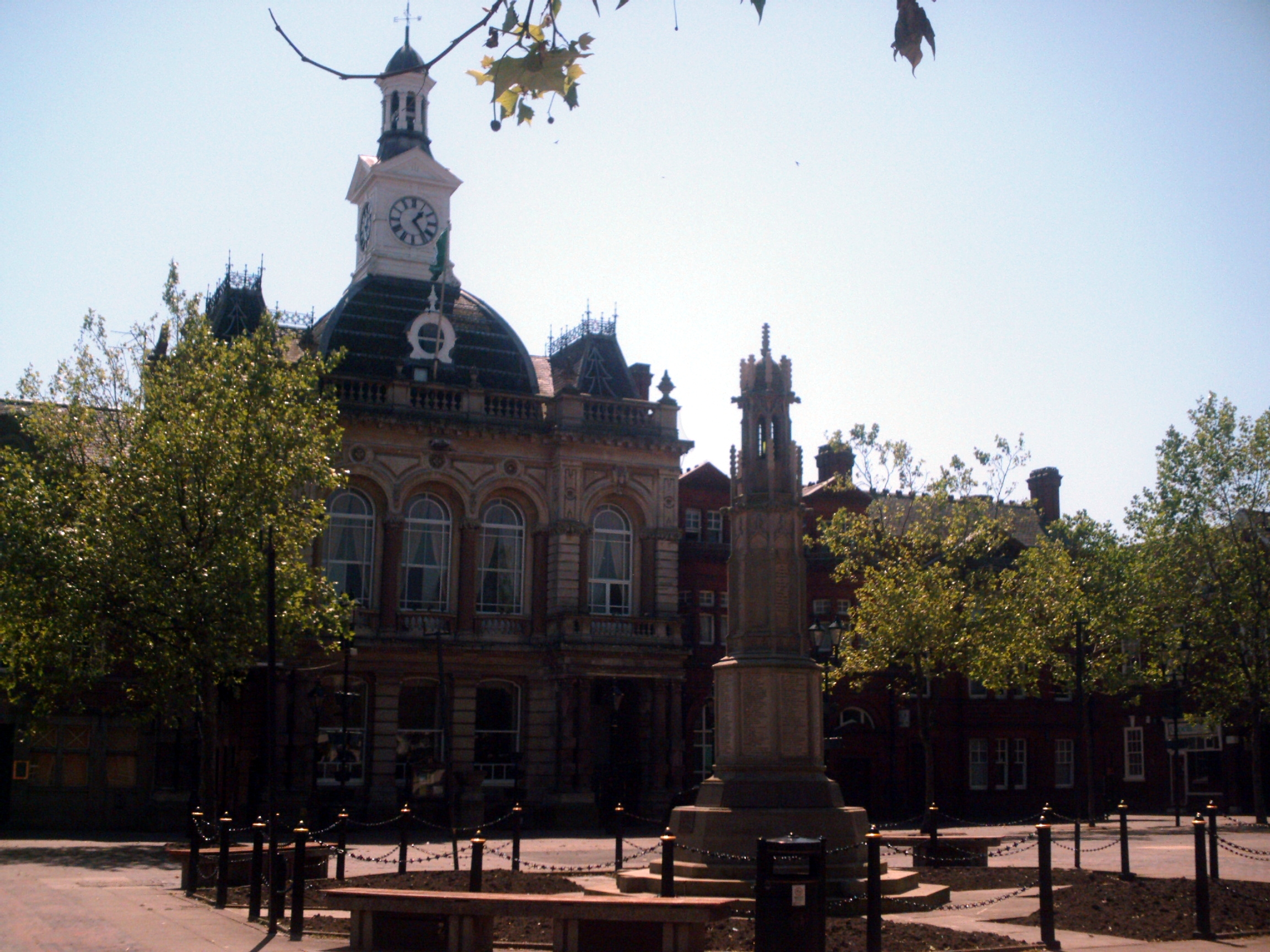
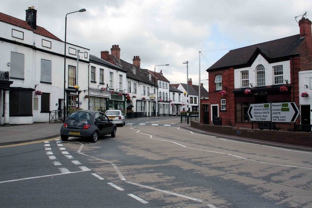
East Markham, historically also known as Great Markham, is a small village and civil parish near Tuxford, Nottinghamshire. The population of the civil parish taken at the 2011 Census was 1,160. It lies about 8 km south of Retford. It is sandwiched between the East Coast Main Line (to the east), the A1 to the west and A57 to the north. It has a sister village, West Markham, which is smaller and on the other side of the road (old A1-B1164) between Tuxford and Markham Moor. To the south is Tuxford Tuxford is a historic market town and a civil parish in the Bassetlaw district of Nottinghamshire, England. At the 2001 census, it had a population of 2,516, increasing to 2,649 at the 2011 census. Geography Nearby towns are Ollerton, Ret .... East Markham has a Church of St. John the Baptist village hall, a charity playgroup and a primary school. The Post Office closed in 1994 and after the village shop closed it re-opened with new owners in 2019. There is one remainin ... [...More Info...] [...Related Items...] OR: [Wikipedia] [Google] [Baidu] |
Bassetlaw District
Bassetlaw is a local government district in Nottinghamshire, England. The district has four towns: Worksop, Tuxford, Harworth Bircotes and Retford. It is bounded to the north by the Metropolitan Boroughs of Doncaster and Rotherham, the east by West Lindsey, the west by both the Borough of Chesterfield and North East Derbyshire and the south by Mansfield District and Newark and Sherwood. The district is along with Bolsover District, North East Derbyshire and Borough of Chesterfield is a non-constituent member of the Sheffield City Region. History Bassetlaw was created as a non-metropolitan district in 1974 by the merger of the municipal boroughs of Worksop and East Retford and most of Worksop Rural District and East Retford Rural District following the passage of the Local Government Act 1972. Local Government in Nottinghamshire is organised on a two-tier basis, with local district councils such as Bassetlaw District Council responsible for local services such as housin ... [...More Info...] [...Related Items...] OR: [Wikipedia] [Google] [Baidu] |
Nottinghamshire
Nottinghamshire (; abbreviated Notts.) is a landlocked county in the East Midlands region of England, bordering South Yorkshire to the north-west, Lincolnshire to the east, Leicestershire to the south, and Derbyshire to the west. The traditional county town is Nottingham, though the county council is based at County Hall in West Bridgford in the borough of Rushcliffe, at a site facing Nottingham over the River Trent. The districts of Nottinghamshire are Ashfield, Bassetlaw, Broxtowe, Gedling, Mansfield, Newark and Sherwood, and Rushcliffe. The City of Nottingham was administratively part of Nottinghamshire between 1974 and 1998, but is now a unitary authority, remaining part of Nottinghamshire for ceremonial purposes. The county saw a minor change in its coverage as Finningley was moved from the county into South Yorkshire and is part of the City of Doncaster. This is also where the now-closed Doncaster Sheffield Airport is located (formerly Robin Hood Airport). In 20 ... [...More Info...] [...Related Items...] OR: [Wikipedia] [Google] [Baidu] |
Newark (UK Parliament Constituency)
Newark is a constituency in Nottinghamshire, England. It is currently represented by Robert Jenrick of the Conservative Party who won the seat in a by-election on 5 June 2014, following the resignation of Patrick Mercer in April 2014. Boundaries 1918–1950: The Municipal Borough of Newark, and the Rural Districts of Bingham, Newark, and Southwell. 1950–1983: The Municipal Borough of Newark, the Urban District of Mansfield Woodhouse, and the Rural Districts of Newark and Southwell. 1983–2010: The District of Newark wards of Beacon, Bridge, Bullpit Pinfold, Castle, Caunton, Collingham, Devon, Elston, Farndon, Magnus, Meering, Milton Lowfield, Muskham, Southwell East, Southwell West, Sutton on Trent, Trent, and Winthorpe, and the District of Bassetlaw wards of East Markham, East Retford East, East Retford North, East Retford West, Elkesley, Trent, and Tuxford. 2010–present: The District of Newark and Sherwood wards of Balderton North, Balderton West, Beacon, Bridge, Ca ... [...More Info...] [...Related Items...] OR: [Wikipedia] [Google] [Baidu] |
Civil Parish
In England, a civil parish is a type of administrative parish used for local government. It is a territorial designation which is the lowest tier of local government below districts and counties, or their combined form, the unitary authority. Civil parishes can trace their origin to the ancient system of ecclesiastical parishes, which historically played a role in both secular and religious administration. Civil and religious parishes were formally differentiated in the 19th century and are now entirely separate. Civil parishes in their modern form came into being through the Local Government Act 1894, which established elected parish councils to take on the secular functions of the parish vestry. A civil parish can range in size from a sparsely populated rural area with fewer than a hundred inhabitants, to a large town with a population in the tens of thousands. This scope is similar to that of municipalities in Continental Europe, such as the communes of France. However, ... [...More Info...] [...Related Items...] OR: [Wikipedia] [Google] [Baidu] |
Tuxford
Tuxford is a historic market town and a civil parish in the Bassetlaw District, Bassetlaw district of Nottinghamshire, England. At the 2001 census, it had a population of 2,516, increasing to 2,649 at the 2011 census. Geography Nearby towns are Ollerton, Nottinghamshire, Ollerton, Retford, Worksop, Mansfield and Newark-on-Trent. The nearest cities are Lincoln, England, Lincoln and Nottingham. The town is located near the border with Lincolnshire in The Dukeries. The A6075 passes through east–west and connects the A57 road, A57 to Ollerton and Mansfield. The East Coast Main Line passes close to the east. The A611 previously went east–west through the town; this is now the A6075; the A611 now goes from Mansfield to Hucknall. The Great North Road (United Kingdom), Great North Road runs through the town (now B1164), though the majority of traffic now uses the modern A1 road (Great Britain), A1 trunk road, which splits the town in two. The town was bypassed in 1967. The se ... [...More Info...] [...Related Items...] OR: [Wikipedia] [Google] [Baidu] |
Retford
Retford (), also known as East Retford, is a market town in the Bassetlaw District in Nottinghamshire, England, and one of the oldest English market towns having been granted its first charter in 1105. It lies on the River Idle and the Chesterfield Canal passes through its centre. Retford is east of Sheffield, west of Lincoln, Lincolnshire, Lincoln and north-east of Nottingham. The population at the 2011 census was 22,013. In 1878 an Act of Parliament extended the borough of East Retford to include the village of Ordsall, Nottinghamshire, Ordsall, West Retford and part of the parish of Clarborough. It is administered by Bassetlaw District Council, which itself is now a non-constituent partner member of the Sheffield City Region Combined Authority. In addition to being an ancient market town and infamous Rotten Borough, Retford is known as being at the centre of Nonconformism, with the origins of the Pilgrims, Baptists and Wesleys being in this area. History Origins of the n ... [...More Info...] [...Related Items...] OR: [Wikipedia] [Google] [Baidu] |
East Coast Main Line
The East Coast Main Line (ECML) is a electrified railway between London and Edinburgh via Peterborough, Doncaster, York, Darlington, Durham and Newcastle. The line is a key transport artery on the eastern side of Great Britain running broadly parallel to the A1 road. The line was built during the 1840s by three railway companies, the North British Railway, the North Eastern Railway, and the Great Northern Railway. In 1923, the Railway Act of 1921 led to their amalgamation to form the London and North Eastern Railway (LNER) and the line became its primary route. The LNER competed with the London, Midland and Scottish Railway (LMS) for long-distance passenger traffic between London and Scotland. The LNER's chief engineer Sir Nigel Gresley designed iconic Pacific steam locomotives, including '' Flying Scotsman'' and '' Mallard'' which achieved a world record speed for a steam locomotive, on the Grantham-to-Peterborough section. In 1948, the railways were nationalise ... [...More Info...] [...Related Items...] OR: [Wikipedia] [Google] [Baidu] |
A1 Road (Great Britain)
The A1 is the longest numbered road in the UK, at . It connects Greater London, London, the capital of England, with Edinburgh, the capital of Scotland. It passes through or near North London, Hatfield, Hertfordshire, Hatfield, Welwyn Garden City, Stevenage, Baldock, Letchworth, Letchworth Garden City, Biggleswade, St Neots, Huntingdon, Peterborough, Stamford, Lincolnshire, Stamford, Grantham, Newark-on-Trent, Retford, Doncaster, York, Pontefract, Wetherby, Ripon, Darlington, Durham, England, Durham, Sunderland, Tyne and Wear, Sunderland, Gateshead, Newcastle upon Tyne, Morpeth, Northumberland, Morpeth, Alnwick and Berwick-upon-Tweed. It was designated by the Department for Transport, Ministry of Transport in 1921, and for much of its route it followed various branches of the historic Great North Road (Great Britain), Great North Road, the main deviation being between Boroughbridge and Darlington. The course of the A1 has changed where towns or villages have been bypass (road), ... [...More Info...] [...Related Items...] OR: [Wikipedia] [Google] [Baidu] |
A57 Road
The A57 is a major road in England. It runs east from Liverpool to Lincoln, England, Lincoln via Warrington, Cadishead, Irlam, Patricroft, Eccles, Greater Manchester, Eccles, Salford, Greater Manchester, Salford and Manchester, then through the Pennines over the Snake Pass (between the high moorlands of Bleaklow and Kinder Scout), around the Ladybower Reservoir, through Sheffield and past Worksop. Between Liverpool and Glossop, the road has largely been superseded by the M62 motorway, M62, M602 motorway, M602 and M67 motorways. Within Manchester a short stretch becomes the Mancunian Way, designated A57(M). Route Liverpool–Warrington The A57 begins at The Strand (A5036) near the River Mersey, as part of Water Street. It forms an east–west route through the north of the city centre with another one-way road system as Tithebarn Street (passing part of Liverpool John Moores University), Great Crosshall Street and Churchill Way in the east direction and Churchill Way and Dale ... [...More Info...] [...Related Items...] OR: [Wikipedia] [Google] [Baidu] |
West Markham
West Markham or Markham Clinton is a village and civil parish north east of Nottingham, in the Bassetlaw district, in the county of Nottinghamshire, England. In 2011 the parish had a population of 170. The parish touches Bevercotes, West Drayton, East Markham, Bothamsall, Walesby and Tuxford. The A1 previously went through the village but its now been bypassed. Features There are 4 listed buildings in West Markham. West Markham has a church called All Saints' Church. History The name "Markham" means 'Boundary homestead/village'. The name "Clinton" comes from the family name of the earls of Lincoln. Markham Clinton was recorded in the Domesday Book as ''Westmarcham''. The medieval village of West Markham is now unoccupied but still has earthworks. On 1 April 1935 a part of Tuxford Tuxford is a historic market town and a civil parish in the Bassetlaw district of Nottinghamshire, England. At the 2001 census, it had a population of 2,516, increasing to 2,649 at the 20 ... [...More Info...] [...Related Items...] OR: [Wikipedia] [Google] [Baidu] |
Markham Moor
Markham Moor is a village which lies five miles south of the town of Retford in Nottinghamshire. The village is in the civil parish of West Drayton. Markham Moor lies on the junction between the A1, A638 and A57 roads. The village was on the route of the old Great North Road and was also traditionally part of the East Markham parish. Markham Moor junction Markham Moor has a junction in the middle of the village which links the A1 between London and Edinburgh, the A638 to Retford and the A57 to Lincoln. Previously, this junction was a simple roundabout, but as part of junction improvements by the Highways Agency between Blyth in Nottinghamshire and Peterborough, the junction changed to the current two level junction, with one roundabout at the north end for the A57 and A638, and another roundabout on the south side for the B1164 Great North Road to Tuxford. Both roundabouts are connected by a flyover. A public inquiry was launched into the improvements in 2006 after a numb ... [...More Info...] [...Related Items...] OR: [Wikipedia] [Google] [Baidu] |
Church Of St
Church may refer to: Religion * Church (building), a building for Christian religious activities * Church (congregation), a local congregation of a Christian denomination * Church service, a formalized period of Christian communal worship * Christian denomination, a Christian organization with distinct doctrine and practice * Christian Church, either the collective body of all Christian believers, or early Christianity Places United Kingdom * Church (Liverpool ward), a Liverpool City Council ward * Church (Reading ward), a Reading Borough Council ward * Church (Sefton ward), a Metropolitan Borough of Sefton ward * Church, Lancashire, England United States * Church, Iowa, an unincorporated community * Church Lake, a lake in Minnesota Arts, entertainment, and media * '' Church magazine'', a pastoral theology magazine published by the National Pastoral Life Center Fictional entities * Church (''Red vs. Blue''), a fictional character in the video web series ''Red vs. Blue'' ... [...More Info...] [...Related Items...] OR: [Wikipedia] [Google] [Baidu] |


