|
Exsul Singularis
''Exsul singularis'', the bat-winged fly, is a species of fly that is endemic to New Zealand, first described by Frederick Hutton in 1901. The males have enormously expanded wings. The species is found in the south-western South Island and occurs mostly in high-altitude meadows near streams. It preys on soft-bodied flying insects and is believed to uses its wings to increase its body temperature to offset the cool temperatures of its alpine habitat. Taxonomy This species was first described by Frederick Hutton in 1901, from a single male specimen collected in Milford Sound by the botanist Arnold Wall. In his paper on the 171 or 172 native flies of New Zealand in the suborder Brachycera, Hutton noted the most remarkable species were ''Exsul singularis'' and '' Cerosomyia usitata''. He considered it to be "clearly belonging to the Anthomyidae", but its exact relationships were unclear for some time; it was eventually placed in the family Muscidae. The female of ''E. singular ... [...More Info...] [...Related Items...] OR: [Wikipedia] [Google] [Baidu] |
Endemism
Endemism is the state of a species being found in a single defined geographic location, such as an island, state, nation, country or other defined zone; organisms that are indigenous to a place are not endemic to it if they are also found elsewhere. For example, the Cape sugarbird is found exclusively in southwestern South Africa and is therefore said to be ''endemic'' to that particular part of the world. An endemic species can be also be referred to as an ''endemism'' or in scientific literature as an ''endemite''. For example '' Cytisus aeolicus'' is an endemite of the Italian flora. '' Adzharia renschi'' was once believed to be an endemite of the Caucasus, but it was later discovered to be a non-indigenous species from South America belonging to a different genus. The extreme opposite of an endemic species is one with a cosmopolitan distribution, having a global or widespread range. A rare alternative term for a species that is endemic is "precinctive", which applies to ... [...More Info...] [...Related Items...] OR: [Wikipedia] [Google] [Baidu] |
Lake Wakatipu
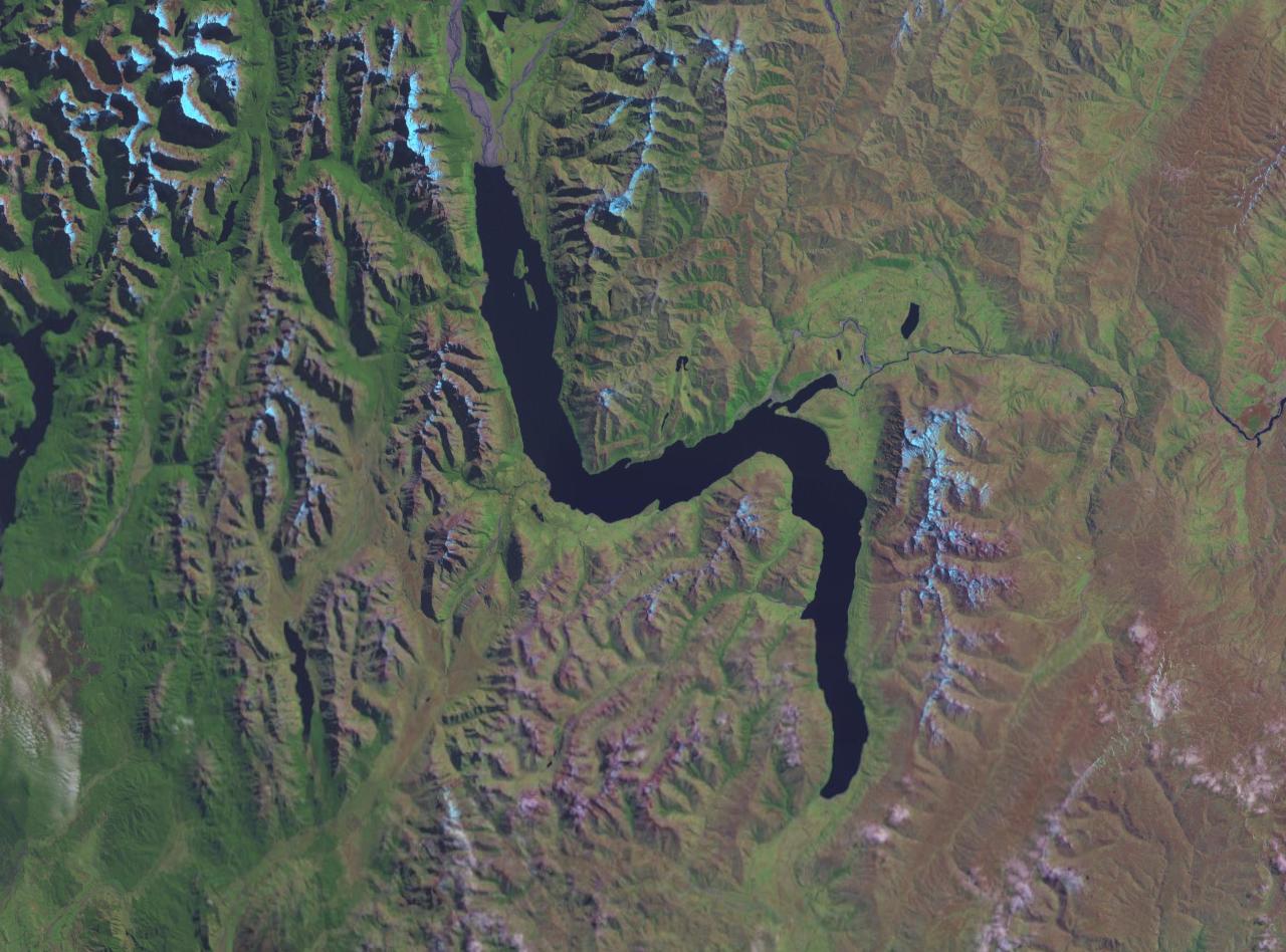
Lake Wakatipu ( mi, Whakatipu Waimāori) is an inland lake (finger lake) in the South Island of New Zealand. It is in the southwest corner of the Otago region, near its boundary with Southland. ''Lake Wakatipu'' comes from the original Māori name . With a length of , it is New Zealand's longest lake, and, at , its third largest. The lake is also very deep, its floor being below sea level, with a maximum depth of . It is at an altitude of , towards the southern end of the Southern Alps / Kā Tiritiri o te Moana. The general topography is a reversed "N" shape or "dog leg". The Dart River / Te Awa Whakatipu flows into the northern end, the lake then runs south for 30 kilometres before turning abruptly to the east. Twenty kilometres (12.4 mi) further along, it turns sharply to the south, reaching its southern end further south, near Kingston. The lake is drained by the Kawarau River, which flows out from the lake's only arm, the Frankton Arm, east of Queenstown. Until ... [...More Info...] [...Related Items...] OR: [Wikipedia] [Google] [Baidu] |
Department Of Conservation (New Zealand)
The Department of Conservation (DOC; Māori: ''Te Papa Atawhai'') is the public service department of New Zealand charged with the conservation of New Zealand's natural and historical heritage. An advisory body, the New Zealand Conservation Authority (NZCA) is provided to advise DOC and its ministers. In addition there are 15 conservation boards for different areas around the country that provide for interaction between DOC and the public. Function Overview The department was formed on 1 April 1987, as one of several reforms of the public service, when the ''Conservation Act 1987'' was passed to integrate some functions of the Department of Lands and Survey, the Forest Service and the Wildlife Service. This act also set out the majority of the department's responsibilities and roles. As a consequence of Conservation Act all Crown land in New Zealand designated for conservation and protection became managed by the Department of Conservation. This is about 30% of New Z ... [...More Info...] [...Related Items...] OR: [Wikipedia] [Google] [Baidu] |
Auckland War Memorial Museum
The Auckland War Memorial Museum Tāmaki Paenga Hira (or simply the Auckland Museum) is one of New Zealand's most important museums and war memorials. Its collections concentrate on New Zealand history (and especially the history of the Auckland Region), natural history, and military history. The present museum building was constructed in the 1920s in the neo-classicist style, and sits on a grassed plinth (the remains of a dormant volcano) in the Auckland Domain, a large public park close to the Auckland CBD. Auckland Museum's collections and exhibits began in 1852. In 1867 Aucklanders formed a learned society – the Auckland Philosophical Society, later the Auckland Institute. Within a few years the society merged with the museum and '' Auckland Institute and Museum'' was the organisation's name until 1996. Auckland War Memorial Museum was the name of the new building opened in 1929, but since 1996 was more commonly used for the institution as well. From 1991 to 2003 the muse ... [...More Info...] [...Related Items...] OR: [Wikipedia] [Google] [Baidu] |
Caddisfly
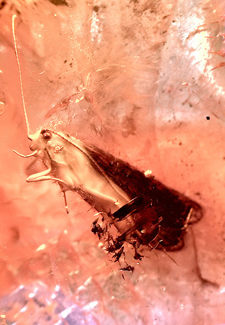
The caddisflies, or order Trichoptera, are a group of insects with aquatic larvae and terrestrial adults. There are approximately 14,500 described species, most of which can be divided into the suborders Integripalpia and Annulipalpia on the basis of the adult mouthparts. Integripalpian larvae construct a portable casing to protect themselves as they move around looking for food, while Annulipalpian larvae make themselves a fixed retreat in which they remain, waiting for food to come to them. The affinities of the small third suborder Spicipalpia are unclear, and molecular analysis suggests it may not be monophyletic. Also called sedge-flies or rail-flies, the adults are small moth-like insects with two pairs of hairy membranous wings. They are closely related to the Lepidoptera (moths and butterflies) which have scales on their wings; the two orders together form the superorder Amphiesmenoptera. The aquatic larvae are found in a wide variety of habitats such as streams, river ... [...More Info...] [...Related Items...] OR: [Wikipedia] [Google] [Baidu] |
Haast, New Zealand
Haast is a small town in the Westland District territorial authority on the West Coast of New Zealand's South Island. The Haast region covers over . The region is named after Julius von Haast, a Prussian-born geologist instrumental in the early geological surveys of New Zealand. The main economic activities in the Haast region are farming, fishing and tourism. Lake Moeraki is to the northeast, and the Haast Pass is to the southeast by road. passes through Haast Junction and just to the east of Haast township. The settlement of Okuru is located on the coast south-west of Haast. The rarest subspecies of kiwi, the Haast tokoeka, is only found in the mountains of the Haast region. History European settlement of the area dates back to the 1870s. The remoteness of the area initially limited access to seagoing vessels, with some rough tracks from the north and east. The present Haast township was originally a New Zealand Ministry of Works road construction camp, which expanded ... [...More Info...] [...Related Items...] OR: [Wikipedia] [Google] [Baidu] |
Mount Aspiring National Park
Mount Aspiring National Park is in the Southern Alps of the South Island of New Zealand, north of Fiordland National Park, situated in Otago and Westland regions. The park forms part of the Te Wahipounamu World Heritage site. Geography Established in 1964 as New Zealand's tenth national park, Mount Aspiring National Park covers at the southern end of the Southern Alps, directly to the west of Lake Wānaka, and is popular for tramping, walking and mountaineering. Mount Aspiring / Tititea, elevation above sea level, gives the park its name. Other prominent peaks within the park include Mount Pollux, elevation , and Mount Brewster, elevation . The Haast Pass, one of the three principal road routes over the Southern Alps, crosses the north-eastern corner of the park. History Landsborough Station added In April 2005 the Nature Heritage Fund purchased private land in the Landsborough River valley as an addition to the park. Milford Sound tunnel proposal In 2006, the Milford Dar ... [...More Info...] [...Related Items...] OR: [Wikipedia] [Google] [Baidu] |
Erebiola Butleri
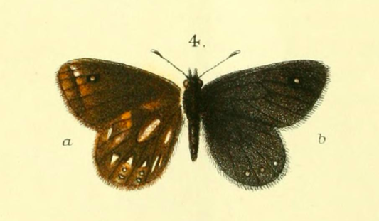
''Erebiola butleri'', or Butler's ringlet, is an elusive New Zealand endemic butterfly, discovered in 1879 by John Enys at the alpine pass at the head of the Rakaia River. It is the only member of the genus ''Erebiola''. ''Erebiola'' is derived from Erebus, the ancient Greek world of darkness between Earth and Hades, while the specific name, ''butleri'', was after Arthur Gardiner Butler of the British Museum who played a major role in early descriptions of New Zealand butterflies. Its Māori name is ''pepe pouri'', which means dark moth, and shares the name with the black mountain ringlet and the forest ringlet butterfly. Description Butler's ringlet has a wingspan of 35–43 mm, with a 40 mm average for males and a 37 mm average for females. Both males and females are smoky brown, though males tend towards the richer browns while the females tend towards the paler browns. The underside of the hindwing has wedge-shaped silvery-white marks. Both the under ... [...More Info...] [...Related Items...] OR: [Wikipedia] [Google] [Baidu] |
McKinnon Pass
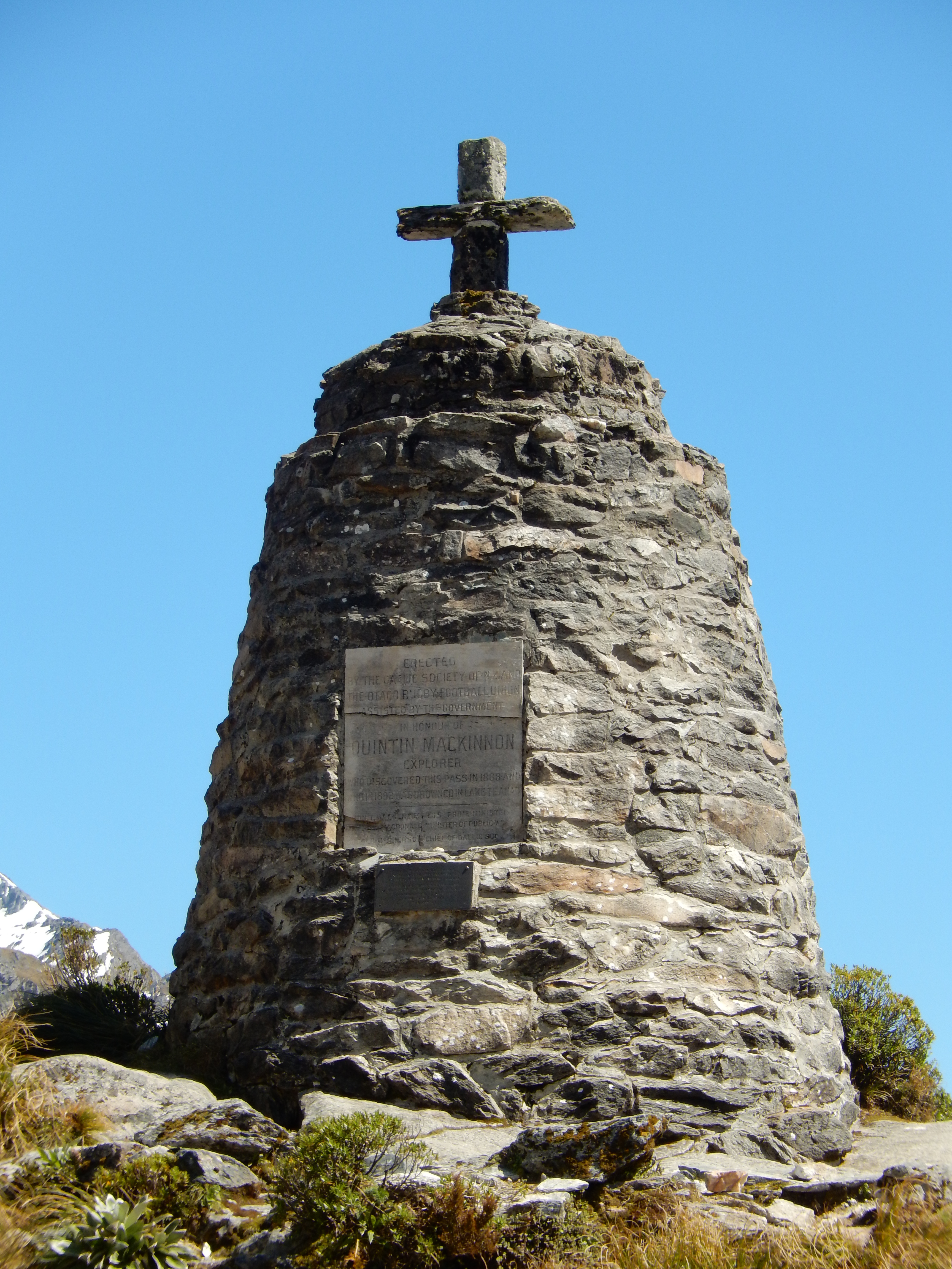
, photo = Milford Track Mackinnon Pass.jpg , photo_size = 270px , photo_alt = , photo_caption = Looking up the Clinton River valley to Omanui / McKinnon Pass , map = New Zealand Fiordland , map_alt = , map_caption = Location within Fiordland , map_relief = , map_size = , label = Omanui / McKinnon Pass , label_position = , elevation = , elevation_m = 1156 , elevation_ft = , elevation_ref = , traversed = Milford Track , length = , length_km = , length_mi = , length_ref = , grade_avg = , grade_max = , ascent = , location = Fiordland, New Zealand , range = , grid_ref_UK = , grid_ref_Ireland = , coordinates = , coordinates_ref = , topo = , embedded = , child = Omanui / McKinnon Pass (prev ... [...More Info...] [...Related Items...] OR: [Wikipedia] [Google] [Baidu] |
Milford Track
The Milford Track is a hiking route in New Zealand, located amidst mountains and temperate rain forest in Fiordland National Park in the southwest of the South Island. The 53.5 km (33.2 mi) hike starts at Glade Wharf at the head of Lake Te Anau and finishes in Milford Sound at Sandfly Point, traversing rainforests, wetlands, and an alpine pass. The New Zealand Department of Conservation classifies this track as a Great Walk and maintains three huts along the track: Clinton Hut, Mintaro Hut and Dumpling Hut. There are also three private lodges and four day shelters available. Most people complete the trail in 15 to 20 hours of hiking over three days, not counting an additional hour or two to reach the first hut from a boat. However, some people run the track in one day. The fastest known completion of the trail was by Hywel Dinnick in 5 hours and 28 minutes. History The native Māori people used the area for gathering and transporting valuable greenstone. The ... [...More Info...] [...Related Items...] OR: [Wikipedia] [Google] [Baidu] |
Homer Tunnel
The Homer Tunnel is a 1.2 km (0.75 miles) long road tunnel in the Fiordland region of the South Island of New Zealand, opened in 1953. New Zealand State Highway 94 passes through the tunnel, linking Milford Sound to Te Anau and Queenstown, by piercing the Darran Mountains at the Homer Saddle. It connects between the valley of the Hollyford River to the east and that of the Cleddau to the west. The tunnel is straight and was originally single-lane and gravel-surfaced. The tunnel walls remain unlined granite. The east portal end is at 945 m elevation; the tunnel runs 1270 m at approximately a 1:10 gradient down to the western portal.Milford Sound Transport – Issues and Options (report by [...More Info...] [...Related Items...] OR: [Wikipedia] [Google] [Baidu] |
Mount Earnslaw / Pikirakatahi
Mount Earnslaw / Pikirakatahi is a mountain in the South Island of New Zealand. It is named after Earnslaw (formerly Herneslawe) village in the parish of Eccles, Berwickshire, hometown of the surveyor John Turnbull Thomson's father.http://digital.otago.ac.nz/results?lcreator=Thomson,%20John%20Turnbull&PHPSESSID=068 e70c223902799... Mount Earnslaw is within Mount Aspiring National Park at the southern end of the Forbes Range of the Southern Alps. It is located 25 kilometres north of the settlement of Glenorchy, which lies at the northern end of Lake Wakatipu. Mount Earnslaw and various other sites in its vicinity feature in the live-action film version of The Lord of the Rings ''The Lord of the Rings'' is an epic high-fantasy novel by English author and scholar J. R. R. Tolkien. Set in Middle-earth, intended to be Earth at some time in the distant past, the story began as a sequel to Tolkien's 1937 children's boo .... Climbing history Reverend W.S. Green had come to ... [...More Info...] [...Related Items...] OR: [Wikipedia] [Google] [Baidu] |
.jpg)


