|
European Route E85
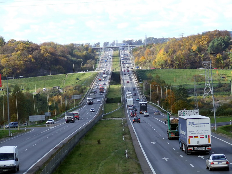
European route E85 is part of the International E-road network, which is a series of main roads in Europe. The E 85 starts from Klaipėda (Lithuania) runs south through Belarus, Ukraine, Romania, Bulgaria to Greece, ending at Alexandroupoli. The E 85 is long. Route *: Klaipėda () - Kryžkalnis () - Kaunas ( ) - Vilnius ( ) *: Vilnius ( ) *: Vilnius () - Šalčininkai *: Beiniakoni - Lida - Slonim - Ivacevičy () *: Ivacevičy (Start of Concurrency with ) - Kobryn (End of Concurrency with ) *: Domanove - Kovel () - Dubno () - Ternopil () - Chernivtsi - Porubne *: Siret - Suceava () - Săbăoani () - Roman - Bacău () - Tișița () - Focșani - Buzău () - Urziceni (Start of concurrency with ) - București (End of concurrency with ) *: București (Start of concurrency with ) - Giurgiu *: Ruse (End of Concurrency with ) *: Ruse () - Byala () - Veliko Tarnovo () - Stara Zagora () - Dimitrovgrad () - Haskovo *: Haskovo - Harmanli - Novo Selo * ... [...More Info...] [...Related Items...] OR: [Wikipedia] [Google] [Baidu] |
Klaipėda
Klaipėda (; ; german: Memel; pl, Kłajpeda; russian: Клайпеда; sgs, Klaipieda) is a city in Lithuania on the Baltic Sea coast. The capital of the eponymous county, it is the third largest city and the only major seaport in Lithuania. The city has a complex recorded history, partially due to the combined regional importance of the usually ice-free Port of Klaipėda at the mouth of the river . Located in the region of Lithuania Minor, at various times, it was a part of the Polish–Lithuanian Commonwealth, Prussia and Germany until the 1919 Treaty of Versailles. As a result of the 1923 Klaipėda Revolt it was annexed by Lithuania and has remained with Lithuania to this day, except between 1939 and 1945 when it was occupied by Germany following the 1939 German ultimatum to Lithuania. The population has migrated from the city to its suburbs and hinterland. The number of inhabitants of Klaipėda city shrank from 202,929 in 1989 to 162,360 in 2011, but the urban zone ... [...More Info...] [...Related Items...] OR: [Wikipedia] [Google] [Baidu] |
Slonim
Slonim ( be, Сло́нім, russian: Сло́ним, lt, Slanimas, lv, Sloņima, pl, Słonim, yi, סלאָנים, ''Slonim'') is a city in Grodno Region, Belarus, capital of the Slonimski rajon. It is located at the junction of the Ščara and Isa rivers, southeast of Hrodna. The population in 2015 was 49,739. Etymology and historical names Slonim has been known by several versions of its name: Сло́нім ( Belarusian), Słonim (Polish), Сло́ним (Russian). Slonim was first mentioned in chronicles in 1252 as Uslonim and in 1255 as Vslonim. According to one version (which is also considered to be an official one), the name of the city originates from the Slavic word 'zaslona' (a screen), meaning that the city used to be an outpost at the southern border of Grand Duchy of Lithuania. Another version, proposed by Jazep Stabroŭski, states that Slonim is a derivative from 'Užslenimas' in the Lithuanian language simply means 'beyond the valley'. History Middle Ages ... [...More Info...] [...Related Items...] OR: [Wikipedia] [Google] [Baidu] |
Bacău
Bacău ( , , ; hu, Bákó; la, Bacovia) is the main city in Bacău County, Romania. At the 2016 national estimation it had a population of 196,883, making it the 12th largest city in Romania. The city is situated in the historical region of Moldavia, at the foothills of the Carpathian Mountains, and on the Bistrița River (which meets the Siret River about to the south of Bacău). The Ghimeș Pass links Bacău to the region of Transylvania. Etymology The town's name, which features in Old Church Slavonic documents as ''Bako'', ''Bakova'' or ''Bakovia'', comes most probably from a personal name. Men bearing the name Bakó or Bako are documented in medieval TransylvaniaRădvan 2010, p. 456. and in 15th-century Bulgaria, but according to Victor Spinei the name itself is of Turkicmost probably of Cuman or Pechenegorigin. Nicolae Iorga believes that the city's name is of Hungarian origin (as Adjud and Sascut). Another theory suggests that the town's name has a Slavic origin, ... [...More Info...] [...Related Items...] OR: [Wikipedia] [Google] [Baidu] |
Roman, Romania
Roman () is a city located in the central part of Western Moldavia, a traditional region of Romania. It is located 46 km east of Piatra Neamț, in Neamț County at the confluence of the rivers Siret and Moldova. Its name was taken from Moldavian Voivode Roman I of Moldavia. From here prince Roman realized the centralization of Moldavia, the city of Roman being the capital of the Lower Country of Moldavia ( ro, Țara de Jos). History The earliest mention of the city is in the Novgorod Chronicle (dated between 1387 and 1392). Five years later, the name appeared on a donation deed. The city is mentioned in a Moldavian document, signed by Moldavia's Voivode Roman I, on March 30. The document is one of the first of documents of the then-young state of Moldavia, being the first which holds a fully legible version of the Moldavia seal, bearing the aurochs, the moon, the star, and the flower, still in use on coat of arms of Moldova. Roman became a diocesan see in September 14, 140 ... [...More Info...] [...Related Items...] OR: [Wikipedia] [Google] [Baidu] |
Săbăoani
Săbăoani ( hu, Szabófalva) is a commune in Neamț County, Western Moldavia, Romania. It is composed of two villages, Săbăoani and Traian. In 2002, the commune had a population of 10,301, of whom all but four were declared ethnic Romanians. 98.6% of residents were Roman Catholic, 1.3% Romanian Orthodox, and 0.1% belonged to other Christian denominations. Situated in the eastern part of the county, on the border with Iași County, Săbăoani is the largest rural settlement in Neamț County. It is located at a distance of north of Roman and east of the county capital, Piatra Neamț. The commune is traversed south to north by national road DN2 (part of European route E85). Route DN28 starts in Săbăoani; bifurcating from DN2, it goes east towards Iași and on to the border with Moldova. The Săbăoani train station serves the CFR Line 500, which starts in Bucharest and runs north, to the border with Ukraine. Natives * Aurel Percă Aurel Percă (born August 15, 1951) is ... [...More Info...] [...Related Items...] OR: [Wikipedia] [Google] [Baidu] |
Suceava
Suceava () is the largest urban settlement and the seat town ( ro, oraș reședință de județ) of Suceava County, situated in the historical region of Bukovina, northeastern Romania, and at the crossroads of Central Europe, Central and Eastern Europe. Klaus Peter BergerThe Creeping Codification of the New Lex Mercatoria Kluwer Law International, 2010, p. 132 During the late Middle Ages, namely between 1388 and 1564, this middle-sized town was the capital of the Moldavia, Principality of Moldavia. From 1775 to 1918, Suceava was controlled by the Habsburg monarchy, initially part of its Kingdom of Galicia and Lodomeria, then gradually becoming the third most populous urban settlement of the Duchy of Bukovina, a constituent land of the Austrian Empire and subsequently a crown land within the Cisleithania, Austrian part of Austria-Hungary. During this time, Suceava was an important, strategically-located commercial border town with the then Romanian Old Kingdom. Throughout the Aust ... [...More Info...] [...Related Items...] OR: [Wikipedia] [Google] [Baidu] |
Siret
Siret (; german: Sereth; hu, Szeretvásár; uk, Серет, Seret; yi, סערעט, Seret) is a town, municipality and former Latin bishopric in Suceava County, northeastern Romania. It is situated in the historical region of Bukovina. Siret is the 11th largest urban settlement in the county, with a population of 7,721 inhabitants, according to the 2011 census. It is one of the oldest towns in Romania and was the capital of the medieval Principality of Moldavia during the late 14th century. Furthermore, the town administers two villages: Mănăstioara and Pădureni. Administration and local politics Town council The town's current local council has the following political composition, according to the results of the 2020 Romanian local elections: Geography The town of Siret is located at the north-eastern limit of Suceava County, from the border with Ukraine, being one of the main border passing points in the north of the country, having both a road border post and a ... [...More Info...] [...Related Items...] OR: [Wikipedia] [Google] [Baidu] |
Chernivtsi
Chernivtsi ( uk, Чернівці́}, ; ro, Cernăuți, ; see also other names) is a city in the historical region of Bukovina, which is now divided along the borders of Romania and Ukraine, including this city, which is situated on the upper course of the Prut river in the Southwestern Ukrainian territory. Chernivtsi serves as the administrative center for the Chernivtsi raion, the Chernivtsi urban hromada, and the oblast itself. In 2021, the Chernivtsi population, by estimate, is and the latest census in 2001 was 240,600. The first document that refers to this city dates back to 1408, when Chernivtsi was a town in the region of Moldavia, formerly as a defensive fortification, and became the center of Bukovina in 1488. In 1538, Chernivtsi was under the control of the Ottoman Empire, and the Turkish control lasted for two centuries until 1774, when Austria took control of Bukovina in the aftermath of the Russo-Turkish War. Chernivtsi (known at that time as ) became th ... [...More Info...] [...Related Items...] OR: [Wikipedia] [Google] [Baidu] |
Ternopil
Ternópil ( uk, Тернопіль, Ternopil' ; pl, Tarnopol; yi, טאַרנאָפּל, Tarnopl, or ; he, טארנופול (טַרְנוֹפּוֹל), Tarnopol; german: Tarnopol) is a city in the west of Ukraine. Administratively, Ternopil serves as the administrative centre of Ternopil Oblast and has the status of city of oblast significance. Located on the banks of the Seret (river), Seret. Until 1944, it was known mostly as Tarnopol. Ternopil is one of the major cities of Western Ukraine and the historical regions of Galicia (Central Europe), Galicia and Podolia. It is served by Ternopil Airport. The population of Ternópil was estimated at . Administrative status The city is the administrative center of Ternopil Oblast (Oblasts of Ukraine, region), as well as of surrounding Ternopil Raion (Raions of Ukraine, district) within the oblast. It hosts the administration of Ternopil urban hromada, one of the hromadas of Ukraine. Demography According to Ukrainian Census (200 ... [...More Info...] [...Related Items...] OR: [Wikipedia] [Google] [Baidu] |
Dubno
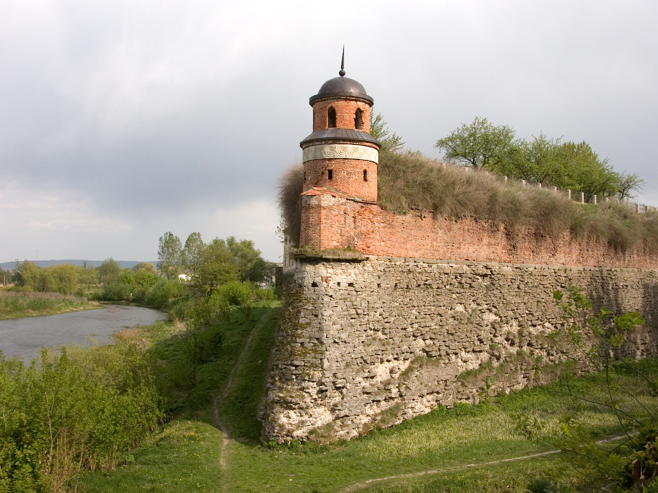
Dubno ( uk, Ду́бно) is a city and municipality located on the Ikva River in Rivne Oblast (province) of western Ukraine. It serves as the administrative center of Dubno Raion (district). The city is located on intersection of two major European routes, E40 and E85. The city is estimated to have a population of . It is located within the historic region of Volhynia. In Soviet times it was home to the Cold War facility Dubno air base. The city is also famous for its fortress. History Middle Ages First mentioned in a chronicle of 1100, when it was in possession of Yaroslav the Wise's grandson David of Brest , Dubno was even a seat of local princes for a short period of time. In 1240 the town was raided by the Mongols. In the early 14th century the region was the subject of Polish- Lithuanian rivalry, as a result of which Dubno became part of the latter. However, soon after with the Union of Krewo (1385), it came under Polish influence as part of the Polish-Lithuanian U ... [...More Info...] [...Related Items...] OR: [Wikipedia] [Google] [Baidu] |
Kovel
Kovel (, ; pl, Kowel; yi, קאוולע / קאוולי ) is a city in Volyn Oblast (province), in northwestern Ukraine. It serves as the administrative center of Kovel Raion (district). Population: Kovel gives its name to one of the oldest runic inscriptions which were lost during World War II. The Kovel spearhead, unearthed near the town in 1858, contained text in Gothic. History The name Kovel comes from a Slavonic word for blacksmith hence the horseshoe on the town's coat of arms. The rune-inscribed Spearhead of Kovel was found near Kovel in 1858. It dates to the early 3rd century, when Gothic tribes lived in the area. Kovel (Kowel) was first mentioned in 1310. It received its town charter from the Polish King Sigismund I the Old in 1518. In 1547 the owner of Kowel became Bona Sforza, Polish queen. In 1564 starost of Kowel became Kurbski (d. 1584). From 1566 to 1795 it was part of the Volhynian Voivodeship. Kowel was a royal city of Poland. After the late 18th century ... [...More Info...] [...Related Items...] OR: [Wikipedia] [Google] [Baidu] |


.jpg)


