|
Ettleton
Ettleton is a village near Castleton, in the Scottish Borders area of Scotland, in the former Roxburghshire. Etymology and history Ettleton Parish was once also known as, or contained, Dinwiddie. The first element of this name appears to be the Cumbric word ''din'', meaning 'fort'.Bethany Fox, 'The P-Celtic Place-Names of North-East England and South-East Scotland', The Heroic Age, 10 (2007), http://www.heroicage.org/issues/10/fox.html (appendix at http://www.heroicage.org/issues/10/fox-appendix.html). Ettleton Cemetery, on the slopes of Ettleton Sike, is the burial place of many members of Clan Armstrong. Other places nearby include Newcastleton. See also *List of places in the Scottish Borders *List of places in Scotland This list of places in Scotland is a complete collection of lists of places in Scotland. * List of burghs in Scotland * List of census localities in Scotland *List of islands of Scotland ** List of Shetland islands ** List of Orkney islands ** L ... Ref ... [...More Info...] [...Related Items...] OR: [Wikipedia] [Google] [Baidu] |
Roxburghshire
Roxburghshire or the County of Roxburgh ( gd, Siorrachd Rosbroig) is a historic county and registration county in the Southern Uplands of Scotland. It borders Dumfriesshire to the west, Selkirkshire and Midlothian to the north-west, and Berwickshire to the north. To the south-west it borders Cumberland and to the south-east Northumberland, both in England. It was named after the Royal Burgh of Roxburgh, a town which declined markedly in the 15th century and is no longer in existence. Latterly, the county town of Roxburghshire was Jedburgh. The county has much the same area as Teviotdale, the basin drained by the River Teviot and tributaries, together with the adjacent stretch of the Tweed into which it flows. The term is often treated as synonymous with Roxburghshire, but may omit Liddesdale as Liddel Water drains to the west coast.Ordnance Gazetteer of Scotland, by, Francis Groome, publ. 2nd edition 1896. Article on Roxburghshire History The county appears to have orig ... [...More Info...] [...Related Items...] OR: [Wikipedia] [Google] [Baidu] |
List Of Places In The Scottish Borders
''Map of places in the Scottish Borders compiled from this list'':See the list of places in Scotland for places in other counties. This list of places in the Scottish Borders includes towns, villages, hamlets, castles, golf courses, historic houses, hillforts, lighthouses, nature reserves, reservoirs, rivers, and other places of interest in the Scottish Borders council area of Scotland. A * Abbey Mill * Abbey St. Bathans *Abbotsford Ferry railway station, Abbotsford House *Abbotrule *Addinston * Aikwood Tower *Ale Water *Alemoor Loch *Allanbank * Allanshaugh * Allanshaws * Allanton *Ancrum, Ancrum Old Parish Church *Anglo-Scottish Border * Appletreehall *Ashiestiel *Ashkirk * Auchencrow * Ayton, Ayton Castle, Ayton Parish Church, Ayton railway station B *Baddinsgill, Baddinsgill Reservoir *Bairnkine * Bassendean * Battle of Ancrum Moor * Battle of Humbleton Hill * Battle of Nesbit Moor (1355) *Battle of Nesbit Moor (1402) *Battle of Philiphaugh ... [...More Info...] [...Related Items...] OR: [Wikipedia] [Google] [Baidu] |
Castleton, Scottish Borders
Castleton ( gd, Baile Chaisteil) is a civil parishes in Scotland, civil parish in the Scottish Borders area of Scotland, in the former Roxburghshire, in the extreme south of the Borders area. It is bounded by Northumberland (England), Dumfries and Galloway, and the parishes of Hobkirk, Southdean and Teviothead. The village of Castleton was commenced in 1793.New Statistical Account of Scotland, Vol III Roxburgh, Peebles, Selkirk, publ.William Blackwood, 1845 pp. 440-447 It was built as a result of the land clearances in the 1790s when people were forced to move from Old Castleton village. While the parish retained the name Castleton, the village later became identified as New Castleton or Newcastleton.Survey Gazetteer of the British Isles, publ. J.G. Bartholomew, 1904, p. 142 The parish is also known by its older name LiddesdaleChurch of Scotland parish web site: http://www.canonbie.liddesdale.talktalk.net/canlid/liddesdale%20history.htm retrieved Feb 2016 The inhabited part of t ... [...More Info...] [...Related Items...] OR: [Wikipedia] [Google] [Baidu] |
Scottish Borders
The Scottish Borders ( sco, the Mairches, 'the Marches'; gd, Crìochan na h-Alba) is one of 32 council areas of Scotland. It borders the City of Edinburgh, Dumfries and Galloway, East Lothian, Midlothian, South Lanarkshire, West Lothian and, to the south-west, south and east, the English counties of Cumbria and Northumberland. The administrative centre of the area is Newtown St Boswells. The term Scottish Borders, or normally just "the Borders", is also used to designate the areas of southern Scotland and northern England that bound the Anglo-Scottish border. Geography The Scottish Borders are in the eastern part of the Southern Uplands. The region is hilly and largely rural, with the River Tweed flowing west to east through it. The highest hill in the region is Broad Law in the Manor Hills. In the east of the region, the area that borders the River Tweed is flat and is known as 'The Merse'. The Tweed and its tributaries drain the entire region with the river flowi ... [...More Info...] [...Related Items...] OR: [Wikipedia] [Google] [Baidu] |
Scotland
Scotland (, ) is a country that is part of the United Kingdom. Covering the northern third of the island of Great Britain, mainland Scotland has a border with England to the southeast and is otherwise surrounded by the Atlantic Ocean to the north and west, the North Sea to the northeast and east, and the Irish Sea to the south. It also contains more than 790 islands, principally in the archipelagos of the Hebrides and the Northern Isles. Most of the population, including the capital Edinburgh, is concentrated in the Central Belt—the plain between the Scottish Highlands and the Southern Uplands—in the Scottish Lowlands. Scotland is divided into 32 administrative subdivisions or local authorities, known as council areas. Glasgow City is the largest council area in terms of population, with Highland being the largest in terms of area. Limited self-governing power, covering matters such as education, social services and roads and transportation, is devolved from the Scott ... [...More Info...] [...Related Items...] OR: [Wikipedia] [Google] [Baidu] |
Cumbric
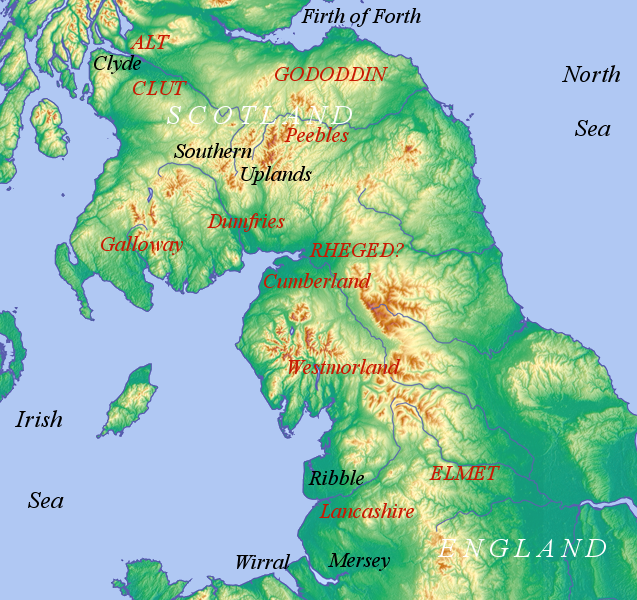
Cumbric was a variety of the Common Brittonic language spoken during the Early Middle Ages in the ''Hen Ogledd'' or "Old North" in what is now the counties of Westmorland, Cumberland and northern Lancashire in Northern England and the southern Scottish Lowlands. It was closely related to Old Welsh and the other Brittonic languages. Place name evidence suggests Cumbric may also have been spoken as far south as Pendle and the Yorkshire Dales. The prevailing view is that it became extinct in the 12th century, after the incorporation of the semi-independent Kingdom of Strathclyde into the Kingdom of Scotland. Problems with terminology Dauvit Broun sets out the problems with the various terms used to describe the Cumbric language and its speakers.Broun, Dauvit (2004): 'The Welsh identity of the kingdom of Strathclyde, ca 900-ca 1200', ''Innes Review'' 55, pp 111–80. The people seem to have called themselves the same way that the Welsh called themselves (most likely from recon ... [...More Info...] [...Related Items...] OR: [Wikipedia] [Google] [Baidu] |
Clan Armstrong
Clan Armstrong is a Scottish clan of the Scottish Borders.Way, George and Squire, Romily. (1994). ''Collins Scottish Clan & Family Encyclopedia''. (Foreword by The Rt Hon. The Earl of Elgin KT, Convenor, The Standing Council of Scottish Chiefs). pp. 352 – 353. The clan does not currently have a chief recognised by the Lord Lyon King of Arms and therefore it is considered an Armigerous clan. History Origins of the clan Traditional origins According to the legend and tradition, the first of the name Armstrong was Siward Beorn (''sword warrior''), who was also known as Siward Digry (''sword strong arm''). He was said to be the last Anglo-Danish Earl of Northumberland and a nephew of King Canute, the Danish king of England who reigned until 1035. Recorded origins The Armstrong name was common over the whole of Northumbria and the Scottish Borders. The Armstrongs became a powerful and warlike clan in Liddesdale and the Debatable Lands. Historian George Fraser Black lists Adam Armst ... [...More Info...] [...Related Items...] OR: [Wikipedia] [Google] [Baidu] |
Newcastleton
Newcastleton, also called Copshaw Holm, is a village in Liddesdale, the Scottish Borders, a few miles from the border with England, on the Liddel Water. It is within the county of Roxburghshire. It is the site of Hermitage Castle. Newcastleton is east of Langholm, south of Hawick, north of Carlisle and south of Edinburgh. History Newcastleton was built as a result of the land clearances in the 1790s when people were forced to move from Old Castleton village. There has been a folk festival at Newcastleton since 1970. "Copshaw Holm" (another name for the village) is celebrated in the song "Copshawholm Fair", written by David Anderson in 1830, as sung by Willie Scott among others. In 2020, the local community purchased 5,000 acres (2,000 hectares) of Langholm Moor for £3.8m from Buccleuch Estates. Amenities A community-owned unmanned fuel station opened after much community fund raising in 2018. The former Townfoot Church (erected in 1803) now houses the Liddesdale Heritag ... [...More Info...] [...Related Items...] OR: [Wikipedia] [Google] [Baidu] |
List Of Places In Scotland
This list of places in Scotland is a complete collection of lists of places in Scotland. *List of burghs in Scotland *List of census localities in Scotland *List of islands of Scotland **List of Shetland islands **List of Orkney islands **List of Inner Hebrides ** List of Outer Hebrides **List of outlying islands of Scotland ** List of freshwater islands in Scotland *List of rivers of Scotland *List of lochs in Scotland *Waterfalls of Scotland *List of Munros * Extreme points of Scotland Lists of places within Scottish local authorities *List of places in Aberdeen *List of places in Aberdeenshire *List of places in Angus *List of places in Argyll and Bute *List of places in Clackmannanshire *List of places in Dumfries and Galloway *List of places in Dundee *List of places in East Ayrshire *List of places in East Dunbartonshire *List of places in East Lothian *List of places in East Renfrewshire * List of places in na h-Eileanan Siar (Western Isles) *List of places in Falkirk (cou ... [...More Info...] [...Related Items...] OR: [Wikipedia] [Google] [Baidu] |


