|
Ennedi
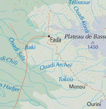
The Ennedi Plateau is located in the northeast of Chad, in the regions of Ennedi-Ouest and Ennedi-Est. It is considered a part of the group of mountains known as the Ennedi Massif found in Chad, which is one of the nine countries that make up the Sahelian belt that spans the Atlantic Ocean to Sudan. The Ennedi is a sandstone bulwark in the middle of the Sahara, which was formed by erosion from wind and temperature. Many people occupied this area, such as hunters and gatherers (5,000-4,000 cal BC) and pastoralists (beginning 4,000 cal BC). The Ennedi area is also known for its large collection of rock art depicting mainly cattle, as these animals were the main source of financial, environmental, and cultural impact. This art dates back nearly 7,000 years ago. Today, two semi-nomadic groups, mainly of the Muslim religion, have permanent villages in the Ennedi during the rainy months and pass through the area during the dry season. They rely on their herds of camels, donkeys, sheep, ... [...More Info...] [...Related Items...] OR: [Wikipedia] [Google] [Baidu] |
Ennedi Region
Ennedi Region was a former region of Chad. It was created in 2008 from the Ennedi Est Department and Ennedi Ouest Department of the former Borkou-Ennedi-Tibesti Region. The capital of the Ennedi region was Fada. In 2012 it was split into two new regions: the department of Wadi Hawar became Ennedi-Est Region and the department of Ennedi became Ennedi-Ouest Region. Per the census of 2009, the population of the region was 173,606, 45.20 per cent female. The total number of households was 24,784: 23,977 in rural areas and 807 in urban areas. The number of nomads in the region was 27,759, 7.20 per cent of the population. The sex ratio was 121.00 females for every hundred males. Demographics Per the census of 2009, the population of the region was 173,606, 45.20 per cent female. The average size of household as of 2009 is 5.90: 5.90 in rural households and 5.40 in urban areas. The total number of households was 24,784: 23,977 in rural areas and 807 in urban areas. The number of no ... [...More Info...] [...Related Items...] OR: [Wikipedia] [Google] [Baidu] |
Ennedi-Ouest Region
Ennedi-Ouest Region ( ar, إنيدي الغربية) is one of the twenty-three regions of Chad. It was created in 2012 from the western half of the former Ennedi Region. It appears to cover the same territory as the former Ennedi Ouest Department. The capital of the region is Fada. Geography The region borders Libya to the north, Ennedi-Est Region to the east, Wadi Fira Region to the south, and Borkou Region to the west. The region is geographically part of the Sahara Desert. The region's northern border lies within the Aouzou Strip, historically a point of dispute between Chad and Libya.Geoffrey Leslie Simons, ''Libya and the West: from independence to Lockerbie'', Centre for Libyan Studies (Oxford, England). Pg. 57 Settlements The regional capital is Fada; other major settlements include Gouro, Kalait, Nohi and Ounianga Kébir. Demographics The region's population is estimated to be 59,744. The main ethnolinguistic groups are the Tedaga and Dazaga Toubou and the Za ... [...More Info...] [...Related Items...] OR: [Wikipedia] [Google] [Baidu] |
Ennedi-Est Region
Ennedi Est Region ( ar, إنيدي الشرقية) is one of the twenty-three regions of Chad. The capital of the region is Am-Djarass. The region's current governor is General Hassan Djorobo. History It was established in 2012 from part of the former Ennedi Region. It appears to cover the same territory as the former Ennedi Est Department. Geography The region borders Libya to the north, Sudan to the east, Wadi Fira Region to the south, and Ennedi-Ouest Region to the west. The region is geographically part of the Sahara Desert. The region's northern border lies within the Aouzou Strip, historically a point of dispute between Chad and Libya.Geoffrey Leslie Simons, ''Libya and the West: from independence to Lockerbie'', Centre for Libyan Studies (Oxford, England). Pg. 57 Settlements Am-Djarass is the regional capital; other major settlements include Bahaï, Bao Billiat, Kaoura and Mourdi. Demographics The main ethnolinguistic groups are the Dazaga Toubou and the Zaghawa ... [...More Info...] [...Related Items...] OR: [Wikipedia] [Google] [Baidu] |
African Parks
African Parks is a non-governmental organization (NGO) focused on conservation, established in 2000 and headquartered in Johannesburg, South Africa. It was founded as the African Parks Management and Finance Company, a private company, then underwent structural changes to become an NGO called African Parks Foundation, and later renamed African Parks Network. The organization manages national parks and protected areas throughout Africa, in collaboration with governments and surrounding communities. African Parks manages 18 protected areas in 11 countries as of August 2020, and employs more than 1,100 rangers. Michael Eustace, Peter Fearnhead, Paul Fentener van Vlissingen, Anthony Hall-Martin, and Mavuso Msimang are credited as co-founders; Fearnhead continues to serve as chief executive officer. Prince Harry was appointed African Parks' president in late 2017. Overview The Johannesburg-based nonprofit conservation organization African Parks manages national parks and protected are ... [...More Info...] [...Related Items...] OR: [Wikipedia] [Google] [Baidu] |
Chad
Chad (; ar, تشاد , ; french: Tchad, ), officially the Republic of Chad, '; ) is a landlocked country at the crossroads of North and Central Africa. It is bordered by Libya to the north, Sudan to the east, the Central African Republic to the south, Cameroon to the southwest, Nigeria to the southwest (at Lake Chad), and Niger to the west. Chad has a population of 16 million, of which 1.6 million live in the capital and largest city of N'Djamena. Chad has several regions: a desert zone in the north, an arid Sahelian belt in the centre and a more fertile Sudanian Savanna zone in the south. Lake Chad, after which the country is named, is the second-largest wetland in Africa. Chad's official languages are Arabic and French. It is home to over 200 different ethnic and linguistic groups. Islam (55.1%) and Christianity (41.1%) are the main religions practiced in Chad. Beginning in the 7th millennium BC, human populations moved into the Chadian basin in great ... [...More Info...] [...Related Items...] OR: [Wikipedia] [Google] [Baidu] |
Ounianga Lakes
Lakes of Ounianga are a series of lakes in the Sahara Desert, in North-Eastern Chad, occupying a basin in the mountains of West Tibesti and Ennedi East. It was added as a UNESCO World Heritage site in 2012. According to the UNESCO description, the lakes are in a hot and hyperarid desert that features a rainfall of less than a year. The lakes exhibit a variety of sizes, depths, chemical compositions and colorations. There is a total of 18 lakes in groups as follows: * Ounianga Kébir group: Lake Yoa, Lake Katam, Lake Oma (or Ouma), Lake Béver, Lake Midji, Lake Forodom; * Lake Motro, about southeast of Ounianga Kébir; * Ounianga Sérir group about southeast of Ounianga Kébir: Lake Melekui, Lake Dirke, Lake Ardjou, Lake Téli, Lake Obrom, Lake Élimé, Lake Hogo, Lake Djiara, Lake Ahoita, Lake Daléyala, and Lake Boukkou. The total surface area of the lakes is about . The largest of the lakes, Lake Yoa, has about a area and attains in depth. The names of the lake ... [...More Info...] [...Related Items...] OR: [Wikipedia] [Google] [Baidu] |
Neolithic Subpluvial
The African humid period (AHP) (also known by other names) is a climate period in Africa during the late Pleistocene and Holocene geologic epochs, when northern Africa was wetter than today. The covering of much of the Sahara desert by grasses, trees and lakes was caused by changes in Earth's orbit around the Sun; changes in vegetation and dust in the Sahara which strengthened the African monsoon; and increased greenhouse gases. During the preceding Last Glacial Maximum, the Sahara contained extensive dune fields and was mostly uninhabited. It was much larger than today, but its lakes and rivers such as Lake Victoria and the White Nile were either dry or at low levels. The humid period began about 14,600–14,500 years ago at the end of Heinrich event 1, simultaneously to the Bølling–Allerød warming. Rivers and lakes such as Lake Chad formed or expanded, glaciers grew on Mount Kilimanjaro and the Sahara retreated. Two major dry fluctuations occurred; during the Younger Dryas ... [...More Info...] [...Related Items...] OR: [Wikipedia] [Google] [Baidu] |
Guelta D'Archei
The Guelta d'Archei is one of the most famous gueltas in the Sahara. It is located in the Ennedi Plateau, in north-eastern Chad, south-east of the town of Fada. The Guelta d'Archei is inhabited by several kinds of animals, most notably the West African crocodile (''Crocodylus suchus''; until recently thought to be a synonym for the Nile crocodile, ''Crocodylus niloticus'' Laurenti). Middle Holocene remains, as well as rock paintings, indicate that this species once thrived across most of today's Sahara Desert and in swamps and rivers along South Mediterranean shores. The small group of surviving crocodiles in the Guelta d'Archei represents one of the last colonies known in the Sahara today; the Tagant Plateau colony in Mauritania Mauritania (; ar, موريتانيا, ', french: Mauritanie; Berber: ''Agawej'' or ''Cengit''; Pulaar: ''Moritani''; Wolof: ''Gànnaar''; Soninke:), officially the Islamic Republic of Mauritania ( ar, الجمهورية الإسلامي� ... [...More Info...] [...Related Items...] OR: [Wikipedia] [Google] [Baidu] |
Sahara
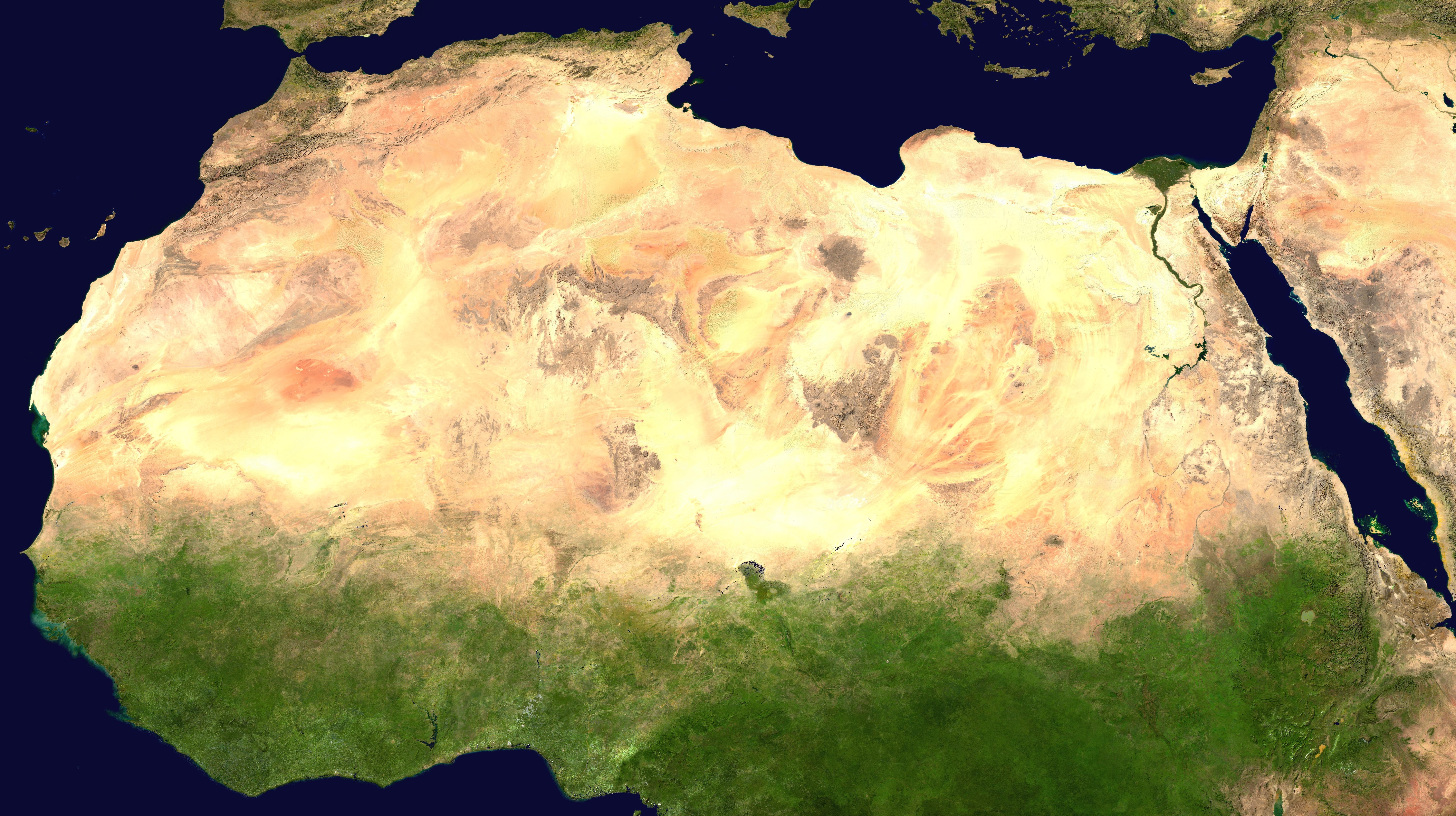
, photo = Sahara real color.jpg , photo_caption = The Sahara taken by Apollo 17 astronauts, 1972 , map = , map_image = , location = , country = , country1 = , country2 = , country3 = , country4 = , country5 = , country6 = , country7 = , country8 = , country9 = , country10 = ( disputed) , region = , state = , district = , city = , relief = , label = , label_position = , coordinates = , coordinates_ref = , elevation = , elevation_m = , elevation_ft = , elevation_ref = , length = , length_mi = , length_km = 4,800 , length_orientation = , length_note = , width = , width_mi = , widt ... [...More Info...] [...Related Items...] OR: [Wikipedia] [Google] [Baidu] |
North African Ostrich
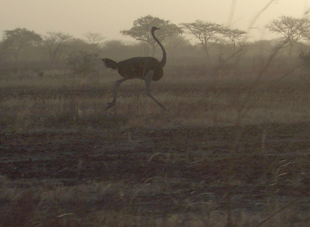
The North African ostrich, red-necked ostrich, or Barbary ostrich (''Struthio camelus camelus'') is the nominate subspecies of the common ostrich from West and North Africa. It is the largest subspecies, making it the largest living bird. Evolutionary history In the 1990s, mtDNA analyses control region haplotypes revealed that the Arabian ostrich from Western Asia is closely related to the North African ostrich. In 2017, the Birbal Sahni Institute of Palaeobotany discovered that common ostriches used to live in India about 25,000 years ago. DNA research on eleven fossilised eggshells from eight archaeological sites in the states of Rajasthan, Gujarat and Madhya Pradesh found 92% genetic similarity between the eggshells and the North African ostrich. Description The North African ostrich is the largest subspecies of ''S. camelus'', at in height and up to in weight. The neck is pinkish-red, the plumage of males is black and white, and the plumage of females is gray. Habitat a ... [...More Info...] [...Related Items...] OR: [Wikipedia] [Google] [Baidu] |
Plateaus Of Africa
In geology and physical geography, a plateau (; ; ), also called a high plain or a tableland, is an area of a highland consisting of flat terrain that is raised sharply above the surrounding area on at least one side. Often one or more sides have deep hills or escarpments. Plateaus can be formed by a number of processes, including upwelling of volcanic magma, extrusion of lava, and erosion by water and glaciers. Plateaus are classified according to their surrounding environment as intermontane, piedmont, or continental. A few plateaus may have a small flat top while others have wide ones. Formation Plateaus can be formed by a number of processes, including upwelling of volcanic magma, extrusion of lava, Plate tectonics movements and erosion by water and glaciers. Volcanic Volcanic plateaus are produced by volcanic activity. The Columbia Plateau in the north-western United States is an example. They may be formed by upwelling of volcanic magma or extrusion of lava. The un ... [...More Info...] [...Related Items...] OR: [Wikipedia] [Google] [Baidu] |


