|
Emerson, Missouri
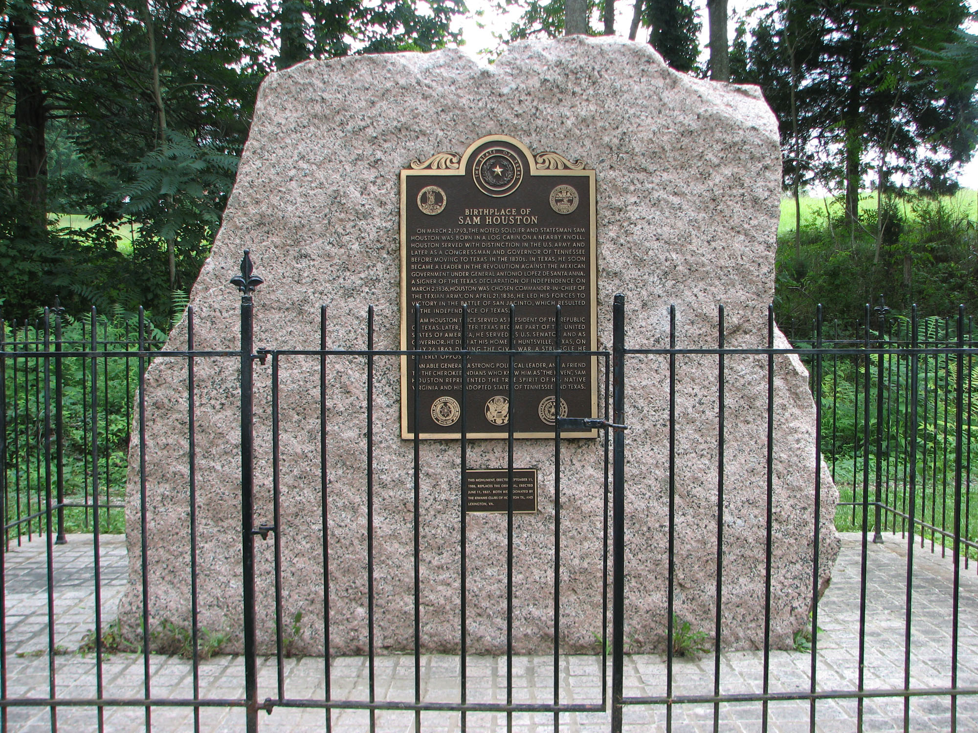
Emerson is an unincorporated community in northwest Marion County, in the U.S. state of Missouri. The community is located on Missouri Route M approximately ten miles northwest of Palmyra, on a ridge north of the South Fabius River. There are no businesses there, or services excepting two churches and a river access ramp; but there are numerous homes. The community was originally named Houston for Sam Houston Samuel Houston (, ; March 2, 1793 – July 26, 1863) was an American general and statesman who played an important role in the Texas Revolution. He served as the first and third president of the Republic of Texas and was one of the first two i ... when established in 1837 and had a post office in 1853. The name was changed to Emerson sometime between 1858 and 1861 for one John Emerson who was an original settler in the area. It had a post office as Emerson from 1867 to 1904. References Unincorporated communities in Marion County, Missouri Unincorporated commu ... [...More Info...] [...Related Items...] OR: [Wikipedia] [Google] [Baidu] |
Unincorporated Community
An unincorporated area is a region that is not governed by a local municipal corporation. Widespread unincorporated communities and areas are a distinguishing feature of the United States and Canada. Most other countries of the world either have no unincorporated areas at all or these are very rare: typically remote, outlying, sparsely populated or uninhabited areas. By country Argentina In Argentina, the provinces of Chubut, Córdoba, Entre Ríos, Formosa, Neuquén, Río Negro, San Luis, Santa Cruz, Santiago del Estero, Tierra del Fuego, and Tucumán have areas that are outside any municipality or commune. Australia Unlike many other countries, Australia has only one level of local government immediately beneath state and territorial governments. A local government area (LGA) often contains several towns and even entire metropolitan areas. Thus, aside from very sparsely populated areas and a few other special cases, almost all of Australia is part of an LGA. Uninc ... [...More Info...] [...Related Items...] OR: [Wikipedia] [Google] [Baidu] |
Marion County, Missouri
Marion County is a county located in the northeastern portion of Missouri. As of the 2010 census, the population was 28,781. Its county seat is Palmyra. Unique from most third-class counties in the state, Marion has two county courthouses, the second located in Hannibal. The county was organized on December 23, 1826 and named for General Francis Marion, the "Swamp Fox," who was from South Carolina and served in the American Revolutionary War. The area was known as the "Two Rivers Country" before organization. Marion County is part of the Hannibal, Missouri Micropolitan Statistical Area, which is included in the Quincy-Hannibal, IL-MO Combined Statistical Area. Geography According to the U.S. Census Bureau, the county has a total area of , of which is land, and (1.7%) is water. Adjacent counties * Lewis County (north) * Adams County, Illinois (northeast) *Pike County, Illinois (southeast) * Ralls County (south) *Monroe County (southwest) * Shelby County (west) Major Roa ... [...More Info...] [...Related Items...] OR: [Wikipedia] [Google] [Baidu] |
Missouri
Missouri is a U.S. state, state in the Midwestern United States, Midwestern region of the United States. Ranking List of U.S. states and territories by area, 21st in land area, it is bordered by eight states (tied for the most with Tennessee): Iowa to the north, Illinois, Kentucky and Tennessee to the east, Arkansas to the south and Oklahoma, Kansas and Nebraska to the west. In the south are the Ozarks, a forested highland, providing timber, minerals, and recreation. The Missouri River, after which the state is named, flows through the center into the Mississippi River, which makes up the eastern border. With more than six million residents, it is the List of U.S. states and territories by population, 19th-most populous state of the country. The largest urban areas are St. Louis, Kansas City, Missouri, Kansas City, Springfield, Missouri, Springfield and Columbia, Missouri, Columbia; the Capital city, capital is Jefferson City, Missouri, Jefferson City. Humans have inhabited w ... [...More Info...] [...Related Items...] OR: [Wikipedia] [Google] [Baidu] |
Missouri Route M
A supplemental route is a state secondary road in the U.S. state of Missouri, designated with letters. Supplemental routes were various roads within the state which the Missouri Department of Transportation was given in 1952 to maintain in addition to the regular routes, though lettered routes had been in use from at least 1932. The four types of roads designated as Routes are: * Farm to market roads * Roads to state parks * Former alignments of U.S. or state highways * Short routes connecting state highways from other states to routes in Missouri Supplemental routes make up (59%) of the state highway system. History Prior to 1907, all road improvement activities in Missouri were undertaken by the individual counties, with little expertise or coordination between them. Amid growing automobile presence and insufficient road networks in Missouri in the ensuing years, the state legislature created a state highway department and the state highway commission as well as enacted vario ... [...More Info...] [...Related Items...] OR: [Wikipedia] [Google] [Baidu] |
Palmyra, Missouri
Palmyra is a city in and the county seat of Marion County, Missouri, United States. The population was 3,595 at the 2010 census. It is part of the Hannibal Micropolitan Statistical Area. History Palmyra was platted in 1819, and named after Palmyra, in Syria. The settlement was designated county seat in 1827. A post office called Palmyra has been in operation since 1830. In 1862, the city was the scene of the Palmyra Massacre, in which ten Confederate prisoners were killed in retaliation for the disappearance of a local Union man. The Culbertson-Head Farmstead, Dryden-Louthan House, Gardner House, Marion County Jail and Jailor's House, Peter J. Sowers House, Speigle House, Walker-Woodward-Schaffer House, and Ephraim J. Wilson Farm Complex are listed on the National Register of Historic Places. Geography Palmyra is located at (39.797396, -91.524857). According to the United States Census Bureau, the city has a total area of , all land. Transportation On US 61- 2 ... [...More Info...] [...Related Items...] OR: [Wikipedia] [Google] [Baidu] |
South Fabius River
The Fabius River (pronounced ''FAY-bee-us'') is a U.S. Geological Survey. National Hydrography Dataset high-resolution flowline dataThe National Map, accessed May 13, 2011 tributary of the Mississippi River in northeastern Missouri in the United States. It is formed near its mouth by the confluence of the North Fabius River and the South Fabius River. The North Fabius River also flows through southeastern Iowa. The Middle Fabius River joins the North Fabius upstream of that river's mouth. Each of the three rivers have been subjected to substantial straightening and channelization. According to tradition, the Fabius River is named for the Roman consul Quintus Fabius Maximus Verrucosus. However, the State Historical Society of Missouri suggests Fabius actually was the name of a French pioneer in the area. Course North Fabius River The North Fabius River, about long, is the longest of the three forks and rises near Moulton in southwestern Appanoose County, Iowa. It flows genera ... [...More Info...] [...Related Items...] OR: [Wikipedia] [Google] [Baidu] |
Sam Houston
Samuel Houston (, ; March 2, 1793 – July 26, 1863) was an American general and statesman who played an important role in the Texas Revolution. He served as the first and third president of the Republic of Texas and was one of the first two individuals to represent Texas in the United States Senate. He also served as the sixth governor of Tennessee and the seventh governor of Texas, the only individual to be elected governor of two different states in the United States. Born in Rockbridge County, Virginia, Houston and his family migrated to Maryville, Tennessee, when Houston was a teenager. Houston later ran away from home and spent about three years living with the Cherokee, becoming known as Raven. He served under General Andrew Jackson in the War of 1812, and after the war, he presided over the removal of many Cherokee from Tennessee. With the support of Jackson and others, Houston won election to the United States House of Representatives in 1823. He strongly supported ... [...More Info...] [...Related Items...] OR: [Wikipedia] [Google] [Baidu] |
Unincorporated Communities In Marion County, Missouri
Unincorporated may refer to: * Unincorporated area, land not governed by a local municipality * Unincorporated entity, a type of organization * Unincorporated territories of the United States, territories under U.S. jurisdiction, to which Congress has determined that only select parts of the U.S. Constitution apply * Unincorporated association Unincorporated associations are one vehicle for people to cooperate towards a common goal. The range of possible unincorporated associations is nearly limitless, but typical examples are: :* An amateur football team who agree to hire a pitch onc ..., also known as voluntary association, groups organized to accomplish a purpose * ''Unincorporated'' (album), a 2001 album by Earl Harvin Trio {{disambig ... [...More Info...] [...Related Items...] OR: [Wikipedia] [Google] [Baidu] |


