|
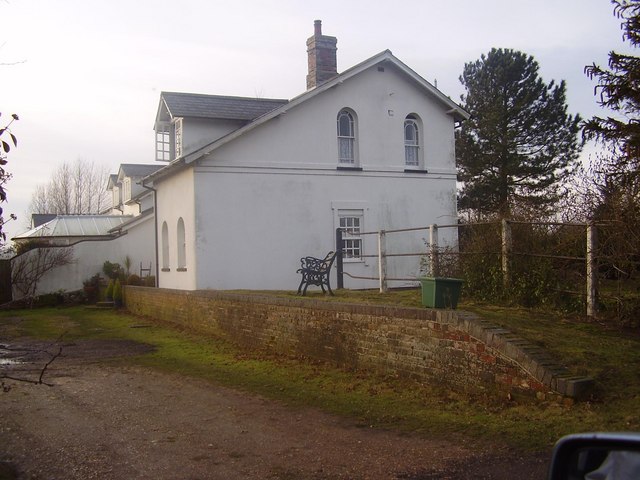
Ellingham Railway Station
Ellingham is a former railway station in Ellingham, Norfolk. It was opened in 1863 as part of the Waveney Valley Line between Tivetshall and Beccles, Suffolk Suffolk () is a ceremonial county of England in East Anglia. It borders Norfolk to the north, Cambridgeshire to the west and Essex to the south; the North Sea lies to the east. The county town is Ipswich; other important towns include Lowes .... It was closed to passengers in 1953 and closed fully on 19 April 1965, when the last goods train called there. The station still stands much altered References External links Disused railway stations in Norfolk Former Great Eastern Railway stations Railway stations in Great Britain opened in 1863 Railway stations in Great Britain closed in 1953 {{EastEngland-railstation-stub ... [...More Info...] [...Related Items...] OR: [Wikipedia] [Google] [Baidu] |
Tivetshall Railway Station
Tivetshall was a railway station on the Great Eastern Main Line located in Tivetshall, Norfolk. It was also the western terminus of the Waveney Valley Line from Beccles. It served six small parishes in an agricultural area. History Design and opening It was first opened when Norwich and London were connected by the Eastern Union Railway in 1849. The EUR was taken over by the Eastern Counties Railway before becoming the Great Eastern Railway in 1862. The station building, located on the down side of the main line, was believed to have been designed by Frederick Barnes (architect) who was responsible for designing a number of other stations at this time in East Anglia. 19th century In 1855, the Waveney Valley Line was opened as far as Harleston; it was extended to Bungay in 1860 and finally on to Beccles. A new signal box was provided in 1880 and this lasted 106 years. Immediately south of the station was a level crossing, which spanned all three tracks (the two main lines and ... [...More Info...] [...Related Items...] OR: [Wikipedia] [Google] [Baidu] |
Former Great Eastern Railway Stations
A former is an object, such as a template, gauge or cutting die, which is used to form something such as a boat's hull. Typically, a former gives shape to a structure that may have complex curvature. A former may become an integral part of the finished structure, as in an aircraft fuselage, or it may be removable, being using in the construction process and then discarded or re-used. Aircraft formers Formers are used in the construction of aircraft fuselage, of which a typical fuselage has a series from the nose to the empennage, typically perpendicular to the longitudinal axis of the aircraft. The primary purpose of formers is to establish the shape of the fuselage and reduce the column length of stringers to prevent instability. Formers are typically attached to longerons, which support the skin of the aircraft. The "former-and-longeron" technique (also called stations and stringers) was adopted from boat construction, and was typical of light aircraft built until the ... [...More Info...] [...Related Items...] OR: [Wikipedia] [Google] [Baidu] |
Ditchingham Railway Station
Ditchingham was a railway station in Ditchingham, Norfolk Norfolk () is a ceremonial and non-metropolitan county in East Anglia in England. It borders Lincolnshire to the north-west, Cambridgeshire to the west and south-west, and Suffolk to the south. Its northern and eastern boundaries are the No ... on the Waveney Valley Line. Opened on 2 March 1863, it closed to passengers along with the rest of the line in 1953. References External links Disused railway stations in Norfolk Former Great Eastern Railway stations Railway stations in Great Britain opened in 1863 Railway stations in Great Britain closed in 1953 {{EastEngland-railstation-stub ... [...More Info...] [...Related Items...] OR: [Wikipedia] [Google] [Baidu] |
Geldeston Railway Station
Geldeston (also Geldeston Halt) was a station on the Waveney Valley Line serving the village of Geldeston, Norfolk. It was operational for passenger services between 1863 and 1953, before closing completely in 1964. It was the penultimate station on the line, and the last in Norfolk as the line crossed the border into Suffolk Suffolk () is a ceremonial county of England in East Anglia. It borders Norfolk to the north, Cambridgeshire to the west and Essex to the south; the North Sea lies to the east. The county town is Ipswich; other important towns include Lowes ... before the junction station of . The station still exists today and can easily be found in Geldeston. References External links Geldeston station on navigable 1946 O. S. map Disused railway stations in Norfolk Former Great Eastern Railway stations Railway stations in Great Britain opened in 1863 Railway stations in Great Britain closed in 1953 {{EastEngland-railstation-stub ... [...More Info...] [...Related Items...] OR: [Wikipedia] [Google] [Baidu] |
Suffolk
Suffolk () is a ceremonial county of England in East Anglia. It borders Norfolk to the north, Cambridgeshire to the west and Essex to the south; the North Sea lies to the east. The county town is Ipswich; other important towns include Lowestoft, Bury St Edmunds, Newmarket, and Felixstowe which has one of the largest container ports in Europe. The county is low-lying but can be quite hilly, especially towards the west. It is also known for its extensive farming and has largely arable land with the wetlands of the Broads in the north. The Suffolk Coast & Heaths and Dedham Vale are both nationally designated Areas of Outstanding Natural Beauty. History Administration The Anglo-Saxon settlement of Suffolk, and East Anglia generally, occurred on a large scale, possibly following a period of depopulation by the previous inhabitants, the Romanised descendants of the Iceni. By the fifth century, they had established control of the region. The Anglo-Saxon inhabitants later b ... [...More Info...] [...Related Items...] OR: [Wikipedia] [Google] [Baidu] |
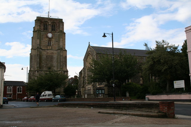
Beccles
Beccles ( ) is a market town and civil parish in the English county of Suffolk.OS Explorer Map OL40: The Broads: (1:25 000) : . The town is shown on the milestone as from London via the A145 and A12 roads, north-east of London as the crow flies, south-east of Norwich and north-northeast of the county town of Ipswich. Nearby towns include Lowestoft to the east and Great Yarmouth to the north-east. The town lies on the River Waveney on the edge of The Broads National Park. It had a population at the 2011 census of 10,123. Worlingham is a suburb of Beccles; the combined population is 13,868. Beccles twinned with Petit-Couronne in France in 1978. History The name is conjectured to be derived from Becc-Liss* (Brittonic=Small-court). However, also offered is Bece-laes* (Old English=Meadow by Stream), as well as a contraction of ''Beata Ecclesia'', the name of the Christian temple erected c. 960 by the monks of the monastery of Bury. Once a flourishing Anglian riverport, it lie ... [...More Info...] [...Related Items...] OR: [Wikipedia] [Google] [Baidu] |
Ellingham, Norfolk
Ellingham is a village and civil parish in the English county of Norfolk. The village is located north-east of Bungay and south-east of Norwich, along the River Waveney. The majority of the population lies in the east of the parish in Kirby Row. History Ellingham's name is of Anglo-Saxon origin and derives from the Old English for either Ella's homestead or village or a settlement with an abudance of eels. Archaeological evidence suggests that Ellingham was the site of several roughly five Roman kilns, one of the kilns was operated by Regalis, who moved to the parish from Camulodunum. In the Domesday Book, Ellingham is listed as a settlement of 31 households in the hundred of Clavering. In 1086, the village was part of the East Anglian estates of King William I. Ellingham Mill was in operation from the Twelfth Century to 1964, grinding crops into either flour or animal feed. The mill still stands today and is awaiting a conservation plan from Norfolk Heritage. In the late ... [...More Info...] [...Related Items...] OR: [Wikipedia] [Google] [Baidu] |
Eastern Region Of British Railways
The Eastern Region was a region of British Railways from 1948, whose operating area could be identified from the dark blue signs and colour schemes that adorned its station and other railway buildings. Together with the North Eastern Region (which it absorbed in 1967), it covered most lines of the former London and North Eastern Railway, except in Scotland. By 1988 the Eastern Region had been divided again into the Eastern Region and the new Anglia Region, with the boundary points being between and , and between and . The region ceased to be an operating unit in its own right in the 1980s and was wound up at the end of 1992. History The region was formed in at nationalisation in 1948, mostly out of the former Great Northern, Great Eastern and Great Central lines that were merged into the LNER in 1923. Of all the "Big Four" pre-nationalisation railway companies, the LNER was most in need of significant investment. In the immediate post-war period there was a need to rebuild ... [...More Info...] [...Related Items...] OR: [Wikipedia] [Google] [Baidu] |
London And North Eastern Railway
The London and North Eastern Railway (LNER) was the second largest (after LMS) of the " Big Four" railway companies created by the Railways Act 1921 in Britain. It operated from 1 January 1923 until nationalisation on 1 January 1948. At that time, it was divided into the new British Railways' Eastern Region, North Eastern Region, and partially the Scottish Region. History The company was the second largest created by the Railways Act 1921. The principal constituents of the LNER were: * Great Eastern Railway * Great Central Railway * Great Northern Railway * Great North of Scotland Railway * Hull and Barnsley Railway * North British Railway * North Eastern Railway The total route mileage was . The North Eastern Railway had the largest route mileage of , whilst the Hull and Barnsley Railway was . It covered the area north and east of London. It included the East Coast Main Line from London to Edinburgh via York and Newcastle upon Tyne and the routes from Edinburgh to ... [...More Info...] [...Related Items...] OR: [Wikipedia] [Google] [Baidu] |


