|
Eggenwil
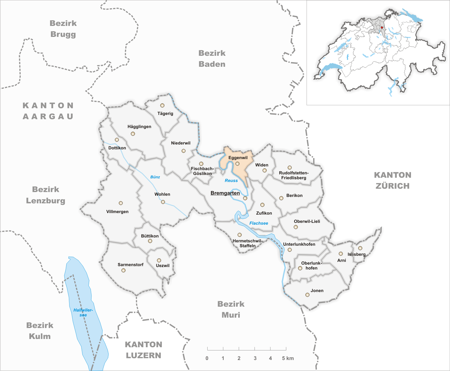
Eggenwil is a municipality in the district of Bremgarten in the canton of Aargau in Switzerland. History Eggenwil is first mentioned about 1160 as ''Egenwilare'' in a donation document, the ''Acta Murensia''. The village and church were given by Albert II, Count of Habsburg (died 1140) to Muri Abbey. However, the Habsburg rights of Low justice were given to the Hermetschwil abbey. In 1415 the canton of Aargau was taken from the Habsburgs by the Swiss Confederates. While Bern kept the southwest portion (Zofingen, Aarburg, Aarau, Lenzburg, and Brugg). Some districts, named the ''Freie Ämter'' or ''free bailiwicks'', with the County of Baden, were governed as "subject lands" by all or some of the Confederates. Part of Eggenwil was transferred to the ''Amt Hermetschwil'' of the ''Freie Ämter'', and the portions of the village north of the main road became part of the County of Baden. During the Helvetic Republic (1798–1803) Eggenwil and Widen formed a single muni ... [...More Info...] [...Related Items...] OR: [Wikipedia] [Google] [Baidu] |
Widen
Widen is a municipality in the district of Bremgarten in the canton of Aargau in Switzerland. History At the end of the 12th century a manor called "Wyda" is mentioned the first time, there's no exact year. "Widen", in the way like it's written today, appears the first time during the 14th century. In medieval times, the manor belonged to Habsburg. 1415 the Eidgenossen conquered the Aargau and Widen then belonged to the Grafschaft Baden. In March 1798 the French conquered Switzerland and proclamated the Helvetic Republic, in which Widen and Eggenwil formed one single municipality in the short-dated canton of Baden. After the foundation of the canton of Aargau 1803, Widen and Eggenwil were separated. Up to that time, there's not much known about Widen, because there are almost no documents left. During the 19th century Widen stayed a small village. Many poor inhabitants had to leave their homes and emigrated. The given up farms were freshly occupied by people from the canto ... [...More Info...] [...Related Items...] OR: [Wikipedia] [Google] [Baidu] |
Bremgarten (district)
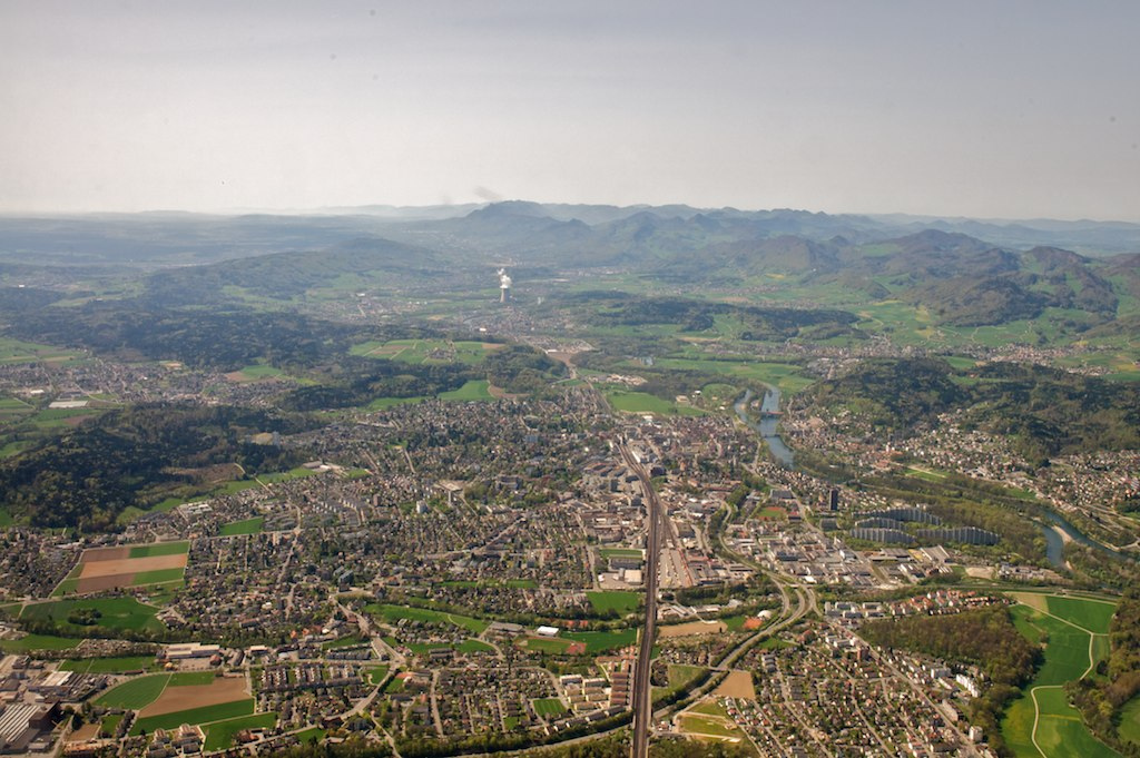
Bremgarten District is a Swiss district in the Canton of Aargau, corresponding to the valleys of the Reuss and Bünz rivers in the area known as the ''Freiamt''. Geography Bremgarten District has an area, , of . Of this area, 48.7% is used for agricultural purposes, while 30.9% is forested. The rest of the land, (18.1%) is settled. Demographics Bremgarten District has a population of (as of ). , there were 2,402 homes with 1 or 2 persons in the household, 11,781 homes with 3 or 4 persons in the household, and 9,773 homes with 5 or more persons in the household. The average number of people per household was 2.43 individuals. there were 10,969 single family homes (or 37.2% of the total) out of a total of 29,488 homes and apartments.Statistical Department of Canton Aargau accessed 20 January 2010 There were a total of 479 em ... [...More Info...] [...Related Items...] OR: [Wikipedia] [Google] [Baidu] |
Bremgarten, Aargau
Bremgarten is a municipality in the Swiss canton of Aargau. It serves as seat of the district of Bremgarten. The medieval old town is listed as a heritage site of national significance. In 2013, Bremgarten was the first municipality in Europe to introduce laws forbidding asylum seekers from visiting certain public places such as libraries, swimming pools, schools and churches. On 1 January 2014 the former municipality of Hermetschwil-Staffeln merged into the municipality of Bremgarten.Nomenklaturen – Amtliches Gemeindeverzeichnis der Schweiz accessed 13 December 2014 History The area was known before 1140 as ''Bremgarten'', though the city wasn't founded until almost a century later. In 1230, a settlement was fo ...[...More Info...] [...Related Items...] OR: [Wikipedia] [Google] [Baidu] |
Fischbach-Göslikon
Fischbach-Göslikon is a municipality in the district of Bremgarten in the canton of Aargau in Switzerland. History While several, individual mesolithic items have been found in the municipality, the first evidence of a settlement are two Hallstatt era graves. The current village was founded in the Middle Ages. The medieval settlements of Fischbach and Göslikon are first mentioned in the first half of the 12th century as ''Visbach und Fischbach''. In 1159 it was mentioned as ''Cohelinchon'', and in 1179 as ''Cozlinchon''. The high and low justice lay with the Habsburgs, and then after 1415 with the Swiss. The monasteries of Hermetschwil and Gnadental as well as citizens and institutions of Bremgarten held property in both villages. The parish church was consecrated in 1048 and at least from 1159, it was in possession of Muri Abbey. In 1360 it came under the authority of the ''Spital Baden''. Between 1529-31 the Protestant Reformation entered Fischbach-Göslikon, ... [...More Info...] [...Related Items...] OR: [Wikipedia] [Google] [Baidu] |
Künten
Künten is a municipality in the district of Baden in the canton of Aargau in Switzerland. It lies on the Reuss River and includes the previously independent community of Sulz, which merged with Künten in 1973. History Künten is first mentioned around 1101-50 as ''Chünten'' though this comes from a 14th Century copy of the original document. Geography Künten has an area, , of . Of this area, 56.3% is used for agricultural purposes, while 26.9% is forested. Of the rest of the land, 12.7% is settled (buildings or roads) and the remainder (4.1%) is non-productive (rivers or lakes). The municipality is located in the Baden district. It consists of the village of Künten on the Bremgarten-Fislisbach road and the village of Sulz along the Reuss river valley. Coat of arms The blazon of the municipal coat of arms is ''Per pale Argent a Latin Cross pattee couped and Gules a Bend Wavy Argent.'' Demographics Künten has a population (as of ) of . , 13.7% of the population ... [...More Info...] [...Related Items...] OR: [Wikipedia] [Google] [Baidu] |
Zufikon
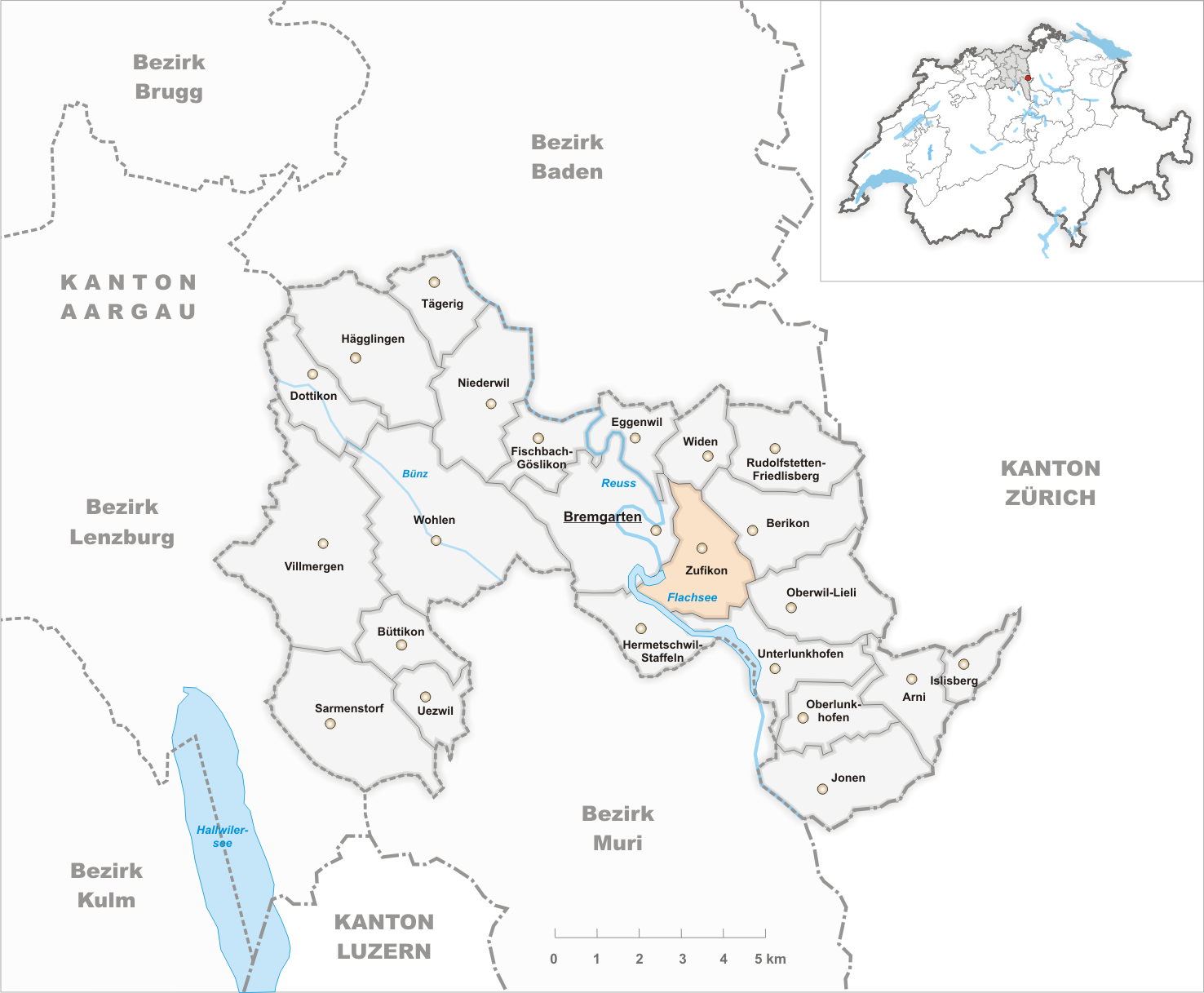
Zufikon is a municipality in the district of Bremgarten in the canton of Aargau in Switzerland. History A single archeological find dates human habitation in the area to the Bronze Age. The first written reference to the village occurred in 1150. Geography Zufikon has an area, , of . Of this area, 49.9% is used for agricultural purposes, while 27.1% is forested. Of the rest of the land, 20.7% is settled (buildings or roads) and the remainder (2.3%) is non-productive (rivers or lakes). Coat of arms The blazon of the municipal coat of arms is ''Argent a Pale Sable between two Keys palewise Azure with wards downwards and inwards.'' accessed 4 March 2010 Demographics Zufikon has a population (as of ) of . , 17.4% of the population was made up of foreign nationals.[...More Info...] [...Related Items...] OR: [Wikipedia] [Google] [Baidu] |
Bellikon
Bellikon is a municipality in the district of Baden in the canton of Aargau in Switzerland. History The area was settled during Roman times. The Roman road between Vindonissa (Windisch) and Turicum ( Zurich) ran through here. In 1934, bricks were found which on examination proved to belong to a villa, which was excavated and documented in 1941, and afterwards covered up again with the help of interned Polish soldiers. Articles found on the site indicate a construction date at the end of the 1st century. In the middle of the 6th century, the Alamanni settled here and cleared the forest, destroying the Roman settlement. Bellikon was first documented on October 11, 1064, in the foundation charter of Muri Abbey, though it was first individually mentioned in the 12th Century as ''Pellikon''. Bellikon and Hausen at first paid tithes to Murbach Abbey in Alsace, but was later part of the Habsburg territories. In 1415, the Aargau was conquered and thereafter Bellikon belonged to the vi ... [...More Info...] [...Related Items...] OR: [Wikipedia] [Google] [Baidu] |
Helvetic Republic
The Helvetic Republic (, , ) was a sister republic of France that existed between 1798 and 1803, during the French Revolutionary Wars. It was created following the French invasion and the consequent dissolution of the Old Swiss Confederacy, marking the end of the ''ancien régime'' in Switzerland. Throughout its existence, the republic incorporated most of the territory of modern Switzerland, excluding the cantons of Geneva and Neuchâtel and the old Prince-Bishopric of Basel. The Swiss Confederacy, which until then had consisted of self-governing cantons united by a loose military alliance (and ruling over subject territories such as Vaud), was invaded by the French Revolutionary Army and turned into an ally known as the "Helvetic Republic". The interference with localism and traditional liberties was deeply resented, although some modernizing reforms took place. Resistance was strongest in the more traditional Catholic cantons, with armed uprisings breaking out in spring 1 ... [...More Info...] [...Related Items...] OR: [Wikipedia] [Google] [Baidu] |
Aarau
Aarau (, ) is a List of towns in Switzerland, town, a Municipalities of Switzerland, municipality, and the capital of the northern Swiss Cantons of Switzerland, canton of Aargau. The List of towns in Switzerland, town is also the capital of the district of Aarau (district), Aarau. It is German-speaking and predominantly Protestant. Aarau is situated on the Swiss plateau, in the valley of the Aare, on the river's right bank, and at the southern foot of the Jura Mountains, and is west of Zürich, south of Basel and northeast of Bern. The municipality borders directly on the canton of Solothurn to the west. It is the largest town in Aargau. At the beginning of 2010 Rohr, Aargau, Rohr became a district of Aarau. The official language of Aarau is (the Swiss variety of Standard) Swiss Standard German, German, but the main spoken language is the local variant of the Alemannic German, Alemannic Swiss German (linguistics), Swiss German dialect. Geography and geology The old city of Aarau ... [...More Info...] [...Related Items...] OR: [Wikipedia] [Google] [Baidu] |
Lenzburg
Lenzburg is a town in the central region of the Swiss canton Aargau and is the capital of the Lenzburg District. The town, founded in the Middle Ages, lies in the Seetal valley, about 3 kilometres south of the Aare river. Lenzburg and the neighbouring municipalities of Niederlenz and Staufen have grown together in an agglomeration. History A Neolithic grave field of the Cortaillod culture has been discovered on the ''Goffersberg'' (close to the Lenzburg Castle) dating from 4300 - 3500 BCE. A Roman theater was uncovered when a motorway was built in 1964. It was part of a small settlement with 500 inhabitants that existed for approximately 200 years. The settlement was abandoned in the 3rd century. In the 5th and 6th centuries, an Alamanni settlement existed. Lenzburg is first mentioned in 924 as ''de Lencis''. In 1036, Lenzburg Castle was used for the first time as seat for the Count of Lenzburg, then an important lord. The house however died out in 1173, and the castle was t ... [...More Info...] [...Related Items...] OR: [Wikipedia] [Google] [Baidu] |
Brugg
, neighboring_municipalities = Gebenstorf, Habsburg, Hausen, Holderbank, Lupfig, Riniken, Rüfenach, Schinznach, Untersiggenthal, Villigen, Villnachern, Veltheim, Windisch , twintowns = Rottweil (Germany) , website = www.stadt-brugg.ch Brugg (sometimes written as Brugg AG in order to distinguish it from other ''Brugg''s) is a Swiss municipality and a town in the canton of Aargau and is the seat of the district of the same name. The town is located at the confluence of the Aare, Reuss, and Limmat, with the Aare flowing through its medieval part. It is located approximately from the cantonal capital of Aarau; from Zürich; and about from Basel. Brugg is the Swiss German term for bridge (german: Brücke). This is an allusion to the purpose of the medieval town's establishment under the Habsburgs, as the town is located at the narrowest point on the Aare in the Swiss midlands. The Habsburgs’ oldest known residence is located in the ne ... [...More Info...] [...Related Items...] OR: [Wikipedia] [Google] [Baidu] |
Choir
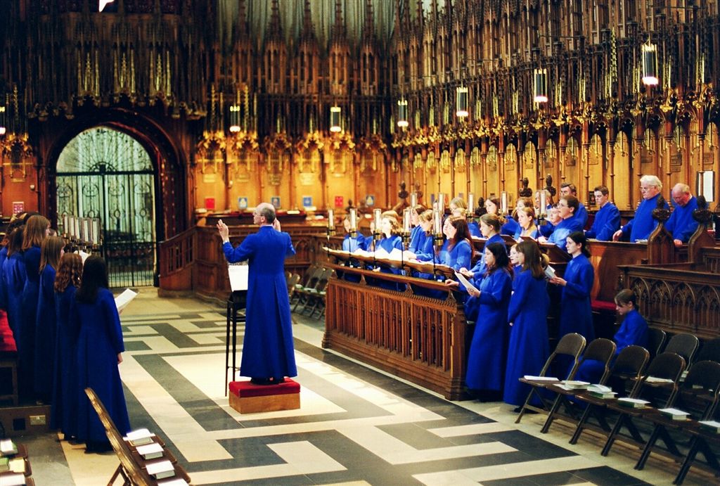
A choir ( ; also known as a chorale or chorus) is a musical ensemble of singers. Choral music, in turn, is the music written specifically for such an ensemble to perform. Choirs may perform music from the classical music repertoire, which spans from the medieval era to the present, or popular music repertoire. Most choirs are led by a conductor, who leads the performances with arm, hand, and facial gestures. The term ''choir'' is very often applied to groups affiliated with a church (whether or not they actually occupy the quire), whereas a ''chorus'' performs in theatres or concert halls, but this distinction is not rigid. Choirs may sing without instruments, or accompanied by a piano, pipe organ, a small ensemble, or an orchestra. A choir can be a subset of an ensemble; thus one speaks of the "woodwind choir" of an orchestra, or different "choirs" of voices or instruments in a polychoral composition. In typical 18th century to 21st century oratorios and masses, 'choru ... [...More Info...] [...Related Items...] OR: [Wikipedia] [Google] [Baidu] |


_restoracio_Fahr_152.jpg)
