|
Edgar Alwin Payne
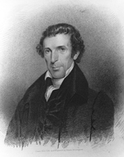
Edgar Alwin Payne (1 March 1883 – 8 April 1947) was an American painter. He was known as a Western landscape painter and muralist. Early life Payne was born near Cassville, Barry County, Missouri, in the heart of the Ozarks.. Cassville is in southwest Missouri, near the Arkansas border. According to the U.S. Census of 1900, he resided with his parents, two sisters and five brothers in Prairie Grove, Washington County, Arkansas; his Alabama-born father was employed as a carpenter. Edgar’s occupation was listed as “carpenter, apprentice.” Leaving home on several occasions, Payne painted houses, signs, portraits, murals, and local theater stage sets, to pay his way. Traveling through the Ozarks, then around the Southeast and Midwest, he finally wound up in Chicago, and enrolled to study portrait art at the School of the Art Institute of Chicago. He remained only two weeks at the institute, finding it too structured. He preferred instead to be self-taught, relying on practice ... [...More Info...] [...Related Items...] OR: [Wikipedia] [Google] [Baidu] |
Barry County, Missouri
Barry County is a county located in the southwest portion of the U.S. state of Missouri. As of the 2020 Census, the population was 34,534. Its county seat is Cassville. The county was organized in 1835 and named after William Taylor Barry, a U.S. Postmaster General from Kentucky. The town of Barry, also named after the postmaster-general, was located just north of Kansas City, not in Barry County. Geography According to the U.S. Census Bureau, the county has a total area of , of which is land and (1.6%) is water. Roaring River State Park is located in the southern part of the county, amid the Mark Twain National Forest. Adjacent counties * Lawrence County (north) * Stone County (east) *Carroll County, Arkansas (southeast) *Benton County, Arkansas (south) * McDonald County (southwest) * Newton County (northwest) Major highways * U.S. Route 60 * Route 37 * Route 39 * Route 76 * Route 86 * Route 97 * Route 248 National protected area *Mark Twain National Fores ... [...More Info...] [...Related Items...] OR: [Wikipedia] [Google] [Baidu] |
Glendale, California
Glendale is a city in the San Fernando Valley and Verdugo Mountains regions of Los Angeles County, California, Los Angeles County, California, United States. At the 2020 United States Census, 2020 U.S. Census the population was 196,543, up from 191,719 at the 2010 United States Census, 2010 census, making it the fourth-largest city in Los Angeles County and the List of largest California cities by population, 24th-largest city in California. It is located about north of downtown Los Angeles. Glendale lies in the Verdugo Mountains, and is a suburb in the Los Angeles metropolitan area. The city is bordered to the northwest by the Sun Valley, Los Angeles, Sun Valley and Tujunga, Los Angeles, California, Tujunga neighborhoods of Los Angeles; to the northeast by La Cañada Flintridge, California, La Cañada Flintridge and the unincorporated area of La Crescenta, California, La Crescenta; to the west by Burbank, California, Burbank and Griffith Park; to the east by Eagle Rock, Los An ... [...More Info...] [...Related Items...] OR: [Wikipedia] [Google] [Baidu] |
Muslin
Muslin () is a cotton fabric of plain weave. It is made in a wide range of weights from delicate sheers to coarse sheeting. It gets its name from the city of Mosul, Iraq, where it was first manufactured. Muslin of uncommonly delicate handspun yarn was handwoven in the Bengal region of South Asia and imported into Europe for much of the 17th and early 18th centuries. In 2013, the traditional art of weaving ''Jamdani'' muslin in Bangladesh was included in the list of Masterpieces of the Oral and Intangible Heritage of Humanity by UNESCO. History In 1298 CE, Marco Polo described the cloth in his book ''The Travels''. He said it was made in Mosul, Iraq. The 16th-century English traveller Ralph Fitch lauded the muslin he saw in Sonargaon. During the 17th and 18th centuries, Mughal Empire, Mughal Bengal Subah, Bengal emerged as the foremost muslin exporter in the world, with Mughal Dhaka as capital of the worldwide muslin trade. It became highly popular in 18th-century France a ... [...More Info...] [...Related Items...] OR: [Wikipedia] [Google] [Baidu] |
Thomas Moran
Thomas Moran (February 12, 1837 – August 25, 1926) was an American painter and printmaker of the Hudson River School in New York whose work often featured the Rocky Mountains. Moran and his family, wife Mary Nimmo Moran and daughter Ruth took residence in New York where he obtained work as an artist. He was a younger brother of the noted marine artist Edward Moran, with whom he shared a studio. A talented illustrator and exquisite colorist, Thomas Moran was hired as an illustrator at ''Scribner's Monthly''. During the late 1860s, he was appointed the chief illustrator for the magazine, a position that helped him launch his career as one of the premier painters of the American landscape, in particular, the American West. Moran along with Albert Bierstadt, Thomas Hill, and William Keith are sometimes referred to as belonging to the Rocky Mountain School of landscape painters because of all of the Western landscapes made by this group. Biography Moran was born in Bolton, Lan ... [...More Info...] [...Related Items...] OR: [Wikipedia] [Google] [Baidu] |
Grand Canyon
The Grand Canyon (, yuf-x-yav, Wi:kaʼi:la, , Southern Paiute language: Paxa’uipi, ) is a steep-sided canyon carved by the Colorado River in Arizona, United States. The Grand Canyon is long, up to wide and attains a depth of over a mile (). The canyon and adjacent rim are contained within Grand Canyon National Park, the Kaibab National Forest, Grand Canyon–Parashant National Monument, the Hualapai Indian Reservation, the Havasupai Indian Reservation and the Navajo Nation. President Theodore Roosevelt was a major proponent of the preservation of the Grand Canyon area and visited it on numerous occasions to hunt and enjoy the scenery. Nearly two billion years of Earth's geological history have been exposed as the Colorado River and its tributaries cut their channels through layer after layer of rock while the Colorado Plateau was uplifted. [...More Info...] [...Related Items...] OR: [Wikipedia] [Google] [Baidu] |
Taos, New Mexico
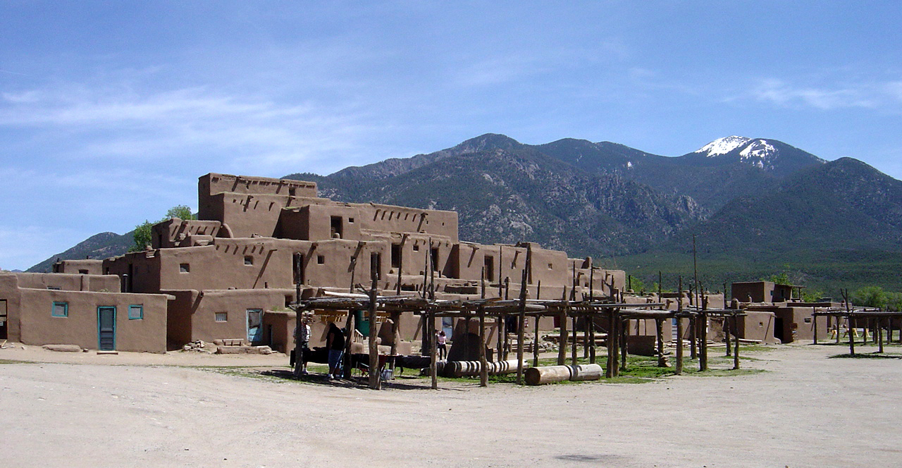
Taos is a town in Taos County in the north-central region of New Mexico in the Sangre de Cristo Mountains. Initially founded in 1615, it was intermittently occupied until its formal establishment in 1795 by Nuevo México Governor Fernando Chacón to act as fortified plaza and trading outpost for the neighboring Native American Taos Pueblo (the town's namesake) and Hispano communities, including Ranchos de Taos, Cañon, Taos Canyon, Ranchitos, El Prado, and Arroyo Seco. The town was incorporated in 1934. As of the 2010 census, its population was 5,716. Taos is the county seat of Taos County. The English name ''Taos'' derives from the native Taos language meaning "(place of) red willows". Taos is the principal town of the Taos, NM, Micropolitan Statistical Area, which includes all of Taos County. History Taos Pueblo The Taos Pueblo, which borders the north boundary of the town of Taos, has been occupied for nearly a millennium. It is estimated that the pueblo was built ... [...More Info...] [...Related Items...] OR: [Wikipedia] [Google] [Baidu] |
Canyon De Chelly National Monument
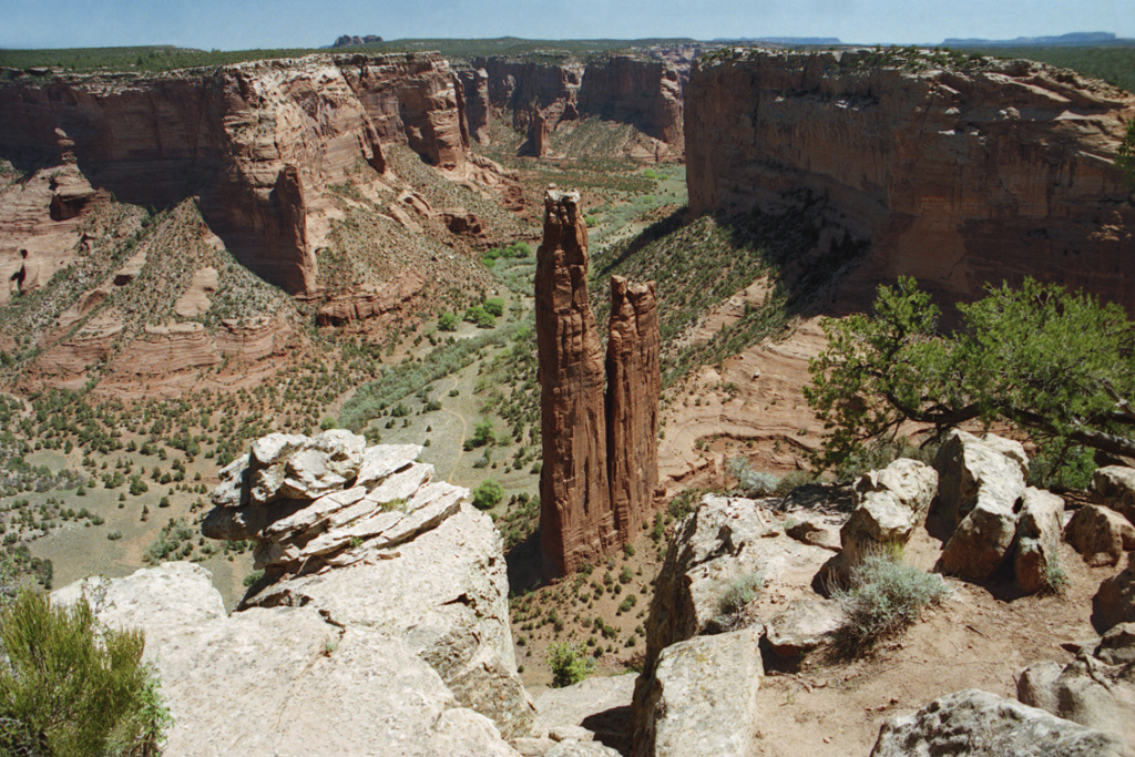
Canyon de Chelly National Monument ( ) was established on April 1, 1931, as a unit of the National Park Service. Located in northeastern Arizona, it is within the boundaries of the Navajo Nation and lies in the Four Corners region. Reflecting one of the longest continuously inhabited landscapes of North America, it preserves ruins of the indigenous tribes that lived in the area, from the Ancestral Puebloans (also known as the Anasazi) to the Navajo. The monument covers and encompasses the floors and rims of the three major canyons: de Chelly, del Muerto, and Monument. These canyons were cut by streams with headwaters in the Chuska Mountains just to the east of the monument. None of the land is federally owned. Canyon de Chelly is one of the most visited national monuments in the United States. Etymology The name ''Chelly'' (or ''Chelley'') is a Spanish borrowing of the Navajo word'' '', which means "canyon" (literally "inside the rock" < ''tsé'' "rock" + ''-yiʼ'' "insid ... [...More Info...] [...Related Items...] OR: [Wikipedia] [Google] [Baidu] |
Yosemite
Yosemite National Park ( ) is an American national park in California, surrounded on the southeast by Sierra National Forest and on the northwest by Stanislaus National Forest. The park is managed by the National Park Service and covers an area of and sits in four County, countiescentered in Tuolumne County, California, Tuolumne and Mariposa County, California, Mariposa, extending north and east to Mono County, California, Mono and south to Madera County, California, Madera County. Designated a World Heritage Site in 1984, Yosemite is internationally recognized for its granite cliffs, waterfalls, clear streams, Sequoiadendron giganteum, giant sequoia groves, lakes, mountains, meadows, glaciers, and Biodiversity, biological diversity. Almost 95 percent of the park is designated National Wilderness Preservation System, wilderness. Yosemite is one of the largest and least fragmented habitat blocks in the Sierra Nevada, and the park supports a diversity of plants and animals. The ... [...More Info...] [...Related Items...] OR: [Wikipedia] [Google] [Baidu] |
Indian Reservation
An Indian reservation is an area of land held and governed by a federally recognized Native American tribal nation whose government is accountable to the United States Bureau of Indian Affairs and not to the state government in which it is located. Some of the country's 574 federally recognized tribes govern more than one of the 326 Indian reservations in the United States, while some share reservations, and others have no reservation at all. Historical piecemeal land allocations under the Dawes Act facilitated sales to non–Native Americans, resulting in some reservations becoming severely fragmented, with pieces of tribal and privately held land being treated as separate enclaves. This jumble of private and public real estate creates significant administrative, political and legal difficulties. The total area of all reservations is , approximately 2.3% of the total area of the United States and about the size of the state of Idaho. While most reservations are small c ... [...More Info...] [...Related Items...] OR: [Wikipedia] [Google] [Baidu] |
Navajo Nation
The Navajo Nation ( nv, Naabeehó Bináhásdzo), also known as Navajoland, is a Native American reservation in the United States. It occupies portions of northeastern Arizona, northwestern New Mexico, and southeastern Utah; at roughly , the Navajo Nation is the largest land area held by a Native American tribe in the U.S., exceeding ten U.S. states. In 2010, the reservation was home to 173,667 out of 332,129 Navajo tribal members; the remaining 158,462 tribal members lived outside the reservation, in urban areas (26 percent), border towns (10 percent), and elsewhere in the U.S. (17 percent). The seat of government is located in Window Rock, Arizona. The United States gained ownership of this territory in 1848 after acquiring it in the Mexican-American War. The reservation was within New Mexico Territory and straddled what became the Arizona-New Mexico border in 1912, when the states were admitted to the union. Unlike many reservations, it has expanded several times since ... [...More Info...] [...Related Items...] OR: [Wikipedia] [Google] [Baidu] |
Four Corners
The Four Corners is a region of the Southwestern United States consisting of the southwestern corner of Colorado, southeastern corner of Utah, northeastern corner of Arizona, and northwestern corner of New Mexico. The Four Corners area is named after the quadripoint at the intersection of approximately 37° north latitude with 109° 03' west longitude, where the boundaries of the four states meet, and are marked by the Four Corners Monument. It is the only location in the United States where four states meet. Most of the Four Corners region belongs to semi-autonomous Native American nations, the largest of which is the Navajo Nation, followed by Hopi, Ute, and Zuni tribal reserves and nations. The Four Corners region is part of a larger region known as the Colorado Plateau and is mostly rural, rugged, and arid. In addition to the monument, commonly visited areas within Four Corners include Monument Valley, Mesa Verde National Park, Chaco Canyon, Canyons of the Ancie ... [...More Info...] [...Related Items...] OR: [Wikipedia] [Google] [Baidu] |


