|
Edelweißspitze
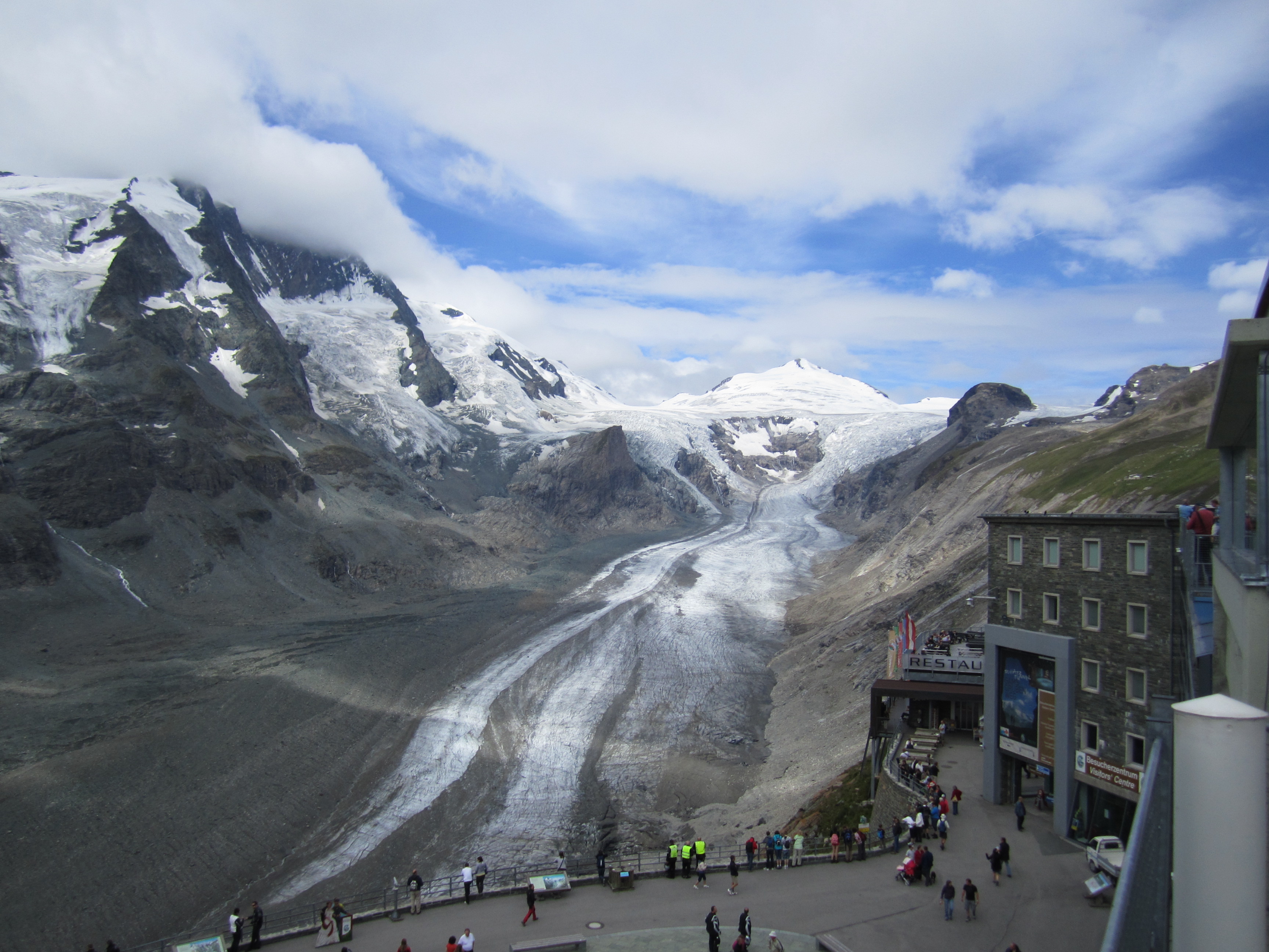
The is a summit in High Tauern, located in Salzburg (state), Salzburg, Austria north of the Alpine divide. It can be accessed by car from Edelweißstraße, a branch-off from Grossglockner High Alpine Road, starting from Fuscher Törl and is the highest-accessible point of the road. Originally, its height was 2577m before building the parking lot and was named ''Poneck'', ''Leitenkogel'' or ''Bergerkogel''. It serves as a scenic viewpoint of the High Tauern National Park with views to summits of the Glockner Group. In north-west direcetion, there is a Mountain hut, hut which includes a restaurant. References External links 360°-Webcam Glockner Group Mountains of Austria Mountains of the Alps {{Austria-mountain-stub ... [...More Info...] [...Related Items...] OR: [Wikipedia] [Google] [Baidu] |
Grossglockner High Alpine Road
The Grossglockner High Alpine Road (in German ''Großglockner Hochalpenstraße'') is the highest surfaced mountain pass road in Austria. It connects Bruck in the state of Salzburg with Heiligenblut in Carinthia via Fuscher Törl at 2,428 m (7,966 ft) and Hochtor Pass at . The road is named after the Grossglockner, Austria's highest mountain. Built as a scenic route, a toll is assessed for passage. Course The road leads from Bruck in the Salzach Valley via the northern toll booth at Ferleiten (near Fusch) with numbered hairpin curves up to Hochtor Pass, with a branch-off from Fuscher Törl at to the ''Edelweißspitze'' viewpoint at 2,571 m (8,435 ft). The scenic route crosses the Alpine divide in a tunnel and runs southwards passing another branch-off which leads to the ''Glocknerhaus'' mountain hut and the Kaiser-Franz-Josefs-Höhe visitors' centre at . The popular overlook was named after a visit by Emperor Franz Joseph I of Austria and his consort Elisabeth in 1856. ... [...More Info...] [...Related Items...] OR: [Wikipedia] [Google] [Baidu] |
Salzburg (state)
Salzburg (, ; bar, Soizbuag, label=Bavarian language, Austro-Bavarian) (also known as ''Salzburgerland'') is a States of Austria, state (''Land'') of the modern Republic of Austria. It is officially named ''Land Salzburg'' to distinguish it from its eponymous capital — the city of Salzburg. For centuries, it was an independent Prince-Archbishopric of Salzburg, Prince-Bishopric of the Holy Roman Empire. Geography Location The state of Salzburg covers area of . It stretches along its main river — the Salzach – which rises in the Central Eastern Alps in the south to the Alpine foothills in the north. It is located in the north-west of Austria, close to the border with the Germany, German state of Bavaria; to the northeast lies the state of Upper Austria; to the east the state of Styria; to the south the states of Carinthia (state), Carinthia and Tyrol (state), Tyrol. With 529,085 inhabitants, it is one of the country's smaller states in terms of population. Running through th ... [...More Info...] [...Related Items...] OR: [Wikipedia] [Google] [Baidu] |
Austria
Austria, , bar, Östareich officially the Republic of Austria, is a country in the southern part of Central Europe, lying in the Eastern Alps. It is a federation of nine states, one of which is the capital, Vienna, the most populous city and state. A landlocked country, Austria is bordered by Germany to the northwest, the Czech Republic to the north, Slovakia to the northeast, Hungary to the east, Slovenia and Italy to the south, and Switzerland and Liechtenstein to the west. The country occupies an area of and has a population of 9 million. Austria emerged from the remnants of the Eastern and Hungarian March at the end of the first millennium. Originally a margraviate of Bavaria, it developed into a duchy of the Holy Roman Empire in 1156 and was later made an archduchy in 1453. In the 16th century, Vienna began serving as the empire's administrative capital and Austria thus became the heartland of the Habsburg monarchy. After the dissolution of the H ... [...More Info...] [...Related Items...] OR: [Wikipedia] [Google] [Baidu] |
High Tauern
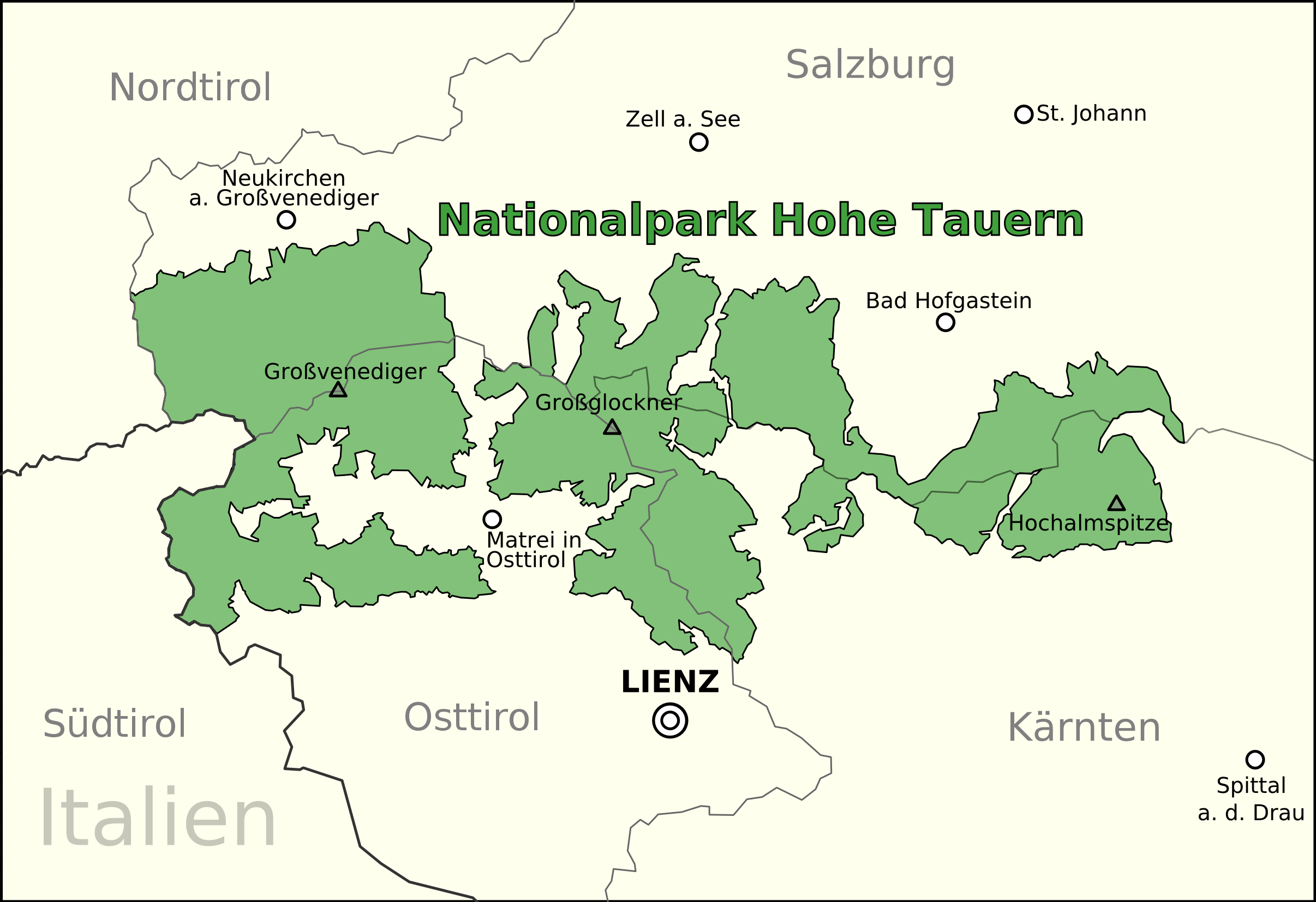
The High Tauern ( pl.; german: Hohe Tauern, it, Alti Tauri) are a mountain range on the main chain of the Central Eastern Alps, comprising the highest peaks east of the Brenner Pass. The crest forms the southern border of the Austrian states of Salzburg, Carinthia and East Tyrol, with a small part in the southwest belongs to the Italian province of South Tyrol. The range includes Austria's highest mountain, the Grossglockner at above the Adriatic. In the east, the range is adjoined by the Lower Tauern. For the etymology of the name, see Tauern. Geography According to the Alpine Club classification of the Eastern Alps, the range is bounded by the Salzach valley to the north (separating it from the Kitzbühel Alps), the Mur valley and the Murtörl Pass to the east (separating it from the Lower Tauern), the Drava valley to the south (separating it from the Southern Limestone Alps), and the Birnlücke Pass to the west (separating it from the Zillertal Alps). Its most important s ... [...More Info...] [...Related Items...] OR: [Wikipedia] [Google] [Baidu] |
Glockner Group
The Glockner Group Reynolds, Kev (2005). ''Walking in the Alps'', 2nd ed., Cicerone, Singapore, p.409, . (german: Glocknergruppe) is a sub-group of the Austrian Central Alps in the Eastern Alps, and is located in the centre section of the High Tauern on the main chain of the Alps. The Glockner Group lies in Austria in the federal states of Salzburg, Tyrol and Carinthia. The three states meet at a tripoint on the summit of the Eiskögele (). The highest summit of the Glockner Group and also the highest peak in Austria is the Großglockner (), which gives the mountain group its name. Considerable portions of the Glockner Group belong to the core zone of the High Tauern National Park. Also found in the Glockner Group is the Pasterze, the largest glacier in Austria. Boundaries The boundaries of the Glockner Group are defined as follows: the River Salzach from Uttendorf to Taxenbach; the Rauriser Tal to Wörth; Seidlwinkltal; Hochtor ( Großglockner High Alpine Road); Tauernba ... [...More Info...] [...Related Items...] OR: [Wikipedia] [Google] [Baidu] |
Alpine Divide
The main chain of the Alps, also called the Alpine divide is the central line of mountains that forms the drainage divide of the range. Main chains of mountain ranges are traditionally designated in this way, and generally include the highest peaks of a range. The Alps are something of an unusual case in that several significant groups of mountains are separated from the main chain by sizable distances. Among these groups are the Dauphine Alps, the Eastern and Western Graians, the entire Bernese Alps, the Tödi, Albula and Silvretta groups, the Ortler and Adamello ranges, and the Dolomites of South Tyrol, as well as the lower Alps of Vorarlberg, Bavaria, and Salzburg. Main features The Alpine Divide is defined for much of its distance by the watershed between the drainage basin of the Po in Italy on one side, with the other side of the divide being formed by the Rhone, the Rhine and the Danube. Further east, the watershed is between the Adige and the Danube, ... [...More Info...] [...Related Items...] OR: [Wikipedia] [Google] [Baidu] |
High Tauern National Park
The High Tauern ( pl.; german: Hohe Tauern, it, Alti Tauri) are a mountain range on the main chain of the Central Eastern Alps, comprising the highest peaks east of the Brenner Pass. The crest forms the southern border of the Austrian states of Salzburg, Carinthia and East Tyrol, with a small part in the southwest belongs to the Italian province of South Tyrol. The range includes Austria's highest mountain, the Grossglockner at above the Adriatic. In the east, the range is adjoined by the Lower Tauern. For the etymology of the name, see Tauern. Geography According to the Alpine Club classification of the Eastern Alps, the range is bounded by the Salzach valley to the north (separating it from the Kitzbühel Alps), the Mur valley and the Murtörl Pass to the east (separating it from the Lower Tauern), the Drava valley to the south (separating it from the Southern Limestone Alps), and the Birnlücke Pass to the west (separating it from the Zillertal Alps). Its most important su ... [...More Info...] [...Related Items...] OR: [Wikipedia] [Google] [Baidu] |
Mountain Hut
A mountain hut is a building located high in the mountains, generally accessible only by foot, intended to provide food and shelter to mountaineers, climbers and hikers. Mountain huts are usually operated by an Alpine Club or some organization dedicated to hiking or mountain recreation. They are known by many names, including alpine hut, mountain shelter, mountain refuge, mountain lodge, and mountain hostel. It may also be called a refuge hut, although these occur in lowland areas (e.g. lowland forests) too. Mountain huts can provide a range of services, starting with shelter and simple sleeping berths. Some, particularly in remote areas, are not staffed, but others have staff which prepare meals and drinks and can provide other services, including providing lectures and selling clothing and small items. Mountain huts usually allow anybody to access their facilities, although some require reservations. While shelters have long existed in mountains, modern hut systems date back ... [...More Info...] [...Related Items...] OR: [Wikipedia] [Google] [Baidu] |


