|
Eastwick, Hertfordshire
Eastwick is a village and civil parish east of Hertford, in the East Hertfordshire district, in the county of Hertfordshire, England. In 2011 the parish had a population of 194. The parish touches Gilston, High Wych, Hunsdon and Widford. Eastwick shares a parish council with Gilston. Landmarks There are 11 listed buildings in Eastwick. Eastwick has a church called St Botolph's Church and a pub called the Lion. History The name "Eastwick" means 'East specialised farm'. Eastwick was recorded in the Domesday Book Domesday Book () – the Middle English spelling of "Doomsday Book" – is a manuscript record of the "Great Survey" of much of England and parts of Wales completed in 1086 by order of King William I, known as William the Conqueror. The manus ... as ''Esteuuiche''. Eastwick was ''Esteuiche'' in the 11th century, ''Estuic'' in the 12th century, ''Estuick'', ''Estwyk'' and ''Estwyke'' in the 13th century, ''Estwyk atte Flore'' in the 14th century and ''Eastuic ... [...More Info...] [...Related Items...] OR: [Wikipedia] [Google] [Baidu] |
East Hertfordshire
East Hertfordshire is a local government district in Hertfordshire, England. Its council is based in Hertford, the county town of Hertfordshire. The largest town in the district is Bishop's Stortford, and the other main towns are Ware, Buntingford and Sawbridgeworth. At the 2011 Census, the population of the district was 137,687. The district was formed on 1 April 1974, under the Local Government Act 1972, by the merger of the municipal borough of Hertford with Bishop's Stortford, Sawbridgeworth and Ware urban districts, and Braughing Rural District, Ware Rural District and part of Hertford Rural District. By area it is the largest of the ten local government districts in Hertfordshire. It borders the North Hertfordshire district and the boroughs of Stevenage, Welwyn Hatfield and Broxbourne in Hertfordshire, and the districts of Epping Forest, Harlow and Uttlesford in Essex. In the 2006 edition of Channel 4's "Best and Worst Places to Live in the UK", East Hertfordshire ... [...More Info...] [...Related Items...] OR: [Wikipedia] [Google] [Baidu] |
Hertfordshire
Hertfordshire ( or ; often abbreviated Herts) is one of the home counties in southern England. It borders Bedfordshire and Cambridgeshire to the north, Essex to the east, Greater London to the south, and Buckinghamshire to the west. For government statistical purposes, it forms part of the East of England region. Hertfordshire covers . It derives its name – via the name of the county town of Hertford – from a hart (stag) and a ford, as represented on the county's coat of arms and on the flag. Hertfordshire County Council is based in Hertford, once the main market town and the current county town. The largest settlement is Watford. Since 1903 Letchworth has served as the prototype garden city; Stevenage became the first town to expand under post-war Britain's New Towns Act of 1946. In 2013 Hertfordshire had a population of about 1,140,700, with Hemel Hempstead, Stevenage, Watford and St Albans (the county's only ''city'') each having between 50,000 and 100,000 r ... [...More Info...] [...Related Items...] OR: [Wikipedia] [Google] [Baidu] |
Civil Parish
In England, a civil parish is a type of administrative parish used for local government. It is a territorial designation which is the lowest tier of local government below districts and counties, or their combined form, the unitary authority. Civil parishes can trace their origin to the ancient system of ecclesiastical parishes, which historically played a role in both secular and religious administration. Civil and religious parishes were formally differentiated in the 19th century and are now entirely separate. Civil parishes in their modern form came into being through the Local Government Act 1894, which established elected parish councils to take on the secular functions of the parish vestry. A civil parish can range in size from a sparsely populated rural area with fewer than a hundred inhabitants, to a large town with a population in the tens of thousands. This scope is similar to that of municipalities in Continental Europe, such as the communes of France. However, ... [...More Info...] [...Related Items...] OR: [Wikipedia] [Google] [Baidu] |
Hertford
Hertford ( ) is the county town of Hertfordshire, England, and is also a civil parish in the East Hertfordshire district of the county. The parish had a population of 26,783 at the 2011 census. The town grew around a ford on the River Lea, near its confluences with the rivers Mimram, Beane, and Rib. The Lea is navigable from the Thames up to Hertford. Fortified settlements were established on each side of the ford at Hertford in 913AD. The county of Hertfordshire was established at a similar time, being named after and administered from Hertford. Hertford Castle was built shortly after the Norman Conquest in 1066 and remained a royal residence until the early seventeenth century. Hertfordshire County Council and East Hertfordshire District Council both have their main offices in the town and are major local employers, as is McMullen's Brewery, which has been based in the town since 1827. The town is also popular with commuters, being only north of central London and connect ... [...More Info...] [...Related Items...] OR: [Wikipedia] [Google] [Baidu] |
GENUKI
GENUKI is a genealogy web portal, run as a charitable trust. It "provides a virtual reference library of genealogical information of particular relevance to the UK and Ireland". It gives access to a large collection of information, with the emphasis on primary sources, or means to access them, rather than on existing genealogical research. Name The name derives from "GENealogy of the UK and Ireland", although its coverage is wider than this. From the GENUKI website: Structure The website has a well defined structure at four levels. * The first level is information that is common to all "the United Kingdom and Ireland". * The next level has information for each of England (see example) Ireland, Scotland, Wales, the Channel Islands and the Isle of Man. * The third level has information on each pre-1974 county of England and Wales, each of the pre-1975 counties of Scotland, each of the 32 counties of Ireland and each island of the Channel Islands (e.g. Cheshire, County Kerry and G ... [...More Info...] [...Related Items...] OR: [Wikipedia] [Google] [Baidu] |
Gilston
Gilston is a village and civil parish in the East Hertfordshire district of Hertfordshire, England. It is located a little over one mile north of the town of Harlow in the neighbouring county of Essex. Together with the nearby hamlet of Eastwick, it forms the parish council of Eastwick and Gilston. At the 2001 Census, the population was 180, and 228 at the 2011 Census. The name derives from ''Gedel'' or ''Gydel'', an Old English personal name, and ''tun'', meaning farm or settlement. The Parish Church of St Mary dates from the 13th century, and is Grade I listed In the United Kingdom, a listed building or listed structure is one that has been placed on one of the four statutory lists maintained by Historic England in England, Historic Environment Scotland in Scotland, in Wales, and the Northern Irel .... See also * The Hundred Parishes References External links Gilston (A Guide to Old Hertfordshire)History of Gilston in East Hertfordshire , Map and description ... [...More Info...] [...Related Items...] OR: [Wikipedia] [Google] [Baidu] |
High Wych
High Wych is a village and civil parish in the East Hertfordshire district of Hertfordshire, England. The village is located a little over one mile south-west of the town of Sawbridgeworth, and around three miles north-east of Harlow in the neighbouring county of Essex. The parish includes the settlements of Great Pennys, Trimms Green, Sacombs Ash, Allens Green, Chandlers, Carters, Rook End, Hoskins and Sayes Park. The village contains a Church of England primary school and a late 19th-century church, St James, with a marble reredos and a Father Willis Henry Willis (27 April 1821 – 11 February 1901), also known as "Father" Willis, was an English organ player and builder, who is regarded as the foremost organ builder of the Victorian era. His company Henry Willis & Sons remains in busin ... organ. A moated site is all that remains of the medieval residence of Mathams. There is also a Georgian historical house called the Manor of Groves which is now a hotel. High ... [...More Info...] [...Related Items...] OR: [Wikipedia] [Google] [Baidu] |
Hunsdon
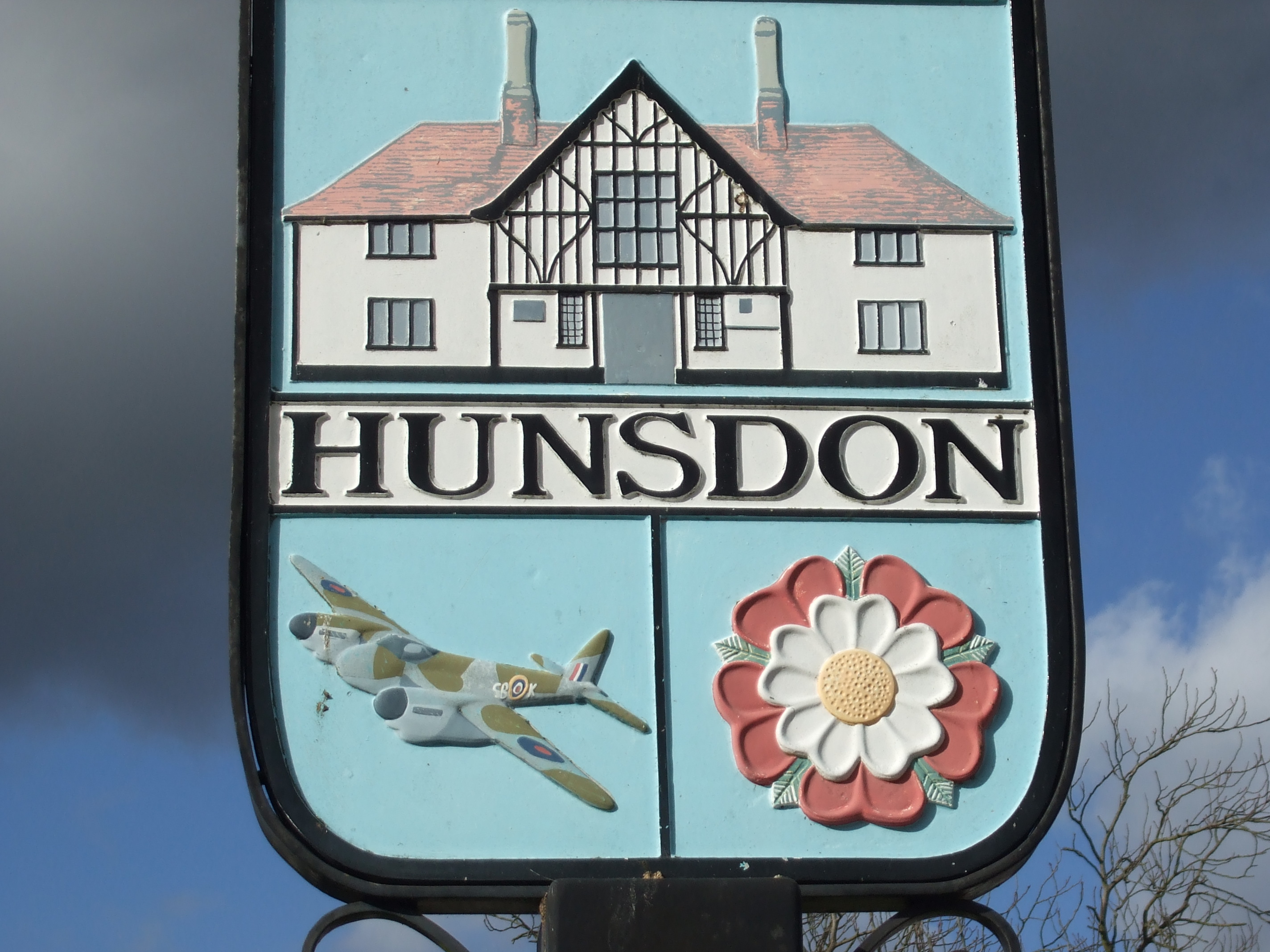
Hunsdon is a village and civil parish in Hertfordshire, England. It is around east of Ware and north-west of Harlow. The population of the village taken at the 2011 Census was 1,080. See also *Baron Hunsdon *Hunsdon Airfield *The Hundred Parishes The Hundred Parishes is an area of the East of England with no formal recognition or status, albeit that the concept has the blessing of county and district authorities. It encompasses around 450 square miles (1,100 square kilometres) of northwes ... References External linksHunsdon Village Hall {{authority control [...More Info...] [...Related Items...] OR: [Wikipedia] [Google] [Baidu] |
Widford, Hertfordshire
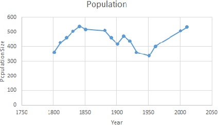
Widford is a village and civil parish between Ware and Much Hadham in the East Hertfordshire district of Hertfordshire in England. It covers an area of approximately 1,167 acres and contains 220 houses. The River Ash flows through the north of the parish. Widford had a population of 534 people in the 2011 census. History The name Widford comes from the old English word 'wid' meaning willow tree and the word 'ford' The Widford commons were extensive and were enclosed under an award of 1856. There was a wood called Lily Wood to the west of the village which was cut down in the late 19th century. Between 1870 and 1872, John Marius Wilson described Widford as: "a parish, with a village, in Ware district, Herts; near the Buntingford railway, 4 miles E by N of Ware. It has a post-office under Ware, and a r. station." Demography and employment The population of Widford was first recorded in 1801 at 361. The population peaked in 1841 at 539. In the most recent census in 2011 the p ... [...More Info...] [...Related Items...] OR: [Wikipedia] [Google] [Baidu] |
Ordnance Survey
, nativename_a = , nativename_r = , logo = Ordnance Survey 2015 Logo.svg , logo_width = 240px , logo_caption = , seal = , seal_width = , seal_caption = , picture = , picture_width = , picture_caption = , formed = , preceding1 = , dissolved = , superseding = , jurisdiction = Great BritainThe Ordnance Survey deals only with maps of Great Britain, and, to an extent, the Isle of Man, but not Northern Ireland, which has its own, separate government agency, the Ordnance Survey of Northern Ireland. , headquarters = Southampton, England, UK , region_code = GB , coordinates = , employees = 1,244 , budget = , minister1_name = , minister1_pfo = , chief1_name = Steve Blair , chief1_position = CEO , agency_type = , parent_agency = , child1_agency = , keydocument1 = , website = , footnotes = , map = , map_width = , map_caption = Ordnance Survey (OS) is the national mapping agency for Great Britain. The agency's name indicates its original military purpose (se ... [...More Info...] [...Related Items...] OR: [Wikipedia] [Google] [Baidu] |
Listed Buildings In Eastwick, Hertfordshire
{{disambig ...
Listed may refer to: * Listed, Bornholm, a fishing village on the Danish island of Bornholm * Listed (MMM program), a television show on MuchMoreMusic * Endangered species in biology * Listed building, in architecture, designation of a historically significant structure * Listed company, see listing (finance), a public company whose shares are traded e.g. on a stock exchange * UL Listed, a certification mark * A category of Group races in horse racing See also * Listing (other) Listing may refer to: * Enumeration of a set of items in the form of a list * Johann Benedict Listing (1808–1882), German mathematician. * Listing (computer), a computer code listing. * Listing (finance), the placing of a company's shares on the l ... [...More Info...] [...Related Items...] OR: [Wikipedia] [Google] [Baidu] |
Domesday Book
Domesday Book () – the Middle English spelling of "Doomsday Book" – is a manuscript record of the "Great Survey" of much of England and parts of Wales completed in 1086 by order of King William I, known as William the Conqueror. The manuscript was originally known by the Latin name ''Liber de Wintonia'', meaning "Book of Winchester", where it was originally kept in the royal treasury. The '' Anglo-Saxon Chronicle'' states that in 1085 the king sent his agents to survey every shire in England, to list his holdings and dues owed to him. Written in Medieval Latin, it was highly abbreviated and included some vernacular native terms without Latin equivalents. The survey's main purpose was to record the annual value of every piece of landed property to its lord, and the resources in land, manpower, and livestock from which the value derived. The name "Domesday Book" came into use in the 12th century. Richard FitzNeal wrote in the ''Dialogus de Scaccario'' ( 1179) that the book ... [...More Info...] [...Related Items...] OR: [Wikipedia] [Google] [Baidu] |


