|
Eastend
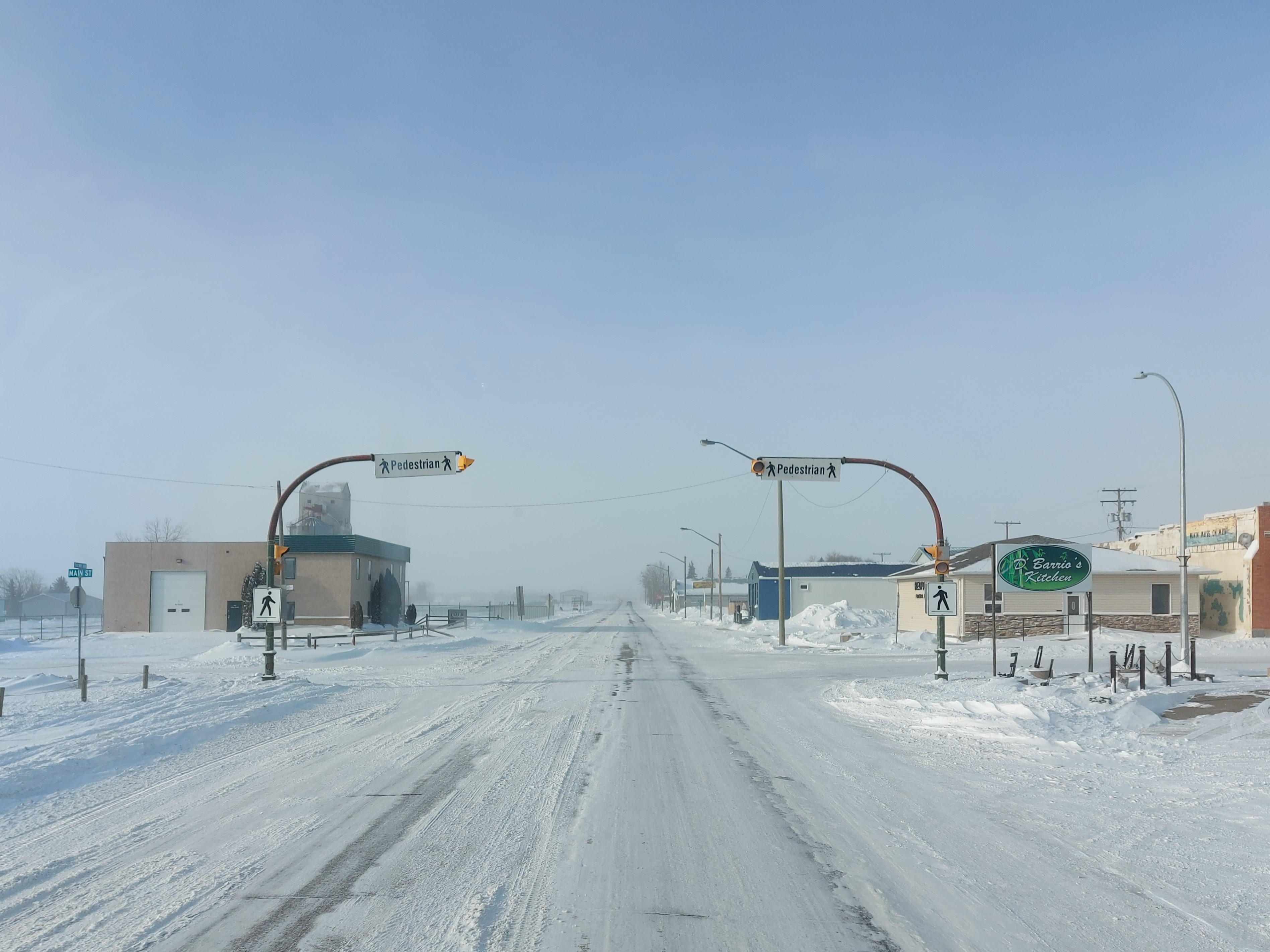
Eastend is a town in south-west part of the Canadian province of Saskatchewan, situated approximately north of the Montana border and east of the Alberta border. The town is best known for the nearby discovery of a ''Tyrannosaurus rex'' skeleton nicknamed "Scotty" in 1994. The town has used the discovery of this fossil as the main centrepiece in the construction of a museum called the ''T.rex Discovery Centre'', which opened on May 30, 2003. The centre is operated by the Royal Saskatchewan Museum, and contains the RSM Fossil Research Station. Eastend has been home to many famous residents, including the writer Wallace Stegner, who lived in the town between 1917 and 1921 and featured it as the village Whitemud in his book ''Wolf Willow''. Today, the former home of Stegner is used as an artists retreat which can be rented out by artists to focus on their work. History The Eastend Area is rich in history and geology, and is rife with paleontological sites. A Métis settlement ... [...More Info...] [...Related Items...] OR: [Wikipedia] [Google] [Baidu] |
Eastend Formation
The Eastend Formation is a stratigraphical unit of Maastrichtian age in the Western Canadian Sedimentary Basin. It takes its name from the town of Eastend, Saskatchewan, and was first described in outcrop around the settlement by L.S. Russell in 1932. The type locality was later defined south-west of the town by W.O. Kupsch in 1956.Kupsch, W.O., 1956. Frenchman Formation of eastern Cypress Hills, Saskatchewan, Canada. Geological Society of America Bull. v. 6a, p. 413-420. Lithology The Eastend Formation is composed lithic sandstone with volcanic grains, concretionary layers and green-grey shale beds. Coal beds are found in southern Alberta. Distribution The Eastend Formation reaches a thickness of near the town of Eastend. It is eroded to the north and east, where the Frenchman Formation lies directly over the Bearpaw Formation. Relationship to other units The Eastend Formation is conformably overlain by the Whitemud Formation and gradually overlies the Bearpaw Formation ... [...More Info...] [...Related Items...] OR: [Wikipedia] [Google] [Baidu] |
Saskatchewan Highway 13
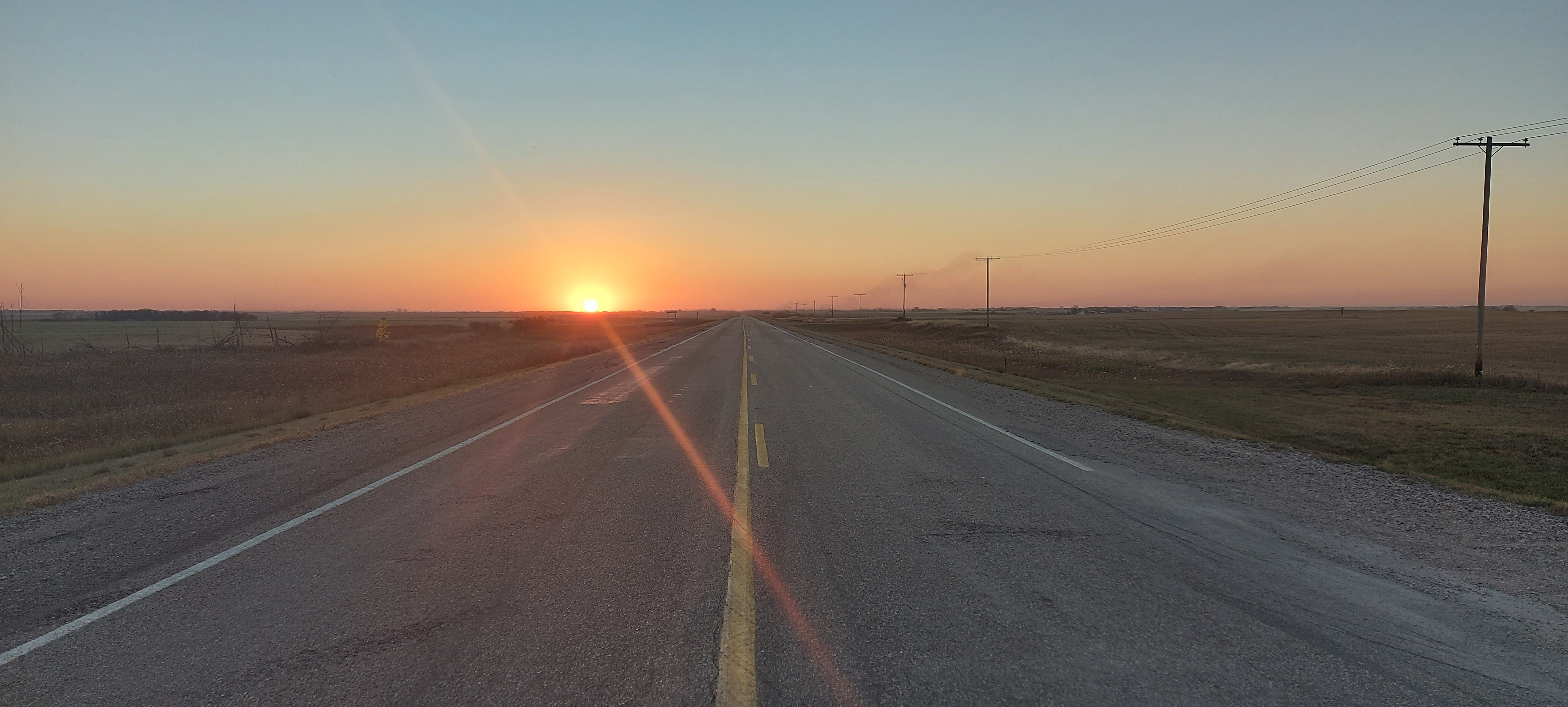
Highway 13 is a highway in the Canadian province of Saskatchewan. It runs from the Alberta border (continuing westward as Alberta Highway 501) until it transitions into Highway 2 at the Manitoba border near Antler. Highway 13 is about 676 km (420 mi.) long. Highway 13 passes through Shaunavon, Assiniboia, Weyburn, Redvers and Carlyle. It is also referred to as the Red Coat Trail, as much of its length follows the route of the original historic path. A majority of the route between Wauchope and Govenlock going through the Palliser's Triangle is also referred to as the Ghost Town Trail. Travel route Travel east through the province of Saskatchewan on the Red Coat Trail is continuous on Highway 13 which is a secondary paved undivided highway until Weyburn. Highway 13 crosses Lodge Creek and Middle Creek, then passes the junction with Highway 21 south followed by Highway 615 north. The highway volume beginning in Saskatchewan along the highway about 45 vehicles pe ... [...More Info...] [...Related Items...] OR: [Wikipedia] [Google] [Baidu] |
Cypress Hills (Canada)
The Cypress Hills are a geographical region of hills in southwestern Saskatchewan and southeastern Alberta, Canada. The hills are part of the Missouri Coteau upland. The highest point in the Cypress Hills is at Head of the Mountain in Alberta at . The highest point in Saskatchewan is , in a farmer's field in the Cypress Hills, at . Name The Cypress Hills have been known by a wide number of Indigenous and European names throughout their history. An 1882 Blackfoot–English dictionary written by C. M. Lanning provided the Blackfoot language name , which translates as "striped earth" or "earth over earth". The Cree language name, in use at the same time, is , (spelled in a variety of anglicized forms including "Mun-a-tuh-gow"), sometimes said to mean "beautiful upland" but more accurately referring to "an area to be respected, protected, taken care of and/or taken care with". The Assiniboine language name is . The Gros Ventre language name is ' "pine trees". Early Métis hunters, ... [...More Info...] [...Related Items...] OR: [Wikipedia] [Google] [Baidu] |
Royal Saskatchewan Museum
The Royal Saskatchewan Museum (RSM) is a Canadian natural history museum in Regina, Saskatchewan. Founded in 1906, it is the first museum in Saskatchewan, and the first provincial museum in the three Prairie Provinces. The institution was formed to secure and preserve natural history specimens and objects of historical and ethnological interest. Known as the Saskatchewan Museum of Natural History, the museum received royal patronage from Queen Elizabeth II, and was renamed the Royal Saskatchewan Museum in 1993. History Between 1906 and 1945 the Museum occupied several premises including the Regina Trading Company Building, the Provincial Legislative Building, and the Normal School (the easternmost historic building on the "College Avenue" campus of the University of Regina). During the Second World War the Museum's collections were taken out of public display and stored initially in the General Motors Building (east on Dewdney Avenue) to permit the Normal School to be used for t ... [...More Info...] [...Related Items...] OR: [Wikipedia] [Google] [Baidu] |
Frenchman River
The Frenchman River, ( ats, níhʔɔɔtóóúníícááh, lit=white person river), also known locally as the Whitemud River, is a river in Saskatchewan, Canada and Montana, United States. It is a tributary of the Milk River, itself a tributary of the Missouri and in turn a part of the Mississippi River watershed that flows to the Gulf of Mexico. The river is approximately long. The name origin is uncertain, although both Métis and francophone settlers inhabited its banks at the turn of the 20th century. The Frenchman Formation, a stratigraphical unit of the Western Canadian Sedimentary Basin, was named for the river. Course The headwaters are found in Cypress Lake, in the Cypress Hills, at an elevation of . It flows east towards Eastend, then turns south-east. Various reservoirs are built on its course (Eastend Reservoir, Huff Lake, Newton Lake) and the river is used extensively for irrigation. The river becomes meandered as it flows through the Grasslands National Park. ... [...More Info...] [...Related Items...] OR: [Wikipedia] [Google] [Baidu] |
Wallace Stegner
Wallace Earle Stegner (February 18, 1909 – April 13, 1993) was an American novelist, short story writer, environmentalist, and historian, often called "The Dean of Western Writers". He won the Pulitzer Prize in 1972 and the U.S. National Book Award in 1977. Personal life Stegner was born in Lake Mills, Iowa, and grew up in Great Falls, Montana; Salt Lake City, Utah; and the village of Eastend, Saskatchewan, which he wrote about in his autobiography ''Wolf Willow''. Stegner says he "lived in twenty places in eight states and Canada". He was the son of Hilda (née Paulson) and George Stegner. Stegner summered in Greensboro, Vermont. While living in Utah, he joined a Boy Scout troop at an LDS Church (although he himself was a Presbyterian) and earned the Eagle Scout award. He received a B.A. at the University of Utah in 1930. While at the University of Utah he was initiated into Sigma Nu International Fraternity. He was inducted into the Sigma Nu Hall of Honor at the 68th Grand ... [...More Info...] [...Related Items...] OR: [Wikipedia] [Google] [Baidu] |
Gull Lake, Saskatchewan
Gull Lake is a town in Saskatchewan, Canada, situated on the junction of the Trans-Canada Highway and Highway 37, west of Swift Current. History The history of the Gull Lake community dates back to 1906, when a development company Conrad and Price acquired and surveyed the town site and subdivided it into blocks. Unlike most other towns located along the Canadian Pacific Railway main line, Gull Lake was not planned and established by the railroad. In fact, there was some animosity from the railroad towards this town that bucked their plan. The origin of the name Gull Lake comes from the Cree word for the area, ''Kiaskus'' (''kiyaskos'') which means "little gull". From 1906 to 1909 there was no municipal government or authority other than Conrad and Price: the company had full jurisdiction over civic affairs. In 1909 the citizens of Gull Lake had their community incorporated as a village.Town of Gull Lake History Committee. (1989). Gull Lake memories: a history of the town of ... [...More Info...] [...Related Items...] OR: [Wikipedia] [Google] [Baidu] |
List Of Saskatchewan Provincial Highways
This is a list of Saskatchewan's highways: Only Highways 1, 2, 5, 6, 7, 11, 12, 16, and 39 contain sections of divided highway. Speed limits range from 90 km/h (55 mph) to 110 km/h (70 mph). Saskatchewan is the only province bordering the United States with no direct connection to the Interstate Highway System. Named routes * Can Am Highway *Circle Drive *Hanson Lake Road * Little Swan Road *Louis Riel Trail * McBride Lake Road *Northern Woods and Water Route * Ring Road *Red Coat Trail *Regina Bypass *Saskatoon Freeway * Saskota Travel Route * Trans-Canada Highway * Veterans Memorial Highway * Yellowhead Highway Primary (1–99) These are primary highways maintained by the provincial government. Almost all of these highways are paved for most of their length. Highways 1, 11, and 16 are the most important highways and are divided highways for much of their lengths, with some sections at expressway or freeway standards. ... [...More Info...] [...Related Items...] OR: [Wikipedia] [Google] [Baidu] |
Saskatchewan Highway 18
Highway 18 is a highway in the Canadian province of Saskatchewan. It runs from Highway 13 near Robsart, approximately east of the Alberta border, to the Manitoba border near Gainsborough, where it becomes Highway 3. It passes through three major communities, all in the eastern quarter of Saskatchewan – Estevan, Oxbow, and Carnduff; it also passes north of the west and east blocks of Grasslands National Park. Highway 18 is about long, which is the longest east-west highway and second longest highway in Saskatchewan. History The original segment of Highway 18 ran from the Manitoba border, through Estevan, to Lake Alma, before turning north, passing through Radville, and terminating at Highway 13 approximately west of Weyburn. In the 1960s, Highway 18 was extended west to Highway 6 near Minton along an upgraded grid road, resulting in the north-south section between Lake Alma and Highway 13 being renumbered as Highway 2 ... [...More Info...] [...Related Items...] OR: [Wikipedia] [Google] [Baidu] |
United Church Of Canada
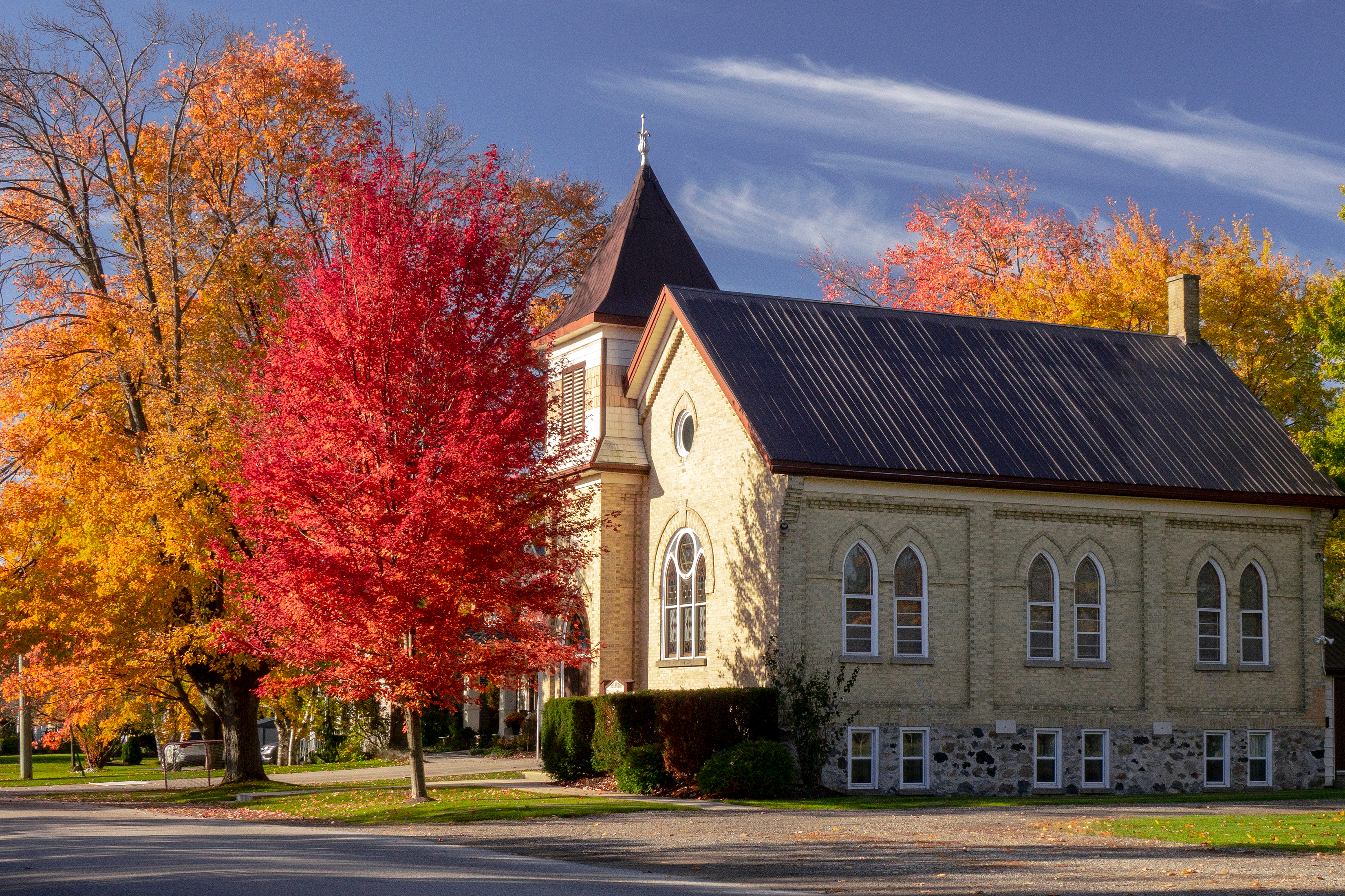
The United Church of Canada (french: link=no, Église unie du Canada) is a mainline Protestant denomination that is the largest Protestant Christian denomination in Canada and the second largest Canadian Christian denomination after the Catholic Church in Canada. The United Church was founded in 1925 as a merger of four Protestant denominations with a total combined membership of about 600,000 members: the Methodist Church, Canada, the Congregational Union of Ontario and Quebec, two-thirds of the congregations of the Presbyterian Church in Canada, and the Association of Local Union Churches, a movement predominantly of the Canadian Prairie provinces. The Canadian Conference of the Evangelical United Brethren Church joined the United Church of Canada on January 1, 1968. Membership peaked in 1964 at 1.1 million and has declined since that time. From 1991 to 2001, the number of people claiming an affiliation with the United Church decreased by 8%, the third largest decrease in ... [...More Info...] [...Related Items...] OR: [Wikipedia] [Google] [Baidu] |
Levee
A levee (), dike (American English), dyke (English in the Commonwealth of Nations, Commonwealth English), embankment, floodbank, or stop bank is a structure that is usually soil, earthen and that often runs parallel (geometry), parallel to the course of a river in its floodplain or along low-lying coastlines. The purpose of a levee is to keep the course of rivers from changing and to protect against flooding of the area adjoining the river or coast. Levees can be naturally occurring ridge structures that form next to the bank of a river, or be an artificially constructed fill dirt, fill or wall that regulates water levels. Ancient civilizations in the Indus Valley civilisation, Indus Valley, ancient Egypt, Mesopotamia and China all built levees. Today, levees can be found around the world, and failures of levees due to erosion or other causes can be major disasters. Etymology Speakers of American English (notably in the Midwestern United States, Midwest and Deep South) u ... [...More Info...] [...Related Items...] OR: [Wikipedia] [Google] [Baidu] |
Western Canadian Sedimentary Basin
The Western Canadian Sedimentary Basin (WCSB) underlies of Western Canada including southwestern Manitoba, southern Saskatchewan, Alberta, northeastern British Columbia and the southwest corner of the Northwest Territories. This vast sedimentary basin consists of a massive wedge of sedimentary rock extending from the Rocky Mountains in the west to the Canadian Shield in the east. This wedge is about thick under the Rocky Mountains, but thins to zero at its eastern margins. The WCSB contains one of the world's largest reserves of petroleum and natural gas and supplies much of the North American market, producing more than per day of gas in 2000. It also has huge reserves of coal. Of the provinces and territories within the WCSB, Alberta has most of the oil and gas reserves and almost all of the oil sands. Conventional oil The WCSB is considered a mature area for exploration of petroleum and recent development has tended toward natural gas and oil sands rather than conventional o ... [...More Info...] [...Related Items...] OR: [Wikipedia] [Google] [Baidu] |


