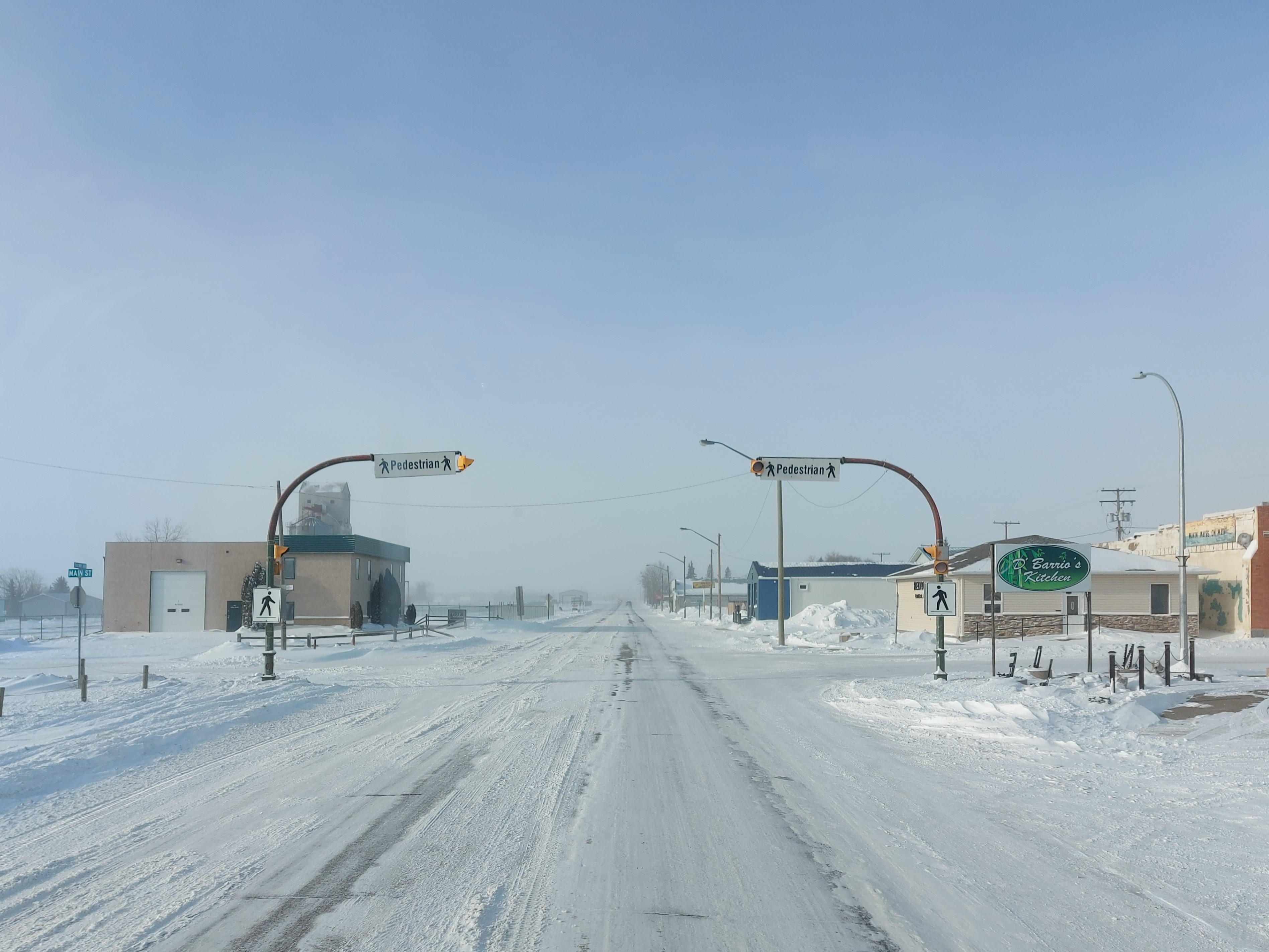
Saskatchewan Highway 18 on:
[Wikipedia]
[Google]
[Amazon]

 Highway 18 is a

 Highway 18 is a
 highway
A highway is any public or private road or other public way on land. It is used for major roads, but also includes other public roads and public tracks. In some areas of the United States, it is used as an equivalent term to controlled-access ...
in the Canadian province
Within the geographical areas of Canada, the ten provinces and three territories are sub-national administrative divisions under the jurisdiction of the Canadian Constitution. In the 1867 Canadian Confederation, three provinces of British North ...
of Saskatchewan
Saskatchewan ( ; ) is a Provinces and territories of Canada, province in Western Canada, western Canada, bordered on the west by Alberta, on the north by the Northwest Territories, on the east by Manitoba, to the northeast by Nunavut, and on t ...
. It runs from Highway 13 near Robsart, approximately east of the Alberta
Alberta ( ) is one of the thirteen provinces and territories of Canada. It is part of Western Canada and is one of the three prairie provinces. Alberta is bordered by British Columbia to the west, Saskatchewan to the east, the Northwest Ter ...
border, to the Manitoba
Manitoba ( ) is a Provinces and territories of Canada, province of Canada at the Centre of Canada, longitudinal centre of the country. It is Canada's Population of Canada by province and territory, fifth-most populous province, with a population o ...
border near Gainsborough Gainsborough or Gainsboro may refer to:
Places
* Gainsborough, Ipswich, Suffolk, England
** Gainsborough Ward, Ipswich
* Gainsborough, Lincolnshire, a town in England
** Gainsborough (UK Parliament constituency)
* Gainsborough, New South Wales, ...
, where it becomes Highway 3. It passes through three major communities, all in the eastern quarter of Saskatchewan – Estevan
Estevan is the eighth-largest city in Saskatchewan, Canada. It is approximately north of the Canada–United States border. The Souris River runs by the city. This city is surrounded by the Rural Municipality of Estevan No. 5.
History
The ...
, Oxbow __NOTOC__
An oxbow is a U-shaped metal pole (or larger wooden frame) that fits the underside and the sides of the neck of an ox or wikt:bullock, bullock. A bow pin holds it in place.
The term "oxbow lake, oxbow" is widely used to refer to a U-sh ...
, and Carnduff
Carnduff is a small agricultural town in southeast Saskatchewan, Canada.
History
Carnduff is named after its first postmaster, John Carnduff. It was marked on early CPR maps, though that location did not exactly correspond to the present town ...
; it also passes north of the west and east blocks of Grasslands National Park. Highway 18 is about long, which is the longest east-west highway and second longest highway in Saskatchewan.
History
The original segment of Highway 18 ran from the Manitoba border, through Estevan, to Lake Alma, before turning north, passing through Radville, and terminating at Highway 13 approximately west ofWeyburn
Weyburn is the eleventh-largest city in Saskatchewan, Canada. The city has a population of 10,870. It is on the Souris River southeast of the provincial capital of Regina, Saskatchewan, Regina and is north from the North Dakota border in the ...
. In the 1960s, Highway 18 was extended west to Highway 6 near Minton along an upgraded grid road, resulting in the north-south section between Lake Alma and Highway 13 being renumbered as Highway 28. In the 1970s, Highway 18 was again extended west along a series of upgraded country roads and existing highways – former highways include Highway 336 between Coronach
A coronach (also written coranich, corrinoch, coranach, cronach, etc.) is the Scottish Gaelic equivalent of the Goll, being the third part of a round of keening, the traditional improvised singing at a death, wake or funeral in the Highlands of S ...
and Rockglen; Highway 319 between Wood Mountain and Highway 19 near Mankota; and Highway 46 between Highway 4 near Orkney
Orkney (; sco, Orkney; on, Orkneyjar; nrn, Orknøjar), also known as the Orkney Islands, is an archipelago in the Northern Isles of Scotland, situated off the north coast of the island of Great Britain. Orkney is 10 miles (16 km) north ...
and Claydon.
Major intersections
From west to east:See also
*Roads in Saskatchewan
Saskatchewan, the middle of Canada's three prairie provinces, has an area of and population of 1,150,632 (according to 2016 estimates), mostly living in the southern half of the province.
Currently Ministry of Highways and Infrastructure opera ...
*Transportation in Saskatchewan
Transport in Saskatchewan includes an infrastructure system of roads, highways, freeways, airports, ferries, pipelines, trails, waterways, and railway systems serving a population of approximately 1,098,352 (according to 2016 census) inhabitants y ...
References
{{Authority control 018 Transport in Estevan