|
Earl Sterndale
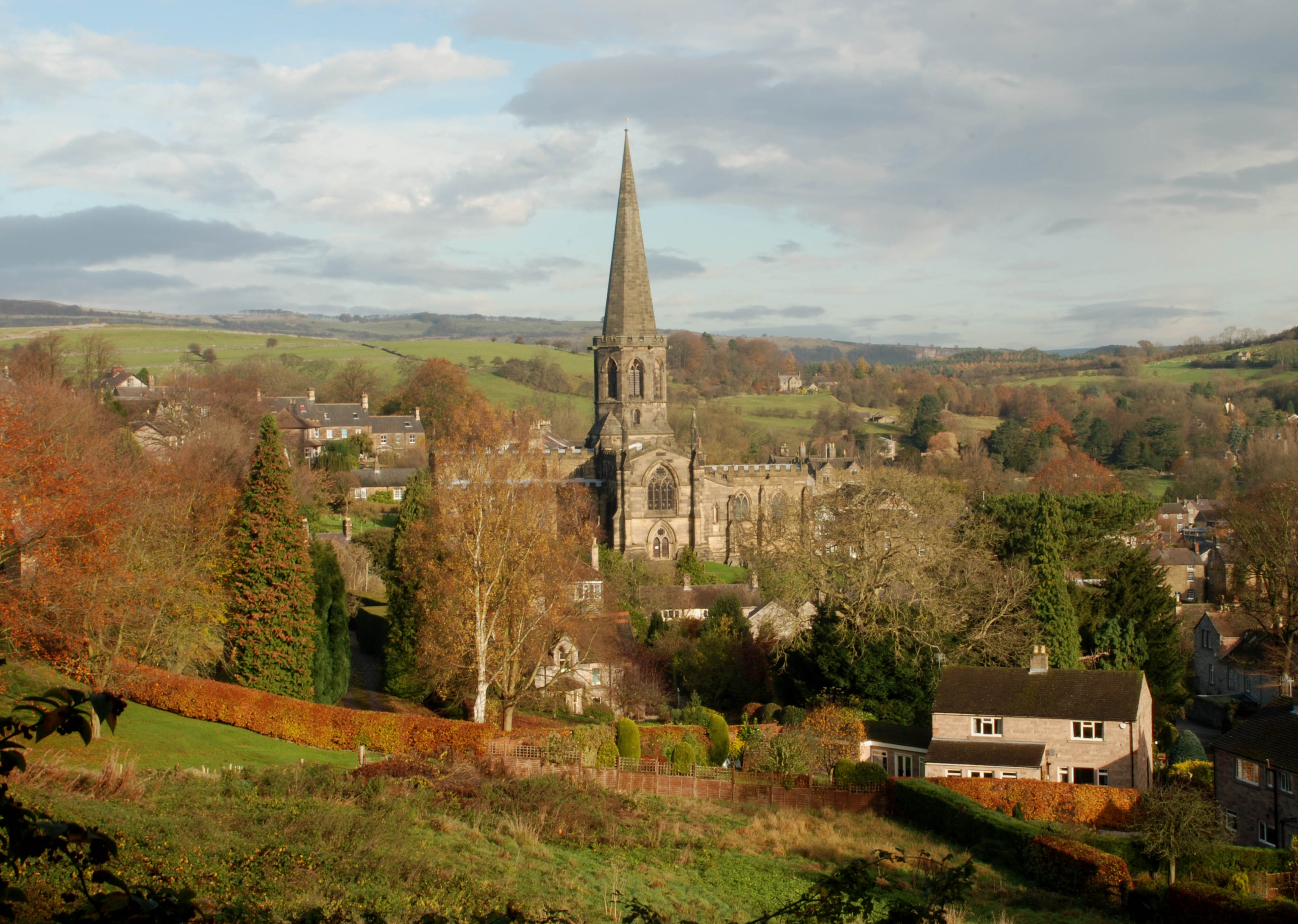
Earl Sterndale is a village in the Upper Dove Valley in the Peak District, Derbyshire, England, situated near the River Dove, 5 miles south of Buxton, and 8 miles west of Bakewell. The population at the 2011 Census is listed under Hartington Middle Quarter. It sits above sea level. The farms surrounding the village were medieval monastic granges in the care of the monks of Basingwerk Abbey. The village church, dedicated to St Michael, was built in 1828 on the site of an ancient chapel. It was substantially destroyed in 1941, when it was bombed by the Germans. It was restored in 1952, and still contains a Saxon font. Earl Sterndale is popular with walkers, as it lies close to the distinctive peaks of Chrome Hill and Parkhouse Hill, and is within walking distance of Hartington and the gateway to Dovedale. See also *List of places in Derbyshire *Listed buildings in Hartington Middle Quarter Hartington Middle Quarter is a civil parish in the Derbyshire Dales district of Derbysh ... [...More Info...] [...Related Items...] OR: [Wikipedia] [Google] [Baidu] |
Derbyshire Dales (UK Parliament Constituency)
Derbyshire Dales ( ) is a constituency that has been represented in the House of Commons of the UK Parliament since 2019 by Sarah Dines of the Conservative Party. The constituency was created for the 2010 general election. History Following their review of parliamentary representation in Derbyshire, the Boundary Commission for England created a new constituency of Derbyshire Dales which is almost coterminous with the previous seat of West Derbyshire. Constituency profile The constituency is geographically large and mostly within the Peak District National Park. Its main settlements are Ashbourne, Bakewell Bakewell is a market town and civil parish in the Derbyshire Dales district of Derbyshire, England, known also for its local Bakewell pudding. It lies on the River Wye, about 13 miles (21 km) south-west of Sheffield. In the 2011 census, ... and Matlock. Boundaries The District of Derbyshire Dales, and the Borough of Amber Valley wards of Alport, Crich, and So ... [...More Info...] [...Related Items...] OR: [Wikipedia] [Google] [Baidu] |
Chrome Hill
Chrome Hill is a limestone reef knoll in Derbyshire, England, in the upper Dove valley beside the border with Staffordshire, within the civil parish of Hartington Middle Quarter. It is adjacent to Parkhouse Hill, another reef knoll. The walk over Chrome Hill and Parkhouse Hill is known as the Dragon's Back ridge. Chrome Hill was declared open access land under the provisions of the Countryside and Rights of Way Act 2000. However, the only access from the north west remains along a concessionary footpath. Chrome Hill contains good exposures of ''Gigantoproductus'' fossils; it is part of a designated Site of Special Scientific Interest which makes it an offence for visitors to remove geological samples. A double sunset can sometimes be seen against Chrome Hill from the southern flank of Parkhouse Hill; and also from nearby Glutton Bridge, on the upper valley of the River Dove, which is more easily accessible. The phenomenon is visible from Glutton Bridge in good weather for ... [...More Info...] [...Related Items...] OR: [Wikipedia] [Google] [Baidu] |
Villages In Derbyshire
A village is a clustered human settlement or community, larger than a hamlet but smaller than a town (although the word is often used to describe both hamlets and smaller towns), with a population typically ranging from a few hundred to a few thousand. Though villages are often located in rural areas, the term urban village is also applied to certain urban neighborhoods. Villages are normally permanent, with fixed dwellings; however, transient villages can occur. Further, the dwellings of a village are fairly close to one another, not scattered broadly over the landscape, as a dispersed settlement. In the past, villages were a usual form of community for societies that practice subsistence agriculture, and also for some non-agricultural societies. In Great Britain, a hamlet earned the right to be called a village when it built a church. [...More Info...] [...Related Items...] OR: [Wikipedia] [Google] [Baidu] |
Listed Buildings In Hartington Middle Quarter
Hartington Middle Quarter is a civil parish in the Derbyshire Dales district of Derbyshire, England. The parish contains 14 listed buildings that are recorded in the National Heritage List for England. All the listed buildings are designated at Grade II, the lowest of the three grades, which is applied to "buildings of national importance and special interest". The parish, which is to the north of the village of Hartington, is almost entirely rural, the main settlements being the villages of Earl Sterndale and Crowdecote Crowdecote (sometimes spelled Crowdicote) is a small village in Derbyshire, England. It is situated on the border between Derbyshire and Staffordshire about south of Buxton. Crowdecote is within the civil parish of Hartington Middle Quarter. It .... Most of the listed buildings are houses, cottages, farmhouses and associated structures, and the other listed buildings are a church, a school, a bridge, and a milepost. __NOTOC__ Buildings Refere ... [...More Info...] [...Related Items...] OR: [Wikipedia] [Google] [Baidu] |
List Of Places In Derbyshire
This is a list of places in Derbyshire, England. A B C D E F G H I K L M N O P Q R S T U V W Y See also * List of settlements in Derbyshire by population * List of places formerly in Derbyshire * List of places in England {{DEFAULTSORT:Places in Derbyshire *Places Derbyshire Derbyshire ( ) is a ceremonial county in the East Midlands, England. It includes much of the Peak District National Park, the southern end of the Pennine range of hills and part of the National Forest. It borders Greater Manchester to the nor ... Derbyshire-related lists ... [...More Info...] [...Related Items...] OR: [Wikipedia] [Google] [Baidu] |
Dovedale
Dovedale is a valley in the Peak District of England. The land is owned by the National Trust and attracts a million visitors annually. The valley was cut by the River Dove, Central England, River Dove and runs for just over between Milldale in the north and a wooded ravine, near Thorpe Cloud and Bunster Hill, in the south. In the wooded ravine, a set of stepping stones cross the river and there are two caves known as the ''Dove Holes''. Dovedale's other attractions include rock pillars such as ''Ilam Rock'', ''Viator's Bridge'' and the limestone features ''Lovers' Leap'' and ''Reynard's Cave''. Geology The limestone rock that forms the geology of Dovedale is the fossilised remains of sea creatures that lived in a shallow sea over the area during the Carboniferous period, about 350 million years ago. During the two ice ages, the limestone rock (known as reef limestone) was cut into craggy shapes by glacial meltwater, and dry caves such as Dove Holes and Reynard's Kitchen C ... [...More Info...] [...Related Items...] OR: [Wikipedia] [Google] [Baidu] |
Hartington, Derbyshire
Hartington is a village in the centre of the White Peak area of the Derbyshire Peak District, England, lying on the River Dove which is the Staffordshire border. According to the 2001 census, the parish of Hartington Town Quarter, which also includes Pilsbury, had a population of 345 reducing to 332 at the 2011 Census. Formerly known for cheese-making and the mining of ironstone, limestone and lead, the village is now popular with tourists. Architecture Notable buildings in the village include the market hall (formerly the site of a market), the 13th-century parish church of Saint Giles, and the 17th-century Hartington Hall. The prominent Bank House in the centre of the village was built by the former village mill owner, and in the past was used as the village bank. A half-mile (800 m) to the south of the village, on the river Dove, is the fishing house of the famous angler Charles Cotton. In the north of the village is Pilsbury Castle, an 11th-century motte-and-ba ... [...More Info...] [...Related Items...] OR: [Wikipedia] [Google] [Baidu] |
Parkhouse Hill
Parkhouse Hill is a small but distinctive hill in the Peak District National Park of the Hartington Middle Quarter civil parish, in the English county of Derbyshire. It lies on the north side of the River Dove, close to the border with Staffordshire. Geologically, the hill is the remains of an atoll (a 'reef knoll') which is believed to have existed during the Carboniferous period when what is now the Peak District was covered by a tropical sea. Together with its higher but less distinctive neighbour, Chrome Hill, it forms the Chrome and Parkhouse Hills SSSI, cited for their geology and limestone flora. The walk over Chrome Hill and Parkhouse Hill is known as the Dragon's Back ridge. For many years access to Parkhouse Hill was difficult, as there was no right of way to the summit. Access is now possible under the Countryside and Rights of Way Act 2000, as the hill is a designated access area. A double sunset can sometimes be seen against Parkhouse Hill from nearby Glutton Gr ... [...More Info...] [...Related Items...] OR: [Wikipedia] [Google] [Baidu] |
Basingwerk Abbey
Basingwerk Abbey ( cy, Abaty Dinas Basing) is a Grade I listed ruined abbey near Holywell, Flintshire, Wales. The abbey, which was founded in the 12th century, belonged to the Order of Cistercians. It maintained significant lands in the English county of Derbyshire. The abbey was abandoned and its assets sold following the Dissolution of the Monasteries in 1536. The site is now managed by Cadw – the national Welsh heritage agency. Medieval history The abbey was founded in 1132 by Ranulf de Gernon, 4th Earl of Chester, who had already brought Benedictine monks from Savigny Abbey in southern Normandy. Likely the first location of the abbey was not at the current location at Greenfields but at the nearby Hen Blas. The abbey became part of the Cistercian Order in 1147. It was a daughter house of Combermere Abbey in Cheshire, of which Earl Ranulf was a great benefactor. However, in 1147 the abbot and convent of Savigny transferred it to Buildwas Abbey in Shropshire. Twenty ... [...More Info...] [...Related Items...] OR: [Wikipedia] [Google] [Baidu] |
Hartington Middle Quarter
Hartington Middle Quarter is a civil parish within the Derbyshire Dales district, which is in the county of Derbyshire, England. Formerly a part of Hartington parish, for which it is named, it has a mix of a number of villages and hamlets amongst a mainly rural and undulating landscape, and is wholly within the Peak District National Park. It had a population of 379 residents in 2011. The parish is north west of London, north west of the county city of Derby, and south east of the nearest market town of Buxton. Being on the edge of the county border, it shares a boundary with the parishes of Chelmorton, Flagg, Hartington Town Quarter, Hartington Upper Quarter, Middleton and Smerrill, Monyash in Derbyshire, as well as Hollinsclough, Longnor and Sheen in Staffordshire. Geography Location Hartington Middle Quarter parish is surrounded by the following local locations: * Buxton, Chelmorton and Sterndale Moor to the north * Hartington and Pilsbury to the south * Flagg an ... [...More Info...] [...Related Items...] OR: [Wikipedia] [Google] [Baidu] |
Monastic Grange
Monastic granges were outlying landholdings held by monasteries independent of the manorial system. The first granges were owned by the Cistercians and other orders followed. Wealthy monastic houses had many granges, most of which were largely agricultural providing food for the monastic community. A grange might be established adjacent to the monastery but others were established wherever it held lands, some at a considerable distance. Some granges were worked by lay-brothers belonging to the order, others by paid labourers. Granges could be of six known types: agrarian, sheep or cattle farms, horse studs, fisheries and industrial complexes. Industrial granges were significant in the development of medieval industries, particularly iron working. Description Granges were landed estates used for food production, centred on a farm and out-buildings and possibly a mill or a tithe barn. The word grange comes through French from Latin meaning a granary. The granges might be locate ... [...More Info...] [...Related Items...] OR: [Wikipedia] [Google] [Baidu] |
Bakewell
Bakewell is a market town and civil parish in the Derbyshire Dales district of Derbyshire, England, known also for its local Bakewell pudding. It lies on the River Wye, about 13 miles (21 km) south-west of Sheffield. In the 2011 census, the population of the civil parish appeared as 3,949. It was estimated at 3,695 in 2019. The town is close to the tourist attractions of Chatsworth House and Haddon Hall. History Although there is evidence of earlier settlement in the area, Bakewell itself was probably founded in Anglo-Saxon times in the Anglian kingdom of Mercia. The name Bakewell means a spring or stream of a woman named Badeca or Beadeca, so deriving from a personal name with the Old English suffix ''wella''. In 949 it was called Badecanwelle and in the 1086 Domesday Book ''Badequelle''. The Domesday book listing stated that King Edward held land here; the settlement had a church and a mill. These are the outlying estates or berewicks of the manor: Haddon addon or Ov ... [...More Info...] [...Related Items...] OR: [Wikipedia] [Google] [Baidu] |


_1845.jpeg)

