|
Dyssebroen
Dyssebroen is a pedestrian and cycle bridge located in the area known as Freetown Christiania in Copenhagen, Denmark. It connects the Christianshavn Side main portion of the community to its more 'rural' Amager Side backdrop across Stadsgraven, the former moat of the Christianshavn Rampart which formed part of the Bastioned Fortification Ring which used to guard the city. History A timber bridge was constructed at the site in the beginning of the 20th century, built to a particularly robust design because it catered for heavy military traffic. When Freetown Christiania was founded in 1971, the bridge became the main link between the two parts of the community, the larger and more 'urban' Christianshavn side and the smaller and more 'rural' Amager Side. In the 1990s it became clear that the bridge was in strong need of thorough restoration. When it was dismantled it turned out that it was hit even harder with rot than had first been assumed and that a brand new bridge was needed ... [...More Info...] [...Related Items...] OR: [Wikipedia] [Google] [Baidu] |
Stadsgraven
Stadsgraven is the canal which separates Christianshavn from the rest of Amager in Copenhagen, Denmark. It was originally a moat located in front of the Christianshavn Rampart as part of the city's Bastioned Ring Fortifications. History Stadsgraven was created when Christianshavn was constructed in the shallow waters off Amager in the early 17th century. Apart from the main Stads canal, there is a parallel Inner Stadsgraven along its northern portion. Stadsgraven is connected to the main harbour both north and south of Christianshavn. There are four causeways and two footbridges across Stadsgraven. The principal crossing is located at the site of the former Amagerport, one of the city's four no longer existent city gates, and connects Torvegade, the main thoroughfare of Christianshavn, to Amagerbrogade, the main shopping street of Amager Side Copenhagen. Another dam is located at the southern mouth of the canal where it passes below Kalbebod Bastion, the southernmost of Christian ... [...More Info...] [...Related Items...] OR: [Wikipedia] [Google] [Baidu] |
Christianshavns Vold
Christianshavns Vold is a former rampart which was part of the bastioned fortification ring which used to surround Copenhagen, Denmark. Running along the full south-eastern perimeter of Christianshavn and Holmen, it used to form a protective barrier towards the island of Amager. It consists of earthworks with 12 bastions and in front of it ran a moat, Stadsgraven, now forming a broad canal which separates Christianshavn from the rest of Amager. On the other side of Stadsgraven. on Amager, was a lower system of outworks called Christianshavns Enveloppe of which only the northern half survives. Along with Kastellet on the other side of the harbour, it is the only intact part of the fortification system. Today Christianshavns Vold serves as an important greenspace for Christianshavn's inhabitants. The southern half of the rampart is a municipal park whereas the northern portion is part of Freetown Christiania, a self-built, semi-autonomous community which has existed since the ... [...More Info...] [...Related Items...] OR: [Wikipedia] [Google] [Baidu] |
Freetown Christiania
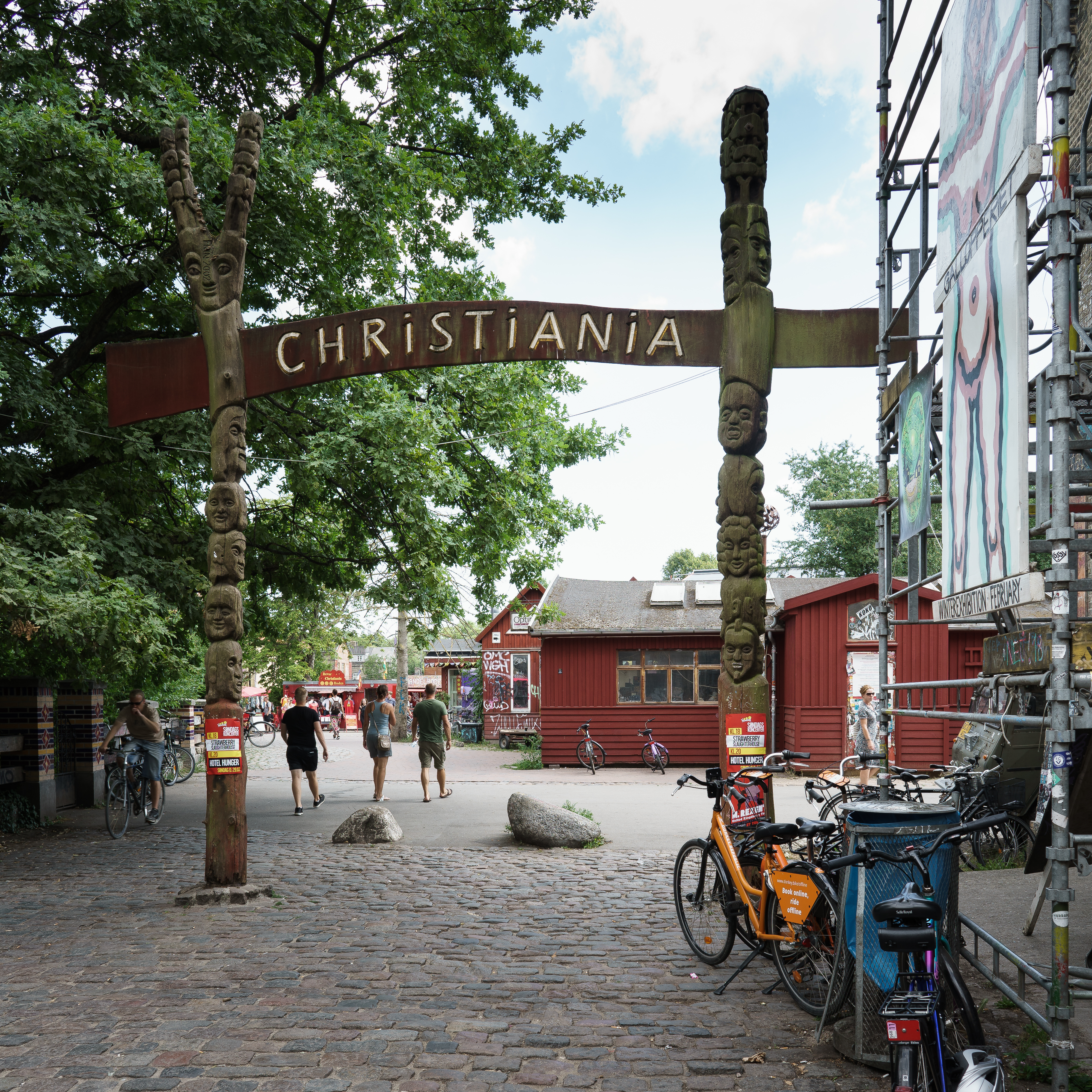
Freetown Christiania, also known as Christiania ( da, Fristaden Christiania or '), is an intentional community, commune and micronation in the Christianshavn neighbourhood of the Danish capital city of Copenhagen, Christinia, Christianshavn, Copenhagen K, Island of Amager. It began in 1971 as a squatted military base. Its Pusher Street is famous for its open trade of cannabis, which is illegal in Denmark. Culture Christiania is considered to be the fourth largest tourist attraction in Copenhagen, with half a million visitors annually. The residents of Christiania are called ''Christianit'', or ''Christianshavner and Amagerkaner'' because Christiania is located on the island of Amager. The 1976 protest song ("You cannot kill us"), written by Tom Lunden of flower power rock group Bifrost, became the unofficial anthem of Christiania. The flag of Christiania is a red banner with three yellow discs representing the dots in each ''i'' in "Christiania". Within Christiania itsel ... [...More Info...] [...Related Items...] OR: [Wikipedia] [Google] [Baidu] |
Pedestrian
A pedestrian is a person traveling on foot, whether walking or running. In modern times, the term usually refers to someone walking on a road or pavement, but this was not the case historically. The meaning of pedestrian is displayed with the morphemes ''ped-'' ('foot') and ''-ian'' ('characteristic of'). This word is derived from the Latin term ''pedester'' ('going on foot') and was first used (in English language) during the 18th century. It was originally used, and can still be used today, as an adjective meaning plain or dull. However, in this article it takes on its noun form and refers to someone who walks. The word pedestrian may have been used in middle French in the Recueil des Croniques et Anchiennes Istories de la Grant Bretaigne, à présent nommé Engleterre. In California the definition of a pedestrian has been broadened to include anyone on any human powered vehicle that is not a bicycle, as well as people operating self-propelled wheelchairs by reason of p ... [...More Info...] [...Related Items...] OR: [Wikipedia] [Google] [Baidu] |
Pedestrian Bridges In Denmark
A pedestrian is a person traveling on foot, whether walking or running. In modern times, the term usually refers to someone walking on a road or pavement, but this was not the case historically. The meaning of pedestrian is displayed with the morphemes ''ped-'' ('foot') and ''-ian'' ('characteristic of'). This word is derived from the Latin term ''pedester'' ('going on foot') and was first used (in English language) during the 18th century. It was originally used, and can still be used today, as an adjective meaning plain or dull. However, in this article it takes on its noun form and refers to someone who walks. The word pedestrian may have been used in middle French in the Recueil des Croniques et Anchiennes Istories de la Grant Bretaigne, à présent nommé Engleterre. In California the definition of a pedestrian has been broadened to include anyone on any human powered vehicle that is not a bicycle, as well as people operating self-propelled wheelchairs by reason of ph ... [...More Info...] [...Related Items...] OR: [Wikipedia] [Google] [Baidu] |
Bridges In Copenhagen
A bridge is a structure built to span a physical obstacle (such as a body of water, valley, road, or rail) without blocking the way underneath. It is constructed for the purpose of providing passage over the obstacle, which is usually something that is otherwise difficult or impossible to cross. There are many different designs of bridges, each serving a particular purpose and applicable to different situations. Designs of bridges vary depending on factors such as the function of the bridge, the nature of the terrain where the bridge is constructed and anchored, and the material used to make it, and the funds available to build it. The earliest bridges were likely made with fallen trees and stepping stones. The Neolithic people built boardwalk bridges across marshland. The Arkadiko Bridge (dating from the 13th century BC, in the Peloponnese) is one of the oldest arch bridges still in existence and use. Etymology The ''Oxford English Dictionary'' traces the origin of the wo ... [...More Info...] [...Related Items...] OR: [Wikipedia] [Google] [Baidu] |
Parks And Open Spaces In Copenhagen
Copenhagen is a green city well endowed with open spaces. It has an extensive and well-distributed system of parks that act as venues for a wide array of events and urban life. As a supplement to the regular parks, there are a number of congenial public gardens and some cemeteries doubling as parks. It is official municipal policy in Copenhagen that all citizens by 2015 must be able to reach a park or beach on foot in less than 15 minutes. Parks King's Garden the garden of Rosenborg Castle, is the oldest and most visited park in Copenhagen. Its landscaping was commenced by Christian IV in 1606. Every year it sees more than 2.5 million visitors, and in the summer months it is packed with sunbathers, picknickers and ballplayers. It also serves as a sculpture garden with a permanent display of sculptures as well as temporary exhibits during summer. Just north of King's Garden a series of parks make up a green strand running right through the centre of the city. These are constructe ... [...More Info...] [...Related Items...] OR: [Wikipedia] [Google] [Baidu] |
Cycling In Copenhagen
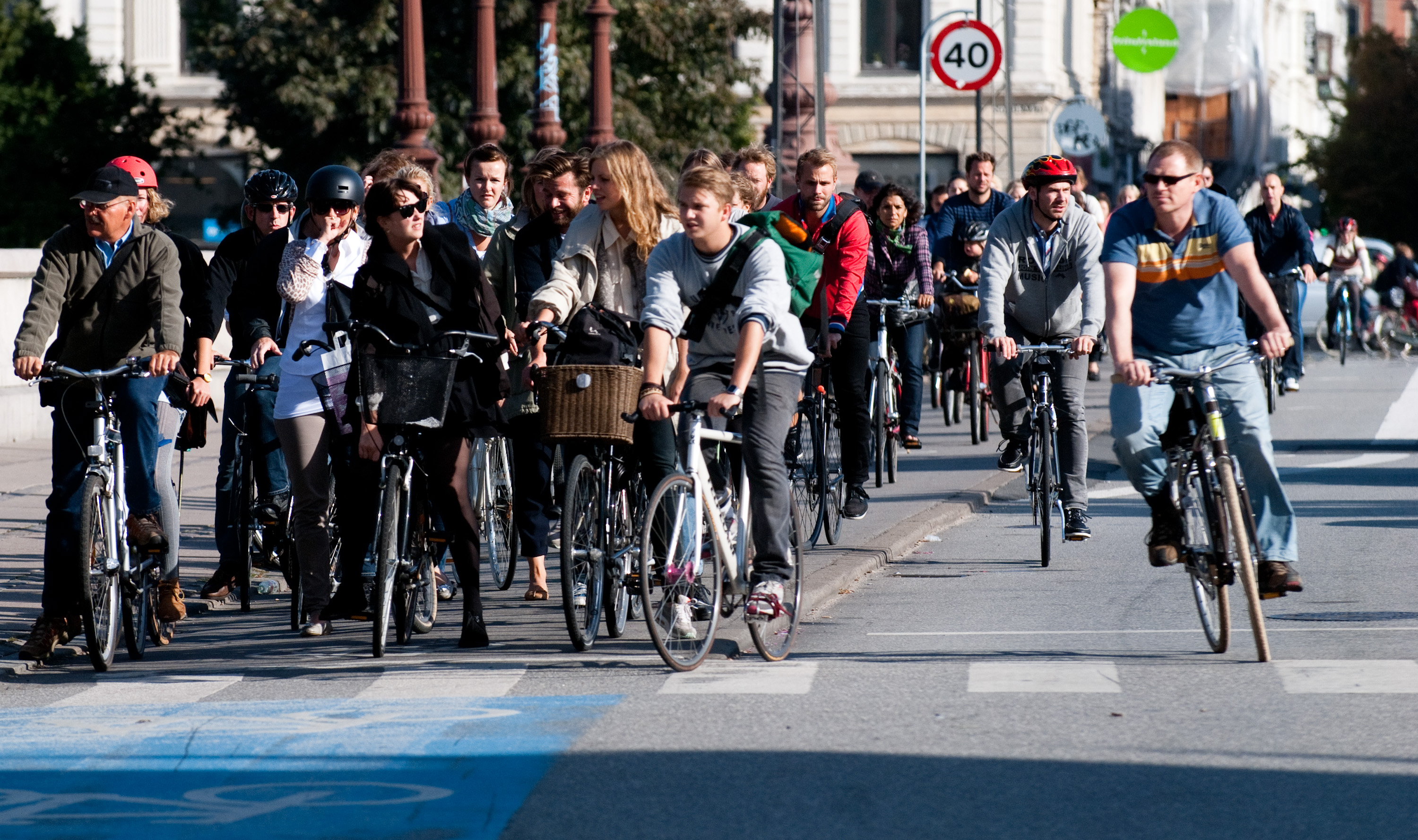
Cycling in Copenhagen is – as with most cycling in Denmark – an important mode of transportation and a dominating feature of the cityscape, often noticed by visitors. The city offers a variety of favourable cycling conditions — dense urban proximities, short distances and flat terrain — along with an extensive and well-designed system of cycle tracks. This has earned it a reputation as one of the most bicycle-friendly cities in the world. Every day 1.2 million kilometres (0.75 million miles) are cycled in Copenhagen, with 62% of all citizens commuting to work, school, or university by bicycle; in fact, almost as many people commute by bicycle in greater Copenhagen as do those cycle to work in the entire United States. Cycling is generally perceived as a healthier, more environmentally friendly, cheaper, and often quicker way to get around town than by using an automobile. History Bicycles became common in Copenhagen at the beginning of the twentieth century. The ci ... [...More Info...] [...Related Items...] OR: [Wikipedia] [Google] [Baidu] |
Vor Frelsers Kirke - Dyssebroen
VOR or vor may refer to: Organizations * Vale of Rheidol Railway in Wales * Voice of Russia, a radio broadcaster * Volvo Ocean Race, a yacht race Science, technology and medicine * VHF omnidirectional range, a radio navigation aid used in aviation * Vestibulo-ocular reflex, a reflex eye movement * Voice-operated recording, see Voice-operated switch * Visual Operating Rules, another term for visual flight rules in aviation * Video operation room, part of the set-up for the video assistant referee in association football Entertainment * Vor of Barrayar, the noble families of Barrayar in the science fiction Vorkosigan Saga * Vor (Star Wars), a race in the ''Star Wars'' universe * ''VOR'', a 1958 science fiction novel by James Blish * Vor Daj, protagonist of the 1940 novel ''Synthetic Men of Mars'' by Edgar Rice Burroughs * Russian title of the 1997 film ''The Thief'' * '' VOR: The Maelstrom'', a science fiction miniature wargame * VOR, a search engine and media company in t ... [...More Info...] [...Related Items...] OR: [Wikipedia] [Google] [Baidu] |
Journeyman Years
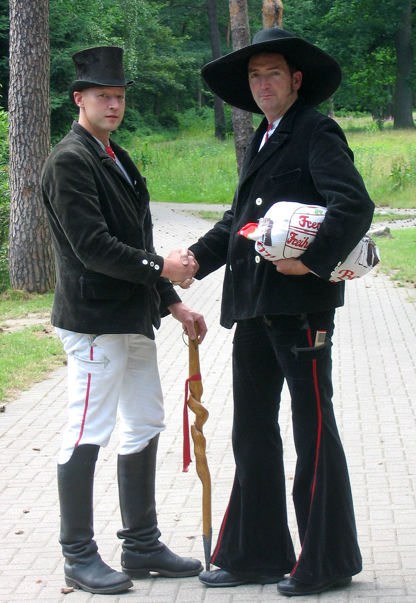
In a certain tradition, the journeyman years () are a time of travel for several years after completing apprenticeship as a craftsman. The tradition dates back to medieval times and is still alive in France, Scandinavia and the German-speaking countries. Normally three years and one day is the minimum period of journeyman/woman. Crafts include roofing, metalworking, woodcarving, carpentry and joinery, and even millinery and musical instrument making/organ building. In the Middle Ages and Renaissance, when the guild system still controlled professions in the visual arts, the ''wanderjahre'' was taken by painters, mason-architects and goldsmiths, and was highly important for the transmission of artistic style around Europe. The development of late modern nations and their borders within Europe did not have much effect until the 19th century. Historic roots In medieval times the apprentice was bound to his master for a number of years. He lived with the master as a member of ... [...More Info...] [...Related Items...] OR: [Wikipedia] [Google] [Baidu] |
Fortifications Of Copenhagen (17th Century)
The fortifications of Copenhagen underwent a comprehensive modernization and expansion in the 17th century. The project was commenced and was largely the masterplan of Christian IV in the early 17th century but was continued and completed by his successors. The new fortifications relied on the existing, medieval fortifications of the city but the fortified area was extended and a defensive ring around the city completed particularly with new edifices facing the sea. The ring fortification consisted of four bastioned ramparts and an annexed citadel as well as various outworks. Though largely developed to a final form in the 17th century, the fortifications remained in use until the second half of the 19th century, when they finally, a long time overdue, were decommissioned. Today only the Christianshavn Rampart and the citadel Kastellet remain intact, while the rest of the fortifications were dismantled in the years after its demise. The grounds were to a large extent laid out as ... [...More Info...] [...Related Items...] OR: [Wikipedia] [Google] [Baidu] |
Amager
Amager ( or, especially among older speakers, ) in the Øresund is Denmark's most densely populated island, with more than 212,000 inhabitants (January 2021) a small appendage to Zealand. The protected natural area of ''Naturpark Amager'' (including Kalvebod Fælled) makes up more than one-third of the island's total area of 96 km2. The Danish capital, Copenhagen Municipality, is partly situated on Amager, covering the northern part of the island, which is connected to the much larger island of Zealand by eight bridges and a metro tunnel. Amager also has a connection across the Øresund to Sweden, the Øresund Bridge. Its western part begins with a tunnel from Amager to another Danish island, Peberholm. Copenhagen Airport is located on the island, around from Copenhagen city centre. Amager is the largest island in the Øresund, and the only one with a large population. , 212,661 people lived on the island, including its northern tip, Christianshavn. The northern part is in ... [...More Info...] [...Related Items...] OR: [Wikipedia] [Google] [Baidu] |


