|
Drumburgh Castle
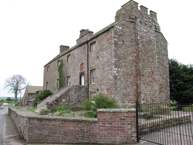
Drumburgh Castle is a medieval pele tower in the village of Drumburgh, in Cumbria, England. History A pele tower was originally built on this site, near the village of Burgh, by Robert le Brun in 1307, on the site of a former tower that had been part of Hadrian's Wall. The construction used red sandstone masonry from the wall for its construction. Thomas Dacre rebuilt the castle in 1518, producing what contemporaries described as "neither castle nor tower but a house of strength". The house was altered again between 1678 and 1681 by John Alglionby, producing the current design. The property today has a distinctive first floor doorway and staircase - a later addition to the castle - decorated with the Dacre coat of arms, and has parts of a Roman shrine incorporated into its stonework.Richards and Clegg, p.177. See also * Grade I listed buildings in Cumbria *Listed buildings in Bowness Bowness is a civil parish in the Borough of Allerdale in Cumbria, England. It contain ... [...More Info...] [...Related Items...] OR: [Wikipedia] [Google] [Baidu] |
Cumbria
Cumbria ( ) is a ceremonial and non-metropolitan county in North West England, bordering Scotland. The county and Cumbria County Council, its local government, came into existence in 1974 after the passage of the Local Government Act 1972. Cumbria's county town is Carlisle, in the north of the county. Other major settlements include Barrow-in-Furness, Kendal, Whitehaven and Workington. The administrative county of Cumbria consists of six districts ( Allerdale, Barrow-in-Furness, Carlisle, Copeland, Eden and South Lakeland) and, in 2019, had a population of 500,012. Cumbria is one of the most sparsely populated counties in England, with 73.4 people per km2 (190/sq mi). On 1 April 2023, the administrative county of Cumbria will be abolished and replaced with two new unitary authorities: Westmorland and Furness (Barrow-in-Furness, Eden, South Lakeland) and Cumberland ( Allerdale, Carlisle, Copeland). Cumbria is the third largest ceremonial county in England by area. It i ... [...More Info...] [...Related Items...] OR: [Wikipedia] [Google] [Baidu] |
Drumburgh Castle - Geograph
Drumburgh ( ) is a small settlement in Cumbria, England. It is northwest of the city of Carlisle and is on the course of Hadrian's Wall, near to Burgh by Sands. The village is sited on a gentle hill with a good view in all directions over the surrounding lowlands. History The name means 'ridge near the fort' as derived from the Celtic language and the common Old English word 'burgh', pronounced as 'bruff' in this instance. Coggabata is the Roman fort referred to in the placename, which was linked by a Roman road to the nearby fort at Kirkbride to the southwest. The fort was located opposite a ford over the Solway Firth, and the site has been both partially overlain by modern housing and additionally it has been damaged by a substantial medieval ditch. John Leland visited in 1539 and reported that the Wall had been heavily robbed to provide for buildings in Drumburgh, such as the castle. The village lies in the old Barony of Burgh, dating from 1092, the baron now being the ... [...More Info...] [...Related Items...] OR: [Wikipedia] [Google] [Baidu] |
Allerdale
Allerdale is a non-metropolitan district of Cumbria, England, with borough status. Its council is based in Workington and the borough has a population of 93,492 according to the 2001 census, increasing to 96,422 at the 2011 Census. The Borough of Allerdale was formed under the Local Government Act 1972, on 1 April 1974 by the merger of the municipal borough of Workington, the urban districts of Maryport, Cockermouth and Keswick; and the rural districts of Cockermouth and Wigton, all of which were within the administrative county of Cumberland. In 1995 Allerdale was granted borough status. The name derives from the ancient region of Allerdale, represented latterly by the two wards of Cumberland, called Allerdale-above-Derwent and Allerdale-below-Derwent, the present borough corresponding largely to the latter with parts of the former. Much of the area during the medieval period was a royal forest subject to forest law. In July 2021 the Ministry of Housing, Communities an ... [...More Info...] [...Related Items...] OR: [Wikipedia] [Google] [Baidu] |
Pele Tower
Peel towers (also spelt pele) are small fortified keeps or tower houses, built along the English and Scottish borders in the Scottish Marches and North of England, mainly between the mid-14th century and about 1600. They were free-standing with defence being a prime consideration of their design with "confirmation of status and prestige" also playing a role. They also functioned as watch towers where signal fires could be lit by the garrison to warn of approaching danger. The FISH Vocabulary ''Monument Types Thesaurus'' lists "pele" alongside "bastle", "fortified manor house" and "tower house" under the broader term "fortified house". Pevsner defines a peel as simply a stone tower. Outside of this, "peel" or "pele" can also be used in related contexts, for example a "pele" or "barmkin" (in Ireland a bawn) was an enclosure where livestock were herded in times of danger. The rustling of livestock was an inevitable part of Border raids, and often their main purpose. In this ... [...More Info...] [...Related Items...] OR: [Wikipedia] [Google] [Baidu] |
Sandstone
Sandstone is a clastic sedimentary rock composed mainly of sand-sized (0.0625 to 2 mm) silicate grains. Sandstones comprise about 20–25% of all sedimentary rocks. Most sandstone is composed of quartz or feldspar (both silicates) because they are the most resistant minerals to weathering processes at the Earth's surface. Like uncemented sand, sandstone may be any color due to impurities within the minerals, but the most common colors are tan, brown, yellow, red, grey, pink, white, and black. Since sandstone beds often form highly visible cliffs and other topographic features, certain colors of sandstone have been strongly identified with certain regions. Rock formations that are primarily composed of sandstone usually allow the percolation of water and other fluids and are porous enough to store large quantities, making them valuable aquifers and petroleum reservoirs. Quartz-bearing sandstone can be changed into quartzite through metamorphism, usually related to ... [...More Info...] [...Related Items...] OR: [Wikipedia] [Google] [Baidu] |
Pele Tower
Peel towers (also spelt pele) are small fortified keeps or tower houses, built along the English and Scottish borders in the Scottish Marches and North of England, mainly between the mid-14th century and about 1600. They were free-standing with defence being a prime consideration of their design with "confirmation of status and prestige" also playing a role. They also functioned as watch towers where signal fires could be lit by the garrison to warn of approaching danger. The FISH Vocabulary ''Monument Types Thesaurus'' lists "pele" alongside "bastle", "fortified manor house" and "tower house" under the broader term "fortified house". Pevsner defines a peel as simply a stone tower. Outside of this, "peel" or "pele" can also be used in related contexts, for example a "pele" or "barmkin" (in Ireland a bawn) was an enclosure where livestock were herded in times of danger. The rustling of livestock was an inevitable part of Border raids, and often their main purpose. In this ... [...More Info...] [...Related Items...] OR: [Wikipedia] [Google] [Baidu] |
Drumburgh
Drumburgh ( ) is a small settlement in Cumbria, England. It is northwest of the city of Carlisle and is on the course of Hadrian's Wall, near to Burgh by Sands. The village is sited on a gentle hill with a good view in all directions over the surrounding lowlands. History The name means 'ridge near the fort' as derived from the Celtic language and the common Old English word 'burgh', pronounced as 'bruff' in this instance. Coggabata is the Roman fort referred to in the placename, which was linked by a Roman road to the nearby fort at Kirkbride to the southwest. The fort was located opposite a ford over the Solway Firth, and the site has been both partially overlain by modern housing and additionally it has been damaged by a substantial medieval ditch. John Leland visited in 1539 and reported that the Wall had been heavily robbed to provide for buildings in Drumburgh, such as the castle. The village lies in the old Barony of Burgh, dating from 1092, the baron now being the ... [...More Info...] [...Related Items...] OR: [Wikipedia] [Google] [Baidu] |
Burgh By Sands
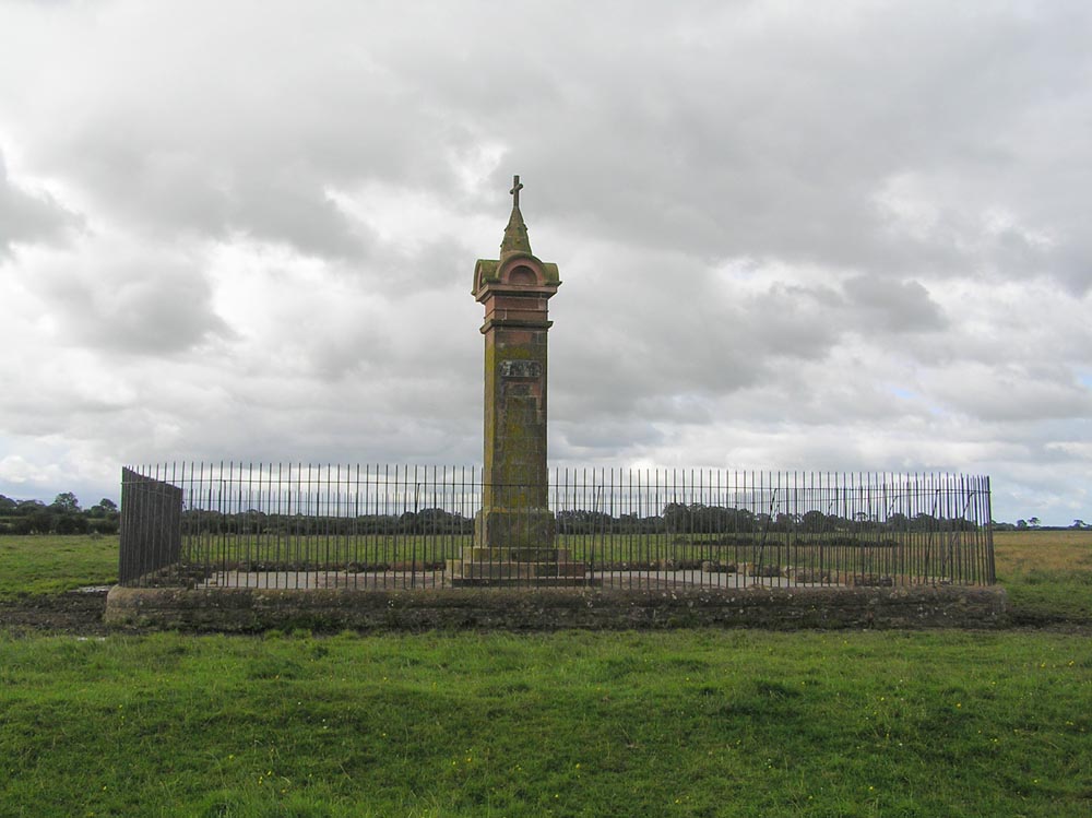
Burgh by Sands () is a village and civil parish in the City of Carlisle district of Cumbria, England, situated near the Solway Firth. The parish includes the village of Burgh by Sands along with Longburgh, Dykesfield, Boustead Hill, Moorhouse and Thurstonfield. It is notable as the site of the first recorded North African (Moorish) military unit in Roman Britain, garrisoning the frontier fort of Aballava on Hadrian's Wall in the 3rd century AD. It is also where Edward I of England died in 1307. According to the 2011 census the parish had a population of 1,176. The village is about seven miles (11 km) west of Carlisle city centre. The village has a primary school, a pub and a post office. It also has a statue of Edward I at some distance to the north. Burgh was on the Carlisle Navigation canal from 1823 to 1853, after which it was served by the Port Carlisle railway, which was built on the bed of the canal, until its closure in 1932. From 1856 to 1964, railway trains oper ... [...More Info...] [...Related Items...] OR: [Wikipedia] [Google] [Baidu] |
Hadrian's Wall
Hadrian's Wall ( la, Vallum Aelium), also known as the Roman Wall, Picts' Wall, or ''Vallum Hadriani'' in Latin, is a former defensive fortification of the Roman province of Britannia, begun in AD 122 in the reign of the Emperor Hadrian. Running from Wallsend on the River Tyne in the east to Bowness-on-Solway in the west of what is now northern England, it was a stone wall with large ditches in front of it and behind it that crossed the whole width of the island. Soldiers were garrisoned along the line of the wall in large forts, smaller milecastles and intervening turrets. In addition to the wall's defensive military role, its gates may have been customs posts. A significant portion of the wall still stands and can be followed on foot along the adjoining Hadrian's Wall Path. The largest Roman archaeological feature in Britain, it runs a total of in northern England. Regarded as a British cultural icon, Hadrian's Wall is one of Britain's major ancient tourist attract ... [...More Info...] [...Related Items...] OR: [Wikipedia] [Google] [Baidu] |
Thomas Dacre, 2nd Baron Dacre
Thomas Dacre, 2nd Baron Dacre of Gilsland, KG (25 November 1467 – 24 October 1525) was the son of Humphrey Dacre, 1st Baron Dacre of Gilsland and Mabel Parr, great-aunt of queen consort Catherine Parr, the sixth and final wife of King Henry VIII of England. His mother was the daughter of Sir Thomas Parr of Kendal by his wife, Alice Tunstall. Early career Thomas Dacre was born in Cumberland, the eldest of nine children. His father Humphrey died of natural causes on 30 May 1485, whereupon, Thomas succeeded him as Baron Dacre of Gilsland. Dacre took part in the Battle of Bosworth (22 August 1485) on the Yorkist side against Henry Tudor, where the Yorkist king, Richard III of England, was defeated and killed. He however quickly made peace with the victor. This early support for the House of Tudor earned him some favour with Henry Tudor (who had now ascended the throne as "King Henry VII of England"), who would continue to trust his services for the remainder of his reign. ... [...More Info...] [...Related Items...] OR: [Wikipedia] [Google] [Baidu] |
Grade I Listed Buildings In Cumbria
There are over 9000 Grade I listed buildings in England. This page is a list of these buildings in the county of Cumbria, sub-divided by district. Allerdale Barrow-in-Furness Carlisle Copeland Eden South Lakeland See also * Listed buildings in Barrow-in-Furness * Grade II* listed buildings in Cumbria The county of Cumbria is divided into six districts. The districts of Cumbria are Borough of Barrow-in-Furness, District of South Lakeland, Borough of Copeland, Borough of Allerdale, District of Eden, City of Carlisle. As there are 460 G ... Notes External links {{GradeIListedbuilding Grade I listed ... [...More Info...] [...Related Items...] OR: [Wikipedia] [Google] [Baidu] |
Listed Buildings In Bowness
Bowness is a civil parish in the Borough of Allerdale in Cumbria, England. It contains 36 listed buildings that are recorded in the National Heritage List for England. Of these, one is listed at Grade I, the highest of the three grades, two are at Grade II*, the middle grade, and the others are at Grade II, the lowest grade. The parish contains the village of Bowness-on-Solway, and the settlements of Port Carlisle, Glasson, Drumburgh, Easton, Fingland, Whitrigg, and Anthorn. Because of its proximity to the Scottish border, it contains fortified houses, some of which have survived and are listed. Hadrian's Wall passes through the parish, and a number of listed buildings are constructed in material taken from the wall. In the early 19th century the Carlisle Canal was built, and was later replaced by the Port Carlisle Dock and Railway There were two interlinked railways on the south shore of the Solway Firth. The Port Carlisle Dock and Railway Compa ... [...More Info...] [...Related Items...] OR: [Wikipedia] [Google] [Baidu] |


Saunders_Quarry-1.jpg)


.jpg)
