|
Delfzijl
Delfzijl (; gos, Delfsiel) is a city and former municipality with a population of 25,651 in the province of Groningen (province), Groningen in the northeast of the Netherlands. Delfzijl was a sluice between the Delf (canal), Delf and the Ems (river), Ems, which became fortified settlement in the 16th century. The fortifications were removed in the late 19th century. Delfzijl is the fifth largest seaport in the Netherlands, and the largest port in the North East of the country. Etymology The name ''Delfzijl'' means 'sluice of the Delf'. Ronald Stenvert, Chris Kolman, Ben Olde Meierink, Sabine Broekhoven & Redmer Alma,Delfzijl, ''Monumenten in Nederland: Groningen'', 1998. Retrieved on 27 March 2015. The Delf was a canal connecting the rivers Fivel and Ems (river), Ems, and is now part of the Damsterdiep. The Dutch verb ''delven'' means 'to delve' or 'to dig' and the Dutch noun ''zijl'' means 'water outlet' or 'sluice'. History Delfzijl was established at the location where t ... [...More Info...] [...Related Items...] OR: [Wikipedia] [Google] [Baidu] |
Eemsdelta
Eemsdelta () is a municipality in the province of Groningen, Netherlands formed from the merger of Appingedam, Delfzijl and Loppersum. The municipality came into existence on 1 January 2021. Geography As of 2020, the areas encompassed by the municipality have a population of approximately 46 thousand people. The municipality is bordered by Het Hogeland to the west, Groningen to the southwest, Midden-Groningen to the south and Oldambt to the southeast. It consists of 32 main population centres, the largest of which are Appingedam (part of the Appingedam municipality), Delfzijl, Wagenborgen, Spijk (all part of the Delfzijl municipality), Loppersum and Middelstum (both part of the Loppersum municipality). Topography ''Dutch topographic map of the municipality of Eemsdelta, 2021.'' History In 2010, the municipalities of Delfzijl, Eemsmond, Appingedam and Loppersum formed Werkorganisatie DEAL, a joint organisation for handling various municipal tasks. Delfzijl, Appingedam ... [...More Info...] [...Related Items...] OR: [Wikipedia] [Google] [Baidu] |
Groningen (province)
Groningen (; gos, Grunn; fry, Grinslân) is the northeasternmost province of the Netherlands. It borders on Friesland to the west, Drenthe to the south, the German state of Lower Saxony to the east, and the Wadden Sea to the north. As of February 2020, Groningen had a population of 586,309 and a total area of . Historically the area was at different times part of Frisia, the Frankish Empire, the Holy Roman Empire, and the Dutch Republic, the precursor state of the modern Netherlands. In the 14th century, the city of Groningen became a member of the Hanseatic League. The provincial capital and the largest city in the province is the city of Groningen (231,299 inhabitants). Since 2016, René Paas has been the King's Commissioner in the province. A coalition of GroenLinks, the Labour Party, ChristianUnion, People's Party for Freedom and Democracy, Democrats 66, and Christian Democratic Appeal forms the executive branch. The province is divided into 10 municipalities. T ... [...More Info...] [...Related Items...] OR: [Wikipedia] [Google] [Baidu] |
Slochteren
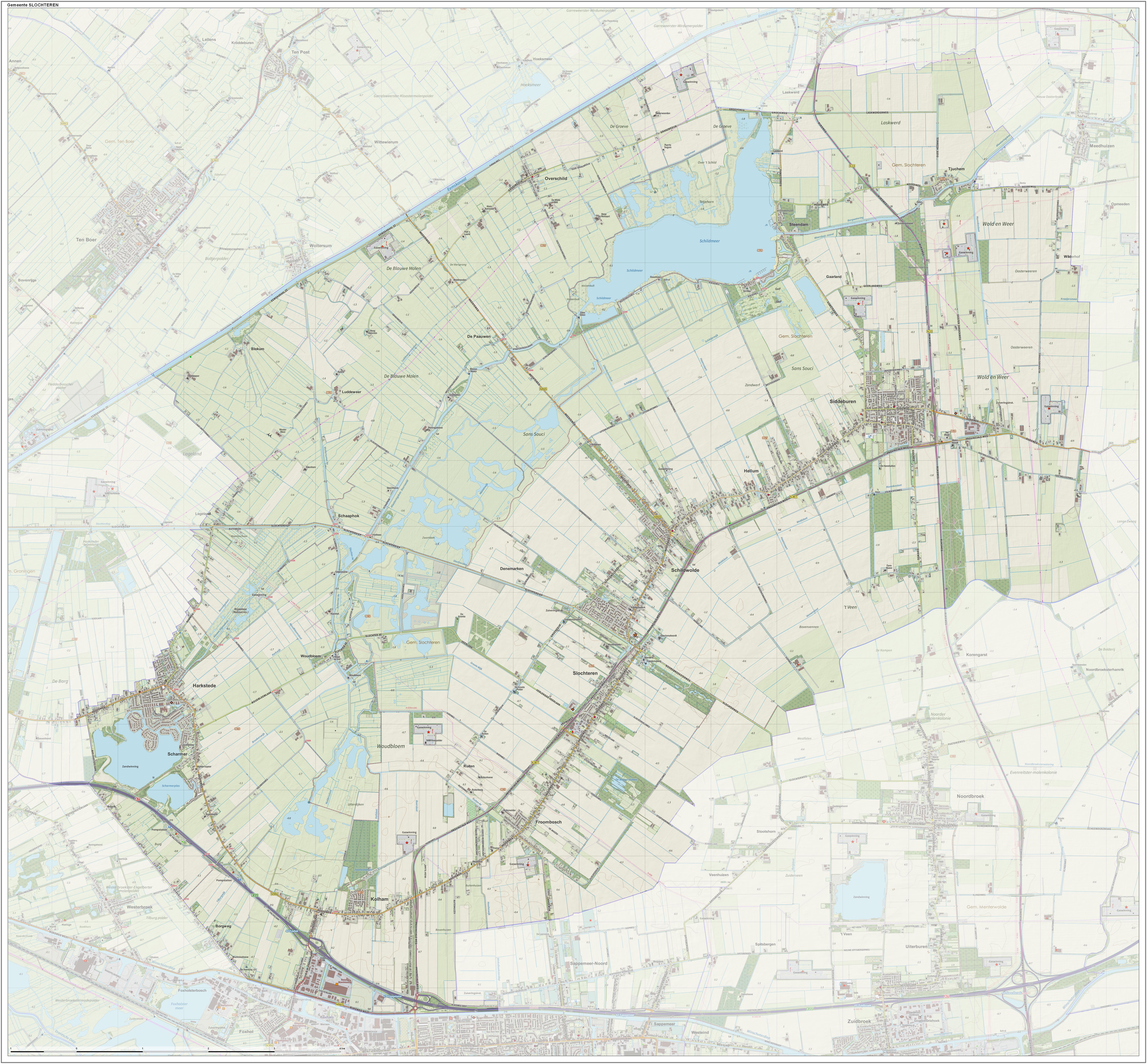
Slochteren () is a village and former municipality with a population of 15,546 in the province of Groningen in the northeast of the Netherlands. On 1 January 2018, Slochteren merged with Hoogezand-Sappemeer and Menterwolde, forming the municipality Midden-Groningen. The former municipality can be characterized as a chain of small villages dividing a mostly agricultural landscape. Having an agricultural background for at least a thousand years, the community houses for the most part commuters to nearby towns like Hoogezand, Groningen and Delfzijl. The mansion Fraeylemaborg (a small 'castle', the oldest parts of which are dated in the Middle Ages) is located in Slochteren. Geography The population centres in the former municipality are: * Denemarken * Froombosch * Harkstede * Hellum * Kolham * Lageland * Luddeweer * Overschild * Schaaphok * Scharmer * Schildwolde * Siddeburen * Slochteren * Steendam * Tjuchem * Woudbloem ''Topographic map of the municipality of ... [...More Info...] [...Related Items...] OR: [Wikipedia] [Google] [Baidu] |
Appingedam
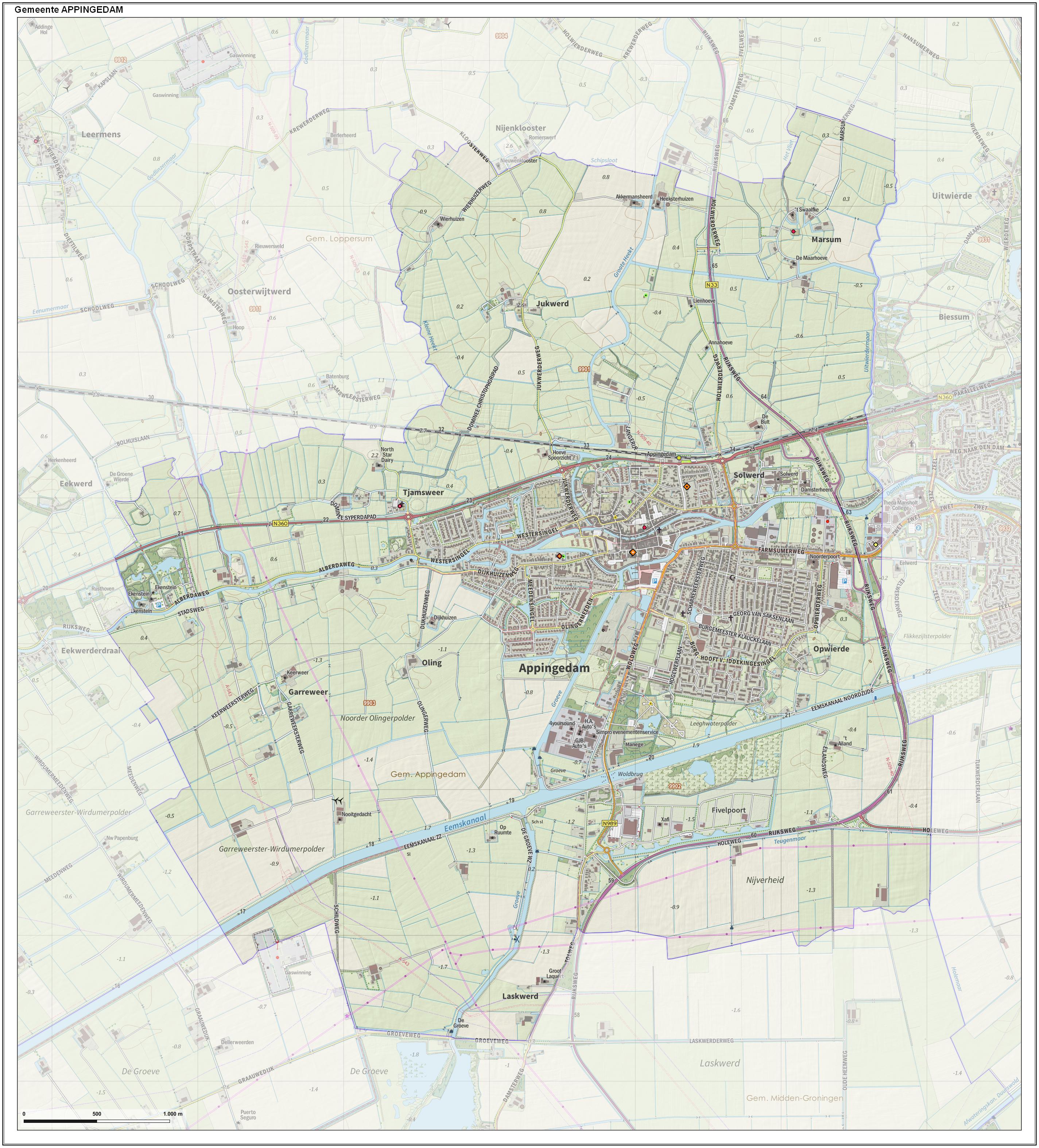
Appingedam (; gos, n Daam) is a city and former municipality in the northeastern Netherlands. Although there is no certainty as to the exact age of Appingedam, historical research demonstrates that the place in which the city would eventually be built had been inhabited for over a millennium. Specifically, the area in which the earliest traces of human settlements have been reported is the Wierde, a quarter located in the northern part of the city centre. Today, a narrow, winding street by the same name runs along the waterfront as a living testimony to the times gone by. The characteristic landmarks of the old Wierde are still recognisable today: the historical East-West Canal, called “Diep,” dug to the south of the Wierde, diked on both sides, still defines the unique layout of the downtown Appingedam. Little is known about the exact age and origin of the name of Appingedam. It came into existence on the banks of the Delf, the present Damsterdiep, around 1200. The name o ... [...More Info...] [...Related Items...] OR: [Wikipedia] [Google] [Baidu] |
Loppersum
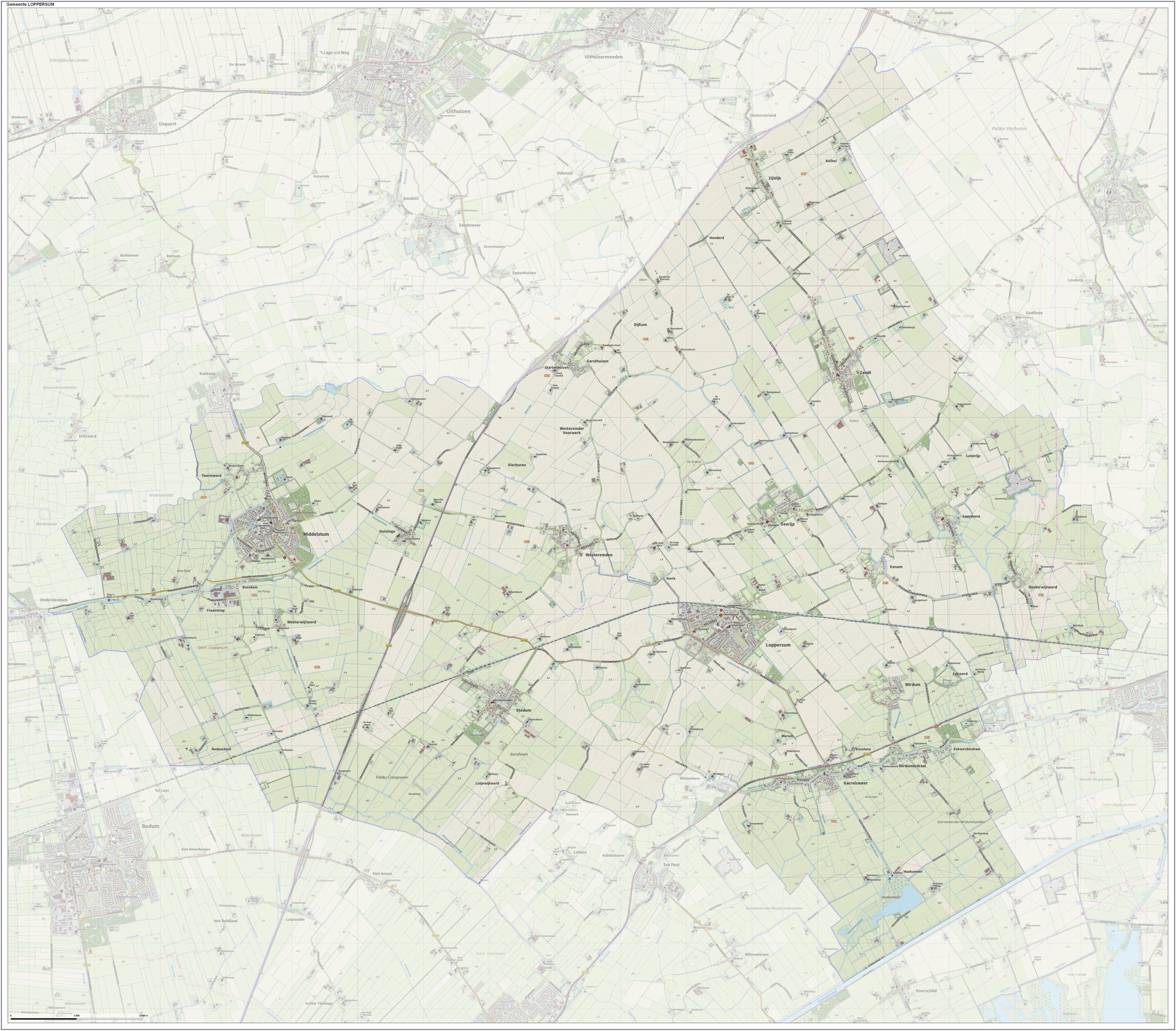
Loppersum () is a village and former municipality in the province of Groningen in the northeast of the Netherlands. Geography Loppersum is located in the province of Groningen in the north of the Netherlands. The former municipality was bordered by the municipalities of Eemsmond (north), Delfzijl (east), Appingedam (east), Slochteren (southeast), Ten Boer (south), and Bedum (southwest). The population centres in the municipality were: * Eekwerd * Eekwerderdraai * Eenum * Fraamklap * Garrelsweer * Garsthuizen * Hoeksmeer * Honderd * Huizinge * Kolhol * Leermens * Loppersum * Lutjerijp * Lutjewijtwerd * Merum * Middelstum * Oosterwijtwerd * Startenhuizen * Stedum * Stork * Toornwerd * Westeremden * Westerwijtwerd * Wirdum * Wirdumerdraai * 't Zandt * Zeerijp * Zijldijk Government The last mayor of Loppersum was Albert Rodenboog of the Christian Democratic Appeal (CDA). [...More Info...] [...Related Items...] OR: [Wikipedia] [Google] [Baidu] |
Eemsmond
Eemsmond (; en, Ems Mouth) is a former municipality with a population of 15,864 in the north of the province of Groningen in the northeast of the Netherlands. On 1 January 2019 it merged with the municipalities of Bedum, De Marne and Winsum to form the new municipality Het Hogeland. History The municipality of Hefshuizen was established on 1 January 1979 by merging the municipalities of Uithuizen and Uithuizermeeden. On 1 January 1990, the municipalities of Kantens, Usquert, and Warffum were added. On 1 January 1992, the name of the municipality was changed from ''Hefshuizen'' to ''Eemsmond'', which means Ems Mouth. Ad van der Meer & Onno BoonstraRepertorium Nederlandse gemeenten vanaf 1812, 2e editie Data Archiving and Networked Services, 2011. Retrieved 21 August 2015. Geography Eemsmond is located at in the north of the province of Groningen and in the northeast of the Netherlands. The population centers in the municipality are: Eemshaven, Eppenhuizen, Kantens, Ol ... [...More Info...] [...Related Items...] OR: [Wikipedia] [Google] [Baidu] |
Estuary
An estuary is a partially enclosed coastal body of brackish water with one or more rivers or streams flowing into it, and with a free connection to the open sea. Estuaries form a transition zone between river environments and maritime environments and are an example of an ecotone. Estuaries are subject both to marine influences such as tides, waves, and the influx of saline water, and to fluvial influences such as flows of freshwater and sediment. The mixing of seawater and freshwater provides high levels of nutrients both in the water column and in sediment, making estuaries among the most productive natural habitats in the world. Most existing estuaries formed during the Holocene epoch with the flooding of river-eroded or glacially scoured valleys when the sea level began to rise about 10,000–12,000 years ago. Estuaries are typically classified according to their geomorphological features or to water-circulation patterns. They can have many different names, such as bays, ... [...More Info...] [...Related Items...] OR: [Wikipedia] [Google] [Baidu] |
Pumping Station
Pumping stations, also called pumphouses in situations such as well drilling, drilled wells and drinking water, are facilities containing pumps and equipment for pumping fluids from one place to another. They are used for a variety of infrastructure systems, such as the supply of water to canals, the drainage of low-lying land, and the removal of sewage to processing sites. A pumping station is an integral part of a pumped-storage hydroelectricity installation. Canal water supply In countries with canal systems, pumping stations are also frequent. Because of the way the system of canal locks work, water is lost from the upper part of a canal each time a vessel passes through. Also, most lock gates are not watertight, so some water leaks from the higher levels of the canal to those lower down. Obviously, the water has to be replaced or eventually the upper levels of the canal would not hold enough water to be navigable. Canals are usually fed by diverting water from streams and ... [...More Info...] [...Related Items...] OR: [Wikipedia] [Google] [Baidu] |
Siege Of Delfzijl
A siege is a military blockade of a city, or fortress, with the intent of conquering by attrition, or a well-prepared assault. This derives from la, sedere, lit=to sit. Siege warfare is a form of constant, low-intensity conflict characterized by one party holding a strong, static, defensive position. Consequently, an opportunity for negotiation between combatants is common, as proximity and fluctuating advantage can encourage diplomacy. The art of conducting and resisting sieges is called siege warfare, siegecraft, or poliorcetics. A siege occurs when an attacker encounters a city or fortress that cannot be easily taken by a quick assault, and which refuses to surrender. Sieges involve surrounding the target to block the provision of supplies and the reinforcement or escape of troops (a tactic known as "investment"). This is typically coupled with attempts to reduce the fortifications by means of siege engines, artillery bombardment, mining (also known as sapping), or the use ... [...More Info...] [...Related Items...] OR: [Wikipedia] [Google] [Baidu] |
Michiel De Ruyter
Michiel Adriaenszoon de Ruyter (; 24 March 1607 – 29 April 1676) was a Dutch admiral. Widely celebrated and regarded as one of the most skilled admirals in history, De Ruyter is arguably most famous for his achievements with the Dutch Navy during the Anglo-Dutch Wars. He fought the English and French forces and scored several critical victories, with the Raid on the Medway being the most famous among them. Often dubbed a Dutch folk hero, De Ruyter is one of a few select officers in the history of the Dutch navy to hold the title of the lieutenant admiral ( nl, luitenant-admiraal). Reportedly beloved by his subordinates and seamen, De Ruyter was commonly nicknamed ''Bestevaêr'' (Middle Dutch for "grandfather") during his service, a nickname that is sometimes still used to refer to him in Dutch media. Early life De Ruyter was born on 24 March 1607 in Vlissingen, in the Spanish Netherlands, the son of a seaman who eventually became a brewery drayman, Adriaen Michielszoo ... [...More Info...] [...Related Items...] OR: [Wikipedia] [Google] [Baidu] |
.jpg)


