|
Deas Island
Deas Island is a peninsula in the south arm of the Fraser River between Delta, British Columbia and Richmond, British Columbia, Canada. The peninsula is home to a regional park approximately in size. It is home to three historic buildings; Burrvilla, a stately Victorian home, Inverholme, a one-room schoolhouse, and the Delta Agricultural Hall. Between 1895-1940's, the peninsula had a small Greek settlement with the population being approximately 80 at its peak. The peninsula is also home to many types of birds and is a popular bird watching destination. The peninsula is notable for being the site of the southern end of the George Massey Tunnel (originally the Deas Island Tunnel). The tunnel is part of Highway 99 and connects Delta to Richmond. The tunnel goes from Deas Island to Lulu Island (Richmond) to the north. There is a small bridge that completes the connection between Deas Island and the main part of Delta. Origin of the name The peninsula was named for John Sullivan ... [...More Info...] [...Related Items...] OR: [Wikipedia] [Google] [Baidu] |
Fraser River
The Fraser River is the longest river within British Columbia, Canada, rising at Fraser Pass near Blackrock Mountain in the Rocky Mountains and flowing for , into the Strait of Georgia just south of the City of Vancouver. The river's annual discharge at its mouth is or , and it discharges 20 million tons of sediment into the ocean. Naming The river is named after Simon Fraser, who led an expedition in 1808 on behalf of the North West Company from the site of present-day Prince George almost to the mouth of the river. The river's name in the Halqemeylem (Upriver Halkomelem) language is , often seen archaically as Staulo, and has been adopted by the Halkomelem-speaking peoples of the Lower Mainland as their collective name, . The river's name in the Dakelh language is . The ''Tsilhqot'in'' name for the river, not dissimilar to the ''Dakelh'' name, is , meaning Sturgeon ''()'' River ''()''. Course The Fraser drains a area. Its source is a dripping spring at Fraser Pas ... [...More Info...] [...Related Items...] OR: [Wikipedia] [Google] [Baidu] |
Delta, British Columbia
Delta is a city in the Lower Mainland region of British Columbia, Canada, as part of Greater Vancouver. Located on the Fraser Lowland south of Fraser River's south arm, it is bordered by the city of Richmond on the Lulu Island to the north, New Westminster to the northeast, Surrey to the east, the Boundary Bay and the American pene-exclave Point Roberts to the south, and the Strait of Georgia to the west. Encompassing the nearby Annacis Island, Deas Island and Westham Island, Delta is mostly rural and officially composed of three distinct communities: North Delta, Ladner and Tsawwassen. History Prior to European settlement, Delta's flatlands and coastal shores were inhabited by the Tsawwassen First Nation of the Coast Salish. The land was first sighted by Europeans in 1791, when Spanish explorer Lieutenant Francisco de Eliza mistook the area for an island and named it "Isla de Cepeda". The first European settler in Delta was James Kennedy who pre-empted 135 acres in what ... [...More Info...] [...Related Items...] OR: [Wikipedia] [Google] [Baidu] |
Richmond, British Columbia
Richmond is a coastal city in the Lower Mainland region of British Columbia, Canada. It occupies almost the entirety of Lulu Island (excluding Queensborough), between the two estuarine distributaries of the Fraser River. Encompassing the adjacent Sea Island (where the Vancouver International Airport is located) and several other smaller islands and uninhabited islets to its north and south, it neighbours Vancouver and Burnaby on the Burrard Peninsula to the north, New Westminster and Annacis Island to the east, Delta to the south, and the Strait of Georgia to the west. The Coast Salish peoples were the first people to inhabit the area of Richmond, with the Musqueam Band naming the site near Terra Nova "spələkʷəqs" or "boiling point". As a member municipality of Metro Vancouver, Richmond is composed of eight local neighbourhoods: Sea Island, City Centre, Thompson, West Richmond, Steveston, South Arm, East Richmond and Hamilton. As of 2022, the city has an estimated pop ... [...More Info...] [...Related Items...] OR: [Wikipedia] [Google] [Baidu] |
Canada
Canada is a country in North America. Its ten provinces and three territories extend from the Atlantic Ocean to the Pacific Ocean and northward into the Arctic Ocean, covering over , making it the world's second-largest country by total area. Its southern and western border with the United States, stretching , is the world's longest binational land border. Canada's capital is Ottawa, and its three largest metropolitan areas are Toronto, Montreal, and Vancouver. Indigenous peoples have continuously inhabited what is now Canada for thousands of years. Beginning in the 16th century, British and French expeditions explored and later settled along the Atlantic coast. As a consequence of various armed conflicts, France ceded nearly all of its colonies in North America in 1763. In 1867, with the union of three British North American colonies through Confederation, Canada was formed as a federal dominion of four provinces. This began an accretion of provinces an ... [...More Info...] [...Related Items...] OR: [Wikipedia] [Google] [Baidu] |
George Massey Tunnel
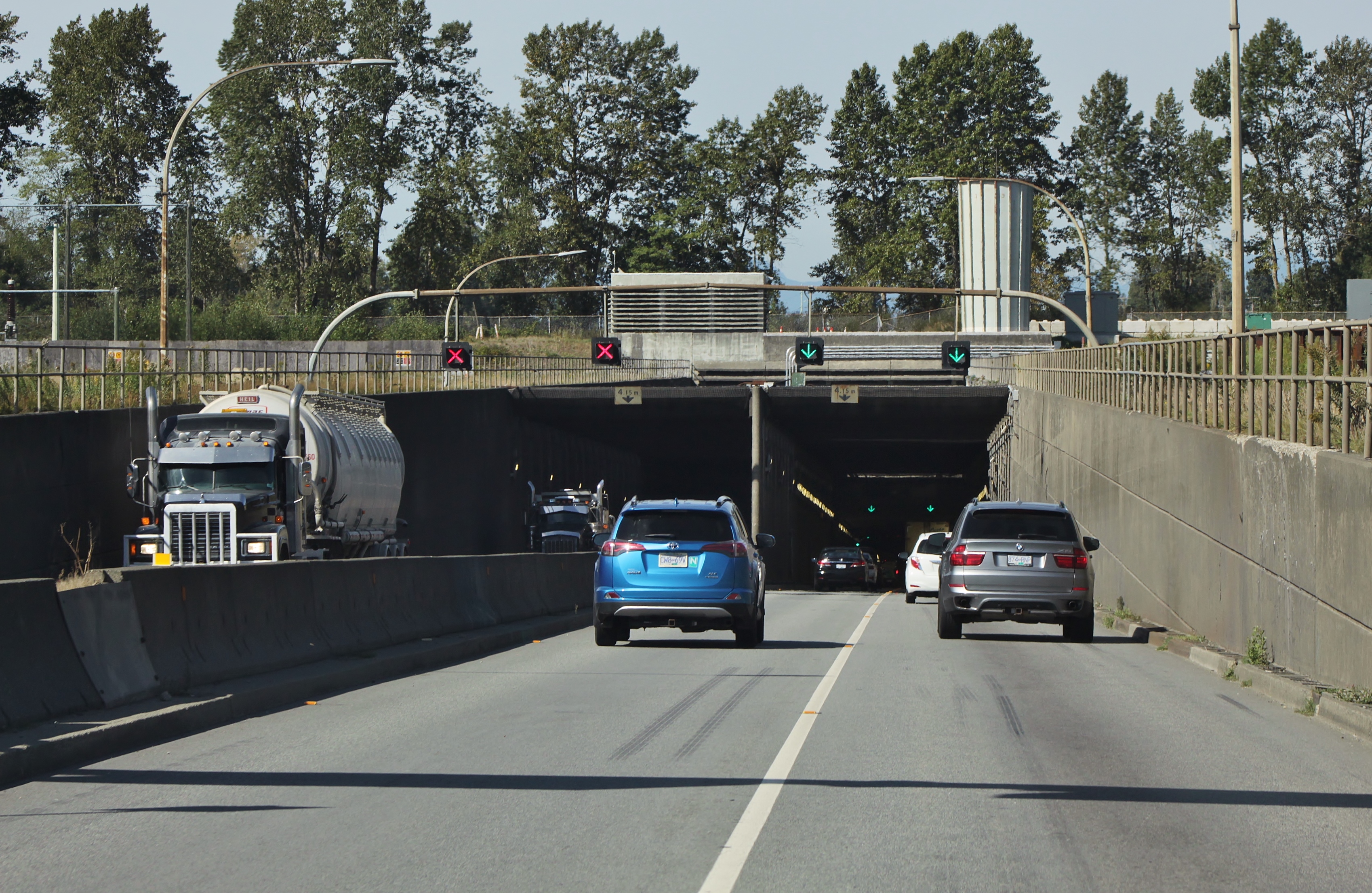
The George Massey Tunnel (often referred to as the Massey Tunnel) is a highway traffic tunnel in the Metro Vancouver region of southwestern British Columbia. It is located approximately south of the city centre of Vancouver, British Columbia, and approximately north of the Canada–United States border at Blaine, Washington. Construction, costing approximately $16.6 million in 1959 ($140 million in 2017), began on the tunnel in March 1957, and it was opened to traffic on May 23, 1959 as the Deas Island Tunnel. Queen Elizabeth II attended the official opening ceremony of the tunnel on July 15, 1959. It carries a four-lane divided highway under the south arm of the Fraser River estuary, joining the City of Richmond to the north with the City of Delta to the south. It is the only road tunnel below sea level in Canada, making its roadway the lowest road surface in Canada. The Massey Tunnel was the first to use immersed tube technology in British Columbia. The tunnel forms part ... [...More Info...] [...Related Items...] OR: [Wikipedia] [Google] [Baidu] |
British Columbia Highway 99
Highway 99 is a provincial highway in British Columbia that serves Greater Vancouver and the Squamish–Lillooet corridor over a length of . It is a major north–south artery within Vancouver and connects the city to several suburbs as well as the U.S. border, where it continues south as Interstate 5. The central section of the route, also known as the Sea to Sky Highway, serves the communities of Squamish, Whistler, and Pemberton. Highway 99 continues through Lillooet and ends at a junction with Highway 97 near Cache Creek. The highway's number, assigned in 1940, was derived from former U.S. Route 99, the predecessor to Interstate 5 and a major route for the U.S. West Coast. Highway 99 originally comprised the King George Highway in Surrey, portions of Kingsway from New Westminster to Vancouver, and local streets. It was extended across the Lions Gate Bridge and to Horseshoe Bay in the 1950s along a new highway that would later be incorporated into Highway 1 (the ... [...More Info...] [...Related Items...] OR: [Wikipedia] [Google] [Baidu] |
Lulu Island
Lulu Island is the name of the largest island in the estuary of the Fraser River, located south of Vancouver, British Columbia, and the second-most populous island in British Columbia, after Vancouver Island. The city of Richmond occupies most of the island, while a small section at the eastern tip, known as Queensborough, is part of the city of New Westminster. Lulu Island is situated between the two principal arms of the Fraser River estuary across and downstream from the City of New Westminster. The Middle Arm of the Fraser River separates it on the northwest from Sea Island, the site of Vancouver International Airport, which, despite its name, is also part of the City of Richmond. At the western edge of the island lies Sturgeon Bank, a large sandbank which falls off into the Strait of Georgia on its western edge. History Lulu Island was named in 1862 by Richard Moody, after Lulu Sweet, a popular showgirl, possibly of Kanaka (Hawaiian) origin, who had bought property t ... [...More Info...] [...Related Items...] OR: [Wikipedia] [Google] [Baidu] |
John Sullivan Deas
John Sullivan Deas (c. 1838 – July 22, 1880) was a Black tinsmith who helped found the salmon canning industry on the Fraser River in southern British Columbia, Canada. His cannery was located on Deas Island, which bears his name to this day. In 2017, he was named one of 150 noteworthy British Columbians by The Vancouver Sun. Early life and career John Sullivan Deas was born in South Carolina in about 1838. He began advertising himself as a tinsmith by 1856, when he would have still been a teenager. San Francisco By 1860, he relocated to San Francisco where he shared an address with other Black South Carolinians Louis and Susan Mortimer and Z. Deas. Deas worked as a tinsmith from 1860-1861 in San Francisco and was employed by Martin Prag, who also owned an establishment on Vancouver Island. Victoria By 1862, Deas was established in Victoria in the colony of Vancouver Island. By late 1868, he was operating a hardware and stove business called Birmingham House at the corner ... [...More Info...] [...Related Items...] OR: [Wikipedia] [Google] [Baidu] |
Tinsmith
A tinsmith is a person who makes and repairs things made of tin or other light metals. The profession may sometimes also be known as a tinner, tinker, tinman, or tinplate worker; whitesmith may also refer to this profession, though the same word may also refer to an unrelated specialty of iron-smithing. By extension it can also refer to the person who deals in tinware, or tin plate. Tinsmith was a common occupation in pre-industrial times. Unlike blacksmiths (who work mostly with hot metals), tinsmiths do the majority of their work on cold metal (although they might use a hearth to heat and help shape their raw materials). Tinsmiths fabricate items such as water pitchers, forks, spoons, and candle holders. Training of tinsmiths The tinsmith learned his trade, like many other artisans, by serving an apprenticeship of 4 to 6 years with a master tinsmith. Apprenticeships were considered "indentures" and an apprentice would start first with simply cleaning the shop, polishing t ... [...More Info...] [...Related Items...] OR: [Wikipedia] [Google] [Baidu] |
Cannery
Canning is a method of food preservation in which food is processed and sealed in an airtight container (jars like Mason jars, and steel and tin cans). Canning provides a shelf life that typically ranges from one to five years, although under specific circumstances, it can be much longer. A freeze-dried canned product, such as canned dried lentils, could last as long as 30 years in an edible state. In 1974, samples of canned food from the wreck of the ''Bertrand'', a steamboat that sank in the Missouri River in 1865, were tested by the National Food Processors Association. Although appearance, smell, and vitamin content had deteriorated, there was no trace of microbial growth and the 109-year-old food was determined to be still safe to eat. History and development French origins During the first years of the Napoleonic Wars, the French government offered a hefty cash award of 12,000 francs to any inventor who could devise a cheap and effective method of preserving la ... [...More Info...] [...Related Items...] OR: [Wikipedia] [Google] [Baidu] |


