|
Dave MacLeod
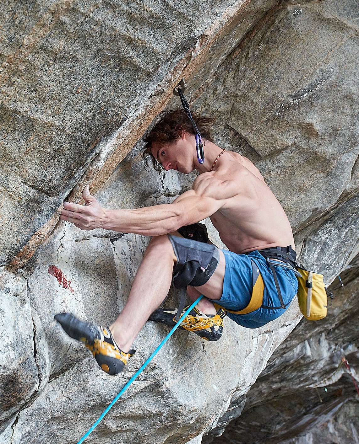
Dave MacLeod (born 17 July 1978) is a Scottish people, Scottish rock climber, ice climbing, ice climber, and climbing author. MacLeod is best known for being the first climber in the world to climb in free solo style (without rope) a route (''Darwin Dixit'' in Margalef, in 2008), and for climbing one of the hardest traditional climbing routes in the world (''Rhapsody'' on Dumbarton, Dumbarton Rock, graded E11 7a, in 2006). Climbing career Rock climbing In April 2006, MacLeod established the climb ''Rhapsody'' on Dumbarton, Dumbarton Rock which, at a grade of E11 7a, was possibly the hardest trad climbing route in the world. ''Rhapsody'' is the true finish to the line of ''Requiem'', graded E8 6b. Requiem was climbed in 1983 by Dave Cuthbertson and was one of the hardest rock climbs in the world at the time. It follows a crack-line that fades out to a seam at half height. Requiem follows a flake heading rightwards to finish, while Rhapsody climbs the line of the crack all t ... [...More Info...] [...Related Items...] OR: [Wikipedia] [Google] [Baidu] |
United Kingdom
The United Kingdom of Great Britain and Northern Ireland, commonly known as the United Kingdom (UK) or Britain, is a country in Europe, off the north-western coast of the continental mainland. It comprises England, Scotland, Wales and Northern Ireland. The United Kingdom includes the island of Great Britain, the north-eastern part of the island of Ireland, and many smaller islands within the British Isles. Northern Ireland shares a land border with the Republic of Ireland; otherwise, the United Kingdom is surrounded by the Atlantic Ocean, the North Sea, the English Channel, the Celtic Sea and the Irish Sea. The total area of the United Kingdom is , with an estimated 2020 population of more than 67 million people. The United Kingdom has evolved from a series of annexations, unions and separations of constituent countries over several hundred years. The Treaty of Union between the Kingdom of England (which included Wales, annexed in 1542) and the Kingdom of Scotland in 170 ... [...More Info...] [...Related Items...] OR: [Wikipedia] [Google] [Baidu] |
List Of First Ascents (sport Climbing)
In rock climbing, a first free ascent (FFA) is the first documented redpoint, onsight or flash of a single-pitch, big wall (multi-pitch), or boulder route that did not involve using aid equipment to help progression or resting; the ascent must therefore be performed in either a sport, a traditional, or a free solo manner. First free ascents that set new grade milestones are important events in rock climbing history, and are listed below. While sport climbing has dominated absolute grade milestones since the mid-1980s, milestones for modern traditional climbing, free solo climbing, onsighted, and flashed ascents, are also listed. A grade is provisional until enough climbers have repeated the route to have a "consensus". At the highest grades, this can take years as few climbers are capable of repeating these routes. For example, in 2001, '' Realization'' was considered the world's first , however, the first repeat of the 1996 route ''Open Air'', which only happened in 2008, ... [...More Info...] [...Related Items...] OR: [Wikipedia] [Google] [Baidu] |
History Of Rock Climbing
In the history of rock climbing, the three main sub-disciplines: bouldering, single-pitch climbing, and big wall (or multi-pitch) climbing can trace their origins to late 19th-century Europe. Bouldering started in Fontainebleau, and was advanced by Pierre Allain in the 1930s, and John Gill in the 1950s. Big wall climbing started in the Dolomites, and was spread across the Alps in the 1930s by climbers such as Emilio Comici and Riccardo Cassin, and in the 1950s by Walter Bonatti, before reaching Yosemite where it was led in the 1950s to 1970s by climbers such as Royal Robbins. Single-pitch climbing started pre-1900 in both the Lake District and in Saxony, and by the 1970s had spread widely with climbers such as Ron Fawcett (Britain), Bernd Arnold (Germany), Patrick Berhault (France), Ron Kauk and John Bachar (USA), As a free solo exercise with no artificial aid or climbing protection, bouldering remained largely consistent since its origins. Single-pitch climbing stopped ... [...More Info...] [...Related Items...] OR: [Wikipedia] [Google] [Baidu] |
Scottish Winter Grade
In rock climbing, mountaineering, and other climbing disciplines, climbers give a grade to a climbing route or boulder problem, intended to describe concisely the difficulty and danger of climbing it. Different types of climbing (such as sport climbing, bouldering or ice climbing) each have their own grading systems, and many nationalities developed their own, distinctive grading systems. There are a number of factors that contribute to the difficulty of a climb, including the technical difficulty of the moves, the strength, stamina and level of commitment required, and the difficulty of protecting the climber. Different grading systems consider these factors in different ways, so no two grading systems have an exact one-to-one correspondence. Climbing grades are inherently subjective.Reynolds Sagar, Heather, 2007, ''Climbing your best: training to maximize your performance'', Stackpole Books, UK, 9. They may be the opinion of one or a few climbers, often the first ascensioni ... [...More Info...] [...Related Items...] OR: [Wikipedia] [Google] [Baidu] |
Cairngorms
The Cairngorms ( gd, Am Monadh Ruadh) are a mountain range in the eastern Highlands of Scotland closely associated with the mountain Cairn Gorm. The Cairngorms became part of Scotland's second national park (the Cairngorms National Park) on 1 September 2003. Although the Cairngorms give their name to, and are at the heart of, the Cairngorms National Park, they only form one part of the national park, alongside other hill ranges such as the Angus Glens and the Monadhliath, and lower areas like Strathspey. The Cairngorms consists of high plateaux at about above sea level, above which domed summits (the eroded stumps of once much higher mountains ) rise to around . Many of the summits have tors, free-standing rock outcrops that stand on top of the boulder-strewn landscape. In places, the edges of the plateau form steep cliffs of granite and they are excellent for skiing, rock climbing and ice climbing. The Cairngorms form an arctic-alpine mountain environment, with tundra-like ... [...More Info...] [...Related Items...] OR: [Wikipedia] [Google] [Baidu] |
Coire An T-Sneachda
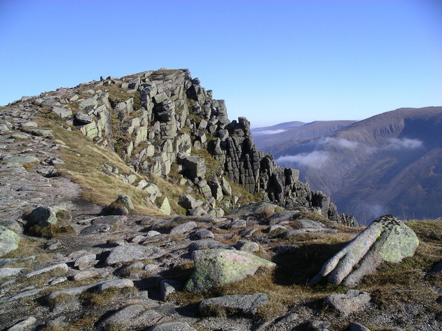
Coire an t-Sneachda (sometimes misspelled as ''Coire an t'Sneachda'') is a glacial cirque or corrie landform in the Cairngorm or mountain range in the Grampian Mountains of the Scottish Highlands. The summits of Cairn Lochan (1215 m) and Stob Coire an t-Sneachda (1176 m) lie above Coire an t-Sneachda's headwall. The Scottish Gaelic translates into English as . Location and access Coire an t-Sneachda is located in Invernesshire, Northern Scotland. The nearest major town is Aviemore. The nearest road access point is the Cairn Gorm ski centre, which is located approximately away (approx. 45–60 minutes walking, in fair conditions). Geology and wildlife The country rock is the Caledonian granite of the Cairngorm batholith which gives rise to the high plateau from which the corrie was eroded. The last glacier occupied this corrie or cirque approximately 10,000 to 11,000 years before present during the Younger Dryas stadial. This cold period, which is also know ... [...More Info...] [...Related Items...] OR: [Wikipedia] [Google] [Baidu] |
Will Gadd
Will Gadd (born March 8, 1967) is a prominent Canadian ice climber and paraglider pilot. He formerly held the paragliding world distance record, with a flight of 423 km in Zapata, Texas. He is the host of the documentary series ''Fearless Planet'', working with regional scientists and traveling with them, or by himself, to various locations that are in the individual episode's focus. Ascent of Niagara Falls In January 2015, Gadd became the first person to scale the ice-covered rock wall next to the Horseshoe Falls at Niagara Falls. He was followed by Canadian climber Sarah Hueniken. Their ascent took place on Goat Island, located on the American side of the falls. "I was so close to the water", Gadd stated, "I could reach out and stick my ice tool in the Niagara Falls". See also *List of climbers This list of climbers and mountaineers is a list of people notable for the activities of mountaineering, rock climbing (including bouldering) and ice climbing. A * V ... [...More Info...] [...Related Items...] OR: [Wikipedia] [Google] [Baidu] |
Peak District
The Peak District is an upland area in England at the southern end of the Pennines. Mostly in Derbyshire Derbyshire ( ) is a ceremonial county in the East Midlands, England. It includes much of the Peak District National Park, the southern end of the Pennine range of hills and part of the National Forest. It borders Greater Manchester to the nor ..., it extends into Cheshire, Greater Manchester, Staffordshire, West Yorkshire and South Yorkshire. It includes the Dark Peak, where moorland is found and the geology is dominated by gritstone, and the White Peak, a limestone area with valleys and gorges. The Dark Peak forms an arc on the north, east and west sides; the White Peak covers central and southern tracts. The historic Peak District extends beyond the National Park, which excludes major towns, quarries and industrial areas. It became the first of the national parks of England and Wales in 1951. Nearby Manchester, Stoke-on-Trent, Derby and Sheffield send millions of v ... [...More Info...] [...Related Items...] OR: [Wikipedia] [Google] [Baidu] |
Yorkshire Dales
The Yorkshire Dales is an upland area of the Pennines in the Historic counties of England, historic county of Yorkshire, England, most of it in the Yorkshire Dales National Park created in 1954. The Dales comprise river valleys and the hills rising from the Vale of York westwards to the hilltops of the Pennine Drainage divide, watershed. In Ribblesdale, Dentdale and Garsdale, the area extends westwards across the watershed, but most of the valleys drain eastwards to the Vale of York, into the River Ouse, Yorkshire, Ouse and the Humber. The extensive limestone cave systems are a major area for caving in the UK and numerous walking trails run through the hills and dales. Etymology The word ''Dale (landform), dale'', like ''dell'', is derived from the Old English word ''dæl''. It has cognates in the North Germanic languages, Nordic/Germanic languages, Germanic words for valley (''dal'', ''tal''), and occurs in valley names across Yorkshire and Northern England. Usage here may have ... [...More Info...] [...Related Items...] OR: [Wikipedia] [Google] [Baidu] |
Handa, Scotland
Handa Island ( gd, Eilean Shannda) or simply Handa is an island off the west coast of Sutherland, Scotland. It is and at its highest point. The island is of national importance for its birdlife and maritime vegetation, and is a Scottish Wildlife Trust nature reserve, a Site of Special Scientific Interest (SSSI), and a Special Protection Area (SPA). Handa also forms part of the North-West Sutherland national scenic area, one of 40 such areas in Scotland. A small ferry sails to Handa from Tarbet on the mainland and boat trips operate to it from Fanagmore. The island receives five thousand visitors per annum. Geography and geology Handa is composed of Torridonian red sandstone and surrounded by cliffs covered with birds. In the north is a hill with two peaks, with the south and east being lower lying. The north and west have cliffs, and there are beaches in the south and east. The Sound of Handa separates it from the mainland and smaller islands around Handa include ... [...More Info...] [...Related Items...] OR: [Wikipedia] [Google] [Baidu] |
Lewis With Harris
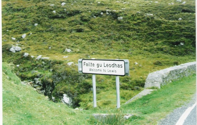
Lewis and Harris ( gd, Leòdhas agus na Hearadh, sco, Lewis an Harris), or Lewis with Harris, is a single Scottish island in the Outer Hebrides, divided by mountains. It is the largest island in Scotland and the third largest in the British Isles, after Great Britain and the island of Ireland, with an area of , which is approximately 1% of the area of Great Britain. The northern two-thirds is called Lewis and the southern third Harris; each is frequently referred to as if it were a separate island. Etymology The island does not have a one-word name in either English or Scottish Gaelic, and is referred to as "Lewis and Harris", "Lewis with Harris", "Harris with Lewis" etc. Rarely used is the collective name of "the Long Island" ( gd, an t-Eilean Fada), although that epithet is sometimes applied to the entire archipelago of the Outer Hebrides, including the Uist group of islands and Barra. Geography Lewis–Harris boundary The boundary between Lewis and Harris runs fo ... [...More Info...] [...Related Items...] OR: [Wikipedia] [Google] [Baidu] |


.jpg)


