|
Draethen
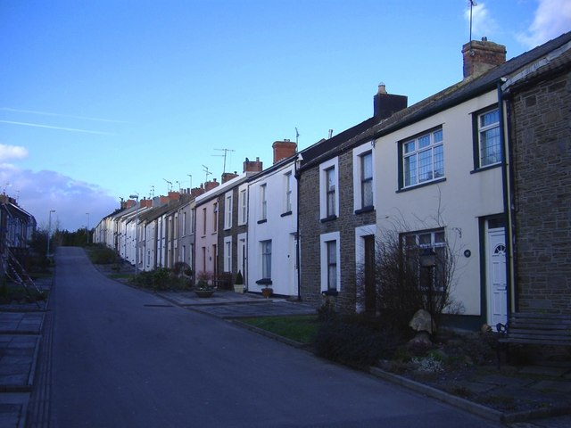
Draethen is a village in the county borough of Caerphilly, South Wales, and the community of Rudry. The village is located some east of Caerphilly, and northeast of Cardiff. Located on the southern reaches of the Rhymney River within the historic boundaries of Glamorgan, Draethen is bordered by Bedwas to the west, Rhiwderin to the east, Michaelston-y-Fedw to the south east and Lower Machen to the north. Draethen Woods contain a number of former lead mining sites and surface workings dating back to at least Roman times. The mines once exploited a vein of lead ore that exists in the exposed limestone Limestone ( calcium carbonate ) is a type of carbonate sedimentary rock which is the main source of the material lime. It is composed mostly of the minerals calcite and aragonite, which are different crystal forms of . Limestone forms whe ... of the Southern Outcrop in this region. All the sites are presently fenced off, but there are no known access restrictions, making ... [...More Info...] [...Related Items...] OR: [Wikipedia] [Google] [Baidu] |
Rudry
Rudry ( cy, Rhydri) is a small village and community located to the east of Caerphilly in Wales. As a community Rudry contains not only the village of Rudry, but also the villages of Draethen, Garth and Waterloo. The population of the community at the 2011 census was 1,053. The village is a rural location, surrounded by woods with walks along the Rhymney Valley Ridgeway Walk. Its main attraction being the Maen llwyd Inn. Another pub, The Griffin was located near the local church. It is thought that Oliver Cromwell Oliver Cromwell (25 April 15993 September 1658) was an English politician and military officer who is widely regarded as one of the most important statesmen in English history. He came to prominence during the 1639 to 1651 Wars of the Three Ki ... took shelter in St James's church, which has existed in the village since the 13th century. The community was once served by two small railway stations— Waterloo Halt and Fountain Bridge Halt. Both closed in 1956.H ... [...More Info...] [...Related Items...] OR: [Wikipedia] [Google] [Baidu] |
Rhymney River
The Rhymney River ( cy, Afon Rhymni) is a river in the Rhymney Valley, South Wales, flowing through Cardiff into the Severn Estuary. The river formed the boundary between the historic counties of Glamorgan and Monmouthshire until in 1887, the parishes east of the river, Rumney and St Mellons, were transferred from the jurisdiction of Newport, to Cardiff in Glamorgan. The river flows south from its source near Rhymney through New Tredegar, Bargoed, Ystrad Mynach, Llanbradach to Caerphilly at the southern end of the Rhymney Valley. Then past Bedwas, Trethomas, Machen, Draethen, Llanrumney and Rumney and its estuary into the River Severn. The Rhymney Valley () was created as a glacial valley. Sourced within the valley, on the southern edge of the Brecon Beacons, the Rhymney River descends steeply through the town of New Tredegar towards Ystrad Mynach, and then onwards south across a flat plain before entering the Severn Estuary to the east of Cardiff. The villages ... [...More Info...] [...Related Items...] OR: [Wikipedia] [Google] [Baidu] |
Caerphilly (county Borough)
Caerphilly County Borough ( cy, Bwrdeistref Sirol Caerffili) is a county borough in the south-east of Wales. It is governed by Caerphilly County Borough Council. Its main and largest town is Caerphilly. Other towns in the county borough are Bedwas, Risca, Ystrad Mynach, Newbridge, Blackwood, Bargoed, New Tredegar and Rhymney. Geography Caerphilly County Borough is in southeast Wales and straddles the border between the historic counties of Glamorgan and Monmouthshire. It is bordered by Cardiff to the southwest, Newport to the southeast, Torfaen to the east, Blaenau Gwent to the northeast, Powys to the north, Merthyr Tydfil to the northwest and Rhondda Cynon Taf to the west. The northern part of the borough is formed by the broad expanse of the Rhymney Valley. The Rhymney River rises in the hills in the north and flows southwards for about thirty miles, looping round to the east just to the north of Caerphilly before reaching the Bristol Channel. Some of the large ... [...More Info...] [...Related Items...] OR: [Wikipedia] [Google] [Baidu] |
Bedwas
Bedwas is a town situated two miles north-east of Caerphilly, south Wales, situated in the Caerphilly county borough, within the historic boundaries of Monmouthshire. Bedwas neighbours Trethomas, Graig-y-Rhacca and Machen, and forms a council ward in conjunction with those communities. Etymology The name Bedwas means "grove, bank or place of birch trees", which is found in more modern Welsh as '. Early history Traditionally a farming community, Bedwas was originally called Lower Bedwas. Maesycwmmer, a small village not far from Bedwas, was called Upper Bedwas. The two villages became known as what we know them today in the 19th century. Bedwas owes much of its own development to the development of the South Wales coalfield and the Welsh coal mining industry. This is depicted in the early Census records. According to the 1811 census, Lower Bedwas consisted of 47 occupied houses and 65 families. 59 of these families were engaged in agriculture and 6 in trade, manufacture ... [...More Info...] [...Related Items...] OR: [Wikipedia] [Google] [Baidu] |
Lead Ore
Lead is a chemical element with the symbol Pb (from the Latin ) and atomic number 82. It is a heavy metal that is denser than most common materials. Lead is soft and malleable, and also has a relatively low melting point. When freshly cut, lead is a shiny gray with a hint of blue. It tarnishes to a dull gray color when exposed to air. Lead has the highest atomic number of any stable element and three of its isotopes are endpoints of major nuclear decay chains of heavier elements. Lead is toxic, even in small amounts, especially to children. Lead is a relatively unreactive post-transition metal. Its weak metallic character is illustrated by its amphoteric nature; lead and lead oxides react with acids and bases, and it tends to form covalent bonds. Compounds of lead are usually found in the +2 oxidation state rather than the +4 state common with lighter members of the carbon group. Exceptions are mostly limited to organolead compounds. Like the lighter members of the group, ... [...More Info...] [...Related Items...] OR: [Wikipedia] [Google] [Baidu] |
Roman Wales
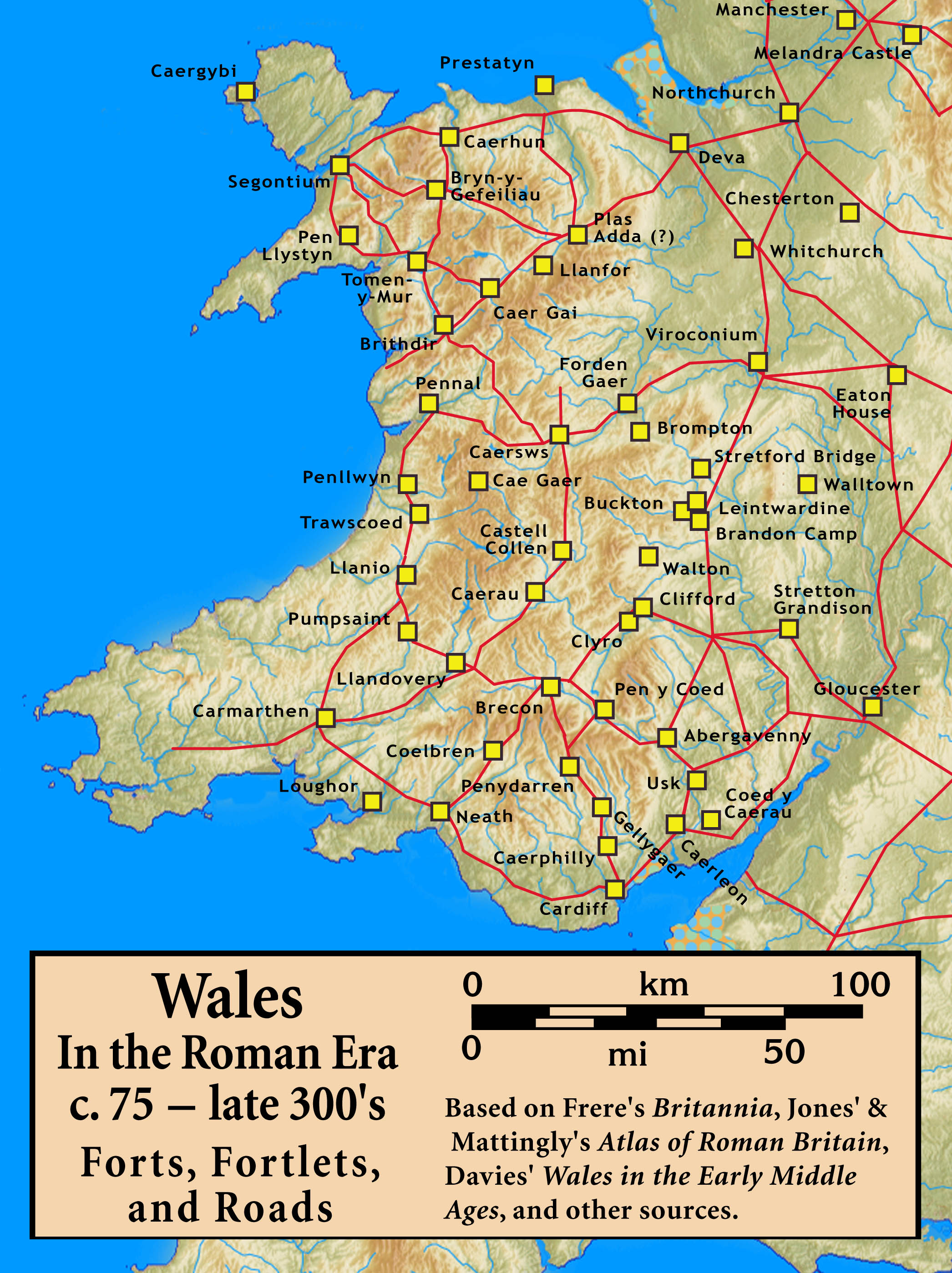
The Roman era in the area of modern Wales began in 48 AD, with a military invasion by the imperial governor of Roman Britain. The conquest was completed by 78 AD, and Roman rule endured until the region was abandoned in 383 AD. The Roman Empire held a military occupation in most of Wales, except for the southern coastal region of South Wales, east of the Gower Peninsula, where there is a legacy of Romanisation in the region, and some southern sites such as Carmarthen, which was the civitas capital of the Demetae tribe. The only town in Wales founded by the Romans, Caerwent, is located in South Wales. Wales was a rich source of mineral wealth, and the Romans used their engineering technology to extract large amounts of gold, copper, and lead, as well as modest amounts of some other metals such as zinc and silver. The Roman campaigns of conquest in Wales appear in surviving ancient sources, who record in particular the resistance and ultimate conquest of two of the five na ... [...More Info...] [...Related Items...] OR: [Wikipedia] [Google] [Baidu] |
Lead Mining
Lead is a chemical element with the symbol Pb (from the Latin ) and atomic number 82. It is a heavy metal that is denser than most common materials. Lead is soft and malleable, and also has a relatively low melting point. When freshly cut, lead is a shiny gray with a hint of blue. It tarnishes to a dull gray color when exposed to air. Lead has the highest atomic number of any stable element and three of its isotopes are endpoints of major nuclear decay chains of heavier elements. Lead is toxic, even in small amounts, especially to children. Lead is a relatively unreactive post-transition metal. Its weak metallic character is illustrated by its amphoteric nature; lead and lead oxides react with acids and bases, and it tends to form covalent bonds. Compounds of lead are usually found in the +2 oxidation state rather than the +4 state common with lighter members of the carbon group. Exceptions are mostly limited to organolead compounds. Like the lighter members of the group, ... [...More Info...] [...Related Items...] OR: [Wikipedia] [Google] [Baidu] |
Lower Machen
Lower Machen ( cy, Machen Isaf) is a small hamlet of 19 houses on the A468 road at the very western edge of the city of Newport, South Wales. Machen itself lies further west in the county borough of Caerphilly, although both lie within the historic boundaries of Monmouthshire. Lower Machen holds an annual festival of chamber music concerts in the 12th-century church of St. Michael and All Angels. Ruperra Castle is also located in Lower Machen. Lower Machen was formerly served by Church Road railway station, which closed in 1957. The Conservative politician, Peter Thorneycroft, lived at Machen House in the hamlet, during his time as Member of Parliament for Monmouth from 1945-1966. St Michael and All Angels' Church It is believed that the church () was founded during the Celtic period in the 6th century. The current building dates back to the 12th century. The church has connections with the Morgan family of the nearby Tredegar House in Newport. There are eleven hatchment ... [...More Info...] [...Related Items...] OR: [Wikipedia] [Google] [Baidu] |
Michaelston-y-Fedw
Michaelston-y-Fedw ( cy, Llanfihangel-y-fedw) is a small rural village and community to the west of the city of Newport, Wales, on the borders of Cardiff city and Caerphilly county boroughs. The population in 2011 was 296. The name, which is a partial Anglicization of the Welsh Llanfihangel-y-fedw – meaning "church enclosure (of) Michael (in) the birches" – may also be seen spelt "Michaelstone-y-Fedw", "Michaelston-y-Vedw" and "Michaelstone-y-Vedw", the parish church being dedicated to Saint Michael. There is a local pub called the Cefn Mably Arms. It first opened in 1824. Since 2017, the local vicar blesses the beer, the public house and the village entire in a special, public ceremony. The community is bounded by the Rhymney River to the west, the A48(M) motorway to the south, and the Pound Hill road to the north and east. It contains Michaelston itself as well as a small cluster of houses known as Michaelstone Bridge or Lower Michaelstone about a mile to the north. Co ... [...More Info...] [...Related Items...] OR: [Wikipedia] [Google] [Baidu] |
Rhiwderin
Rhiwderin ( cy, Rhiwderyn) is a small village in the west of the city of Newport, South Wales. It lies in the community parish and electoral district (ward) of Graig. The original village lies across a level crossing alongside the Ebbw Valley Railway and off the main A468 Newport—Caerphilly road. There are additional houses on the other side of the main road known as Rhiwderin Heights which have almost merged the village with neighbouring Bassaleg. The Pentrepoeth School is the local primary school in the area. Rhiwderin Community Centre is located in the former village school and administered by Graig Community Council. The village was served by Rhiwderin railway station until 1954. Rhyderin lies on the route of the old Brecon and Merthyr Tydfil Junction Railway line. The line now ends at Machen Quarry and carries only freight trains. The trackbed from Machen to Caerphilly is now part of National Cycle Route 4 Between these, the route runs through Reading, Bath, ... [...More Info...] [...Related Items...] OR: [Wikipedia] [Google] [Baidu] |
Historic Counties Of Wales
The historic counties of Wales are sub-divisions of Wales. They were used for various functions for several hundred years,Bryne, T., ''Local Government in Britain'', (1994) but for administrative purposes have been superseded by contemporary sub-national divisions,Her Majesty's Stationery Office, ''Aspects of Britain: Local Government'', (1996) some of which bear some limited similarity to the historic entities in name and extent. They are alternatively known as ancient counties. The counties :1 The earldom of Pembroke and lordship of Glamorgan pre-date the Edwardian conquest. :2 These counties originate in 1282, following King Edward I's conquest. :3 These counties originate in 1535, with the Laws in Wales Act, 1535, converting the remaining Marcher Lordships into counties. :4 Despite being created at the same Act as the other counties, Monmouthshire was included with English counties for legal purposes until 1974. Between 1536 and 1974 the formulation "Wales an ... [...More Info...] [...Related Items...] OR: [Wikipedia] [Google] [Baidu] |
Glamorgan
, HQ = Cardiff , Government = Glamorgan County Council (1889–1974) , Origin= , Code = GLA , CodeName = Chapman code , Replace = * West Glamorgan * Mid Glamorgan * South Glamorgan , Motto = ("He who suffered, conquered") , Image = Flag adopted in 2013 , Map = , Arms = , PopulationFirst = 326,254 , PopulationFirstYear = 1861 , AreaFirst = , AreaFirstYear = 1861 , DensityFirst = 0.7/acre , DensityFirstYear = 1861 , PopulationSecond = 1,120,910Vision of Britain â€Glamorgan population , PopulationSecondYear = 1911 , AreaSecond = , AreaSecondYear = 1911 , DensitySecond ... [...More Info...] [...Related Items...] OR: [Wikipedia] [Google] [Baidu] |


