|
Dorje Lhakpa
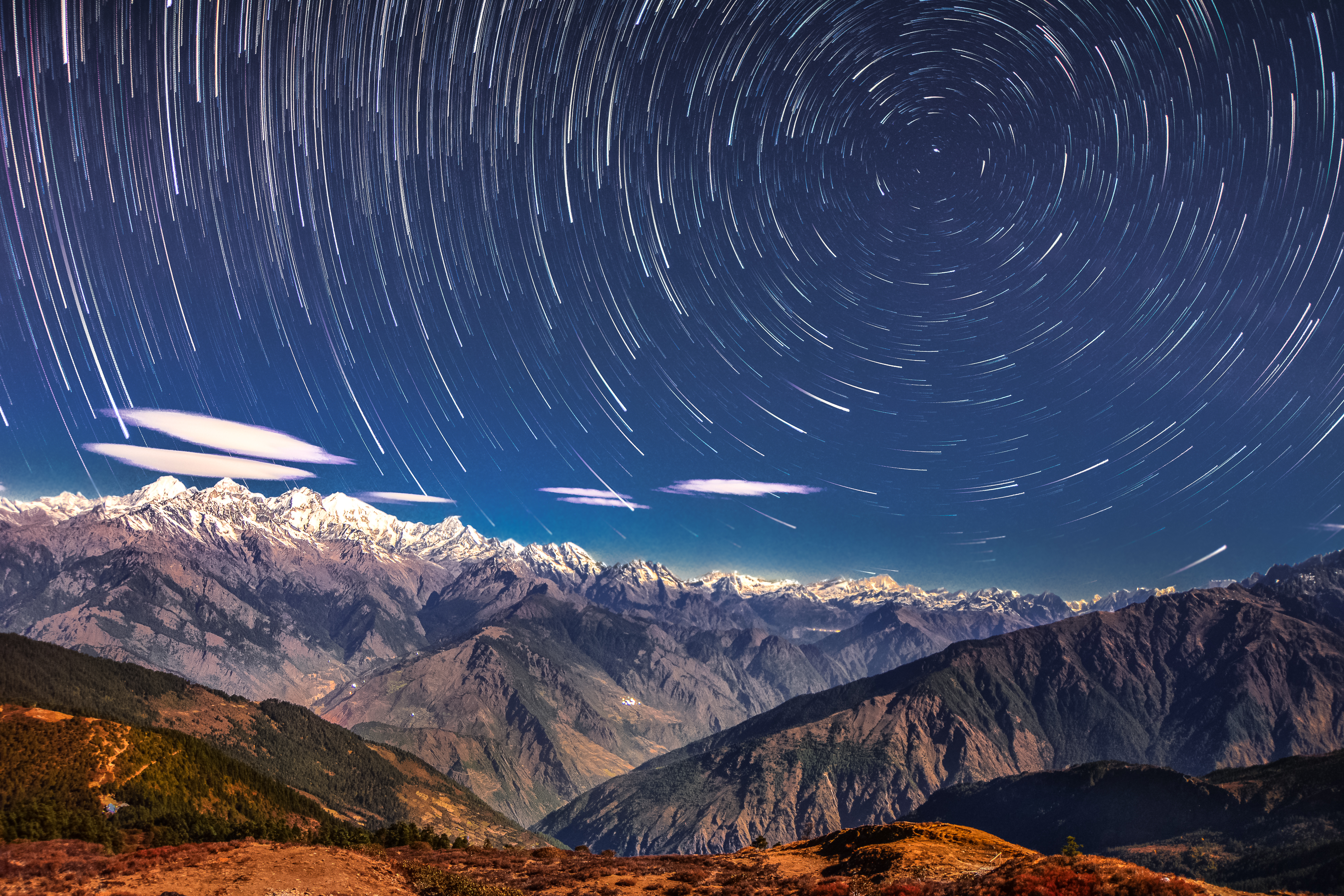
Dorje Lhakpa is a mountain in the Jugal Himal, southeast of Langtang valley in Nepal. Visible also from Kathmandu valley it has an elegant pyramid-shaped figure and is an ideal target for photographers and mountaineers. Considered by many of intermediate difficulty with easiest route from the west ridge. Its climb is offered by many trekking and mountaineering agencies in Nepal. Climbing history The first attempt and successful climb recorded is by a Japanese expedition in the late 1960s by the west ridge. In 1986, a German–Nepalese expedition (Klaus Stark (leader of the expedition), Mathias Rau, Helmut Müller, Bernd Mayer (doctor), Thomas Oeser from T.A.K. (Turner-Alpen-Kränzchen), a German section of the DAV, German alpine club, and the Nepalese Joint-Members Ang Pasang (Sirdar) and Pemba Tharke) reached the mountain from the southern Balephi Khola and attempt to climb it over the west ridge. On July 11, 1986, Helmut Müller, Bernd Mayer reached the summit separately; M ... [...More Info...] [...Related Items...] OR: [Wikipedia] [Google] [Baidu] |
Dulalthok
Dulalthok is a village located in Panchkhal, Panchkhal Municipality of Kavrepalanchok District, Kabhrepalanchok, Nepal. It lies about 6 km east of Dhulikhel, district headquarters of Kavrepalanchok District. It extends from 870 m to 1100 m above the sea level. Name The name comes from combination of ''Dulal'', surname of a Hindu Brahmin community, meaning wanderer and ''thok'' meaning abode. Health and Education Dulalthok was declared open defecation free zone in 2008 . References External links * Populated places in Kavrepalanchok District {{Kavrepalanchok-geo-stub ... [...More Info...] [...Related Items...] OR: [Wikipedia] [Google] [Baidu] |
List Of Mountains In Nepal
Nepal contains most of the Himalayas, the highest mountain range in the world. Eight of the fourteen eight-thousanders are located in the country, either in whole or shared across a border with China or India. Nepal has the highest mountain in the world, Mount Everest as well as 1,310 peaks over 6,000 m height. Mountains Other ranges North of the Greater Himalayas in western Nepal, ~6,100 metre ''Tibetan Border Ranges'' form the Ganges-Brahmaputra divide, which the international border generally follows. South of the Greater Himalayas, Nepal has a ''High Mountain'' region of ~4,000 metre summits, then the '' Middle Hills'' and Mahabharat Range with 1,500 to 3,000 metre summits. South of the Mahabharats, an outer range of foothills with ~1,000 metre summits is called the Siwaliks or ''Churiya Hills''. Gallery of highest peaks File:Everest kalapatthar crop.jpg, Everest File:Kanchenjunga from Tiger Hills.JPG, Kangchenjunga File:Lhotse-fromChukhungRi.jpg, Lhotse File:Mount Makalu ... [...More Info...] [...Related Items...] OR: [Wikipedia] [Google] [Baidu] |
Langtang National Park
Langtang National Park was established in 1976 as Nepal's first Himalayan national park and the country's fourth protected area. It exceeds an elevation range of and covers an area of in the Nuwakot, Rasuwa and Sindhulpalchok Districts of the central Himalayan region. It encompasses 26 village communities and includes the Langtang valley. In the north and east it is linked with Qomolangma National Nature Preserve in Tibet Autonomous Region. The eastern and western boundaries follow the Bhote Koshi and the Trishuli river, respectively. The southern border lies north of the Kathmandu Valley. The Gosainkunda lake is located at an elevation of inside the park. The Dorje Lakpa range at bisects the park from west–east to south–east. The summit of Langtang Lirung () is the highest point in the park. Langtang National Park is part of the Sacred Himalayan Landscape. History In 1970, royal approval designated the establishment of Langtang National Park as the first protected ... [...More Info...] [...Related Items...] OR: [Wikipedia] [Google] [Baidu] |
Nepal
Nepal (; ne, नेपाल ), formerly the Federal Democratic Republic of Nepal ( ne, सङ्घीय लोकतान्त्रिक गणतन्त्र नेपाल ), is a landlocked country in South Asia. It is mainly situated in the Himalayas, but also includes parts of the Indo-Gangetic Plain, bordering the Tibet Autonomous Region of China to the north, and India in the south, east, and west, while it is narrowly separated from Bangladesh by the Siliguri Corridor, and from Bhutan by the Indian state of Sikkim. Nepal has a diverse geography, including fertile plains, subalpine forested hills, and eight of the world's ten tallest mountains, including Mount Everest, the highest point on Earth. Nepal is a multi-ethnic, multi-lingual, multi-religious and multi-cultural state, with Nepali as the official language. Kathmandu is the nation's capital and the largest city. The name "Nepal" is first recorded in texts from the Vedic period of the India ... [...More Info...] [...Related Items...] OR: [Wikipedia] [Google] [Baidu] |
Langtang
Langtang valley is a Himalayan valley in the mountains of north-central Nepal, known for its trekking routes and natural environment. Administrative The Langtang valley lies in the Rasuwa district of the Bagmati Province in Nepal. Situated 80 kilometres north of the Kathmandu Valley, the valley lies within the Langtang national park, which borders the Tibet autonomous region of China. Prior to the 2015 earthquake, 668 individuals are estimated to have lived within the Langtang valley. Ecology The Langtang valley lies within the Langtang National Park. The park contains a wide variety of climatic zones, from subtropical to alpine. Approximately 25% of the park is forested. Trees include the deciduous oak and maple, evergreens like pine, and various types of rhododendron. Animal life includes the Himalayan black bear, Himalayan tahr, Assam macaque, snow leopard, yak, red panda and more than 250 species of birds. Culture Among themselves, the local inhabitants of the ... [...More Info...] [...Related Items...] OR: [Wikipedia] [Google] [Baidu] |
Kathmandu
, pushpin_map = Nepal Bagmati Province#Nepal#Asia , coordinates = , subdivision_type = Country , subdivision_name = , subdivision_type1 = Province , subdivision_name1 = Bagmati Province , subdivision_type2 = District , subdivision_name2 = Kathmandu , established_title = , founder = Manjushri , parts_type = No. of Wards , parts = 32 , seat_type = , seat = , government_footnotes = , government_type = Mayor–council government , governing_body = Kathmandu Metropolitan Government, , leader_title = Mayor , leader_name = Balendra Shah ( Ind.) , leader_title1 = Deputy mayor , leader_name1 = Sunita Dangol (UML) , leader_title2 = Executive Officer , leader_name2 = Basanta Adhikari , unit_pref ... [...More Info...] [...Related Items...] OR: [Wikipedia] [Google] [Baidu] |
Carlos Buhler
Carlos Buhler (born October 17, 1954 in Harrison, New York) is one of America's leading high altitude mountaineers. Buhler's specialty is high-standard mountaineering characterized by small teams, no oxygen, minimal gear and equipment, and relatively low amounts of funding; yielding first ascents of difficult routes in challenging conditions, such as the Himalayan winter season. Buhler is a graduate of The Putney School and is a 1978 graduate of the Huxley College of the Environment, Western Washington University. He is a recipient of the university's Distinguished Alumni Award, and currently resides in Canmore, Alberta, Canada. He has two children. Notable ascents * 1977 ''North Face'', Mount Temple (Alberta), Canadian Rockies, Canada. First winter ascent of face with Phil Hein (Canada). January, 1977. * 1977 ''Super Couloir (North Face)'', Deltaform Mountain, Canadian Rockies, Canada. First winter ascent of face with Mark Whalen (Canada). February, 1977. * 1977 ''West Face'', ... [...More Info...] [...Related Items...] OR: [Wikipedia] [Google] [Baidu] |
Dorje Lakpa Night View From Base Camp
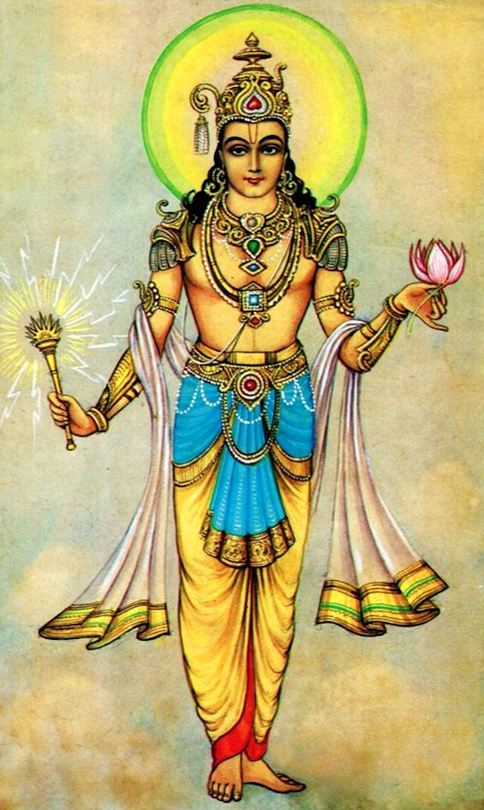
The Vajra () is a legendary and ritual weapon, symbolising the properties of a diamond (indestructibility) and a thunderbolt (irresistible force). The vajra is a type of club with a ribbed spherical head. The ribs may meet in a ball-shaped top, or they may be separate and end in sharp points with which to stab. The vajra is the weapon of Indra, the Vedic king of the devas and heaven. It is used symbolically by the dharmic traditions of Hinduism, Buddhism, and Jainism, often to represent firmness of spirit and spiritual power. According to Hinduism, the vajra is considered one of the most powerful weapons in the universe. The use of the vajra as a symbolic and ritual tool spread from Hinduism to other religions in India and other parts of Asia. Etymology According to Asko Parpola, the Sanskrit () and Avestan both refer to a weapon of the Godhead, and are possibly from the Proto-Indo-European root ''*weg'-'' which means "to be(come) powerful". It is related to Proto- Fi ... [...More Info...] [...Related Items...] OR: [Wikipedia] [Google] [Baidu] |
Dorje Lapka
The Vajra () is a legendary and ritual weapon, symbolising the properties of a diamond (indestructibility) and a thunderbolt (irresistible force). The vajra is a type of club with a ribbed spherical head. The ribs may meet in a ball-shaped top, or they may be separate and end in sharp points with which to stab. The vajra is the weapon of Indra, the Vedic king of the devas and heaven. It is used symbolically by the dharmic traditions of Hinduism, Buddhism, and Jainism, often to represent firmness of spirit and spiritual power. According to Hinduism, the vajra is considered one of the most powerful weapons in the universe. The use of the vajra as a symbolic and ritual tool spread from Hinduism to other religions in India and other parts of Asia. Etymology According to Asko Parpola, the Sanskrit () and Avestan both refer to a weapon of the Godhead, and are possibly from the Proto-Indo-European root ''*weg'-'' which means "to be(come) powerful". It is related to Proto- Fi ... [...More Info...] [...Related Items...] OR: [Wikipedia] [Google] [Baidu] |
Mountains Of The Bagmati Province
A mountain is an elevated portion of the Earth's crust, generally with steep sides that show significant exposed bedrock. Although definitions vary, a mountain may differ from a plateau in having a limited Summit (topography), summit area, and is usually higher than a hill, typically rising at least 300 metres (1,000 feet) above the surrounding land. A few mountains are Monadnock, isolated summits, but most occur in mountain ranges. Mountain formation, Mountains are formed through Tectonic plate, tectonic forces, erosion, or volcanism, which act on time scales of up to tens of millions of years. Once mountain building ceases, mountains are slowly leveled through the action of weathering, through Slump (geology), slumping and other forms of mass wasting, as well as through erosion by rivers and glaciers. High elevations on mountains produce Alpine climate, colder climates than at sea level at similar latitude. These colder climates strongly affect the Montane ecosystems, ecosys ... [...More Info...] [...Related Items...] OR: [Wikipedia] [Google] [Baidu] |


