|
Didymoteicho
Didymoteicho ( el, Διδυμότειχο, Didymóteicho ) is a city located on the eastern edge of the Evros regional unit of Eastern Macedonia and Thrace, in northeastern Greece. It is the seat of the municipality of the same name. The town (pop. 9,263 in 2011) sits on a plain and located south east of Svilengrad, south of Edirne, Turkey and Orestiada, west of Uzunköprü, Turkey, about 20 km north of Soufli and about 90 km north of Alexandroupoli. The municipality of Didymóteicho has a land area of 565.4 km² and a population of 19,493 inhabitants. Name "Didymoteicho" is the modern Greek form of , ''Didymóteichon'', from , ''dídymos'', "twin" and , ''teîchos'', "wall". The name first appears in 591/592, and most resulted from the refortification of the city under Justinian I (see below). The corrupted short form ''Dimotica'' or ''Demotica'' or variants thereof are attested in Western languages since the late 12th century (early forms ''Timoticon'', ''D ... [...More Info...] [...Related Items...] OR: [Wikipedia] [Google] [Baidu] |
Evros (regional Unit)
Evros ( el, Περιφερειακή ενότητα Έβρου) is one of the regional units of Greece. It is part of the region of East Macedonia and Thrace. Its name is derived from the river Evros, which appears to have been a Thracian hydronym. Evros is the northernmost regional unit. It borders Turkey to the east, across the river Evros, and it borders Bulgaria to the north and the northwest. Its capital is Alexandroupolis. Together with the regional units Rhodope and Xanthi, it forms the geographical region of Western Thrace. The population density was 34.77 per km2 (2011). Geography Evros is one of the largest regional units of Greece. It forms the eastern part of the geographical region Western Thrace, and includes the island Samothrace in the northern Aegean Sea. Its length is about 150 km from north to south (excluding Samothrace). Its width ranges from 70 to 100 km from east to west. The most important rivers are the Evros and its tributary Arda ... [...More Info...] [...Related Items...] OR: [Wikipedia] [Google] [Baidu] |
Didymoteicho Fortress
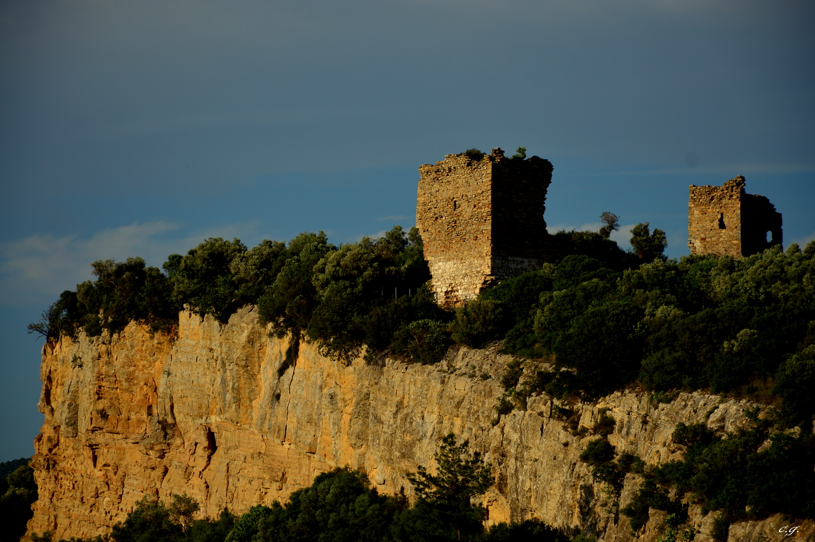
The Didymoteicho Fortress or Castle ( el, Κάστρο του Διδυμοτείχου), is an ancient and medieval hilltop citadel complex in the town of Didymoteicho, Eastern Macedonia and Thrace, Greece. It has been an important landmark since ancient times due to the strong fortification surrounding it. The castle is accompanied by several myths, one of the most famous is that of the Forty Arches, and is where Charles XII, King of Sweden, is said to have been imprisoned by the Turks. Location Located on the hilltop, strategically placed, due in-part to its strategic location overlooking both the town of Didymoteicho, the Erythropotamos River and the road to Constantinople, it is one of the most important Byzantine-era castles in Thrace and the Balkans. History According to the 6th-century historian Procopius, the reconstruction of the walls of Didymoteicho took place during the reign of Justinian I. The castle experienced several long sieges, and as a result The walls were ... [...More Info...] [...Related Items...] OR: [Wikipedia] [Google] [Baidu] |
Metaxades
Metaxades ( el, Μεταξάδες, ) is a large village and a former municipality in the Evros regional unit, East Macedonia and Thrace, Greece. Since the 2011 local government reform it is part of the municipality Didymoteicho, of which it is a municipal unit. The municipal unit has an area of 211.238 km2. In 2011 its population was 687 for the village, 717 for the community and 3,415 for the municipality. It's a settlement where the popular form of the most characteristic industrial buildings of Thrace was created. These buildings are the koukoulospita (cocoon houses) made for housing families and hosting sericulture as a homemade activity. These residencies did not have any particularities but inside them housing was restricted and the traditional chagiati (roofed balcony) was a big hall with wooden piers. The traditional architecture of Metaxades is based on a particular way of building with carefully made wooden frameworks filled with big well assorted pieces of soft l ... [...More Info...] [...Related Items...] OR: [Wikipedia] [Google] [Baidu] |
Asimenio
Asimenio ( el, Ασημένιο) is a village in the municipality of Didymoteicho in the northern part of the Evros regional unit in Greece. It is about 8 km northeast of the centre of Didymoteicho. It is bypassed by the Greek National Road 51 (Alexandroupoli - Didymoteicho - Orestiada - Ormenio). The nearest larger villages are Sofiko to the north, and Pythio to the southeast. Population The village has historically also been settled by Arvanites. See also *List of settlements in the Evros regional unit This is a list of settlements in the Evros regional unit, Greece: * Aisymi * Alepochori * Alexandroupoli * Amorio * Ampelakia * Antheia * Ardani * Arzos * Asimenio * Asproneri * Asvestades * Avas * Chandras * Dadia * Didymoteicho * Di ... Notes {{Didymoteicho Populated places in Evros (regional unit) Didymoteicho Albanian communities of Western Thrace ... [...More Info...] [...Related Items...] OR: [Wikipedia] [Google] [Baidu] |
Çelebi Sultan Mehmed Mosque
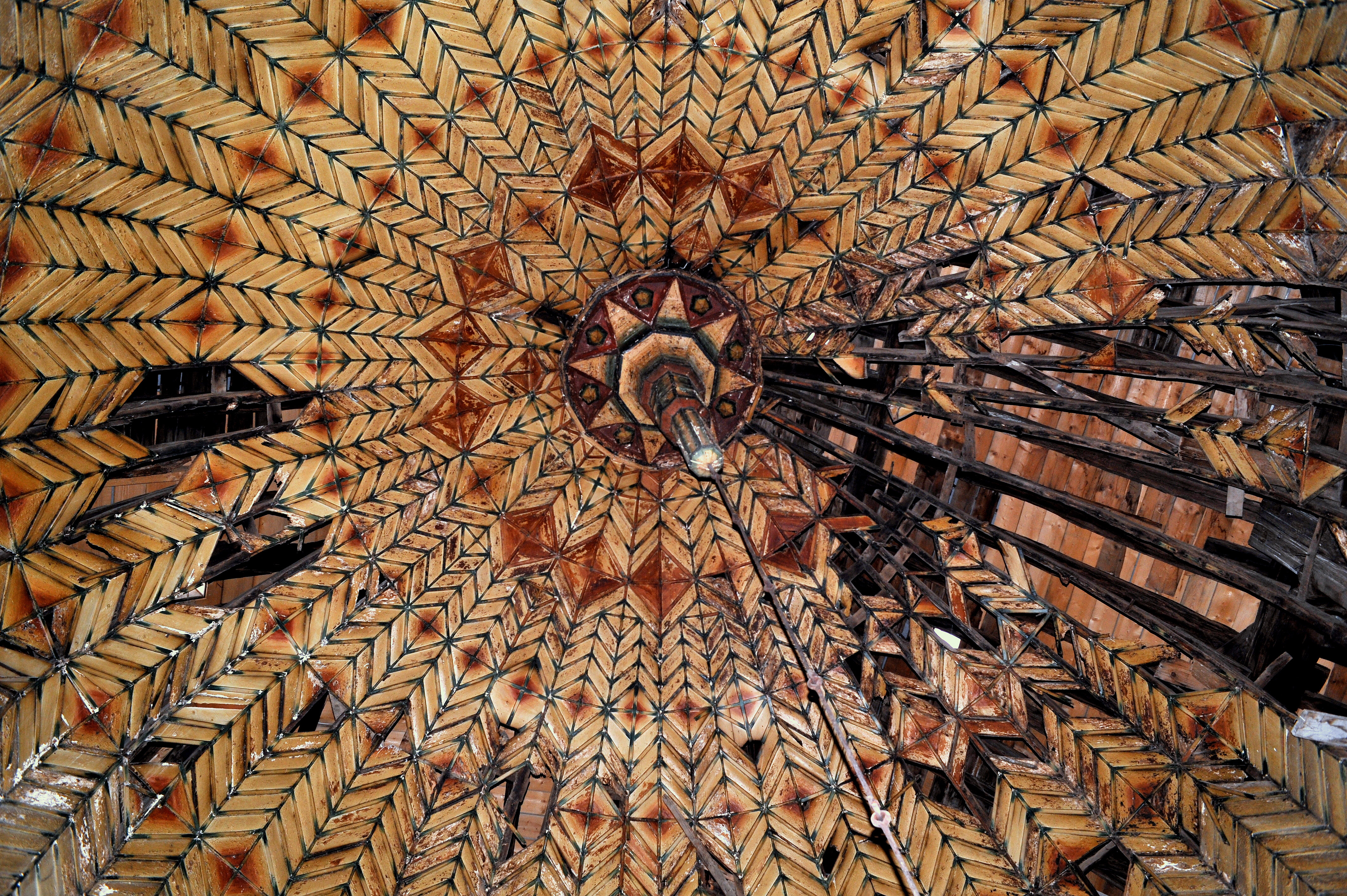
The Çelebi Sultan Mehmed Mosque ( tr, Çelebi Sultan Mehmed Camii; el, Τέμενος Μεχμέτ Α'), also known as the Bayezid Mosque (Τέμενος Βαγιαζήτ) and the Great Mosque ( tr, Büyük Camii or ''Ulu Camii''), is an early 15th-century Ottoman mosque in Didymoteicho, East Macedonia and Thrace, in the far northeast of Greece. Construction The 17th-century Ottoman traveller Evliya Çelebi records that the mosque was begun under Sultan Bayezid I (r. 1389–1402), but after his death at the Battle of Ankara and the turmoil that followed, it was interrupted. Construction was taken up again under Sultan Mehmed I (r. 1413–1421), and the mosque was completed and inaugurated in March 1420, as recorded in the inscription above the main entrance. A second inscription over a side-entrance records the name of the architect Ivaz ibn Bayezid, the builder (donor) Dogan ibn Abdullah and the local ''qadi'', Seyid Ali, who supervised construction. Structure The mosque is a ... [...More Info...] [...Related Items...] OR: [Wikipedia] [Google] [Baidu] |
Asvestades
Asvestades ( el, Ασβεστάδες) is a village in the municipality of Didymoteicho in the northern part of the Evros regional unit in Greece. It is 14 km west of the centre of Didymoteicho, in the hills south of the river Erythropotamos. It was known as "Kireççiler" during Ottoman rule. It was annexed to Greece Greece,, or , romanized: ', officially the Hellenic Republic, is a country in Southeast Europe. It is situated on the southern tip of the Balkans, and is located at the crossroads of Europe, Asia, and Africa. Greece shares land borders wit ... in 1920. The nearest larger village is Kyani to its northeast. Population See also * List of settlements in the Evros regional unit References External linksAsvestades at the GTP Travel Pages{{Didymoteicho Didymoteicho Populated places in Evros (regional unit) ... [...More Info...] [...Related Items...] OR: [Wikipedia] [Google] [Baidu] |
Pythio
Pythio (Greek: Πύθιο, tr, Kuleliburgaz), sometimes referred to as Pythion, is a village and community in the eastern part of Didymoteicho municipality, Evros regional unit, Greece. It is 16 km east of the centre of Didymoteicho, on the right bank of the river Evros, where it forms the border with Turkey. There is no road border crossing near Pythio. The community of Pythio consists of the villages of Pythio, Rigio and Pythio railway station ( gr, Σταθμός Πυθίου, translit=Stathmos Pythiou). The nearest villages are Petrades to the south and Asimenio to the northwest. Railway Pythio railway station is a junction where the railway to Ormenio and Bulgaria branches off the main line from Thessaloniki to Istanbul through Alexandroupoli and Uzunköprü. The railway was built by the Chemins de fer Orientaux (CO), managed by Maurice de Hirsch, as part of the CO's contract to build a line from Istanbul to Vienna. The railway reached Pythio, known as Ku ... [...More Info...] [...Related Items...] OR: [Wikipedia] [Google] [Baidu] |
Western Thrace
Western Thrace or West Thrace ( el, �υτικήΘράκη, '' ytikíThráki'' ; tr, Batı Trakya; bg, Западна/Беломорска Тракия, ''Zapadna/Belomorska Trakiya''), also known as Greek Thrace, is a geographic and historical region of Greece, between the Nestos and Evros rivers in the northeast of the country; East Thrace, which lies east of the river Evros, forms the European part of Turkey, and the area to the north, in Bulgaria, is known as Northern Thrace. Inhabited since paleolithic times, it has been under the political, cultural and linguistic influence of the Greek world since the classical era; Greeks from the Aegean islands extensively colonized the region (especially the coastal part) and built prosperous cities such as Abdera (home of Democritus, the 5th-century B.C. philosopher who developed an atomic particle theory, and of Protagoras, a leading sophist) and Sale (near present-day Alexandroupolis). Under the Byzantine Empire, W ... [...More Info...] [...Related Items...] OR: [Wikipedia] [Google] [Baidu] |
Orestiada
Orestiada ( el, Ορεστιάδα, formerly , ''Nea Orestiás''), is the northeasternmost, northernmost and newest city of Greece and the second largest town of the Evros regional unit of Thrace. Founded by Greek refugees from Edirne after the Treaty of Lausanne when the population exchange occurred between Turkey and Greece, in which the river Evros became the new border between the two countries. The population is around 20,000. History Ancient Orestiada was located in present-day Turkey, across the river from the current town of Kastanies. In ancient times, there was a small settlement on this site which legends claim was founded by Orestes, the son of Agamemnon and Clytemnestra. In 1920, after the liberation of Thrace, the city was renamed Orestiada and conferred on Greece along with the whole of Western Thrace and most of Eastern Thrace under the Treaty of Sevres. Following the Greco-Turkish War (1919–1922) and the Armistice of Mudanya (October 1922), the Western ... [...More Info...] [...Related Items...] OR: [Wikipedia] [Google] [Baidu] |
Alexandroupoli
Alexandroupolis ( el, Αλεξανδρούπολη, ), Alexandroupoli, or Alexandrople is a city in Greece and the capital of the Evros regional unit. It is the largest city in Western Thrace and the region of Eastern Macedonia and Thrace. It has 71,601 inhabitants and is an important port and commercial center of northeastern Greece. The city was first settled by the Ottoman Empire in the 19th century and grew into a fishing village, Dedeağaç. In 1873, it became a ''kaza'' and one year later, it was promoted to a ''sanjak''. The city developed into a regional trading center. Later, it became a part of Adrianople Vilayet. During the Russo-Turkish War (1877–1878), it was briefly captured by the Russians. Ottoman rule ended with the First Balkan War, when the city was captured by Bulgaria in 1912. In the Second Balkan War, Greece took the control of the city. With the Treaty of Bucharest (10 August 1913), the city returned back to Bulgaria. With the defeat of Bulgaria in W ... [...More Info...] [...Related Items...] OR: [Wikipedia] [Google] [Baidu] |
Maritsa
Maritsa or Maritza ( bg, Марица ), also known as Meriç ( tr, Meriç ) and Evros ( ell, Έβρος ), is a river that runs through the Balkans in Southeast Europe. With a length of ,Statistical Yearbook 2017 , p. 17 it is the longest river that runs solely in the interior of the , and one of the [...More Info...] [...Related Items...] OR: [Wikipedia] [Google] [Baidu] |


