|
Derryvullan
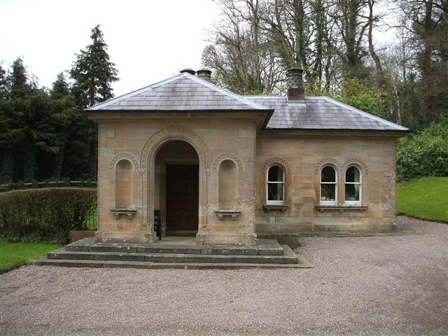
Derryvullan () is a civil parish and townland (of 296 acres) in County Fermanagh, Northern Ireland. The civil parish is situated in the historic baronies of Tirkennedy and Lurg. Derryvullan townland is in the portion of the parish of the same name in Tirkennedy. The ruins of an 18th-century church mark the site of an early church in Derryvullan. Civil parish of Derryvullan The civil parish includes the villages of Irvinestown and Lisnarick and the house at Castle Coole. Townlands The civil parish includes the following townlands: A Agharainy, Arda, Ardlougher, Aughey B Ballindullagh Inward, Ballindullagh Outward, Ballintarsan, Ballymactaggart, Boyaghan, Bracky, Brownhill, Bunaninver, Burfits Hill C Cantytrindle, Carran Little, Carranboy, Carry, Cassidy, Castle Coole, Castle Irvine Demesne, Cavanacross, Cavancarragh, Clenaghisle, Cloghcor, Coolaness, Coolbuck, Coolisk, Crockaleen, Cules Long, Cules Short, Cullaghmore, Cultiagh, Curraghlare D Derryb ... [...More Info...] [...Related Items...] OR: [Wikipedia] [Google] [Baidu] |
Lisnarick, County Fermanagh
Lisnarick or Lisnarrick () is a small village in County Fermanagh, Northern Ireland, 4 km west of Irvinestown. It is situated in the civil parish of Derryvullan and historic barony of Lurg. The village was once known as Archdalestown after the nearby Castle Archdale. In the 2001 Census it had a population of about 250. The village is mostly housing although there is one multi-purpose store, a restaurant, a filling station and a sub-post office. At the middle of the village is a green with horse chestnut trees and a play park. There is also a rath beside the bridge. History Rory Maguire was leader of the Irish Rebellion of 1641 in Fermanagh, and the burning of Lisnarick on 23 October 1641 was the signal for the rebellion to start. Castle Archdale was also destroyed at the time. Places of interest Castle Archdale Country Park is on the main Enniskillen to Kesh road (B82), 1 mile on the Enniskillen side of Lisnarick. See also *List of villages in Northern Ireland *Lisna ... [...More Info...] [...Related Items...] OR: [Wikipedia] [Google] [Baidu] |
Castle Coole
Castle Coole (from ga, CúlLogainm – Castle Coole – scanned record 2) is a and a late-18th-century neo-classical situated in , , |
Aughey
Aughey () is a townland of 109 acres in County Fermanagh, Northern Ireland. It is situated in the civil parish of Derryvullan and the historic barony of Tirkennedy. See also *List of townlands in County Fermanagh In Ireland, counties are divided into civil parishes, and parishes are further divided into townlands. The following is a list of townlands in County Fermanagh, Northern Ireland: __NOTOC__ A Abocurragh, Abohill, Acres, Aghaboy, Aghacramphi ... References Townlands of County Fermanagh Civil parish of Derryvullan {{Fermanagh-geo-stub ... [...More Info...] [...Related Items...] OR: [Wikipedia] [Google] [Baidu] |
Tirkennedy
Tirkennedy () is a barony in County Fermanagh, Northern Ireland. To its west lies Lower Lough Erne and south Upper Lough Erne, and it is bordered by seven other baronies: Clanawley and Magheraboy to the west; Lurg and Omagh East to the north; Clogher to the east; Magherastephana and Knockninny to the south. History Despite its name, Tirkennedy has nothing to do with the modern personal name of Kennedy, which derives from ''Cennétig'' (ugly/rough headed). Rather it takes its name from the epithet of Fergus son of Cremthann, the eponymous ancestor of the ''Ui Chremthainn'', the predominant tribe of the western Airgialla. Fergus lived in the late fifth century AD and was known as ''Cennfhota'' (long-head). His descendants became known as the ''Ui Chennfhota'', with the kingdom of ''Tir Cennfhota'' receiving its first mention in the Annals in 1349. Chieftains of Tirkennedy at the beginning of the Maguire’s reign over Fermanagh in the late 1200s were the Magunshinan, originally M ... [...More Info...] [...Related Items...] OR: [Wikipedia] [Google] [Baidu] |
Lurg
Lurg () is a barony situated in the north of County Fermanagh, Northern Ireland. To its south lies Lower Lough Erne, and it is bordered by four other baronies in Northern Ireland: Magheraboy to the south; Tirkennedy to the south-east; Omagh West to the north; and Omagh East to the east. It also borders to the west the barony of Tirhugh in the Republic of Ireland. History The barony of Lurg is based on the ancient Irish territory of ''Tuath Luirg'', also known as ''Fir Luirg'' (the men of Lurg), who are claimed to be genealogically related to the Airgialla. This territory was the patrimonial inheritance of the O'Muldoon ( ga, Ó Maoldúin). It is listed in the Annals, under the name ''Lorg'', as being a kingdom in the year 1039. Prior to this, Lurg was the base of the O'Monaghan ( ga, Ó Manacháin), thought to be descended from the original inhabitants of the area, the ''Fir Manach'', from which County Fermanagh gets its name. According to 19th century genealogist John O'H ... [...More Info...] [...Related Items...] OR: [Wikipedia] [Google] [Baidu] |
Irvinestown
Irvinestown is a town in County Fermanagh, Northern Ireland. In 2011 it had a population of 2,267 people. The most notable buildings are Necarne Castle, formerly known as Castle Irvine, and Castle Archdale. Irvinestown is situated within Fermanagh and Omagh district. History Before the Plantation of Ulster, the area was known as Necarne or Nakerny; in Irish ''Na Caorthann'' (the rowans). The village was founded during the Plantation in 1618 by Sir Gerald Lowther and named Lowtherstown. Ownership later passed to the Irvines of Dumfries and the name changed accordingly. Places of interest * The village boasts the annual Lady of The Lake Festival, a large 10-day summer festival and carnival which begins on the first Friday following the 12th of July. * Nearby is Necarne Castle, formerly known as Castle Irvine, which is now an equestrian school – Necarne Castle Equestrian School. * The nearby Castle Archdale Country Park on the shores of Lower Lough Erne was used as an RAF ... [...More Info...] [...Related Items...] OR: [Wikipedia] [Google] [Baidu] |
Carran Little
Carran (), also Carron, is a small village in County Clare, Ireland. It is in the Burren region, within a civil parish of the same name. It is notable mainly for being the birthplace of Michael Cusack, the inspirer and co-founder of the Gaelic Athletic Association. At the time of the 2011 Census, Carran had 106 inhabitants. Geography Carran parish is located on the uplands of the Burren and is bounded on the northwest by County Galway and on the south by Kilnaboy. ''Slieve Carran'', one of the highest points in the Burren, lies north of the village. The land is mainly rocky pasture with much limestone. In the past there were copper mines. It is said that Saint Columb founded an abbey at Glanculmkil, later to become the parish church. An 1837 account said this church was in ruins, and there were the remains of two other old churches at Crunane and Glanculmkil. A stone bed is called Saint Columb's bed, and nearby is a spring of fine water. The parish contains the townlan ... [...More Info...] [...Related Items...] OR: [Wikipedia] [Google] [Baidu] |
County Fermanagh
County Fermanagh ( ; ) is one of the thirty-two counties of Ireland, one of the nine counties of Ulster and one of the six counties of Northern Ireland. The county covers an area of 1,691 km2 (653 sq mi) and has a population of 61,805 as of 2011. Enniskillen is the county town and largest in both size and population. Fermanagh is one of four counties of Northern Ireland to have a majority of its population from a Catholic background, according to the 2011 census. Geography Fermanagh is situated in the southwest corner of Northern Ireland. It spans an area of 1,851 km2 (715 sq; mi), accounting for 13.2% of the landmass of Northern Ireland. Nearly a third of the county is covered by lakes and waterways, including Upper and Lower Lough Erne and the River Erne. Forests cover 14% of the landmass (42,000 hectares). It is the only county in Northern Ireland that does not border Lough Neagh. The county has three prominent upland areas: * the expansive We ... [...More Info...] [...Related Items...] OR: [Wikipedia] [Google] [Baidu] |


