|
Denholm, Quebec
Denholm is a municipality in La Vallée-de-la-Gatineau Regional County Municipality, Quebec, Canada, north of Gatineau. Its territory is along the eastern shores of Lake Sainte Marie, part of the Gatineau River. Denholm is a popular location for cottage vacationing and noted for its outdoor sport and recreation opportunities, such as fishing and hunting. There are several businesses and summer camps catering to these activities. Geography Denholm's territory is characterized as a harmonious alternation between gently rolling hills (part of the Gatineau Hills) and numerous glacial lakes, such as Cardinal, Normandeau, Plomb, Priest, Rond, and Sam Lakes. Its highest point is located in the western portion near the Gatineau River, reaching . Lac McArthur is in Denholm at , at an elevation of . It is near to the Réserve écologique André-Michaux. Lac McArthur is downstream from Lac du Chevreuil to the east, and drains into Lac Holme to the north. The Lac du Plomb road runs along ... [...More Info...] [...Related Items...] OR: [Wikipedia] [Google] [Baidu] |
Municipality (Quebec)
The following is a list of the types of local and supralocal territorial units in Quebec, including those used solely for statistical purposes, as defined by the Ministry of Municipal Affairs, Regions and Land Occupancy and compiled by the Institut de la statistique du Québec. Not included are the urban agglomerations in Quebec, which, although they group together multiple municipalities, exercise only what are ordinarily local municipal powers. A list of local municipal units in Quebec by regional county municipality can be found at List of municipalities in Quebec. Local municipalities All municipalities (except cities), whether township, village, parish, or unspecified ones, are functionally and legally identical. The only difference is that the designation might serve to disambiguate between otherwise identically named municipalities, often neighbouring ones. Many such cases have had their names changed, or merged with the identically named nearby municipality since t ... [...More Info...] [...Related Items...] OR: [Wikipedia] [Google] [Baidu] |
Canada
Canada is a country in North America. Its ten provinces and three territories extend from the Atlantic Ocean to the Pacific Ocean and northward into the Arctic Ocean, covering over , making it the world's second-largest country by total area. Its southern and western border with the United States, stretching , is the world's longest binational land border. Canada's capital is Ottawa, and its three largest metropolitan areas are Toronto, Montreal, and Vancouver. Indigenous peoples have continuously inhabited what is now Canada for thousands of years. Beginning in the 16th century, British and French expeditions explored and later settled along the Atlantic coast. As a consequence of various armed conflicts, France ceded nearly all of its colonies in North America in 1763. In 1867, with the union of three British North American colonies through Confederation, Canada was formed as a federal dominion of four provinces. This began an accretion of provinces an ... [...More Info...] [...Related Items...] OR: [Wikipedia] [Google] [Baidu] |
Calcite
Calcite is a Carbonate minerals, carbonate mineral and the most stable Polymorphism (materials science), polymorph of calcium carbonate (CaCO3). It is a very common mineral, particularly as a component of limestone. Calcite defines hardness 3 on the Mohs scale of mineral hardness, based on Scratch hardness, scratch hardness comparison. Large calcite crystals are used in optical equipment, and limestone composed mostly of calcite has numerous uses. Other polymorphs of calcium carbonate are the minerals aragonite and vaterite. Aragonite will change to calcite over timescales of days or less at temperatures exceeding 300 °C, and vaterite is even less stable. Etymology Calcite is derived from the German ''Calcit'', a term from the 19th century that came from the Latin word for Lime (material), lime, ''calx'' (genitive calcis) with the suffix "-ite" used to name minerals. It is thus etymologically related to chalk. When applied by archaeology, archaeologists and stone trade pr ... [...More Info...] [...Related Items...] OR: [Wikipedia] [Google] [Baidu] |
Serpentine Group
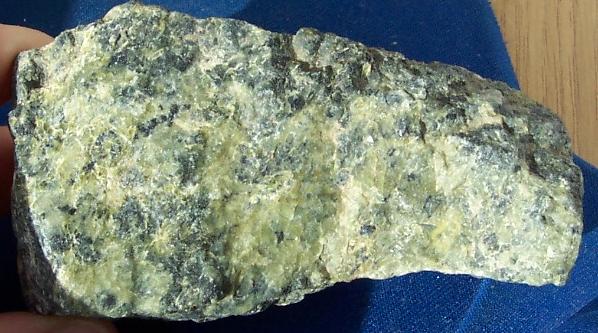
Serpentine subgroup (part of the kaolinite-serpentine group in the category of phyllosilicates) are greenish, brownish, or spotted minerals commonly found in serpentinite. They are used as a source of magnesium and asbestos, and as decorative stone. The name comes from the greenish colour and smooth or scaly appearance from the Latin , meaning "serpent rock". Serpentine subgroup is a set of common rock-forming hydrous magnesium iron phyllosilicate () minerals, resulting from the metamorphism of the minerals that are contained in mafic to ultramafic rocks. They may contain minor amounts of other elements including chromium, manganese, cobalt or nickel. In mineralogy and gemology, serpentine may refer to any of the 20 varieties belonging to the serpentine subgroup. Owing to admixture, these varieties are not always easy to individualize, and distinctions are not usually made. There are three important mineral polymorphs of serpentine: antigorite, lizardite and chrysotile. Serpen ... [...More Info...] [...Related Items...] OR: [Wikipedia] [Google] [Baidu] |
Asbestos
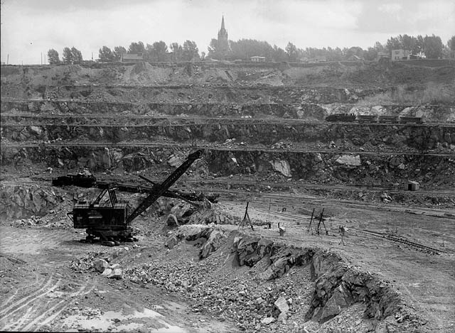
Asbestos () is a naturally occurring fibrous silicate mineral. There are six types, all of which are composed of long and thin fibrous crystals, each fibre being composed of many microscopic "fibrils" that can be released into the atmosphere by abrasion and other processes. Inhalation of asbestos fibres can lead to various dangerous lung conditions, including mesothelioma, asbestosis, and lung cancer, so it is now notorious as a serious health and safety hazard. Archaeological studies have found evidence of asbestos being used as far back as the Stone Age to strengthen ceramic pots, but large-scale mining began at the end of the 19th century when manufacturers and builders began using asbestos for its desirable physical properties. Asbestos is an excellent electrical insulator and is highly fire-resistant, so for much of the 20th century it was very commonly used across the world as a building material, until its adverse effects on human health were more widely acknowledged ... [...More Info...] [...Related Items...] OR: [Wikipedia] [Google] [Baidu] |
Types Of Municipalities In Quebec
The following is a list of the types of Local government in Quebec, local and Wiktionary:supralocal, supralocal territorial units in Quebec, including those used solely for statistical purposes, as defined by the Ministry of Municipal Affairs, Regions and Land Occupancy (Quebec), Ministry of Municipal Affairs, Regions and Land Occupancy and compiled by the Institut de la statistique du Québec. Not included are the urban agglomerations in Quebec, which, although they group together multiple municipalities, exercise only what are ordinarily local municipal powers. A list of local municipal units in Quebec by regional county municipality can be found at List of municipalities in Quebec. Local municipalities All municipalities (except cities), whether township, village, parish, or unspecified ones, are functionally and legally identical. The only difference is that the designation might serve to disambiguate between otherwise identically named municipalities, often neighbouring o ... [...More Info...] [...Related Items...] OR: [Wikipedia] [Google] [Baidu] |
Roxburghshire
Roxburghshire or the County of Roxburgh ( gd, Siorrachd Rosbroig) is a historic county and registration county in the Southern Uplands of Scotland. It borders Dumfriesshire to the west, Selkirkshire and Midlothian to the north-west, and Berwickshire to the north. To the south-west it borders Cumberland and to the south-east Northumberland, both in England. It was named after the Royal Burgh of Roxburgh, a town which declined markedly in the 15th century and is no longer in existence. Latterly, the county town of Roxburghshire was Jedburgh. The county has much the same area as Teviotdale, the basin drained by the River Teviot and tributaries, together with the adjacent stretch of the Tweed into which it flows. The term is often treated as synonymous with Roxburghshire, but may omit Liddesdale as Liddel Water drains to the west coast.Ordnance Gazetteer of Scotland, by, Francis Groome, publ. 2nd edition 1896. Article on Roxburghshire History The county appears to have orig ... [...More Info...] [...Related Items...] OR: [Wikipedia] [Google] [Baidu] |
Hawick
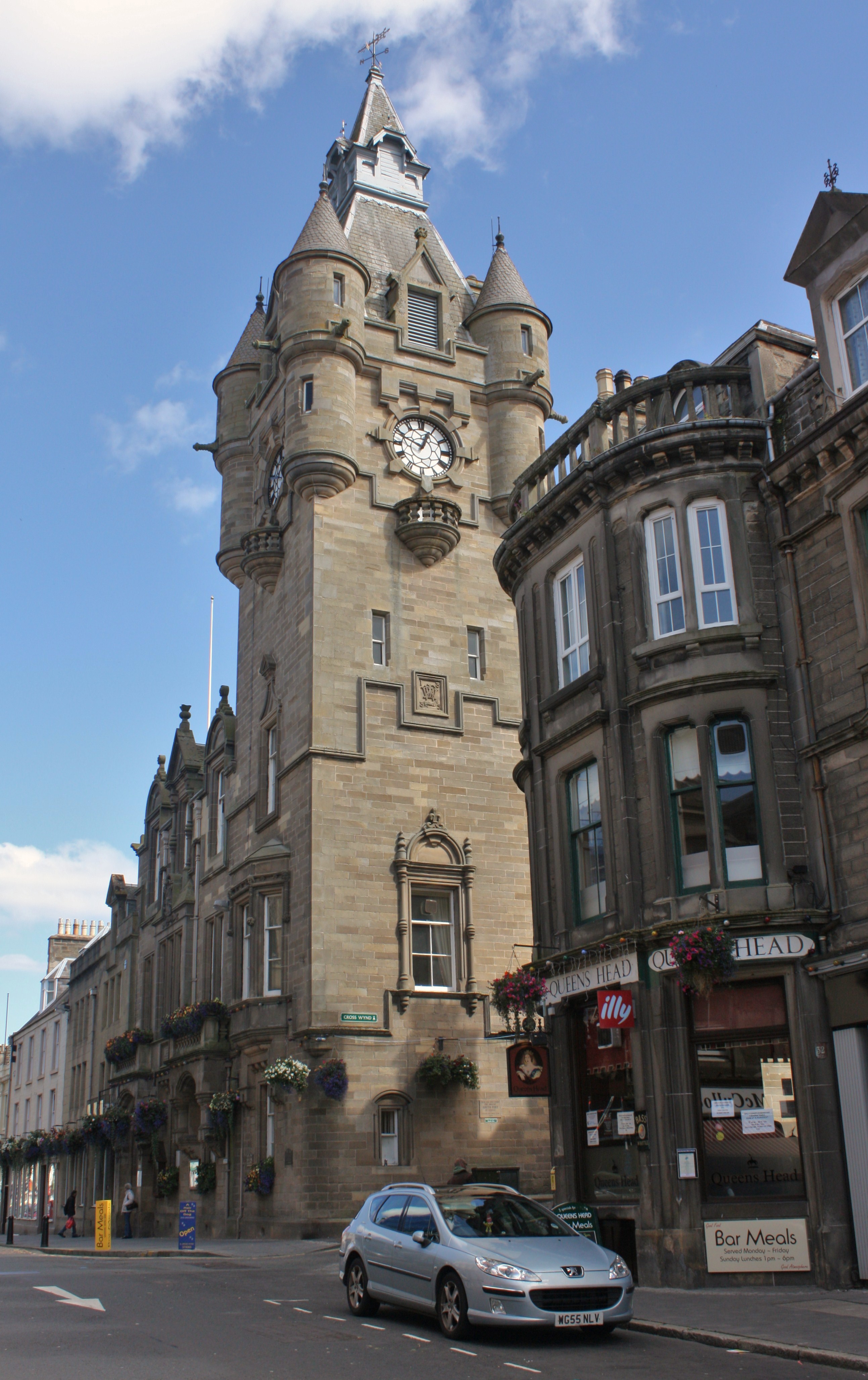
Hawick ( ; sco, Haaick; gd, Hamhaig) is a town in the Scottish Borders council area and historic county of Roxburghshire in the east Southern Uplands of Scotland. It is south-west of Jedburgh and south-south-east of Selkirk. It is one of the farthest towns from the sea in Scotland, in the heart of Teviotdale, and is the biggest town in the former county of Roxburghshire. The town is at the confluence of the Slitrig Water with the River Teviot. The town was formally established in the 16th century, but was previously the site of historic settlement going back hundreds of years. By the late 17th century, the town began to grow significantly, especially during the Industrial Revolution and Victorian era as a centre for the production of textiles, with a focus on knitting and weaving, involving materials such as tweed and cashmere. By the late 20th century, textile production had declined but the town remains an important regional centre for shopping, tourism and services. H ... [...More Info...] [...Related Items...] OR: [Wikipedia] [Google] [Baidu] |
Denholm
Denholm is a small village located between Jedburgh and Hawick in the Scottish Borders region of Scotland, UK. The estimated population of Denholm is 600. There is a village green in the centre. It lies in the valley of the River Teviot. Denholm is a Conservation Area listed as 'a planned village as opposed to the traditional unplanned or organic form of village usually found in Roxburghshire.' The village of Denholm is situated in Teviotdale, about halfway between the towns of Hawick and Jedburgh. It lies in gentle rolling countryside between Rubers Law and the Minto Hills, volcanic outcrops which thrust up through the underlying Old Red Sandstone. The original settlement of 'Denum' was sited 'at the valleys' where the broad valley of the River Teviot meets the narrow glen of the Dean Burn. The early hamlet was plundered and burnt during English raids of the 16th century. The village we see today dates from the 17th century when it was laid out around the Green. The populati ... [...More Info...] [...Related Items...] OR: [Wikipedia] [Google] [Baidu] |
Gatineau Hills
The Gatineau Hills (french: Collines de la Gatineau) are a geological formation in Canada that makes up part of the southern tip of the Canadian Shield, and acts as the northern shoulder of the Ottawa Valley. They are also the foothills of the Laurentian Mountains which stretch east through Quebec, beginning north of Montreal and joining up with others into Vermont and New Hampshire. Geology The geology of Gatineau Park, which encompasses these foothills, is related to the Eardley Escarpment, which is a fault line that lies along the southern edge of the hills. This escarpment makes the park an attractive location for rock climbers and hikers, offering a beautiful view of the relatively flat fields below, which extend to the Ottawa River. The Eardley Escarpment is part of the northern side of the Ottawa-Bonnechere Graben, which is an ancient rift valley. History The Algonquin people settled in the Ottawa valley more than 4000 years ago. French explorers arrived in the early ... [...More Info...] [...Related Items...] OR: [Wikipedia] [Google] [Baidu] |
Summer Camp
A summer camp or sleepaway camp is a supervised program for children conducted during the summer months in some countries. Children and adolescents who attend summer camp are known as ''campers''. Summer school is usually a part of the academic curriculum for a student to make up work not accomplished during the academic year (summer camps can include academic work, but is not a requirement for graduation). The traditional view of a summer camp as a woody place with hiking, canoeing, and campfires is changing, with greater acceptance of newer types of summer camps that offer a wide variety of specialized activities. For example, there are camps for the performing arts, music, magic, computer programming, language learning, mathematics, children with special needs, and weight loss. In 2006, the American Camp Association reported that 75 percent of camps added new programs. This is largely to counter a trend in decreasing enrollment in summer camps, which some argue to have bee ... [...More Info...] [...Related Items...] OR: [Wikipedia] [Google] [Baidu] |


