|
Den Norske Los
''Den norske los'' (literally ''The Norwegian Pilot'') is an eight-volume book published by the Norwegian Mapping and Cadastre Authority The Norwegian Mapping Authority (NMA) ( no, Statens kartverk or Kartverket) is Norway's national mapping agency, dealing with land surveying, geodesy, hydrographic surveying, cadastre and cartography. The current director is Johnny Welle. Its .... It provides supplementary information to charts for shipping crew. The book is obligatory for all vessels required to register. The first volume covers general information, while the remaining volumes cover specific geographic areas. References {{Italic title Norwegian books ... [...More Info...] [...Related Items...] OR: [Wikipedia] [Google] [Baidu] |
Norwegian Mapping And Cadastre Authority
The Norwegian Mapping Authority (NMA) ( no, Statens kartverk or Kartverket) is Norway's national mapping agency, dealing with land surveying, geodesy, hydrographic surveying, cadastre and cartography. The current director is Johnny Welle. Its headquarters are in Hønefoss and it is a public agency under the Ministry of Local Government and Regional Development. NMA was founded in 1773. The Norwegian Mapping Authority participates in R&D and cooperates with Norwegian industry and other government agencies in areas such as export-oriented measures. Tasks • Define frameworks, methodologies and specifications for the Norwegian Spatial Data Infrastructure • Administrator and driving force for Norway digital • Survey and map both at land and sea • Produce, manage and make available the geographical information defined as a government responsibility • Geodetic network and services for accurate GNSS-positioning • Primary data series, digital and printed map series (land an ... [...More Info...] [...Related Items...] OR: [Wikipedia] [Google] [Baidu] |
Langesund
is the administrative centre of the municipalities of Norway, municipality of Bamble, Norway. The town of Langesund was established as a municipality 1 January 1838 (see formannskapsdistrikt). It was merged with Bamble 1 January 1964. In the early days, Langesund was one of the most important shipping towns in Norway. Peter Wessel Tordenskiold got one of his ships built in Langesund, ''Løvendals Gallej''. It was known as Longsound in English in the 1800s. It is possible to visit the remains of the old Coastal Fortress on Langesundstangen on the extreme end of the Langesund peninsula. The fort was established during the Second World War by Nazi Germany and later used by the Norwegian Coastal Artillery and Home Guard (Norway), Home Guard until 1993. Langesund is one of the most celebrated summer towns in Norway because of the large number of sunny days. It is also well known for Wrightegaarden, a building that hosts outdoor concerts every weekend the whole summer. Artists lik ... [...More Info...] [...Related Items...] OR: [Wikipedia] [Google] [Baidu] |
Jærens Rev
Jærens rev (Jæren's reef) is the westernmost sandbank on the coast of Jæren, located approximately off Reve in Klepp municipality, between Orrestranda and Borestranda. Its location has been used to define the limits of the Norwegian fishery zone. The shoal The shoal is a partly stony sandbar and extends almost to the west in front of the Revtangen headland, the westernmost point of Jæren. It is very shallow: at Klausgrunnen, about off the coast, the water depth is still only . A light buoy is located about off the coast at the western end of the shoal, approximately at position 58 ° 45 'N, 5 ° 26' E, for safe passage making. A high steel mark on Revtangen built in 2004 also serves as a navigational beacon; its top mark has a side length of . A first wooden navigation mark was set up here as early as 1854; it was replaced by a steel construction in 1911, which was dismantled in 1994 and only replaced by the current beacon ten years later. About further north-northeast ... [...More Info...] [...Related Items...] OR: [Wikipedia] [Google] [Baidu] |
Stad (peninsula)
Stad or Stadlandet is a peninsula in Stad Municipality in the northwestern part of the Nordfjord district in Vestland county in Norway. The peninsula is considered the dividing point between the Norwegian Sea to the north and the North Sea to the south. The name is sometimes also written as ''Stadt'', ''Statt'', or ''Statlandet'' (not to be confused with the similar German word '' Stadt''), because the Norwegian pronunciation of the ''d'' in this case is as a ''t''. The name could be translated as "''the land of places''" or ''"the land of towns''". Some of the larger villages on the peninsula include Ervik (northwestern tip), Borgundvåg and Leikanger (northeastern side), and the village of Selje (southwestern side). Geography The peninsula is a mountain plateau topped by the Tarvaldsegga peak. There are several lower valleys on the peninsula, but at the western end, the plateau plunges into the sea in a cliff at ''Kjerringa''. Stad Peninsula has a very harsh, windy clima ... [...More Info...] [...Related Items...] OR: [Wikipedia] [Google] [Baidu] |
Rørvik
Rørvik is a port town and administrative centre in the municipality of Nærøysund in Trøndelag county, Norway. It is on the eastern side of the Vikna archipelago on the island of Inner-Vikna. The town has a population (2022) of 3,385 and a population density of .The municipality has a population (2022) of 9,840. Prior to 2020, the town served as the administrative centre of the old Vikna Municipality. There are several museums in Rørvik. The Norwegian Coastal Museum, with its center for coastal culture and vessel protection, is located here. The critically acclaimed museum building ''Norveg'' was designed by the architect Guðmundur Jónsson. Telenor Mobil is an important employer, as is public service, ship-related industry, fishing, and commercial salmon fish farming. Rørvik is also home to the Ytre Namdal Upper Secondary School, Ytre Namdal Vocational School for maritime education and the Safety Center Rørvik which offers safety training for seafarers. Old Rør ... [...More Info...] [...Related Items...] OR: [Wikipedia] [Google] [Baidu] |
Lødingen
Lødingen ( sme, Lodegat) is a municipality in Nordland county in Norway. Lødingen is located on the southeastern corner of the island of Hinnøya, and is part of the traditional district of Ofoten. The administrative centre of the municipality is the village of Lødingen. The other main part of the municipality is Vestbygda. Lødingen has the nickname "Biketown" because it hosts several annual bicycle races, including "Lofoten Insomnia" and Vestbygd-rittet. The municipality is by area the 202nd largest out of the 356 municipalities in Norway. Lødingen is the 282nd most populous municipality in Norway with a population of 1,976. The municipality's population density is and its population has decreased by 9.3% over the previous 10-year period. General information The municipality of Lødingen was established on 1 January 1838 (see formannskapsdistrikt law). On 1 January 1869, the southern district of Lødingen surrounding the Tysfjorden on the mainland (population: 1,402 ... [...More Info...] [...Related Items...] OR: [Wikipedia] [Google] [Baidu] |
Andenes
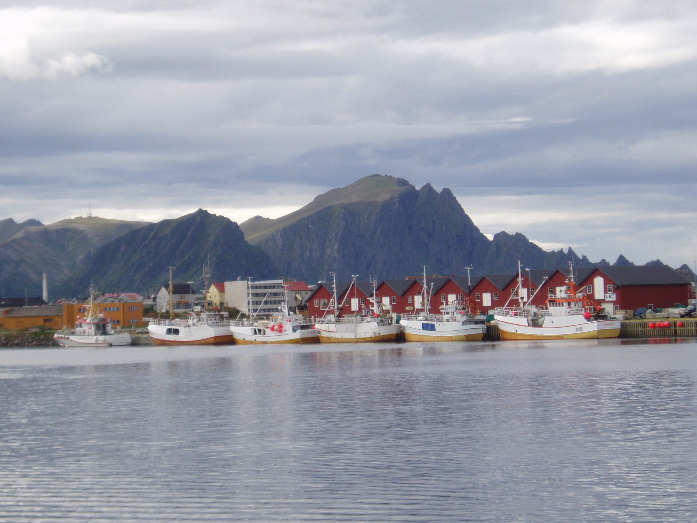
is the administrative centre of Andøy Municipality which is located in the Vesterålen district of Nordland county, Norway. The village of Andenes is the northernmost settlement of the island of Andøya (and in Nordland county). To the east is the island of Senja (in Troms county), and to the west the endless horizon of the North Atlantic Ocean. Andenes Lighthouse sits along the harbor and can be seen for long distances. Andøya Airport, Andenes is located just south of the village, off of Norwegian County Road 82. The village has a population (2018) of 2,694 which gives the village a population density of . History Andenes was already an important fishing village during the Iron Age. By the early 1900s, it had become one of the largest fishing ports in Norway. The municipality of Andenes was established on 1 January 1924 when it was separated from Dverberg municipality. Initially, Andenes had 2,213 residents. On 1 January 1964, Andenes was merged with Dverberg ... [...More Info...] [...Related Items...] OR: [Wikipedia] [Google] [Baidu] |
Grense Jakobselv
( Skolt Sami: Vue'rjemjokk sme, Vuorjánjohka fi, Vuoremijoki and russian: Гренсе Якобсэльв) is a small village in Sør-Varanger Municipality in Troms og Finnmark county, Norway. It is located on the shore of the Barents Sea at the mouth of the Jakobselva river. It lies about by road east of the town of Kirkenes. The area was settled by Norwegians in 1851. Border with Russia The Jakobselva river forms the border with Russia, on the east side of Grense Jakobselv. Here, there is a small post of the Garrison of Sør-Varanger of the Norwegian Army, from where soldiers patrol the border. In this area, however, there is no public border crossing. King Oscar II Chapel In the village, there is a stone chapel built in 1869 called King Oscar II Chapel. The church was built to reinforce Norway's territorial claim to the area, and was named after King Oscar II of Sweden and Norway at a visit he made in 1873. Distance from Oslo Grense Jakobselv is the point in ma ... [...More Info...] [...Related Items...] OR: [Wikipedia] [Google] [Baidu] |
Svalbard
Svalbard ( , ), also known as Spitsbergen, or Spitzbergen, is a Norwegian archipelago in the Arctic Ocean. North of mainland Europe, it is about midway between the northern coast of Norway and the North Pole. The islands of the group range from 74° to 81° north latitude, and from 10° to 35° east longitude. The largest island is Spitsbergen, followed by Nordaustlandet and . The largest settlement is Longyearbyen. The islands were first used as a base by the whalers who sailed far north in the 17th and 18th centuries, after which they were abandoned. Coal mining started at the beginning of the 20th century, and several permanent communities were established. The Svalbard Treaty of 1920 recognizes Norwegian sovereignty, and the 1925 Svalbard Act made Svalbard a full part of the Kingdom of Norway. They also established Svalbard as a free economic zone and a demilitarized zone. The Norwegian Store Norske and the Russian remain the only mining companies in place. Res ... [...More Info...] [...Related Items...] OR: [Wikipedia] [Google] [Baidu] |
Jan Mayen
Jan Mayen () is a Norwegian volcanic island in the Arctic Ocean with no permanent population. It is long (southwest-northeast) and in area, partly covered by glaciers (an area of around the Beerenberg volcano). It has two parts: larger northeast Nord-Jan and smaller Sør-Jan, linked by a wide isthmus. It lies northeast of Iceland (495 km 05 miNE of Kolbeinsey), east of central Greenland, and west of the North Cape, Norway. The island is mountainous, the highest summit being the Beerenberg volcano in the north. The isthmus is the location of the two largest lakes of the island, Sørlaguna (South Lagoon) and Nordlaguna (North Lagoon). A third lake is called Ullerenglaguna (Ullereng Lagoon). Jan Mayen was formed by the Jan Mayen hotspot and is defined by geologists as a separate continent. Although administered separately, in the ISO 3166-1 standard, Jan Mayen and Svalbard are collectively designated as ''Svalbard and Jan Mayen'', with the two-letter country code "SJ". N ... [...More Info...] [...Related Items...] OR: [Wikipedia] [Google] [Baidu] |


