|
Delap
Delap ( Marshallese: , ) is an island district in the Marshall Islands. It is located in the east of Majuro Atoll. Along with Uliga and Djarrit it forms what is known as the "Delap-Uliga-Djarrit". During World War II was the site of a large base, Naval Base Majuro. 'pacificwrecks.com'' See also *Majuro Airfield
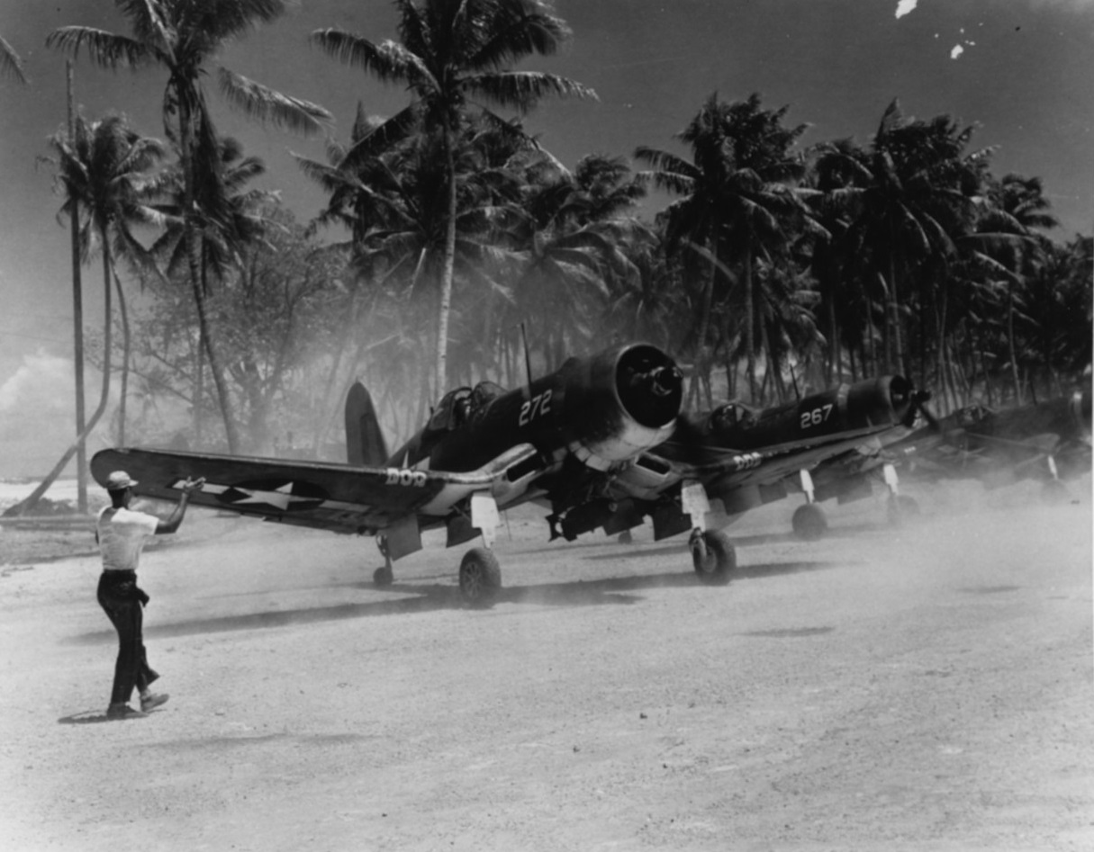
Majuro Airfield or Naval Air Facility Majuro (NAF Majuro) is a former World War II airfield on the island of Delap in the Marshall Islands. The facility was supported by the large base, Naval Base Majuro
History
World War II
Majuro Airfield was ...
References [...More Info...] [...Related Items...] OR: [Wikipedia] [Google] [Baidu] |
Delap-Uliga-Djarrit
Delap-Uliga-Djarrit (DUD, mh, Teļap-Wūlika-Jarōj) is the capital and the largest city of the Marshall Islands with 20,301 people (2012 census). The town is located in Majuro Atoll. History Majuro Atoll was claimed by the German Empire with the rest of the Marshall Islands in 1884, and the Germans established a trading outpost. As with the rest of the Marshalls, Majuro was captured by the Imperial Japanese Navy in 1914 during World War I and mandated to the Empire of Japan by the League of Nations in 1920. The island then became a part of the Japanese mandated territory of the South Seas Mandate; although the Japanese had established a government in the mandate, local affairs were mostly left in the hands of traditional local leaders until the start of World War II. On January 30, 1944, United States troops invaded and built a large base, Naval Base Majuro. In 1986, Marshall Islands become an independent nation and Delap-Uliga-Djarrit became the country's capital. Dem ... [...More Info...] [...Related Items...] OR: [Wikipedia] [Google] [Baidu] |
Majuro Atoll-USA-P-Gilberts-15
Majuro (; Marshallese: ' ) is the capital and largest city of the Marshall Islands. It is also a large coral atoll of 64 islands in the Pacific Ocean. It forms a legislative district of the Ratak (Sunrise) Chain of the Marshall Islands. The atoll has a land area of and encloses a lagoon of . As with other atolls in the Marshall Islands, Majuro consists of narrow land masses. It has a tropical trade wind climate, with an average temperature of . Majuro has been inhabited by humans for at least 2,000 years and was first settled by the Austronesian ancestors of the modern day Marshallese people. In 1885, the Marshall Islands were annexed by the German Empire and Majuro became their first and primary trading post. The city has also been under Japanese and American administration. After the Marshall Islands broke away from the Federated States of Micronesia in 1978 to form the Republic of the Marshall Islands, Majuro became the new country's capital and meeting place of the Nitije� ... [...More Info...] [...Related Items...] OR: [Wikipedia] [Google] [Baidu] |
Majuro
Majuro (; Marshallese: ' ) is the capital and largest city of the Marshall Islands. It is also a large coral atoll of 64 islands in the Pacific Ocean. It forms a legislative district of the Ratak (Sunrise) Chain of the Marshall Islands. The atoll has a land area of and encloses a lagoon of . As with other atolls in the Marshall Islands, Majuro consists of narrow land masses. It has a tropical trade wind climate, with an average temperature of . Majuro has been inhabited by humans for at least 2,000 years and was first settled by the Austronesian ancestors of the modern day Marshallese people. In 1885, the Marshall Islands were annexed by the German Empire and Majuro became their first and primary trading post. The city has also been under Japanese and American administration. After the Marshall Islands broke away from the Federated States of Micronesia in 1978 to form the Republic of the Marshall Islands, Majuro became the new country's capital and meeting place of the Nitije ... [...More Info...] [...Related Items...] OR: [Wikipedia] [Google] [Baidu] |
Majuro Airfield
Majuro Airfield or Naval Air Facility Majuro (NAF Majuro) is a former World War II airfield on the island of Delap in the Marshall Islands. The facility was supported by the large base, Naval Base Majuro History World War II Majuro Airfield was originally established by the Imperial Japanese Navy Air Service in 1942 . The island was captured on 31 January 1944 during Battle of Kwajalein by the V Amphibious Corps' Marine Reconnaissance Company and the 2nd Battalion, 106th Infantry Regiment who found it to be unoccupied. The 100th Naval Construction Battalion began to improve the airfield creating a coral-surfaced by runway covering most of Delap Island. By mid-March the airfield was in limited operation and by 15 April the airfield, taxiways, aprons, housing, shops, and piers were fully operational. The Seabees also constructed roads and causeways linking Delap to the adjacent islands. The carrier replacement plane pool was subsequently located at Majuro and a new by runwa ... [...More Info...] [...Related Items...] OR: [Wikipedia] [Google] [Baidu] |
Naval Base Majuro
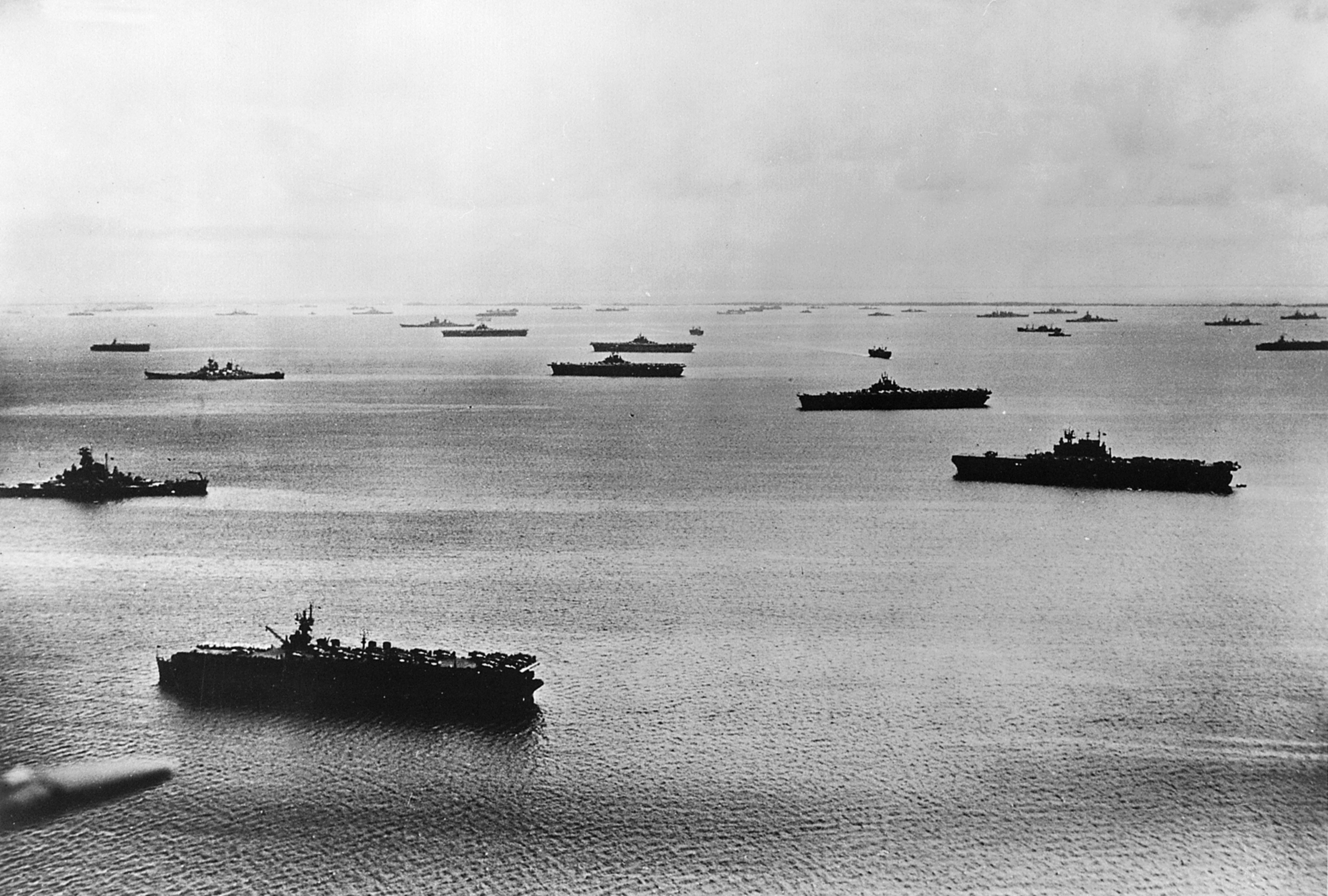
Map Majuro and Arno Atolls Naval Base Majuro was a major United States Navy base built on Majuro Atoll, in the Marshall Islands to support the World War II efforts in the Pacific War. The base was built after the Battle of Majuro-Kwajalein ended 3 February 1944. Majuro was found to be unoccupied and abandoned when the United States Army arrived. The US Navy built airfields, seaport, and other facilities on the captured islands. The base was part of the vast Naval Base Marshall Islands. History When the US Army arrived they found abandoned a Darrit Island 400-foot timber pier, a seaplane ramp, Dalop Island 5,800-foot runway, and warehouses. US Navy Seabees of the 100th Construction Battalion began improvement projects at the base. On the Delap the 800 feet (1,800 m) by 445 feet (136 m) runway was repaired and paved in coral. The complete Majuro Airfield became home to a number of units: two Marine dive-bomber squadrons, half a Marine patrol squadron, and staging a United States ... [...More Info...] [...Related Items...] OR: [Wikipedia] [Google] [Baidu] |
Uliga
Uliga ( Marshallese: , ) is an island district in the Marshall Islands, located in the eastern portion of Majuro Atoll. Along with Delap and Djarrit, it forms a town known as "Delap-Uliga-Djarrit". The terrain is about 2 metres above sea level. Variant forms of spelling for Majuro Uliga exist in several different languages: Urego To, Uliga Island, Vuleka, Ulika, Ulliga, Urega-tō, Uliga Island, Ulika, Ulliga, Urega-to, Urega-tō, Urego To, Vuleka. On January 30, 1944, United States troops invaded and built a large base, Naval Base Majuro file:Majuro and Arno Atolls 2.jpg, Map Majuro and Arno Atolls Naval Base Majuro was a major United States Navy base built on Majuro Atoll, in the Marshall Islands to support the World War II efforts in the Pacific War. The base was built after t .... 'pacificwrecks.com''
|
Djarrit
Djarrit (also called Darrit and Rita; Marshallese: , ) is an island district in the Marshall Islands. It is located in the east of Majuro Atoll. Along with Uliga and Delap, it forms what is known as the "Delap-Uliga-Djarrit". Djarrit is largely residential and is the home of Rita Elementary School and Marshall Islands High School, the largest public primary and secondary schools in the Marshall Islands. A road connects Djarrit with Laura at the western end of the atoll. It passes through the Marshall Islands International Airport. The name Rita was bestowed by American GIs on the large Naval Base Majuro in honor of film star Rita Hayworth Rita Hayworth (born Margarita Carmen Cansino; October 17, 1918May 14, 1987) was an American actress, dancer and producer. She achieved fame during the 1940s as one of the era's top stars, appearing in 61 films over 37 years. The press coined th .... References Populated places in the Marshall Islands Majuro {{Marshalls-geo-stub ... [...More Info...] [...Related Items...] OR: [Wikipedia] [Google] [Baidu] |
Marshallese Language
The Marshallese language ( mh, Kajin M̧ajeļ, link=no or ), also known as Ebon, is a Micronesian language spoken in the Marshall Islands. Spoken by the ethnic Marshallese people, the language is spoken by nearly the country's entire population of 59,000, making it the principal language of the country. There are also roughly 27,000 Marshallese citizens residing in the United States, nearly all of whom speak Marshallese, as well as in other countries including Nauru. There are two major dialects: Rālik (western) and Ratak (eastern). Classification Marshallese, a Micronesian language, is a member of the Eastern Oceanic subgroup of the Austronesian languages. The closest linguistic relatives of Marshallese are the other Micronesian languages, including Chuukese, Gilbertese, Kosraean, Nauruan and Pohnpeian. Marshallese shows 33% lexical similarity with Pohnpeian. Within the Micronesian archipelago, Marshallese—along with the rest of the Micronesian language group—is n ... [...More Info...] [...Related Items...] OR: [Wikipedia] [Google] [Baidu] |
Marshall Islands
The Marshall Islands ( mh, Ṃajeḷ), officially the Republic of the Marshall Islands ( mh, Aolepān Aorōkin Ṃajeḷ),'' () is an independent island country and microstate near the Equator in the Pacific Ocean, slightly west of the International Date Line. Geographically, the country is part of the larger island group of Micronesia. The country's population of 58,413 people (at the 2018 World Bank Census) is spread out over five islands and 29 coral atolls, comprising 1,156 individual islands and islets. The capital and largest city is Majuro. It has the largest portion of its territory composed of water of any sovereign state, at 97.87%. The islands share maritime boundaries with Wake Island to the north, Kiribati to the southeast, Nauru to the south, and Federated States of Micronesia to the west. About 52.3% of Marshall Islanders (27,797 at the 2011 Census) live on Majuro. In 2016, 73.3% of the population were defined as being "urban". The UN also indicates a population d ... [...More Info...] [...Related Items...] OR: [Wikipedia] [Google] [Baidu] |
World War II
World War II or the Second World War, often abbreviated as WWII or WW2, was a world war that lasted from 1939 to 1945. It involved the vast majority of the world's countries—including all of the great powers—forming two opposing military alliances: the Allies and the Axis powers. World War II was a total war that directly involved more than 100 million personnel from more than 30 countries. The major participants in the war threw their entire economic, industrial, and scientific capabilities behind the war effort, blurring the distinction between civilian and military resources. Aircraft played a major role in the conflict, enabling the strategic bombing of population centres and deploying the only two nuclear weapons ever used in war. World War II was by far the deadliest conflict in human history; it resulted in 70 to 85 million fatalities, mostly among civilians. Tens of millions died due to genocides (including the Holocaust), starvation, ma ... [...More Info...] [...Related Items...] OR: [Wikipedia] [Google] [Baidu] |


