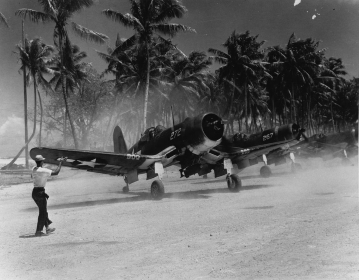
Majuro Airfield on:
[Wikipedia]
[Google]
[Amazon]
Majuro Airfield or Naval Air Facility Majuro (NAF Majuro) is a former
World War II
World War II or the Second World War, often abbreviated as WWII or WW2, was a world war that lasted from 1939 to 1945. It involved the vast majority of the world's countries—including all of the great powers—forming two opposin ...
airfield on the island of Delap
Delap ( Marshallese: , ) is an island district in the Marshall Islands. It is located in the east of Majuro Atoll. Along with Uliga and Djarrit it forms what is known as the "Delap-Uliga-Djarrit".
During World War II was the site of a large base ...
in the Marshall Islands
The Marshall Islands ( mh, Ṃajeḷ), officially the Republic of the Marshall Islands ( mh, Aolepān Aorōkin Ṃajeḷ),'' () is an independent island country and microstate near the Equator in the Pacific Ocean, slightly west of the Internati ...
. The facility was supported by the large base, Naval Base Majuro
Map Majuro and Arno Atolls
Naval Base Majuro was a major United States Navy base built on Majuro Atoll, in the Marshall Islands to support the World War II efforts in the Pacific War. The base was built after the Battle of Majuro-Kwajalein end ...
History
World War II
Majuro Airfield was originally established by the Imperial Japanese Navy Air Service in 1942 . The island was captured on 31 January 1944 duringBattle of Kwajalein
The Battle of Kwajalein was fought as part of the Pacific campaign of World War II. It took place from 31 January – 3 February 1944, on Kwajalein Atoll in the Marshall Islands. Employing the hard-learned lessons of the Battle of Tarawa, the Un ...
by the V Amphibious Corps' Marine Reconnaissance Company and the 2nd Battalion, 106th Infantry Regiment who found it to be unoccupied. The 100th Naval Construction Battalion began to improve the airfield creating a coral-surfaced by runway covering most of Delap Island. By mid-March the airfield was in limited operation and by 15 April the airfield, taxiways, aprons, housing, shops, and piers were fully operational. The Seabees also constructed roads and causeways linking Delap to the adjacent islands. The carrier replacement plane pool was subsequently located at Majuro and a new by runway was built on Uliga Island and a two-lane causeway connecting Uliga and Delap was constructed. An by apron was cleared and paved adjacent to the main runway to facilitate transport operations.
Fourth Marine Air Wing headquarters and Marine Air Group 13 (MAG-13) relocated to Majuro Atoll in mid-March 1944. Units stationed at Majuro included VF-39 operating the F6F Hellcat
The Grumman F6F Hellcat is an American Carrier-based aircraft, carrier-based fighter aircraft of World War II. Designed to replace the earlier Grumman F4F Wildcat, F4F Wildcat and to counter the Japanese Mitsubishi A6M Zero, it was the United St ...
, VMF-155 and VMF-224
Marine All Weather Fighter Attack Squadron 224 (VMFA(AW)-224) is a United States Marine Corps F/A-18 Hornet squadron. Also known as the "Fighting Bengals", the squadron is based at Marine Corps Air Station Beaufort, South Carolina and falls under ...
operating F4Us and VMSB-231
Marine Attack Squadron 231 (VMA-231) is a United States Marine Corps fixed wing attack squadron that consists of AV-8B Harrier ( V/STOL) jets. The squadron, known as the "Ace of Spades", is based at Marine Corps Air Station Cherry Point, North ...
operating SBDs.
B-25s of the 41st Bombardment Group operating out of Bairiki (Mullinix) Airfield, Tarawa
Tarawa is an atoll and the capital of the Republic of Kiribati,Kiribati
''
''
Maloelap
The Maloelap Atoll ( Marshallese: , ) (also spelled Maleolap) is a coral atoll of 71 islands in the Pacific Ocean, and forms a legislative district of the Ratak Chain of the Marshall Islands. Its land area is only , but that encloses a lagoon of ...
, Wotje
Wotje Atoll ( Marshallese: , ) is a coral atoll of 75 islands in the Pacific Ocean, and forms a legislative district of the Ratak Chain of the Marshall Islands.
Geography
Wotje's land area of is one of the largest in the Marshall Islands, and en ...
Mili Atoll
Mili Atoll (Marshallese language, Marshallese: , ) is a coral atoll of 92 islands in the Pacific Ocean, and forms a legislative district of the Ratak Chain of the Marshall Islands. It is located approximately southeast of Arno Atoll, Arno. Its to ...
and Jaluit
Jaluit Atoll ( Marshallese: , , or , ) is a large coral atoll of 91 islands in the Pacific Ocean and forms a legislative district of the Ralik Chain of the Marshall Islands. Its total land area is , and it encloses a lagoon with an area of . Mo ...
during March and April 1944.

Postwar
The airfield was reduced to inactive status on 1 January 1947 and disestablished on 1 June 1947. In the postwar period the airfield continued to serve as the airport for Majuro, however by the mid-1960s the runway surface was deteriorating and it was becoming unsuitable for use by modern aircraft, so it was decided to relocate the airport to its current location west ofRairok
Rairok ( Marshallese: , ) is a town in the Marshall Islands. It is located on the southeastern side Majuro Atoll, between Delap in the east and Ajeltake in the west.
On January 30, 1944, United States troops invaded and built a large base, Naval ...
and to utilize the area on Delap for industrial, commercial and residential development. Marshall Islands International Airport
Marshall Islands International Airport , also known as Amata Kabua International Airport, is located in the western part of Rairok on the south side of Majuro Atoll, the capital of the Republic of the Marshall Islands. The airport was built duri ...
opened in 1972 and Majuro Airfield ceased operation.
References
{{reflist Airfields of the United States Navy Military installations closed in 1947 Majuro Closed installations of the United States Navy